| Locality type: | Quarry |
| Classification |
|---|
|
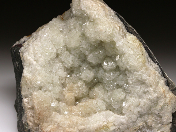
| Species: | Datolite |
| Formula: | CaB(SiO4)(OH) |
| Confirmation |
|---|
|
| Validity: | Believed Valid |
| Associated Minerals Based on Photo Data: |
|---|
|
| Calcite | ⓘ2 photos of Datolite associated with Calcite at this locality. |
| Hematite | ⓘ1 photo of Datolite associated with Hematite at this locality. |
| Data |
|---|
|
| Mineral Data: | Click here to view Datolite data |
| Locality Data: | Click here to view Farmington Trap Rock Quarry, Farmington, Hartford County, Connecticut, USA |
| Photo Gallery | View Gallery (4 photos) |
| Data Identifiers |
|---|
|
| Mindat Occurrence Record ID: | 772877 |
| Long-form Identifier: | 1:3:772877:8 |
| GUID (UUID V4): | 62ad3d24-1d51-44a1-ac09-cd50d4a53a37 |
| Nearest other occurrences of Datolite |
|---|
|
|
| 0.8km (0.5 miles) | ⓘState Route 4 road cut, Farmington, Hartford County, Connecticut, USA |
| 3.4km (2.1 miles) | ⓘTomasso Quarry, Farmington, Hartford County, Connecticut, USA |
| 3.7km (2.3 miles) | ⓘState Route 9 & State Route 71 Interchange, New Britain, Hartford County, Connecticut, USA |
| 4.9km (3.1 miles) | ⓘThe Woodlands, Newington, Hartford County, Connecticut, USA |
| 6.5km (4.0 miles) | ⓘState Route 372 construction site, Plainville, Hartford County, Connecticut, USA |
| 6.8km (4.2 miles) | ⓘInterstate 84 and State Route 72 Intersection, New Britain, Hartford County, Connecticut, USA |
| 7.3km (4.5 miles) | ⓘPlainville Trap Rock Quarry (Tilcon New Britain Quarry), Plainville, Hartford County, Connecticut, USA |
| 7.8km (4.8 miles) | ⓘBalf Quarry, Newington, Hartford County, Connecticut, USA |
| 8.5km (5.3 miles) | ⓘState Route 9 - Ellis Street and State Route 72 interchanges (State Route 72 roadcut), New Britain, Hartford County, Connecticut, USA |
| 9.0km (5.6 miles) | ⓘSherrill Street quarry, New Britain, Hartford County, Connecticut, USA |
| References |
|---|
|
|


Farmington Trap Rock Quarry, Farmington, Hartford County, Connecticut, USA