| Classification |
|---|
|
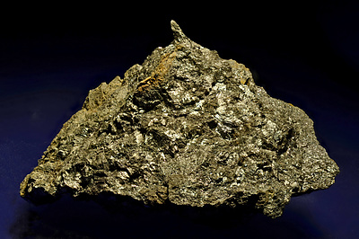
| Species: | Pyrolusite |
| Formula: | Mn4+O2 |
| Confirmation |
|---|
|
| Validity: | Confirmed |
| Confirmation Methods: | Dealer/Collection Label |
| Data |
|---|
|
| Mineral Data: | Click here to view Pyrolusite data |
| Locality Data: | Click here to view Teltschen-Rötelstein (Teltschen-Röthelstein; Teltschengraben), Bad Mitterndorf, Liezen District, Styria, Austria |
| Photo Gallery | View Gallery (4 photos) |
| Data Identifiers |
|---|
|
| Mindat Occurrence Record ID: | 926837 |
| Long-form Identifier: | 1:3:926837:1 |
| GUID (UUID V4): | baadd88b-4d70-4da6-9c42-bf6b4346b877 |
| Nearest other occurrences of Pyrolusite |
|---|
|
|
| 41.9km (26.1 miles) | ⓘRotgsol (Rotgsoll), Molln, Kirchdorf an der Krems District, Upper Austria, Austria |
| 43.2km (26.8 miles) | ⓘStrubberg mines (incl. Sattelberg; Strubbergsattel; Unterberg), Abtenau, Hallein District, Salzburg, Austria |
| 50.6km (31.5 miles) | ⓘRadiolarite outcrop (incl. Gfrererloch), Fuchs Alp - Fuchs lake area, Tweng, Tamsweg District, Salzburg, Austria |
| 52.0km (32.3 miles) | ⓘFuchs Alp - Fuchs lake area, Tweng, Tamsweg District, Salzburg, Austria |
| 57.0km (35.4 miles) | ⓘManganese prospects, St. Johann im Pongau, St. Johann im Pongau District, Salzburg, Austria |
| 57.5km (35.7 miles) | ⓘGrubhöhe Inn, St. Johann im Pongau, St. Johann im Pongau District, Salzburg, Austria |
| 64.5km (40.1 miles) | ⓘKunigunde Mine, Jenner, Berchtesgaden, Berchtesgadener Land District, Upper Bavaria, Bavaria, Germany |
| 77.9km (48.4 miles) | ⓘFe deposit, Dürnstein, Neumarkt in der Steiermark, Murau District, Styria, Austria |
| 79.7km (49.5 miles) | ⓘZölz, Krumpengraben, Hafning, Trofaiach, Leoben District, Styria, Austria |
| 81.4km (50.6 miles) | ⓘPirkerkogel (Pirknerkogel), Friesach, Sankt Veit an der Glan District, Carinthia, Austria |
| References |
|---|
|
|


Teltschen-Rötelstein, Bad Mitterndorf, Liezen District, Styria, Austria