| Locality type: | Quarry |
| Classification |
|---|
|
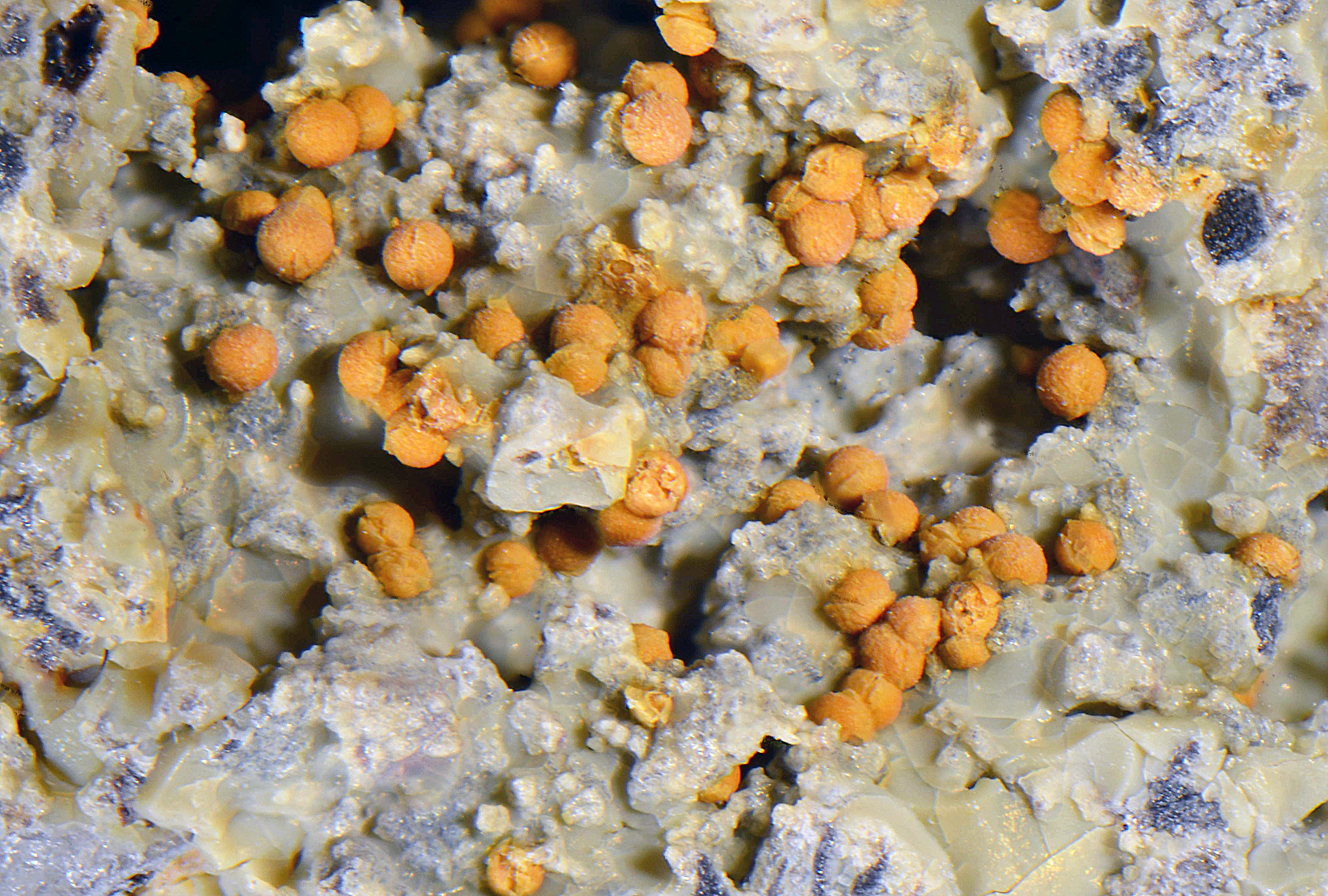
| Species: | 'Limonite' (not an IMA approved species) |
| Confirmation |
|---|
|
| Validity: | Believed Valid |
| Data |
|---|
|
| Mineral Data: | Click here to view Limonite data |
| Locality Data: | Click here to view Schlarbaum quarry, Klausen, Bad Gleichenberg, Südoststeiermark District, Styria, Austria |
| Data Identifiers |
|---|
|
| Mindat Occurrence Record ID: | 263208 |
| Long-form Identifier: | 1:3:263208:7 |
| GUID (UUID V4): | 81416201-85c7-4b74-97d8-41d31aec7220 |
| Nearest other occurrences of Limonite |
|---|
|
|
| 2.3km (1.4 miles) | ⓘBorehole St W2, Bad Gleichenberg, Südoststeiermark District, Styria, Austria |
| 30.6km (19.0 miles) | ⓘBockmoar Inn, Buchkogel Mountain, Wildon, Leibnitz District, Styria, Austria |
| 32.7km (20.3 miles) | ⓘRailway construction site, Lichendorf, Wildon, Leibnitz District, Styria, Austria |
| 33.4km (20.8 miles) | ⓘKuketz Mountain, Hengsberg, Leibnitz District, Styria, Austria |
| 40.1km (24.9 miles) | ⓘHofer quarry, Stubenberg am See, Hartberg-Fürstenfeld District, Styria, Austria |
| 40.5km (25.2 miles) | ⓘAg-Ag-Cu mineralisation, Schlossberg, Innere Stadt, Graz, Styria, Austria |
| 40.8km (25.4 miles) | ⓘClay Pit, Neusafenau, Hartberg, Hartberg-Fürstenfeld District, Styria, Austria |
| 43.1km (26.8 miles) | ⓘBuchkogel Mine, Buchkogel, Straßgang, Graz, Styria, Austria |
| 47.5km (29.5 miles) | ⓘChristandl quarry, Peunt, Naintschgraben, Anger, Weiz District, Styria, Austria |
| 47.6km (29.5 miles) | ⓘMarxenkogel, Stattegg, Graz-Umgebung District, Styria, Austria |
| References |
|---|
|
|
| Reference Search (possible matching items) |
|---|
 | | Book | | spectra of diopside from Rotkopf, Zillertal, Tyrol, Austria, measured on (100) and (010) plates (X, Y and Z...of sturmanite from the Black Rock mine, Kuruman District, South Africa, determined from its crystal structure...2.2) Locality: Schlegeistal, Zillertaler Alps, Austria (type locality). Description: Light green aggregates...2.3) Locality: Schlegeistal, Zillertaler Alps, Austria. Description: Grains from the association with...Scramble claim, Ryan, Black Mts., Furnace Creek district, Death Valley region, Inyo Co., California, USA |
|


Schlarbaum quarry, Klausen, Bad Gleichenberg, Südoststeiermark District, Styria, Austria