| Locality type: | Alluvials |
| Classification |
|---|
|
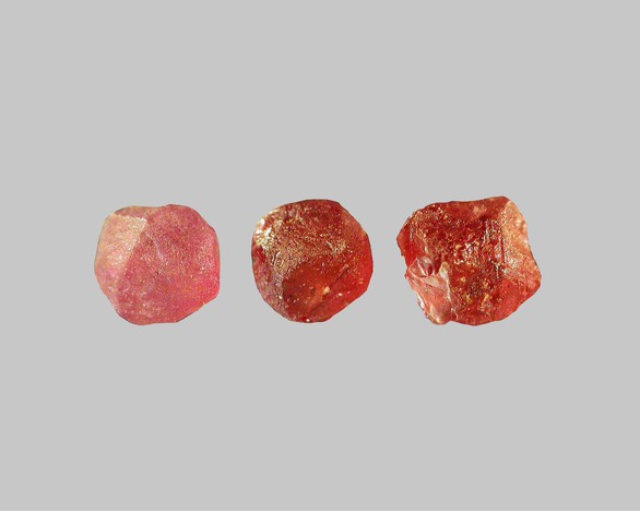
| Species: | 'Garnet Group' (not an IMA approved species) |
| Formula: | X3Z2(SiO4)3 |
| Confirmation |
|---|
|
| Validity: | Confirmed |
| Confirmation Methods: | Visually Identified |
| Data |
|---|
|
| Mineral Data: | Click here to view Garnet Group data |
| Locality Data: | Click here to view Cher river alluvial deposits, Épineuil-le-Fleuriel, Saint-Amand-Montrond, Cher, Centre-Val de Loire, France |
| Data Identifiers |
|---|
|
| Mindat Occurrence Record ID: | 948134 |
| Long-form Identifier: | 1:3:948134:3 |
| GUID (UUID V4): | 469cdfc1-a077-4d98-b754-e9942ad15408 |
| Nearest other occurrences of Garnet Group |
|---|
|
|
| 35.1km (21.8 miles) | ⓘMontebras Mines, Montebras, Soumans, Aubusson, Creuse, Nouvelle-Aquitaine, France |
| 50.0km (31.1 miles) | ⓘLa Bosse Mine, Montmins mining district, Échassières, Vichy, Allier, Auvergne-Rhône-Alpes, France |
| 56.0km (34.8 miles) | ⓘAllier river alluvial deposits, Le Guétin, Cuffy, Saint-Amand-Montrond, Cher, Centre-Val de Loire, France |
| 60.6km (37.7 miles) | ⓘLoire river alluvial deposits, Cours-les-Barres, Saint-Amand-Montrond, Cher, Centre-Val de Loire, France |
| 63.6km (39.5 miles) | ⓘChazeuil, Varennes-sur-Allier, Vichy, Allier, Auvergne-Rhône-Alpes, France |
| 65.0km (40.4 miles) | ⓘGrand Etang alluvial deposits, Andelot River watershed, Saint-Didier-la-Forêt, Vichy, Allier, Auvergne-Rhône-Alpes, France |
| 70.4km (43.7 miles) | ⓘEtang de la Gasne alluvial deposits, Sainte-Feyre, Guéret, Creuse, Nouvelle-Aquitaine, France |
| 79.4km (49.3 miles) | ⓘGartempe river alluvial deposits, Villedary, Saint-Victor-en-Marche, Guéret, Creuse, Nouvelle-Aquitaine, France |
| 88.1km (54.7 miles) | ⓘLe Raffaut stream alluvial deposits, Saint-Aubin-sur-Loire, Charolles, Saône-et-Loire, Bourgogne-Franche-Comté, France |
| 91.0km (56.5 miles) | ⓘSioulot stream alluvial deposits, Olby, Issoire, Puy-de-Dôme, Auvergne-Rhône-Alpes, France |
| References |
|---|
|
|


Cher river alluvial deposits, Épineuil-le-Fleuriel, Saint-Amand-Montrond, Cher, Centre-Val de Loire, France