| Locality type: | Mine |
| Classification |
|---|
|
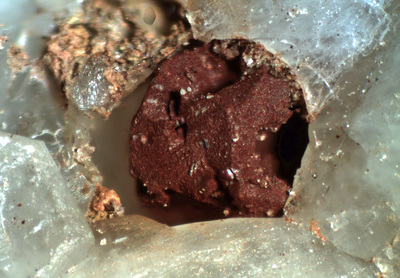
| Species: | Hematite |
| Formula: | Fe2O3 |
| Confirmation |
|---|
|
| Validity: | Confirmed |
| Confirmation Methods: | Visually Identified |
| Associated Minerals Based on Photo Data: |
|---|
|
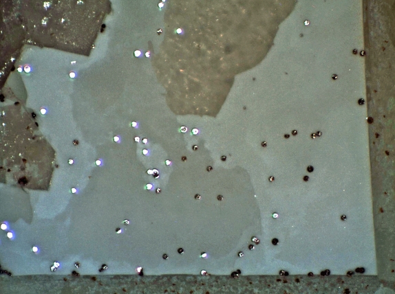
| Quartz | ⓘ8 photos of Hematite associated with Quartz at this locality. |
| Gypsum | ⓘ2 photos of Hematite associated with Gypsum at this locality. |
| Cerussite | ⓘ2 photos of Hematite associated with Cerussite at this locality. |
| Chrysocolla | ⓘ2 photos of Hematite associated with Chrysocolla at this locality. |
| Vanadinite | ⓘ1 photo of Hematite associated with Vanadinite at this locality. |
| Pyrite | ⓘ1 photo of Hematite associated with Pyrite at this locality. |
| Limonite | ⓘ1 photo of Hematite associated with Limonite at this locality. |
| Malachite | ⓘ1 photo of Hematite associated with Malachite at this locality. |
| Data |
|---|
|
| Mineral Data: | Click here to view Hematite data |
| Locality Data: | Click here to view Leiser Ray Mine (Lester Ray-Goffs Mine; Camp Signal Mine; Vanadium King Mine), Signal Hill, Piute Range [N], Signal Mining District (Vontrigger Mining District), San Bernardino County, California, USA |
| Photo Gallery | View Gallery (4 photos) |
| Data Identifiers |
|---|
|
| Mindat Occurrence Record ID: | 1018857 |
| Long-form Identifier: | 1:3:1018857:4 |
| GUID (UUID V4): | 1f636c4f-15f0-4e66-8efe-985f9804cf6d |
| Nearest other occurrences of Hematite |
|---|
|
|
| 14.2km (8.8 miles) | ⓘHomer Mountain prospect, Homer Mountain, San Bernardino County, California, USA |
| 35.0km (21.8 miles) | ⓘNewberry Mountains, Clark County, Nevada, USA |
| 48.3km (30.0 miles) | ⓘQuartette Mine, Searchlight Deposit, Searchlight Mining District, Clark County, Nevada, USA |
| 48.6km (30.2 miles) | ⓘGood Hope Mine (Phoenix mine), Searchlight Mining District, Clark County, Nevada, USA |
| 48.7km (30.3 miles) | ⓘCyrus Noble mine, Searchlight Mining District, Clark County, Nevada, USA |
| 48.8km (30.3 miles) | ⓘPyramid Mine (Pyramid group), Union Pass Mining District (Katherine Mining District), Oatman Mining District, Black Mountains, Mohave County, Arizona, USA |
| 49.2km (30.6 miles) | ⓘDuplex mine, Searchlight Deposit, Searchlight Mining District, Clark County, Nevada, USA |
| 49.8km (30.9 miles) | ⓘVulcan Mine (Burro prospect), Fountain Peak, Trojan District (Providence District), San Bernardino County, California, USA |
| 49.8km (30.9 miles) | ⓘKatherine Mine (Catherine Mine), Union Pass Mining District (Katherine Mining District), Oatman Mining District, Black Mountains, Mohave County, Arizona, USA |
| 49.8km (31.0 miles) | ⓘSearchlight Deposit, Searchlight Mining District, Clark County, Nevada, USA |
| References |
|---|
|
|


Leiser Ray Mine, Signal Hill, Piute Range [N], Signal Mining District, San Bernardino County, California, USA