 | | Journal (article/letter/editorial) |
| where they are enclosed by the slightly younger Am~tsoq gneisses (Michard-Vitrac et al. 1977). Similar...complex (Fig. 1). These supracrustals form extensive outcrops up to several hundred meters wide and several...prominent is a banded amphibolite accounting for more than half of the amphibolite outcrops. The banded amphibolites...NOk gneiss .:.~ ~........:.~.. :.7 ~::::::::::::i Am]tsoq gneiss Isua supracrustal rocks w Scheelite...mineralizations found in the Malene supracrustals (see below). The Malene metasediments comprise quartz-garnetsilimanite |
 | | Report (issue) |
| rock forming dikes as much as 10 feet thick. Outcrops rare. Mapped largely from float PEGMATITE coarse-grained...thin slabs. Breaks Commonly makes prominent outcrops and relatively thin sandy residual soils. Locally...Locally contains abundant lenses and layers of amphibolite and hornblende gneiss similar to those described...exposed over areas greater than a few acres AMPHIBOLITE, HORNBLENDE GNEISS, AND ASSOCIATED ROCKS Predominantly...fine- to medium-grained dark-green to black amphibolite and medium- to dark-gray-green hornblende gneiss |
 | | Journal (article/letter/editorial) |
| (N = 2), 12.6 ± 0.6‰ (N = 4) for < 1 m thick amphibolite layers, and 12.1 ± 0.4‰ (N = 24) for the concordant...activity are active during detachment faulting (e.g., see Fig. 2; Reynolds and Lister, 1987): (1) a convective...interlayered metapelite, quartzofeldspathic gneiss, amphibolite, hornblende gneiss, pyroclastic carbonatite,...green- chist facies (450°C, 3.4 kbar) to upper amphibolite facies (650 to 680°C, 2.5 kbar) in an upward...8.0 6.5 3117 4 Granite 8.4 6.7 3118 4 Amphibolite 3.8 2.5 4.3 2.7 4.1 ? ? ?4 Metaconglomerate |
 | | Journal (article/letter/editorial) |
| intermediate amphibolite............................................................... Coarse amphibolite.............................. Special textures in amphibolite................................................and to correlate their history with that of the district as a whole. Structural and petrographic evidence...pre-Cambrian sedimentary rocks are small masses of amphibolite. These bodies, both here and in other parts of...amphibolites was mapped by plane table, and individual amphibolite bodies were studied in detail in the Homestake |
 | | Report (chapter) |
| detrital zircon dates (Whitehouse et al. 1997a, 2001) (see below). 4.1 Semipefites 4.1.1 Distribution Semipelites...separated by amphibolite sheets. The most prominent belt comprises the Flowerdale schist unit (see map) which...a northwesterly direction across the Gairloch district, but ending north of the mapped area, where the...basite (amphibolite) sheet. Narrower bands of Kerrysdale-type semipelite occur within the amphibolite in the...and less wellexposed outcrops compared with the adjoining rugged amphibolite outcrops, which tend to form |
 | | Report (issue) |
| amphibolitized 38 olivine gabbro 22. Photomicrograph of amphibolite . 39 23. Photograph of a diallage-plagioclase...olivine gabbro show a progressive alteration into amphibolite which consists of an assemblage of hornblend...occurs locally within the sill. Evidence that the amphibolite margin, previously termed Roan Gneiss, is orthoamphibolite...of Keith (1907) shows associated ultramafic-amphibolite bodies within a thick interlayered sequence of...likely that many of the attitudes measured at small outcrops represent some of the smaller minor folds. The |
 | | Journal (article/letter/editorial) |
| indicates they were produced by greenschist to amphibolite facies dynamothermal metamorphism of alkalic...lavas rrTlJ sheeted dykes STUDIED METAMORPHIC OUTCROPS g bbros ultramafics v v TROODOS COMPLEX v...Cyprus locating the three studied metamorphic outcrops. 33030 ' I 275 width of ca. 1.5 km and is...alkali lavas of the Mamonia Complex. North of the amphibolite unit the fault contains serpentinite within which...grade are tectonically intermixed. Three small outcrops of amphibolites were sampled from southwest, west |
 | | Journal (article/letter/editorial) |
| nappes reached middle crustal levels (in the amphibolite facies field), strain partitioned into structurally...structure comprising separate autonomous units (see Fiala et al. in Dallmeyer et al. 1995, Fiala and...palaeobiogeographic reconstructions, or deep reflection profiles (see e. g. Franke 1989, Oncken 1988, Vollbrecht et al...corresponding CA (calc-alkaline) volcanic belts (see Matte 1986, Matte et al. 1990, Franke 1989, Neugebauer...Moldanubian Zone including the units at its periphery (see discussions in Tollmann 1982, Matte 1986, Matte et |
 | | Journal (article/letter/editorial) |
| nodules of probable stromatolitic origin in amphibolite from the Neoproterozoic terrain of southern Israel...ACT Several small bodies of massive to banded amphibolite occur within plagioclase-quartz-biotite hornblende...terrain of southern Israel. Entrapped within the amphibolite are nodules consisting mainly of calcite+talc...amphibolites is thus enigmatic. K EY WORDS : amphibolite, stromatolite, Neoproterozoic, Arabo-Nubian Shield...proposed. Geological setting The Neoproterozoic outcrops of southern Israel (totalling some 90 km2) occur |
 | | Journal (article/letter/editorial) |
| the magmatic character and tectonic setting of amphibolite-facies basic rocks, in which former textures...pre-metamorphic magmatic characters of amphibolite bodies subjected to amphibolite-facies metamorphism may be determined...Division in the type area is almost devoid of amphibolite bodies. Further north, in northern Ross-shire...concordant bodies of garnet amphibolite, known locally as Sgurr Mor amphibolite, occur sporadically (Winchester...to consist of a series rather than a single amphibolite body. 51 At most of the collecting traverses |
 | | Report (issue) |
| Mineralization North Carolina Robert Butler) District, 78 Southernmost at Four Gold Slate Belt Mine...Element Signature of Some Major Dahlonega District, Lumpkin County, Jc., and James R. Burnell, Jr...important ore controls. They have also served to see through the masking effects of superimposed metamorphism... of new not the been Ducktown previously district and described. the Hail information. serves...rifts/extensional * For a general review massive sulfide, see arcs of the various volcanic-associated Franklin |
 | | Book |
| will learn how the island formed. For now, let's see how it fits into the Georgia map. The two red lines...EPRIP island about 400 million years ago. You can see the Middleton-Lowndesville Fault breaks the Piedmont...take another look at the Georgia map on page 9, and see how it relates to this picture. The Middleton-Lowndesville...lava or Diorite pluton Igneous, intermediate Amphibolite Basalt lava or Gabbro pluton Igneous, mafic...Has tiny lines or striations that are difficult to see. AMPHIBOLE Same as (also called Hornblende) |
 | Jahn, B.M., Auvray, B., Cornichet, J., Bai, Y.L., Shen, Q.H., Liu, D.Y. (1987) 3.5 Ga old amphibolites from eastern Hebei Province, China: Field occurrence, petrography, Sm-Nd isochron age and REE geochemistry. Precambrian Research, 34 (3) 311-346 doi:10.1016/0301-9268(87)90006-4 | Journal (article/letter/editorial) |
| geochemistry. Precambrian Res., 34: 311--346. Amphibolite blocks frequently occur in association with grey...were subsequently retrogressed to the present amphibolite facies mineral assemblages. The positive end...represented by highly metamorphosed and deformed amphibolite enclaves in late Archaean granitic rocks. The...ancient age for the contrasting rock types: amphibolite and quartz diorite. These points will be discussed...(granulite and upper amphibolite facies), and less than 10% belongs to lower grade amphibolite and greenschist |
 | Floyd, P. A., Winchester, J. A., Ciesielczuk, J., Lewandowska, A., Szczepanski, J., Turniak, K. (1996) Geochemistry of early Palaeozoic amphibolites from the Orlica-Śnieżnik dome, Bohemian massif: petrogenesis and palaeotectonic aspects. Geologische Rundschau, 85 (2) 225-238 doi:10.1007/bf02422230 | Journal (article/letter/editorial) |
| represents one of the largest and most complex outcrops of the central European Variscides and encompasses... 1990) showing the distribution of the main amphibolite bodies within the Stronie, Staré Město and Nové...individual units and its deformation history (e.g. see Żelaźniewicz et al. 1995), and being cut off from...amphibolites, predominantly metamorphosed in the amphibolite facies, with rarer granulite and eclogite facies...elements. Samples were selected from small, scattered outcrops within the Stronie formation, as well as basic |
 | | Journal (volume) |
| . . . . . .. 21 The transport distance of amphibolite at Palojärvi . . . . . . . . . . . . . . . ....materials, and also sampies have been taken from the outcrops for lithogeochemical investigation. Copper was...the basement complex is the Presvecokarelidic amphibolite formation. It includes voleanogenic amphibolites...partly from acid lavas (Nykänen 1971 b). The amphibolite formation is heterogeneous and the rock types...In the Otravaara- Linnansuo area (Fig. 2) the amphibolite formation contains beds a few tens of metres |
 | | Report (issue) |
| Thorium and Rare-Earth Minerals in Powderhorn District, Gunnison County, Colorado By J. C. OLSON and...porphyry.________-___----___--__.-___-___--__ Amphibolite. ___-_____________-_-__--____---_--_-___-____Granite...PLATE 55. Generalized geologic map of Powderhorn district showing localities examined....____________________________...map of Colorado, showing location of Powderhorn district, Gunnison County, Colo_-__-__--_-_-_----_-_--_...Deposits showing abnormal radioactivity, Powderhorn district 700 704 707 718 A CONTRIBUTION TO ECONOMIC |
 | | Report (issue) |
| coincides with the westernmost sandstone and shale outcrops of the Chilhowee Group and Sandsuck Formation...that of the field mapper. We have recorded many outcrops on our field sheets while making cross-country...oversimplification to relate isolated or selected outcrops of mylonite in these basement rocks to single...CENTRAL BLUE RIDGE, NORTH CAROLINA mapped as amphibolite contain interlayers of calc-silicate granofels...sedimentary origin (Kuchenbuch, 1979). Another amphibolite variety is mottled white and green, inequigranular |
 | | Journal (volume) |
| employment, only the helpers are engaged from the district in question. The research assistant directs the...each end of the levelling tube, transport it and see to the orientation. - 1 helper acts as tripod mo... . Chlorite schist ...................... . Amphibolite ... ..... .. ... .. ... ..... . . Gneiss, depending...and electric conductivity are measured on the outcrops or diamond drill cores. A geologist working in...supplies information concerning the location of the outcrops, their rock types and tectonic data. Since the |
 | | Report (issue) |
| that has caved from the working. The waste rock, outcrops in the ends of the larger trenches, and pillars...area in the core of the amphibolite mass north of Samrah, Here the outcrops consist of large boulders...boulders was mapped in the nearby, circular mass of amphibolite straddling the dacite-andesite dike swarm east...of gabbro occur sporadically throughout the amphibolite. Northwest and north of the map, gabbro is common...by Quinn in 1964. The gabbro characteristically outcrops in the form of large nearly spherical boulders |
 | | Journal (article/letter/editorial) |
| of the sillimanite-almandite subfacies of the amphibolite facies and lies within the sillimanite zone....SCOTFORD-METAMORPHISM AND AXIAL-PLANE FOLDING, N. Y. Amphibolite Inwood marble Poundridge granite Siscowit granite...Index map 2. Sillimanite-almandite subfacies of amphibolite fades 3. Cation variation 4. Stereographic projection...Fordham migmatite gneiss 10. Measured modes of the amphibolite 11. Estimated modes of the Inwood marble. .....Bedford augen gneiss and the Bedford pegmatite district. Bell (1936) investigated the petrography of the |
 | | Journal (article/letter/editorial) |
| migmatite gneiss, quartz-feldspathic gneiss, and amphibolite from the Bucaramanga Gneiss recorded metamorphic...melting reactions. The evaluation of mesosomes (amphibolite, pelitic and quartz-feldspathic rocks) as potential...Proterozoic - Cretaceous; these events include (see Spikings et al., 2016 for a CE review): i) Permian...and southern Santander Massif, several migmatite outcrops were characterized in order to constrain evolution...arnet bearing gneiss, hornblende gneiss and amphibolite collectively called the Bucaramanga CE Gneiss |
 | | Corporate Document |
| Tshanda and Mero deposits. Several mineralised outcrops were also observed, providing limited first hand...north east of the Democratic Republic of Congo (see Figures1.2 and 1.3). The concession is approximately...appeared to be in reasonable condition. The Kamituga district is composed of fairly mountainous topography lying...striking feature of the image in the Kamituga district is the circular dome feature to the northwest...The geological interpretation of the Kamituga district is based on historical data from the exploration |
 | | Journal (article/letter/editorial) |
| The Swakop Terrane was metamorphosed to upper amphibolite-facies conditions with anatexis in the Uitdraai...edge of the Okawakuejawa Ridge, the Omusema amphibolite separates the Quelle from the Kudulecke unit...unit. In this locality, the lower part of this amphibolite is interlayered with the upper beds of the Quelle...small lens of Quelle rocks separates the Omusema amphibolite from the Etusis meta-arkose. This complex stratigraphic...have been incorporated in the overlying Omusema amphibolite. The conglomerate shows a slight increase in |
 | Garihan, John M., Ranson, William A., Muthukrishnan, Suresh, Bridgeman, James L., Goforth, Tom (2012) Geologic Studies of the Inner Piedmont, Brevarrd Zone, and Blue RIdge, South Carolina and North Carolina. Field Trip Guidebook. Carolina Geological Society | Report (issue) |
| desirable for the program committee to fish around and see if they can get invitations for the Society to hold...maintain a mineralogical museum in the Spruce Pine District”. Copies of the resolution were sent to Congressman...its members. The opportunity is always present to see old friends, make new friends, and discuss research...21 articles by 27 authors), 1982 (Kaolin Mining District of South Carolina with 8 articles by 10 authors)...related to the stratigraphy in the kaolin mining district, Geologic Investigations in the Blue Ridge of |
 | | Journal (article/letter/editorial) |
| Eastern Palmer Land Shear Zone. Based on the high-amphibolite grade rocks exposed in central western Palmer...(EPLSZ) (for geographical position of Palmer Land, see inset in Fig. 1). Geochemical data suggest tectonic... Methods and sample description 3.a. Mapping Outcrops containing metamorphic rocks in several previously...−65.47 Orthogneiss E 1661.5 −69.28 −64.63 Amphibolite E 3607.2 Grimley Glacier Mt Sullivan −69.57...−70.96 −67.05 Orthogneiss −70.97 −67.07 Amphibolite −70.96 −66.67 Metasediment −70.64 −67.13 |

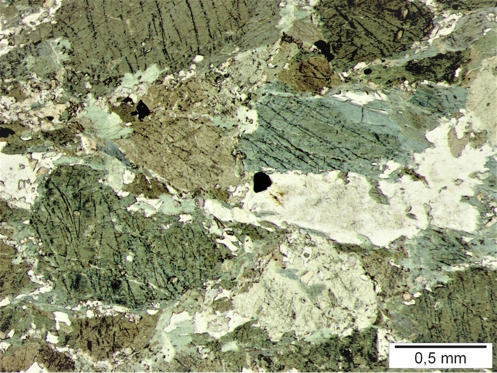


Amphibolite outcrops, Moar Alp, Bramberg am Wildkogel, Zell am See District, Salzburg, Austria