|
Mexico | |
|
| Panczner(1987):350. |
|
| Singer, D.A., Berger, V.I., Moring, B.C. (2008) Porphyry copper deposits of the world: Database and grade and tonnage models, 2008. Open-File Report 2008-1155 |
|
| Panczner(1987):350. |
|
| Sotelo, C. M. (2016). Geology and mineralization controls surrounding the Palmarejo mining district-A compilation of remote and hands on exploration techniques. The University of Texas at El Paso. |
|
| Sotelo, C. M. (2016). Geology and mineralization controls surrounding the Palmarejo mining district-A compilation of remote and hands on exploration techniques. The University of Texas at El Paso. |
|
| Panczner (1987): 355. |
|
| Panczner (1987): 355. |
|
| Rocks & Min.: 20:276. |
|
| Mason, Anita (1976) The World of Rocks and Minerals. Larousse & Co., Inc., New York.
Dana 7: I: 213. |
|
| Panczner(1987): 355.
American Mineralogist (1929) 14: 161 |
|
| Singer, Donald A., Berger, Vladimir Iosifovich, Moring, Barry C. (2005) Porphyry copper deposits of the world: database, map, and grade and tonnage models. Open-File Report 2005-1060. US Geological Survey doi:10.3133/ofr20051060 |
|
| Econ Geol (1985) 80:1566-1592 |
|
| Econ Geol (1985) 80:1566-1592 |
|
| Lapis 2001(1), 11-40 |
|
| Criddle, Alan J., Chisholm, Jim E., Stanley, Chris J. (1989) Cervelleite, Ag4TeS, a new mineral from the Bambolla mine, Mexico, and a description of a photo-chemical reaction involving cervelleite, acanthite and hessite. European Journal of Mineralogy, 1 (3) 371-380 doi:10.1127/ejm/1/3/0371 |
|
| Dana 7:I:409. |
|
| Panczner (1987): 355. |
- Los Tarahumaras (Las Tarahumares; Tarahumara)
| Panczner(1987):355. |
|
| Panczner(1987):355. |
|
| Panczner(1987):355. |
|
| Panczner(1987):355. |
|
| Panczner (1987): 355. |
|
| Panczner (1987): 355. |
|
| Panczner (1987): 355. |
|
| Panczner(1987):355. |
|
| Panczner(1987):355. |
|
| Panczner(1987):355. |
|
| Panczner(1987):355. |
|
| Panczner(1987): 355. |
|
| Panczner(1987):355. |
|
| Panczner(1987): 355. |
|
| Panczner (1987): 355. |
|
| Panczner (1987): 355. |
|
| Panczner (1987): 355. |
|
| Panczner (1987): 400.
Williams S A, Cesbron F P (1985) Yecoraite Fe3Bi5(TeO3)(TeO4)2O9·nH2O a new mineral from Sonora, Mexico. Boletín de Mineralogía 1, 10-16 |
|
USA | |
|
| Luetcke, Rolf (n.d.) Personal communication. |
|
| MRDS database Dep. ID file #10046236, MRDS ID #M241100. |
|
| Grant, Raymond W., Bideaux, R.A., Williams, S.A. (2005) Minerals Added to the Arizona List 1995-2005 (1st ed.) |
|
| Rob Bowell, lab tested |
|
| Robert Bowell and Rolf Luetcke |
|
| Ransome, F.L. (1904a), The geology and ore deposits of the Bisbee quadrangle, Arizona: U.S. Geological Survey Professional Paper 21, 168 p., 3 sheets, scales 1:12,000 and 1:62,500: 119. |
|
| Anthony, J.W., et al (1995), Mineralogy of Arizona, 3rd.ed.: 362
Palache, Charles (1941) Crystallographic notes: cahnite, stolzite, zincite, ultrabasite. American Mineralogist, 26 (7) 429-436 |
|
| MRDS database Dep. ID file #10104058, MRDS ID #M241047. |
|
| Keith, Stanton B. (1973), Arizona Bureau of Geology & Mineral Technology, Geol. Sur. Branch Bull. 187, Index of Mining Properties in Cochise Co., AZ: 55 (Table 4). |
|
| Anthony, J.W., et al (1995), Mineralogy of Arizona, 3rd.ed.: 377
Romslo, T.M. (1949), Investigation of Keystone and St. George copper-zinc deposits, Cochise Co., AZ, US Bur. Mines Rept. Inv. 4504. |
|
| Anthony, J.W., et al (1995), Mineralogy of Arizona, 3rd.ed.: 383
Galbraith, F.W. & D.J. Brennan (1959), Minerals of AZ: 81.
Palache, Charles (1941) Crystallographic notes: cahnite, stolzite, zincite, ultrabasite. American Mineralogist, 26 (7) 429-436 |
|
| Luetcke, Rolf (n.d.) Personal communication. |
|
| Anthony, J.W., et al (1995), Mineralogy of Arizona, 3rd.ed.: 377, 388
Cooper, J.R. & L.T. Silver (1964), Geology and ore deposits of the Dragoon quadrangle, Cochise Co., AZ, USGS PP 416
Cooper, J.R. (1957), Metamorphism and volume losses in carbonate rocks near Johnson Camp, Cochise Co., AZ, Geol. Soc. Amer. Bull.: 68: 577-610
Wilson, E.D. (1941), AZ Bur. Mines Bull. 148: 45.
Kellogg, L.O. (1906), Sketch of the geology and ore deposits of the Cochise mining district, Cochise Co., AZ, Econ.Geol.: 1: 651-659 |
|
| MRDS database Dep. ID file #10103729, MRDS ID #M050009. |
|
| MRDS database Dep. ID file #10039385, MRDS ID #M050011. |
|
| MRDS database Dep. ID file #10039384, MRDS ID #M050007. |
|
| Luetcke, Rolf (n.d.) Personal communication. |
|
| MRDS database Dep. ID file #10039387, MRDS ID #M050012. |
|
| Keith, Stanton B. (1973), Arizona Bureau of Geology & Mineral Technology, Geol. Sur. Branch Bull. 187, Index of Mining Properties in Cochise Co., AZ: 58 (Table 4). |
|
| Keith, Stanton B. (1973), Arizona Bureau of Geology & Mineral Technology, Geol. Sur. Branch Bull. 187, Index of Mining Properties in Cochise Co., AZ: 58 (Table 4). |
|
| MRDS database Dep. ID file #10039386, MRDS ID #M050010. |
|
| Keith, Stanton B. (1973), Arizona Bureau of Geology & Mineral Technology, Geol. Sur. Branch Bull. 187, Index of Mining Properties in Cochise Co., AZ: 59 (Table 4)
Cooper & Silver (1964): 165-168. |
|
| Luetcke, Rolf (n.d.) Personal communication. |
|
| MRDS database Dep. ID file #10109836, MRDS ID #M800156. |
|
| MRDS database Dep. ID file #10109835, MRDS ID #M800154. |
|
| Anthony, J.W., et al (1995), Mineralogy of Arizona, 3rd.ed.: 165
Keith, Stanton B. (1973), Arizona Bureau of Geology & Mineral Technology, Geol. Sur. Branch Bull. 187, Index of Mining Properties in Cochise Co., AZ: 59 (Table 4)
Cooper & Silver (1964): 174-175.
Romslo, T.M. (1949), Investigation of Keystone and St. George copper-zinc deposits, Cochise Co., AZ, US Bur. Mines Rept. Inv. 4504 |
|
| Keith, Stanton B. (1973), Arizona Bureau of Geology & Mineral Technology, Geol. Sur. Branch Bull. 187, Index of Mining Properties in Cochise Co., AZ: 59 (Table 4)
Cooper & Silver (1964): 171-181. |
- Dos Cabezas Mining District (Two Heads Mining District)
| Drewes, H., et al (1988), Volcanic and Structural Controls of Mineralization in the Dos Cabezas Mountains of SE AZ, USGS Bull. 1676: 20. |
|
| Luetcke, Rolf (n.d.) Personal communication. |
|
| Ref.: Keith, Stanton B. (1973), Arizona Bureau of Geology & Mineral Technology, Geol. Sur. Branch Bull. 187, Index of Mining Properties in Cochise Co., AZ: 62 (Table 4)
US Atomic Energy Commission Prelim. Reconnaisance Report A-P-49 (1953).
Wilson, et al (1934)(1967): 120-121 |
|
| Keith, Stanton B. (1973), Arizona Bureau of Geology & Mineral Technology, Geol. Sur. Branch Bull. 187, Index of Mining Properties in Cochise Co., AZ: 62 (Table 4)
US Atomic Energy Commission Prelim. Reconnaisance Report A-P-49 (1953).
Wilson, et al (1934)(1967): 120-121 |
|
| Keith, Stanton B. (1973), Arizona Bureau of Geology & Mineral Technology, Geol. Sur. Branch Bull. 187, Index of Mining Properties in Cochise Co., AZ: 62 (Table 4)
US Atomic Energy Commission Prelim. Reconnaisance Report A-P-49 (1953).
Wilson, et al (1934)(1967): 120-121 |
|
| Keith, Stanton B. (1973), Arizona Bureau of Geology & Mineral Technology, Geol. Sur. Branch Bull. 187, Index of Mining Properties in Cochise Co., AZ: 62 (Table 4)
US Atomic Energy Commission Prelim. Reconnaisance Report A-P-49 (1953).
Wilson, et al (1934)(1967): 120-121 |
|
| Keith, Stanton B. (1973), Arizona Bureau of Geology & Mineral Technology, Geol. Sur. Branch Bull. 187, Index of Mining Properties in Cochise Co., AZ: 62 (Table 4)
US Atomic Energy Commission Prelim. Reconnaisance Report A-P-49 (1953).
Wilson, et al (1934)(1967): 120-121 |
|
| Anthony, J.W., et al (1995), Mineralogy of Arizona, 3rd.ed.: 381.
Wilson, E.D., et al (1934), AZ Bur. Mines Bull. 137: 120-121 |
|
| Keith, Stanton B. (1973), Arizona Bureau of Geology & Mineral Technology, Geol. Sur. Branch Bull. 187, Index of Mining Properties in Cochise Co., AZ: 62 (Table 4)
US Atomic Energy Commission Prelim. Reconnaisance Report A-P-49 (1953).
Wilson, et al (1934)(1967): 120-121 |
|
| Keith, Stanton B. (1973), Arizona Bureau of Geology & Mineral Technology, Geol. Sur. Branch Bull. 187, Index of Mining Properties in Cochise Co., AZ: 62 (Table 4)
US Atomic Energy Commission Prelim. Reconnaisance Report A-P-49 (1953).
Wilson, et al (1934)(1967): 120-121 |
|
| Keith, Stanton B. (1973), Arizona Bureau of Geology & Mineral Technology, Geol. Sur. Branch Bull. 187, Index of Mining Properties in Cochise Co., AZ: 62 (Table 4)
US Atomic Energy Commission Prelim. Reconnaisance Report A-P-49 (1953).
Wilson, et al (1934)(1967): 120-121 |
|
| Keith, Stanton B. (1973), Arizona Bureau of Geology & Mineral Technology, Geol. Sur. Branch Bull. 187, Index of Mining Properties in Cochise Co., AZ: 62 (Table 4)
US Atomic Energy Commission Prelim. Reconnaisance Report A-P-49 (1953).
Wilson, et al (1934)(1967): 120-121 |
|
| Luetcke, Rolf (n.d.) Personal communication. |
|
| MRDS database Dep. ID file #10097928, MRDS ID #D011804. |
|
| Drewes, Harold, et al (1988), Volcanic and structural controls of mineralization in the Dos Cabezas Mountains, southeast AZ, USGS Bull. 1676: 22 (Table 2). |
|
| Keith, Stanton B. (1973), Arizona Bureau of Mines Bull. 187: 72 (Table 4). |
|
| MRDS database Dep. ID file #10037133, MRDS ID #M030564. |
|
| Drewes, Harold, et al (1988), Volcanic Structural Controls on Mineralization in the Dos Cabezas Mts, SE AZ, USGS Bull. 1676: 23 (Table 2). |
- Dragoon District (Golden Rule District)
- Buena Vista and Horse Fall Mines
| Anthony, J.W., et al (1995), Mineralogy of Arizona, 3rd.ed.: 244. |
|
| Hampf, A.W. (1972) The geology of the Golden Rule mine area, Cochise County, Arizona: Tucson, University of Arizona, M.S. thesis, 156 p. |
|
| Ref.: Keith, Stanton B. (1973), Arizona Bureau of Geology & Mineral Technology, Geol. Sur. Branch Bull. 187, Index of Mining Properties in Cochise Co., AZ: 64 (Table 4)
(1951, July) Arizona Zinc and Lead Deposits - Part II. University of Arizona Bulletin 158. Arizona Bureau of Mines |
- Middle Pass Mining District
| Keith, Stanton B. (1973), Arizona Bureau of Geology & Mineral Technology, Geol. Sur. Branch Bull. 187, Index of Mining Properties in Cochise Co., AZ: 68 (Table 4). |
|
| Luetcke, Rolf (n.d.) Personal communication. |
|
| Ref.: Keith, Stanton B. (1973), Arizona Bureau of Geology & Mineral Technology, Geol. Sur. Branch Bull. 187, Index of Mining Properties in Cochise Co., AZ: 68 (Table 4). |
|
| Anthony, J.W., et al (1995), Mineralogy of Arizona, 3rd.ed.: 211, 377
Keith, Stanton B. (1973), Arizona Bureau of Geology & Mineral Technology, Geol. Sur. Branch Bull. 187, Index of Mining Properties in Cochise Co., AZ: 68 (Table 4)
(1951, July) Arizona Zinc and Lead Deposits - Part II. University of Arizona Bulletin 158. Arizona Bureau of Mines |
|
| MRDS database Dep. ID file #10026902, MRDS ID #M000921. |
|
| MRDS database Dep. ID file #10048227, MRDS ID #M800321. |
|
| Keith, Stanton B. (1973), Arizona Bureau of Geology & Mineral Technology, Geol. Sur. Branch Bull. 187, Index of Mining Properties in Cochise Co., AZ: 69 (Table 4)
(1951, July) Arizona Zinc and Lead Deposits - Part II. University of Arizona Bulletin 158. Arizona Bureau of Mines |
|
| Luetcke, Rolf (n.d.) Personal communication. |
|
| MRDS database Dep. ID file #10109856, MRDS ID #M800322. |
|
| MRDS database Dep. ID file #10109855, MRDS ID #M800320. |
|
| MRDS database Dep. ID file #10037134, MRDS ID #M030567. |
|
| Luetcke, Rolf (n.d.) Personal communication. |
|
| Anthony, J.W., et al (1995), Mineralogy of Arizona, 3rd.ed.: 164. |
|
| Anthony, J.W., et al (1995), Mineralogy of Arizona, 3rd.ed.: 258. |
|
| Luetcke, Rolf (n.d.) Personal communication. |
|
| Luetcke, Rolf (n.d.) Personal communication. |
|
| Mr. Roy Parsons, Huachuca City, AZ |
|
| Ransome, F.L. (1904a), The geology and ore deposits of the Bisbee quadrangle, Arizona: U.S. Geological Survey Professional Paper 21, 168 p., 3 sheets, scales 1:12,000 and 1:62,500: 119. |
|
| Anthony, J.W., et al (1995), Mineralogy of Arizona, 3rd.ed.: 377
Keith, Stanton B. (1973), Arizona Bureau of Geology & Mineral Technology, Geol. Sur. Branch Bull. 187, Index of Mining Properties in Cochise Co., AZ: 67 (Table 4)
(1951, July) Arizona Zinc and Lead Deposits - Part II. University of Arizona Bulletin 158. Arizona Bureau of Mines |
|
| Keith, Stanton B. (1973), Arizona Bureau of Geology & Mineral Technology, Geol. Sur. Branch Bull. 187, Index of Mining Properties in Cochise Co., AZ: 65 (Table 4). |
- Tombstone Mining District
| Luetcke, Rolf (n.d.) Personal communication. |
|
| Anthony, J.W., et al (1995), Mineralogy of Arizona, 3rd.ed.: 396
Galbraith, F. W. (1947) Minerals of Arizona (Second Edition, Revised) University of Arizona Bulletin 153. Arizona Bureau of Mines
Rasor, C.A. (1939), Manganese mineralization at Tombstone, AZ, Econ.Geol.: 34: 790-803
Butler, B.S., et al (1938b), Geology and ore deposits of the Tombstone district, AZ, AZ Bur. Mines Bull. 143: 46, 87, 98, 107, Pl. III, Pl. IV, Pl. XIV, Pl. XXIII |
|
| Anthony, J.W., et al (1995), Mineralogy of Arizona, 3rd.ed.: 377
Galbraith, F. W. (1947) Minerals of Arizona (Second Edition, Revised) University of Arizona Bulletin 153. Arizona Bureau of Mines
Rasor, C.A. (1939), Manganese mineralization at Tombstone, AZ, Econ.Geol.: 34: 790-803
Butler, B.S., et al (1938b), Geology and ore deposits of the Tombstone district, AZ, AZ Bur. Mines Bull. 143 |
|
| Thorne, Brent (n.d.) Personal communcation. |
|
| Anthony, J.W., et al (1995), Mineralogy of Arizona, 3rd.ed.: 377
(1951, July) Arizona Zinc and Lead Deposits - Part II. University of Arizona Bulletin 158. Arizona Bureau of Mines |
|
| (1951, July) Arizona Zinc and Lead Deposits - Part II. University of Arizona Bulletin 158. Arizona Bureau of Mines |
- Costello Mine group (Costello claims)
| Keith, Stanton B. (1973), Arizona Bureau of Mines Bull. 187, Index of Mining Properties in Cochise County, AZ: 81
Farnham, et al (1961): 39-40
Arizona Bureau of Mines files. |
|
| Keith, Stanton B. (1973), Arizona Bureau of Mines Bull. 187, Index of Mining Properties in Cochise County, AZ: 81. |
|
| MRDS database Dep. ID file #10039573, MRDS ID #M050355. |
- Yellowstone Mining District
| Keith, Stanton B. (1973), Arizona Bureau of Mines Bull. 187, Index of Mining Properties in Cochise County, AZ: 92 (Table 4)
Cooper & Silver (1964): 162. |
|
| Anthony, J.W., et al (1995), Mineralogy of Arizona, 3rd.ed.: 377
Willden, Ronald (1964) Geology of the Christmas quadrangle, Gila and Pinal Counties, Arizona: U.S. Geological Survey Bulletin 1161-E, p. E1-E64
Knoerr, A. & M. Eigo (1963), Arizona's newest copper producer - The Christmas mine, Engr. Mining Jour.: 164: 55.
Peterson, Nels P. & Swanson (1956), USGS Bull. 1027-H, Geology of the Christmas Copper Mine, Gila Co., AZ: 363
Ross, Clyde P. (1925a) Ore deposits of the Saddle Mountain and Banner Mining Districts, Arizona. USGS Bull. 771.
Eastlick, J.T., 1968, Geology of the Christmas mine and vicinity, Banner mining district, Arizona, in Ridge, J.D., ed., Ore Deposits of the United States, 1933?1967: American Institute of Mining, Metallurgical, and Petroleum Engineers, Inc., p. 1191-1210. |
|
| (2005) Mineral Resources Data System (MRDS), US Geological Survey.
Anthony, J.W., et al (1995), Mineralogy of Arizona, 3rd.ed.: 264
Williams, Sidney A. (1976) Junitoite, a new hydrated calcium zinc silicate from Christmas, Arizona. American Mineralogist, 61 (11-12) 1255-1258 |
|
| Anthony, J.W., et al (1995), Mineralogy of Arizona, 3rd.ed.: 161, 377
Keith, Stanley B. (1972) Mineralogy and Paragenesis of the 79 Mine Lead-Zinc-Copper Deposit [Arizona]. The Mineralogical Record, 3 (6) 247-264
(1951, July) Arizona Zinc and Lead Deposits - Part II. University of Arizona Bulletin 158. Arizona Bureau of Mines
(1951, July) Arizona Zinc and Lead Deposits - Part II. University of Arizona Bulletin 158. Arizona Bureau of Mines
Kiersch, G.A. (1949), Structural control and mineralization at the Seventy-nine mine, Gila Co., AZ, Econ.Geol.: 44: 24-39
Galbraith, F.W. (1947), Minerals of AZ, AZ Bur. of Mines Bull. 153: 18.
Arizona Department of Mineral Resources 79 Mine file |
- Dripping Springs Mining District
| MRDS database Dep. ID #10046332, MRDS ID #M241245. |
|
| Anthony, J.W., et al (1995), Mineralogy of Arizona, 3rd.ed.: 377
Peterson, N.P. (1962), Geology and ore deposits of the Globe-Miami district, AZ, USGS PP 342. |
- Globe Hills Mining District
| Rocks & Min.: 20:591. |
|
| Peterson, N.P. (1962), Geology and ore deposits of the Globe-Miami district, AZ, USGS PP 342: 132. |
|
| MRDS database Dep. ID #10046353, MRDS ID #M241482. |
|
| Peterson, N.P. (1962), Geology and ore deposits of the Globe-Miami district, AZ, USGS PP 342: 70
Wilson, E.D., et al (1950), Arizona zinc and lead deposits, part I, AZ Bur. Mines Bull. 156: 110. |
|
| Peterson, N.P. (1962), Geology and ore deposits of the Globe-Miami District, Arizona, USGS PP 342: 73, 131. |
- Miami-Inspiration Mining District
| Peterson, N.P. (1962), Geology and ore deposits of the Globe-Miami District, Arizona, USGS PP 342: 91, 123. |
- Castle Dome area (Castle Dome Mine area; Pinto Valley Mine area)
| Peterson, N.P. (1962), Geology and ore deposits of the Globe-Miami district, AZ, USGS PP 342: 69, 70. |
|
| Singer, Donald A., Berger, Vladimir Iosifovich, Moring, Barry C. (2005) Porphyry copper deposits of the world: database, map, and grade and tonnage models. Open-File Report 2005-1060. US Geological Survey doi:10.3133/ofr20051060 |
|
| Peterson, N.P. (1962), Geology and ore deposits of the Globe-Miami District, Arizona, USGS PP 342: 70, 122
Wilson, E.D., et al (1950), Arizona zinc and lead deposits, part I, AZ Bur. Mines Bull. 156: 111. |
|
| MRDS database Dep. ID #120048778, MRDS ID #MP90002. |
|
| MRDS database Dep. ID #10027462, MRDS ID #M003145. |
|
| Peterson, N.P. (1962), Geology and ore deposits of the Globe-Miami district, AZ, USGS PP 342: 91. |
- El Capitan Mining District
| MRDS database Dep. ID #10109791, MRDS ID #M241242. |
- Pinal Mountains Mining District
| Peterson, N.P. (1963), Geology of the Pinal Ranch quadrangle, USGS Bull. 1141-H: H13-H14. |
|
| Wilson, E.D. (1941), Tungsten Deposits of Arizona. Arizona Bureau of Mines Bull. 148
MRDS database Dep. ID #10009943, MRDS ID #D003242. |
|
| A.I.M.E. Ore Deposits of the Western States (1933): 605.
Univ. of AZ Bull. 41 (1916-17), Mineralogy iof Useful Minerals in AZ: 56 |
|
| MRDS database Dep. ID #10046328, MRDS ID #M241240. |
|
| Peterson, N.P. (1963), Geology of the Pinal Ranch quadrangle, USGS Bull. 1141-H: H14. |
|
| MRDS database Dep. ID #10046323, MRDS ID #M241231. |
|
| Peterson, N.P. (1962), Geology and ore deposits of the Globe-Miami District, Arizona, USGS PP 342: 123. |
- Sierra Ancha Mining District
| Granger, H.C. & R.B. Raup (1959), Uranium deposits in Dripping Spring Quartzite, Gila Co., AZ, USGS Bull. 1046-P: 446, 464-466. |
|
| Anthony, J.W., et al (1995), Mineralogy of Arizona, 3rd.ed.: 423
Dale, V.B. (1961), Tungsten deposits of Gila, Yavapai and Mohave Cos., AZ, US Bur. of Mines Info Circ. 8078.
Ransome, F.L. (1903a), Geology of the Globe copper district, AZ, USGS PP 12 |
|
| Wilson, E.D., et al (1950), Arizona zinc and lead deposits, part I, AZ Bur. Mines Bull. 156: 59. |
|
| Wilson, E.D., et al (1950), Arizona zinc and lead deposits, part I, AZ Bur. Mines Bull. 156: 60. |
|
| Wilson, E.D., et al (1950), Arizona zinc and lead deposits, part I, AZ Bur. Mines Bull. 156: 59. |
|
| Simons, F.S. (1964), Geology of the Klondyke quadrangle, Graham and Pinal Counties, Arizona, USGS PP 461: 141.
MRDS file #10039450. |
|
| [var. Cleiophane] MRDS database Dep. ID #10039451. |
|
| MRDS database Dep. ID #10039440, MRDS ID #M050082. |
|
| Anthony, J.W., et al (1995), Mineralogy of Arizona, 3rd.ed.: 258, 377
Wilson, E.D., et al (1950), Arizona zinc and lead deposits, part I, AZ Bur. Mines Bull. 156: 58.. |
|
| Anthony, J.W., et al (1995), Mineralogy of Arizona, 3rd.ed.: 288. |
|
| Simons, F.S. (1964), Geology of the Klondyke quadrangle, Graham & Pinal Cos., Arizona, USGS PP 461: 137.
MRDS database Dep. ID #10039435, MRDS ID #M050077. |
|
| Simons, F.S. (1964) Geology of the Klondyke Quadrangle Graham and Pinal Counties. USGS Professional Paper 461: 135.
MRDS database Dep. ID #10039446, MRDS ID #M050092. |
|
| [var. Cleiophane] MRDS database Dep. ID #10039452. |
|
| Anthony, J.W., et al (1995), Mineralogy of Arizona, 3rd.ed.: 263
Simons, F.S. & E. Munson (1963), Johannsenite from the Aravaipa mining district, AZ, Am.Min.: 48: 1154-1158. |
|
| Simons, F.S. (1964) Geology of the Klondyke Quadrangle Graham and Pinal Counties. USGS Professional Paper 461: 138.
MRDS database Dep. ID #10039454, MRDS ID #M050102. |
|
| Anthony, J.W., et al (1995), Mineralogy of Arizona, 3rd.ed.: 100
Wilson, E.D., et al (1950), Arizona zinc and lead deposits, part I, AZ Bur. Mines Bull. 156: 62.
Galbraith, F.W. (1947), Minerals of AZ, AZ Bur. Mines Bull. 153: 15
Ross, C.P. (1925a), Geology and ore deposits of the Aravaipa and Stanley mining districts, Graham Co., AZ, USGS Bull. 763 |
|
| MRDS database Dep. ID #10039485, MRDS ID #M050151. |
|
| Anthony, J.W., et al (1995), Mineralogy of Arizona, 3rd.ed.: 135. |
- Lone Star Mining District (Safford Mining District; Dos Pobres Mining District)
| (2005) Mineral Resources Data System (MRDS), US Geological Survey. |
|
| MRDS database Dep. ID #10027031, MRDS ID #M001755. |
|
| Anthony, J.W., et al (1995), Mineralogy of Arizona, 3rd.ed.: 377
Wilson, E.D., et al (1950), Arizona zinc and lead deposits, part I, AZ Bur. Mines Bull. 156. |
|
| MRDS database Dep. ID #10027033, MRDS ID #M001762. |
|
| MRDS database Dep. ID #10111298, MRDS ID #M800414. |
|
| Anthony, J.W., et al (1995), Mineralogy of Arizona, 3rd.ed.: 176. |
|
| MRDS database Dep. ID #10048288, MRDS ID #M800417. |
|
| MRDS database Dep. ID #10048281, MRDS ID #M800406. |
|
| MRDS database Dep. ID #10048273, MRDS ID #M800396. |
|
| MRDS database Dep. ID #10109874, MRDS ID #M800410. |
|
| Frank Karasti |
|
| Wilson, E.D., et al (1934), AZ Bur. of Mines Bull. 137: 187 |
|
| MRDS database Dep. ID #10088899, MRDS ID #M800405. |
|
| MRDS database Dep. ID #10048296, MRDS ID #M800428. |
|
| Walder, I. F., Carr, D., Lee, J. S., & Williamson, A. (2004) Similarities in hydrogeochemical processes between ore deposition formation and acid mine drainage. Example near a porphyry copper mine. Proceedings 2004 - International Mine Water Association |
|
| MRDS database Dep. ID #10088900, MRDS ID #M800409. |
|
| Merritt Stephen Enders (2000) The Evolution of Supergene Enrichment in the Morenci Porphyry Copper Deposit, Greenlee County, Arizona. PhD Thesis, University of Arizona
Anthony, J.W., et al (1995), Mineralogy of Arizona, 3rd.ed.: 166
Moolick, R. T., Durek, J. J. (1966) The Morenci District. In Geology of the Porphyry Copper Deposits. The University of Arizona Press, Tucson, AZ. p.221-232. |
|
| [var. Marmatite] (1951, July) Arizona Zinc and Lead Deposits - Part II. University of Arizona Bulletin 158. Arizona Bureau of Mines
Wilson, E.D. (1933), AZ Bur. Mines Bull. 137: 40, 70-71 |
- Ellsworth Mining District
| (n.d.) ADMMR Mines Database, Arizona Geological Survey.
Keith, Stanton B. (1978) State of Arizona Bureau of Geology and Mineral Technology, Geol. Sur. Br. Bull. 192, Index of Mining Properties in Yuma Co., Arizona: 149 (Table 4)
Dale (1959): 15-16 |
- Imperial National Wildlife Refuge
| [var. Marmatite] (n.d.) ADMMR Mines Database, Arizona Geological Survey.
Keith, Stanton B. (1978) State of Arizona Bureau of Geology and Mineral Technology, Geol. Sur. Br. Bull. 192, Index of Mining Properties in Yuma Co., Arizona: 178 (Table 4) |
|
| MRDS file #10009776. |
|
| S.A. Williams and J. W. Anthony, Am. Min. v. 55 p. 1088 (1970) |
|
| Miller, R.J., et al (1989), Mineral resources of the Eagletail Mountains Wilderness Study Area, LaPaz, Maricopa, and Yuma Counties, Arizona: US
MRDS file #10096103. |
|
| Orr, R. L. (1990). Geology and mineralization associated with the early proterozoic alder group, the Sunflower Mining District, Maricopa and Gila Counties, Arizona. Masters thesis: University of Arizona. |
|
| Allen, George B., Hunt, William (1988) The Tonopah-Belmont Mine, Maricopa County, Arizona, in May - June 1988. The Mineralogical Record, 19 (3) 139-207
Tenney, J.B. (1928), The mineral industries of Arizona, AZ Bur. Mines Bull. 125: 83-84 |
- Painted Rock Mining District
| Rocks & Min.: 65: 10 & 23. |
|
| Wilson, E.D., et al (1934), AZ Bur. of Mines Bull. 137: 157-162. |
|
| Thomas, William J., Gibbs, Ronald B. (1983) Famous Mineral Localities: The New Cornelia Mine, Ajo, Arizona. The Mineralogical Record, 14 (5) 283-298
Gilluly, J. (1937), AZ Bur. Mines Bull. 141: 68-75, 79-81. |
|
| MRDS database Dep. ID file #10048085, MRDS ID #M800067. |
- Baboquivari Mining District
| (n.d.) ADMMR Mines Database, Arizona Geological Survey.
Keith, Stanton B. (1974), AZ Bur. of Geol. & Min. Technology, Geol. Survey Br. Bull. 189, Index of Mining Properties in Pima County, AZ: 109 (Table 4) |
- Cerro Colorado Mining District
| (n.d.) ADMMR Mines Database, Arizona Geological Survey.
Keith, Stanton B. (1974), AZ Bur. of Geol. & Min. Technology, Geol. Survey Br. Bull. 189, Index of Mining Properties in Pima County, AZ: 114 (Table 4) |
|
| (n.d.) ADMMR Mines Database, Arizona Geological Survey.
Keith, Stanton B. (1974), AZ Bur. of Geol. & Min. Technology, Geol. Survey Br. Bull. 189, Index of Mining Properties in Pima County, AZ: 114 (Table 4) |
|
| (n.d.) ADMMR Mines Database, Arizona Geological Survey.
Keith, Stanton B. (1974), AZ Bur. of Geol. & Min. Technology, Geol. Survey Br. Bull. 189, Index of Mining Properties in Pima County, AZ: 114 (Table 4) |
|
| collected 2/5/08 by and in the collection of Eckhard D. Stuart |
- Cababi Mining District (Comobabi Mining District)
| (n.d.) ADMMR Mines Database, Arizona Geological Survey.
Keith, Stanton B. (1974), AZ Bur. of Geol. & Min. Technology, Geol. Survey Br. Bull. 189, Index of Mining Properties in Pima County, AZ: 112 (Table 4) |
|
| MRDS databaseDep. ID file #10039661, MRDS ID #M050610. |
|
| (n.d.) ADMMR Mines Database, Arizona Geological Survey.
Keith, Stanton B. (1974), AZ Bur. of Geol. & Min. Technology, Geol. Survey Br. Bull. 189, Index of Mining Properties in Pima County, AZ: 113 (Table 4) |
|
| (n.d.) ADMMR Mines Database, Arizona Geological Survey.
Keith, Stanton B. (1974), AZ Bur. of Geol. & Min. Technology, Geol. Survey Br. Bull. 189, Index of Mining Properties in Pima County, AZ: 116 (Table 4) |
|
| Anthony, J.W., et al (1995), Mineralogy of Arizona, 3rd.ed.: 377
Schrader, F.C. & J.M. Hill (1915), Mineral deposits of the Santa Rita and Patagonia Mountains, AZ, USGS Bull. 582. |
|
| MRDS database Dep. ID file #10039625, MRDS ID #M050521. |
- Greaterville Mining District
| Keith, Stanton B. (1974), AZ Bur. of Geol. & Min. Technology, Geol. Survey Br. Bull. 189, Index of Mining Properties in Pima County, AZ: 120 (Table 4)
Schrader, F.C. & J.M. Hill (1915), Mineral deposits of the Santa Rita and Patagonia Mountains, Arizona, USGS Bull. 582: 154. |
- Greaterville placer deposits
| (n.d.) ADMMR Mines Database, Arizona Geological Survey.
Keith, Stanton B. (1974), AZ Bur. of Geol. & Min. Technology, Geol. Survey Br. Bull. 189, Index of Mining Properties in Pima County, AZ: 121 (Table 4)
Stewart, J.C. (1971) Geology of the Morningstar Mine area, Greaterville Mining district, Pima County, Arizona: Tucson, University of Arizona, M.S. thesis, 79 p.
Schrader, F.C. & J.M. Hill (1915), Mineral deposits of the Santa Rita and Patagonia Mountains, Arizona, USGS Bull. 582: 156
Luetcke, Rolf (n.d.) Personal communication. |
|
| (n.d.) ADMMR Mines Database, Arizona Geological Survey.
Keith, Stanton B. (1974), AZ Bur. of Geol. & Min. Technology, Geol. Survey Br. Bull. 189, Index of Mining Properties in Pima County, AZ: 121 (Table 4)
Schrader (1915): 156-157
Hill, J.M. (1910), Notes on the placer deposits of Greaterville, AZ, USGS Bull. 430 |
|
| (n.d.) ADMMR Mines Database, Arizona Geological Survey.
Keith, Stanton B. (1974), AZ Bur. of Geol. & Min. Technology, Geol. Survey Br. Bull. 189, Index of Mining Properties in Pima County, AZ: 121 (Table 4)
Schrader, F.C. & J.M. Hill (1915), Mineral deposits of the Santa Rita and Patagonia Mountains, Arizona, USGS Bull. 582: 155 |
|
| Schrader, F.C. & J.M. Hill (1915), Mineral deposits of the Santa Rita and Patagonia Mountains, Arizona, USGS Bull. 582: 155. |
|
| Tenney, J.B. (1928), The mineral industries of AZ, AZ Bur. Mines Bull. 125: 90. |
- Helvetia-Rosemont Mining District
| MRDS database Dep. ID file #10103753, MRDS ID #M050489. |
|
| MRDS database Dep. ID file #10039407, MRDS ID #M050040. |
|
| MRDS database Dep. ID file #10039414, MRDS ID #M050049. |
|
| (n.d.) ADMMR Mines Database, Arizona Geological Survey.
Keith, Stanton B. (1974), AZ Bur. of Geol. & Min. Technology, Geol. Survey Br. Bull. 189, Index of Mining Properties in Pima County, AZ: 127 (Table 4)
Schrader, F.C. & J.M. Hill (1915), Mineral deposits of the Santa Rita and Patagonia Mountains, Arizona, USGS Bull. 582: 115 |
|
| (n.d.) ADMMR Mines Database, Arizona Geological Survey.
Keith, Stanton B. (1974), AZ Bur. of Geol. & Min. Technology, Geol. Survey Br. Bull. 189, Index of Mining Properties in Pima County, AZ: 126 (Table 4)
Schrader (1915): 106-108
Schrader & Hill (1910): 156-157 |
|
| MRDS database Dep. ID file #10103745, MRDS ID #M050179. |
|
| (n.d.) ADMMR Mines Database, Arizona Geological Survey.
Keith, Stanton B. (1974), AZ Bur. of Geol. & Min. Technology, Geol. Survey Br. Bull. 189, Index of Mining Properties in Pima County, AZ: 128 (Table 4)
Univ. AZ Bull. 41 (1916-17), Mineralogy of Useful Minerals in AZ: 56
Schrader (1915): 126-127
Schrader, F.C. & J.M. Hill (1915), Mineral deposits of the Santa Rita and Patagonia Mountains, Arizona, USGS Bull. 582: 127 |
|
| (n.d.) ADMMR Mines Database, Arizona Geological Survey.
Keith, Stanton B. (1974), AZ Bur. of Geol. & Min. Technology, Geol. Survey Br. Bull. 189, Index of Mining Properties in Pima County, AZ: 124 (Table 4)
Schrader (1915): 99-106 |
|
| MRDS database Dep. ID file #10039611, MRDS ID #M050490. |
|
| (n.d.) ADMMR Mines Database, Arizona Geological Survey.
Keith, Stanton B. (1974), AZ Bur. of Geol. & Min. Technology, Geol. Survey Br. Bull. 189, Index of Mining Properties in Pima County, AZ: 125 (Table 4) |
|
| Schrader, F.C. & J.M. Hill (1915), Mineral deposits of the Santa Rita and Patagonia Mountains, Arizona, USGS Bull. 582: 138. |
|
| Creasey, S.C. & G.L. Quick (1955), Copper deposits of part of Helvetia Mining district, Pima Co., AZ, USGS Bull. 1027-F: 312-314. |
- Las Guijas & San Luis Mountains
- Arivaca Mining District (Las Guijas Mining District)
| (n.d.) ADMMR Mines Database, Arizona Geological Survey.
Keith, Stanton B. (1974), AZ Bur. of Geol. & Min. Technology, Geol. Survey Br. Bull. 189, Index of Mining Properties in Pima County, AZ: 104 (Table 4) |
|
| (n.d.) ADMMR Mines Database, Arizona Geological Survey.
Keith, Stanton B. (1974), AZ Bur. of Geol. & Min. Technology, Geol. Survey Br. Bull. 189, Index of Mining Properties in Pima County, AZ: 104 (Table 4) |
|
| (n.d.) ADMMR Mines Database, Arizona Geological Survey.
Keith, Stanton B. (1974), AZ Bur. of Geol. & Min. Technology, Geol. Survey Br. Bull. 189, Index of Mining Properties in Pima County, AZ: 104 (Table 4) |
|
| (n.d.) ADMMR Mines Database, Arizona Geological Survey.
Keith, Stanton B. (1974), AZ Bur. of Geol. & Min. Technology, Geol. Survey Br. Bull. 189, Index of Mining Properties in Pima County, AZ: 105 (Table 4)
Dale, et al (1960): 102-104 |
|
| (n.d.) ADMMR Mines Database, Arizona Geological Survey.
Keith, Stanton B. (1974), AZ Bur. of Geol. & Min. Technology, Geol. Survey Br. Bull. 189, Index of Mining Properties in Pima County, AZ: 104 (Table 4) |
|
| (n.d.) ADMMR Mines Database, Arizona Geological Survey.
Keith, Stanton B. (1974), AZ Bur. of Geol. & Min. Technology, Geol. Survey Br. Bull. 189, Index of Mining Properties in Pima County, AZ: 103 (Table 4) |
|
| (n.d.) ADMMR Mines Database, Arizona Geological Survey.
Keith, Stanton B. (1974), AZ Bur. of Geol. & Min. Technology, Geol. Survey Br. Bull. 189, Index of Mining Properties in Pima County, AZ: 106 (Table 4) |
|
| (n.d.) ADMMR Mines Database, Arizona Geological Survey.
Keith, Stanton B. (1974), AZ Bur. of Geol. & Min. Technology, Geol. Survey Br. Bull. 189, Index of Mining Properties in Pima County, AZ: 139 (Table 4) |
|
| MRDS database Dep. ID file #10027155, MRDS ID #M002305. |
|
| (n.d.) ADMMR Mines Database, Arizona Geological Survey.
Keith, Stanton B. (1974), AZ Bur. of Geol. & Min. Technology, Geol. Survey Br. Bull. 189, Index of Mining Properties in Pima County, AZ: 140 (Table 4) |
- Papago Mining District (Sierrita Mining District)
| MRDS database Dep. ID file #10039556, MRDS ID #M050276. |
|
| (n.d.) ADMMR Mines Database, Arizona Geological Survey.
Keith, Stanton B. (1974), AZ Bur. of Geol. & Min. Technology, Geol. Survey Br. Bull. 189, Index of Mining Properties in Pima County, AZ: 132 (Table 4)
Ransome (1922): 415-416 |
|
| Granger, H.C. & R.B. Raup (1962), Reconnaissance study of uranium deposits in Arizona, USGS Bull. 1147-A: A31-A34. |
|
| MRDS database Dep. ID file #10039559, MRDS ID #M050281. |
|
| (n.d.) ADMMR Mines Database, Arizona Geological Survey.
Keith, Stanton B. (1974), AZ Bur. of Geol. & Min. Technology, Geol. Survey Br. Bull. 189, Index of Mining Properties in Pima County, AZ: 132 (Table 4)
Ransome (1922): 415-416 |
|
| (n.d.) ADMMR Mines Database, Arizona Geological Survey.
Keith, Stanton B. (1974), AZ Bur. of Geol. & Min. Technology, Geol. Survey Br. Bull. 189, Index of Mining Properties in Pima County, AZ: 132 (Table 4)
Ransome (1922): 415 |
|
| (n.d.) ADMMR Mines Database, Arizona Geological Survey.
Keith, Stanton B. (1974), AZ Bur. of Geol. & Min. Technology, Geol. Survey Br. Bull. 189, Index of Mining Properties in Pima County, AZ: 132 (Table 4)
Ransome (1922): 415 |
|
| MRDS database Dep. ID fle #10039560, MRDS ID #M050282. |
|
| (n.d.) ADMMR Mines Database, Arizona Geological Survey.
Keith, Stanton B. (1974), AZ Bur. of Geol. & Min. Technology, Geol. Survey Br. Bull. 189, Index of Mining Properties in Pima County, AZ: 132 (Table 4)
Ransome (1922): 415 |
|
| (n.d.) ADMMR Mines Database, Arizona Geological Survey.
Keith, Stanton B. (1974), AZ Bur. of Geol. & Min. Technology, Geol. Survey Br. Bull. 189, Index of Mining Properties in Pima County, AZ: 132 (Table 4)
Ransome (1922): 415 |
|
| Anthony, J.W., et al (1995), Mineralogy of Arizona, 3rd.ed.: 377
Guild, F.N. (1910), The mineralogy iof Arizona, The Chemical Publishing Co., Easton, PA. |
|
| MRDS database Dep. ID file #10009831, MRDS ID #D003067. |
|
| MRDS database Dep. ID file #10039631, MRDS ID #M050531. |
|
| Wilson, E.D., et al (1950), Arizona zinc and lead deposits, part I, AZ Bur. Mines Bull. 156: 51. |
|
| MRDS database Dep. ID file #10103750, MRDS ID #M050378. |
|
| MRDS database Dep. ID file #10048086, MRDS ID #M800068. |
|
| MRDS database Dep. ID file #10039594, MRDS ID #M050391. |
|
| (n.d.) ADMMR Mines Database, Arizona Geological Survey.
Keith, Stanton B. (1974), AZ Bur. of Geol. & Min. Technology, Geol. Survey Br. Bull. 189, Index of Mining Properties in Pima County, AZ: 135 (Table 4) |
|
| MRDS database Dep. ID file #10026759, MRDS ID #M000103. |
|
| (n.d.) ADMMR Mines Database, Arizona Geological Survey.
Keith, Stanton B. (1974), AZ Bur. of Geol. & Min. Technology, Geol. Survey Br. Bull. 189, Index of Mining Properties in Pima County, AZ: 136 (Table 4)
Wilson, E.D. (1950): 49-50
Ransome (1922): 413, 424-425 |
|
| Anthony, J.W., et al (1995), Mineralogy of Arizona, 3rd.ed.: 377
Nye, T. (1961), Geology of the Paymaster mine, Pima Co., AZ, AZ Geol. Soc. Digest: 4: 161-168
Wilson, E.D., et al (1951), AZ zinc and lead deposits, part II, AZ Bur. Mines Bull. 158
Galbraith, F.W. (1947), Minerals of AZ, AZ Bur. Mines Bull. 153: 18.
Ransome, F.L. (1922), Ore deposits of the Sierrita Mountains, Pima Co., AZ, USGS Bull. 725-J: 407-428 |
|
| (n.d.) ADMMR Mines Database, Arizona Geological Survey.
Keith, Stanton B. (1974), AZ Bur. of Geol. & Min. Technology, Geol. Survey Br. Bull. 189, Index of Mining Properties in Pima County, AZ: 136 (Table 4)
Wilson, E.D., et al (1950), Arizona zinc and lead deposits, part I, AZ Bur. Mines Bull. 156: 48
Ransome (1922): 423-424 |
|
| Wilson, E.D., et al (1950), Arizona zinc and lead deposits, part I, AZ Bur. Mines Bull. 156: 49. |
|
| MRDS database Dep. ID file #10009955, MRDS ID #D003263. |
|
| (n.d.) ADMMR Mines Database, Arizona Geological Survey.
Keith, Stanton B. (1974), AZ Bur. of Geol. & Min. Technology, Geol. Survey Br. Bull. 189, Index of Mining Properties in Pima County, AZ: 137 (Table 4)
Wilson, E.D. (1950): 48-49
Ransome (1922): 423 |
|
| Wilson, E.D., et al (1950), Arizona zinc and lead deposits, part I, AZ Bur. Mines Bull. 156: 48. |
|
| (n.d.) ADMMR Mines Database, Arizona Geological Survey.
Keith, Stanton B. (1974), AZ Bur. of Geol. & Min. Technology, Geol. Survey Br. Bull. 189, Index of Mining Properties in Pima County, AZ: 137 (Table 4)
Wilson, E.D., et al (1950), Arizona zinc and lead deposits, part I, AZ Bur. Mines Bull. 156: 47
Ransome (1922): 422-423 |
|
| MRDS database Dep. ID file #10103751, MRDS ID #M050384. |
|
| MRDS database Dep. ID file #10039575, RDS D #M050359. |
|
| (n.d.) ADMMR Mines Database, Arizona Geological Survey.
Keith, Stanton B. (1974), AZ Bur. of Geol. & Min. Technology, Geol. Survey Br. Bull. 189, Index of Mining Properties in Pima County, AZ: 134 (Table 4)
Storms & Bowman (1957) |
|
| [var. Marmatite] ASARCO site geologist. |
|
| MRDS database Dep. ID file #10039593, MRDS ID #M050388. |
|
| Anthony, J.W., et al (1995), Mineralogy of Arizona, 3rd.ed.: 377. |
|
| MRDS database Dep. ID file #10009828, MRDS ID #D003063. |
|
| (n.d.) ADMMR Mines Database, Arizona Geological Survey.
Keith, Stanton B. (1974), AZ Bur. of Geol. & Min. Technology, Geol. Survey Br. Bull. 189, Index of Mining Properties in Pima County, AZ: 133 (Table 4)
Cummings & Romslo (1950)
Ransome (1922): 425-426 |
|
| Wilson, E.D., et al (1950), Arizona zinc and lead deposits, part I, AZ Bur. Mines Bull. 156: 48-49. |
|
| Galbraith, F. W. (1947) Minerals of Arizona (Second Edition, Revised) University of Arizona Bulletin 153. Arizona Bureau of Mines |
|
| Anthony, J.W., et al (1995), Mineralogy of Arizona, 3rd.ed.: 377
Stewart, C.A. (1912)The geology and ore deposits of the Silverbell mining district, AZ, AIME Bull. 65: 455-505 (AIME Transactions, Vol. 43: 240-290 |
|
| MRDS database Dep. ID file #10039683, MRDS ID #M050647. |
|
| MRDS database Dep. ID file #10109625, MRDS ID #M051099. |
|
| Copper Handbook 1911 |
|
| Luetcke, Rolf (n.d.) Personal communication. |
|
| MRDS database Dep. ID file #10039918, MRDS ID #M051104. |
|
| MRDS database Dep. ID file #10095464, MRDS ID #M051102. |
|
| MRDS database Dep. ID file #10039912, MRDS ID #M051095. |
|
| MRDS database Dep. ID file #10039914, MRDS ID #M051097. |
|
| MRDS database Dep. ID file #10039927, MRDS ID #M051123. |
|
| MRDS database Dep. ID file #10039913, MRDS ID #M051096. |
|
| Anthony, J.W., et al (1995), Mineralogy of Arizona, 3rd.ed.: 346
Galbraith, F.W. (1947), Minerals of AZ, AZ Bur. of Mines Bull. 153: 20. |
|
| MRDS database Dep. ID file #10039672, MRDS ID #M050626. |
- Saginaw Hill (Saginaw property)
| (n.d.) ADMMR Mines Database, Arizona Geological Survey.
Keith, Stanton B. (1974), AZ Bur. of Geol. & Min. Technology, Geol. Survey Br. Bull. 189, Index of Mining Properties in Pima County, AZ: 102 (Table 4) |
|
| MRDS database Dep. ID file #10039854, MRDS ID #M050936. |
|
| MRDS database Dep. ID file #10039777, MRDS ID #M050838. |
|
| MRDS database Dep. ID file #10095435, MRDS ID #M050836. |
|
| MRDS database Dep. ID file #10039847, MRDS ID #M050927. |
|
| MRDS database Dep. ID file #10039775, MRDS ID #M050835. |
|
| MRDS database Dep. ID file #10039758, MRDS ID #M050781. |
|
| MRDS database Dep. ID file #10039863, MRDS ID #M050972. |
|
| MRDS database Dep. ID file #10039859, MRDS ID #M050967. |
|
| MRDS database Dep. ID file #10039862, MRDS ID #M050970. |
|
| MRDS database Dep. ID file #10039861, MRDS ID #M050969. |
|
| MRDS database Dep. ID file #10103757, MRDS ID #M050601. |
- Bunker Hill District (Copper Creek District)
- Copper Creek (Copper Creek Canyon)
| MRDS database Dep. ID #10039464
MRDS ID #M050121. |
|
| Kuhn, T.H. (1951), Bunker Hill District, in AZ zinc and lead deposits, AZ Bur. of Mines Bull. 158: 65. |
|
| MRDS database Dep. ID #10039463, MRDS ID #M050120. |
- Casa Grande Mining District
| MRDS database Dep. ID #10106636, MRDS ID #D000752. |
|
| MRDS database Dep. ID #10046285, MRDS ID #241181. |
|
| MRDS database Dep. ID #10046286, MRDS ID #M241182. |
|
| Singer, D.A., Berger, V.I., Moring, B.C. (2008) Porphyry copper deposits of the world: Database and grade and tonnage models, 2008. Open-File Report 2008-1155 |
- Dripping Springs Mining District
| MRDS database Dep. ID #10037116
MRDS ID #M030474. |
- Florence Mining District (Blackwater Mining District; Black Rock Mining District)
| Singer, Donald A., Berger, Vladimir Iosifovich, Moring, Barry C. (2005) Porphyry copper deposits of the world: database, map, and grade and tonnage models. Open-File Report 2005-1060. US Geological Survey doi:10.3133/ofr20051060 |
|
| MRDS database Dep. ID #10037122
MRDS D #M030492. |
- Goldfield Mining District
| MRDS file Dep ID #10009951
MRDS ID #D003254. |
|
| Anthony, J.W., et al (1995), Mineralogy of Arizona, 3rd.ed.: 377-378
(1951, July) Arizona Zinc and Lead Deposits - Part II. University of Arizona Bulletin 158. Arizona Bureau of Mines
Wilson, E.D., et al (1950), Arizona zinc and lead deposits, part I, AZ Bur. Mines Bull. 156: 98.
Galbraith, F. W. (1947) Minerals of Arizona (Second Edition, Revised) University of Arizona Bulletin 153. Arizona Bureau of Mines
Short, M.N., et al (1943), Geology and ore deposits of the Superior mining area, AZ, AZ Bur. Minesz Bull. 151
Guild, F.N. (1917), A microscopic study of the silver ores and their associated minerals, Econ.Geol.: 12: 297-353
The Resources of Arizona - A Manual of Reliable Information Concerning the Territory, compiled by Patrick Hamilton (1881), Prescott, AZ: 59
The History of Arizona, 2nd. State legislature, Chap. X: 119
Rocks & Min.: 21:431 |
|
| Anthony, J.W., et al (1995), Mineralogy of Arizona, 3rd.ed.: 378
Fahey, Joseph J., Daggett, E. B., Gordon, Samuel G. (1950) Wherryite, a new mineral from Mammoth Mine, Arizona. American Mineralogist, 35 (1-2) 93-98
Wilson, E.D., et al (1950), AZ zinc and lead deposits, part I, AZ Bur. Mines Bull. 156.
Peterson, N.P. (1938b), Geology and Ore deposits of the Mammoth mining camp area, Pinal Co., AZ, AZ Bur. Mines Bull. 144 |
|
| MRDS database Dep. ID #10048300, MRDS ID #M899857. |
- Mineral Mountain Mining District
| MRDS database Dep. ID #10088905, MRDS ID #M899862. |
|
| MRDS database Dep. ID #10048303, MRDS D #M899861. |
|
| MRDS database Dep. ID #10048322, MRDS ID #M899895. |
|
| MRDS database Dep. ID #10048304, MRDS D #M899863. |
|
| Wilson, K. S. (1984). The geology and epithermal silver mineralization of the Reymert Mine, Pinal County, Arizona. MS Thesis University of Arizona |
- Oracle Mining District (Control Mining District; Old Hat Mining District; Santa Catalina Mining District)
| MRDS database Dep. ID #10048308, MRDS ID #M899872. |
|
| MRDS database Dep. ID #10037120
MRDS ID #M030486. |
- Saddle Mountain Mining District
| Anthony, J.W., et al (1995), Mineralogy of Arizona, 3rd.ed.: 378
Galbaith, F.W. (1947), Minerals of AZ, AZ Bur. of Mines Bull. 153: 19.
Ross, Clyde P. (1925a) Ore deposits of the Saddle Mountain and Banner Mining Districts, Arizona. USGS Bull. 771. |
|
| Anthony, J.W., et al (1995), Mineralogy of Arizona, 3rd.ed.: 378.
Ross, Clyde P. (1925a) Ore deposits of the Saddle Mountain and Banner Mining Districts, Arizona. USGS Bull. 771. |
|
| Galbaith, F.W. (1947), Minerals of AZ, AZ Bur. of Mines Bull. 153: 19. |
|
| D. Court Collection |
|
| MRDS database Dep. ID #10026870
MRDS ID #M000667. |
|
| Peterson, N.P. (1962), Geology and ore deposits of the Globe-Miami District, Arizona, USGS PP 342: 123. |
|
| Anthony, J.W., et al (1995), Mineralogy of Arizona, 3rd.ed.: 377
Barnes, Reginald, Hay, Mark (1983) Famous Mineral Localities: the Magma Mine [Arizona]. The Mineralogical Record, 14 (2) Tucson. 72-82
Wilson, E.D., et al (1950), Arizona zinc and lead deposits, part I, AZ Bur. Mines Bull. 156: 95.
Galbraith, F.W. (1947), Minerals of AZ, AZ Bur. of Mines Bull. 153: 18
Short, M.N., et al (1943), Geology and ore deposits of the Superior mining area, AZ, AZ Bur. Mines Bull. 151 |
|
| Presmyk, Les (2020) The Magma Mine, Pioneer District, Superior, Pinal County, Arizona. Rocks & Minerals, 95 (1) 68-91 doi:10.1080/00357529.2020.1670573
Anthony, J.W., et al (1995), Mineralogy of Arizona, 3rd.ed.: 377
Barnes, Reginald, Hay, Mark (1983) Famous Mineral Localities: the Magma Mine [Arizona]. The Mineralogical Record, 14 (2) Tucson. 72-82
Wilson, E.D., et al (1950), Arizona zinc and lead deposits, part I, AZ Bur. Mines Bull. 156: 93.
Galbraith, F.W. (1947), Minerals of AZ, AZ Bur. Mines Bull 153: 18
Short, M.N., et al (1943), Geology and ore deposits of the Superior mining area, AZ, AZ Bur. Mines Bull. 151 |
|
| Hehnke, C., Ballantyne, G., Martin, H., Hart, W., Schwarz, A., & Stein, H. (2012). Geology and exploration progress at the Resolution porphyry Cu-Mo deposit, Arizona. Geology and exploration progress at the Resolution porphyry Cu-Mo deposit, Arizona, 147-166.
Manske, S. L., & Paul, A. H. (2002). Geology of a major new porphyry copper center in the Superior (Pioneer) district, Arizona. Economic Geology, 97(2), 197-220. |
|
| Anthony, J.W., et al (1995), Mineralogy of Arizona (1995), 3rd.ed.: 158, 247
Williams, Sidney A., Anthony, John W. (1970) Hemihedrite, a new mineral from Arizona. American Mineralogist, 55 (7-8) 1088-1102 |
|
| MRDS database Dep. ID #10046293, MRDS ID #M241191. |
|
| MRDS database Dep. ID #10046299, MRDS ID #M241200. |
|
| Galbraith, F.W. & Brennan (1959), Minerals of AZ: 33. |
|
| Anthony, J.W., et al (1995), Mineralogy of Arizona, 3rd.ed.: 378
Denton, T.C. & P.S. Haury (1946), Exploration of the Reward (Vekol) zinc deposit, Pinal Co., AZ, US Bur. of Mines. Rept. Inv. 3975. |
|
| MRDS database Dep. ID #10046282, MRDS ID #M241177. |
|
| Anthony, J.W., et al (1995), Mineralogy of Arizona, 3rd.ed.: 378. |
- Old Baldy Mining District
| Schrader, F.C. & J.M. Hill (1915), Mineral deposits of the Santa Rita and Patagonia Mountains, Arizona, USGS Bull. 582: 179. |
|
| Schrader, F.C. & J.M. Hill (1915), Mineral deposits of the Santa Rita and Patagonia Mountains, Arizona, USGS Bull. 582: 179. |
- Oro Blanco Mining District (Ruby Mining District)
| Granger, H.C. & R.B. Raup (1962), Recon study of uranium deposits in AZ, USGS Bull. 1147-A: A39-A42.
Wright, R.J. (1951) Annie Laurie prospect, Santa Cruz County, Arizona: U.S. Atomic Energy Commission Raw Material Report RMO-677, 8 p. |
|
| (n.d.) ADMMR Mines Database, Arizona Geological Survey.
Keith, Stanton B. (1975), Arizona Bureau of Mines Bull. 191, Index of Mining Properties in Santa Cruz County Arizona: 63 (Table 4) |
|
| (n.d.) ADMMR Mines Database, Arizona Geological Survey.
Keith, Stanton B. (1975), Arizona Bureau of Mines Bull. 191, Index of Mining Properties in Santa Cruz County Arizona: 63 (Table 4)
Knight (1970) |
|
| (n.d.) ADMMR Mines Database, Arizona Geological Survey.
Keith, Stanton B. (1975), Arizona Bureau of Mines Bull. 191, Index of Mining Properties in Santa Cruz County Arizona: 68 (Table 4)
Knight (1970) |
|
| Anthony, J.W., et al (1995), Mineralogy of Arizona, 3rd.ed.: 393. |
|
| MRDS database Dep. ID file #10102400, MRDS ID #M000418. |
|
| (n.d.) ADMMR Mines Database, Arizona Geological Survey.
Keith, Stanton B. (1975), Arizona Bureau of Mines Bull. 191, Index of Mining Properties in Santa Cruz County Arizona: 64 (Table 4)
Knight (1970)
Wilson, E.D. (1961): 42 |
|
| (n.d.) ADMMR Mines Database, Arizona Geological Survey.
Keith, Stanton B. (1975), Arizona Bureau of Mines Bull. 191, Index of Mining Properties in Santa Cruz County Arizona: 64 (Table 4)
Knight (1970)
Wilson, E.D. (1961): 42 |
|
| Keith, Stanton B. (1975), Arizona Bureau of Mines Bull. 191, Index of Mining Properties in Santa Cruz County Arizona: 62 (Table 4)
Wilson, E.D., et al (1934)(revised 1967): 190. |
|
| Keith, Stanton B. (1975), Arizona Bureau of Mines Bull. 191, Index of Mining Properties in Santa Cruz County Arizona: 64 (Table 4). |
|
| Anthony, John W., Williams, Sidney A., Bideaux, Richard A., Grant, Raymond W. (1995) Mineralogy of Arizona (3rd ed.) University of Arizona Press, Tucson, AZ.
Anderson, R.Y. & E.B. Kurtz, Jr. (1955), Biochemical reconnaissance of the Annie Laurie uranium prospect, Santa Cruz Co., AZ, Econ.Geol.: 50: 227-232
Warren, H.V. & R.W. Loofburrow (1932), The occurrence and distribution of the precious metals in the Montana and Idaho Mines, Ruby, AZ, Econ.Geol.: 27: 578-585
Tenney, J.B. (1928), Mineral Industries of AZ, AZ Bur. Mines Bull. 125: 88. |
|
| MRDS database Dep. ID file #10039541, MRDS ID #M050245. |
|
| Keith, Stanton B. (1975), Arizona Bureau of Mines Bull. 191, Index of Mining Properties in Santa Cruz County Arizona: 65 (Table 4). |
|
| Anthony, J.W., et al (1995), Mineralogy of Arizona, 3rd.ed.: 229, 378
Wilson, E.D., et al (1951), AZ zinc and lead deposits, part II, AZ Bur. Mines Bull. 158
Galbraith, F.W. (1947), Minerals of AZ, AZ Bur. Mines Bull. 153: 18, 19
Fowler, G.M. (1938), AZ Bur. Mines Bull. 145: 119-124
Wilson, E.D., et al (1934), AZ Bur. Mines Bull. 137: 188
Tenney, J.B. (1928), The mineral industries of AZ, AZ Bur. Mines Bull. 125: 88.
Guild, F.N. (1910), The mineralogy of Arizona, The Chemical Publishing Co., Easton, PA |
|
| (n.d.) ADMMR Mines Database, Arizona Geological Survey.
Keith, Stanton B. (1975), Arizona Bureau of Mines Bull. 191, Index of Mining Properties in Santa Cruz County Arizona: 69 (Table 4)
Knight (1970) |
|
| Anthony, J.W., et al (1995), Mineralogy of Arizona, 3rd.ed.: 378
Schrader, F.C. (1917), The geologic distribution and genesis of the metals in the Santa Rita-Patagonia Mountains, AZ, Econ.Geol.: 12: 237-269.
Schrader, F.C. & J.M. Hill (1915), Mineral deposits of the Santa Rita and Patagonia Mountains, AZ, USGS Bull. 582 |
- Blue Eagle and Exposed Reef group
| (n.d.) ADMMR Mines Database, Arizona Geological Survey.
Ref.: Keith, Stanton B. (1975), Arizona Bureau of Mines Bull. 191, Index of Mining Properties in Santa Cruz County Arizona: 57 (Table 4)
Schrader (1915): 257-258 |
|
| MRDS database Dep. ID file #10048345, MRDS ID #M899932. |
|
| MRDS database Dep. ID file #10048349, MRDS ID #M899936. |
|
| Keith, Stanton B. (1975), Arizona Bureau of Mines Bull. 191, Index of Mining Properties in Santa Cruz County Arizona: 58 (Table 4)
Kartchner (1944)
(1915) Mineral deposits of the Santa Rita and Patagonia Mountains, Arizona. Bulletin Vol. 582. US Geological Survey doi:10.3133/b582
Arizona Bureau of Mines file data |
|
| (n.d.) ADMMR Mines Database, Arizona Geological Survey.
Keith, Stanton B. (1975), Arizona Bureau of Mines Bull. 191, Index of Mining Properties in Santa Cruz County Arizona: 59 (Table 4)
Kartchner (1944)
Schrader (1915): 252-253 |
|
| Schrader, F.C. & J.M. Hill (1915), Mineral deposits of the Santa Rita and Patagonia Mountains, AZ, USGS Bull. 582: 253. |
|
| (n.d.) ADMMR Mines Database, Arizona Geological Survey.
Keith, Stanton B. (1975), Arizona Bureau of Mines Bull. 191, Index of Mining Properties in Santa Cruz County Arizona: 58 (Table 4)
Schrader, F.C. & J.M. Hill (1915), Mineral deposits of the Santa Rita and Patagonia Mountains, Arizona, USGS Bull. 582: 251 |
|
| (n.d.) ADMMR Mines Database, Arizona Geological Survey.
Keith, Stanton B. (1975), Arizona Bureau of Mines Bull. 191, Index of Mining Properties in Santa Cruz County Arizona: 80 (Table 4)
Tenney, J.B. (1928), The Mineral Industries of AZ, AZ Bur. Mines Bull. 125: 91
Schrader (1915): 306-307
Schrader, F.C. & J.M. Hill (1915), Mineral deposits of the Santa Rita and Patagonia Mountains, Arizona, USGS Bull. 582: 307 |
|
| (n.d.) ADMMR Mines Database, Arizona Geological Survey.
Keith, Stanton B. (1975), Arizona Bureau of Mines Bull. 191, Index of Mining Properties in Santa Cruz County Arizona: 59 (Table 4)
Karchner (1944)
Schrader (1915): 254-256 |
- Trench and Josephine Mine group (Josephine Mines; Trench group of claims; Lunch Cans prospect)
| Anthony, J.W., et al (1995), Mineralogy of Arizona, 3rd.ed.: 104, 353
Galbraith, F.W. & D.J. Brennan (1959), Minerals of AZ: 48.
Hewett, D.F. & O.N. Rove (1930), Occurrence and relations of alabandite, Econ.Geol.: 25: 36-56 |
|
| |
|
| Anthony, J.W., et al (1995), Mineralogy of Arizona, 3rd.ed.: 229
Hewett, D.F. & O.N. Rove (1930), Occurrence and relations of alabandite, Econ.Geol.: 25: 36-56. |
|
| (n.d.) ADMMR Mines Database, Arizona Geological Survey.
Keith, Stanton B. (1975), Arizona Bureau of Mines Bull. 191, Index of Mining Properties in Santa Cruz County Arizona: 60 (Table 4)
Schrader (1915): 248-251 |
|
| (n.d.) ADMMR Mines Database, Arizona Geological Survey.
Keith, Stanton B. (1975), Arizona Bureau of Mines Bull. 191, Index of Mining Properties in Santa Cruz County Arizona: 56 (Table 4)
Schrader, F.C. & J.M. Hill (1915), Mineral deposits of the Santa Rita and Patagonia Mts, AZ, USGS Bull. 582: 278 |
|
| Keith, Stanton B. (1975), Arizona Bureau of Mines Bull. 191, Index of Mining Properties in Santa Cruz County Arizona: 75 (Table 4)
Schrader (1915): 308. |
|
| (n.d.) ADMMR Mines Database, Arizona Geological Survey.
Keith, Stanton B. (1975), Arizona Bureau of Mines Bull. 191, Index of Mining Properties in Santa Cruz County Arizona: 57 (Table 4)
Schrader (1915): 278-279 |
|
| (n.d.) ADMMR Mines Database, Arizona Geological Survey.
Ref.: Keith, Stanton B. (1975), Arizona Bureau of mines Bull. 191, Index of Mining Properties in Santa Cruz County Arizona: 56
Schrader, F.C. & J.M. Hill (1915), Mineral deposits of the Santa Rita and Patagonia Mountains, Arizona, USGS Bull. 582: 272
The Resources of Arizona - A Reliable Manual of Information Concerning the Territory, compiled by Patrick Hamilton (1881), Prescott, AZ: 42 |
|
| Luetcke, Rolf (n.d.) Personal communication. |
|
| (n.d.) ADMMR Mines Database, Arizona Geological Survey.
Keith, Stanton B. (1975), Arizona Bureau of Mines Bull. 191, Index of Mining Properties in Santa Cruz County Arizona: 74 (Table 4)
Schrader (1915): 291-292 |
|
| (n.d.) ADMMR Mines Database, Arizona Geological Survey.
Keith, Stanton B. (1975), Arizona Bureau of Mines Bull. 191, Index of Mining Properties in Santa Cruz County Arizona: 74 (Table 4)
Schrader (1915): 290 |
|
| (n.d.) ADMMR Mines Database, Arizona Geological Survey.
Keith, Stanton B. (1975), Arizona Bureau of Mines Bull. 191, Index of Mining Properties in Santa Cruz County Arizona: 74 (Table 4)
Schrader (1915): 291 |
- Patagonia Mining District
| Schrader, F.C. and J.M. Hill (1915), Mineral deposits of the Santa Rita and Patagonia Mountains, AZ, USGS Bull. 582: 329. |
|
| (n.d.) ADMMR Mines Database, Arizona Geological Survey.
Keith, Stanton B. (1975), Arizona Bureau of Mines Bull. 191, Index of Mining Properties in Santa Cruz County Arizona: 76 (Table 4)
Crosby (1906): 120-122 |
|
| (n.d.) ADMMR Mines Database, Arizona Geological Survey.
Keith, Stanton B. (1975), Arizona Bureau of Mines Bull. 191, Index of Mining Properties in Santa Cruz County Arizona: 76 (Table 4)
Schrader, F.C. & J.M. Hill (1915), Mineral deposits of the Santa Rita and Patagonia Mountains, Arizona, USGS Bull. 582: 340
Crosby (1906): 120-122 |
|
| (n.d.) ADMMR Mines Database, Arizona Geological Survey.
Keith, Stanton B. (1975), Arizona Bureau of Mines Bull. 191, Index of Mining Properties in Santa Cruz County Arizona: 77 (Table 4) |
|
| (n.d.) ADMMR Mines Database, Arizona Geological Survey.
Keith, Stanton B. (1975), Arizona Bureau of Mines Bull. 191, Index of Mining Properties in Santa Cruz County Arizona: 77 (Table 4) |
- Nash Mines group (Duquesne-Washington group)
| (n.d.) ADMMR Mines Database, Arizona Geological Survey.
Keith, Stanton B. (1975), Arizona Bureau of Mines Bull. 191, Index of Mining Properties in Santa Cruz County Arizona: 77 (Table 4)
Schrader, F.C. & J.M. Hill (1915), Mineral deposits of the Santa Rita and Patagonia Mountains, Arizona, USGS Bull. 582: 339 |
|
| (n.d.) ADMMR Mines Database, Arizona Geological Survey.
Keith, Stanton B. (1975), Arizona Bureau of Mines Bull. 191, Index of Mining Properties in Santa Cruz County Arizona: 77 (Table 4)
Copper Handbook 1911 |
|
| (n.d.) ADMMR Mines Database, Arizona Geological Survey.
Keith, Stanton B. (1975), Arizona Bureau of Mines Bull. 191, Index of Mining Properties in Santa Cruz County Arizona: 77 (Table 4) |
|
| (n.d.) ADMMR Mines Database, Arizona Geological Survey.
Keith, Stanton B. (1975), Arizona Bureau of Mines Bull. 191, Index of Mining Properties in Santa Cruz County Arizona: 77 (Table 4)
Crosby (1906) |
|
| (n.d.) ADMMR Mines Database, Arizona Geological Survey.
Anthony, J.W., et al (1995), Mineralogy of Arizona, 3rd.ed.: 378
Keith, Stanton B. (1975), Arizona Bureau of Mines Bull. 191, Index of Mining Properties in Santa Cruz County Arizona: 78 (Table 4) |
|
| (n.d.) ADMMR Mines Database, Arizona Geological Survey.
Keith, Stanton B. (1975), Arizona Bureau of Mines Bull. 191, Index of Mining Properties in Santa Cruz County Arizona: 79 (Table 4) |
|
| Schrader, F.C. & J.M. Hill (1915), Mineral deposits of the Santa Rita and Patagonia Mountains, Arizona, USGS Bull. 582: 333. |
|
| (n.d.) ADMMR Mines Database, Arizona Geological Survey.
Keith, Stanton B. (1975), Arizona Bureau of Mines Bull. 191, Index of Mining Properties in Santa Cruz County Arizona: 78 (Table 4)
(1915) Mineral deposits of the Santa Rita and Patagonia Mountains, Arizona. Bulletin Vol. 582. US Geological Survey doi:10.3133/b582 |
|
| (n.d.) ADMMR Mines Database, Arizona Geological Survey.
Keith, Stanton B. (1975), Arizona Bureau of Mines Bull. 191, Index of Mining Properties in Santa Cruz County Arizona: 78 (Table 4)
Schrader (1915): 342-343 |
|
| Galbraith, F.W. (1947), Minerals of AZ, AZ Bur. of Mines Bull. 153: 19. |
|
| (n.d.) ADMMR Mines Database, Arizona Geological Survey.
Keith, Stanton B. (1975), Arizona Bureau of Mines Bull. 191, Index of Mining Properties in Santa Cruz County Arizona: 76 (Table 4)
Schrader, F.C. & J.M. Hill (1915), Mineral deposits of the Santa Rita and Patagonia Mountains, Arizona, USGS Bull. 582: 337
Crosby (1906): 120-122 |
|
| (n.d.) ADMMR Mines Database, Arizona Geological Survey.
Keith, Stanton B. (1975), Arizona Bureau of Mines Bull. 191, Index of Mining Properties in Santa Cruz County Arizona: 78 (Table 4) |
- Poole group of claims (Washington Poole Mines)
| (n.d.) ADMMR Mines Database, Arizona Geological Survey.
Keith, Stanton B. (1975), Arizona Bureau of Mines Bull. 191, Index of Mining Properties in Santa Cruz County Arizona: 76 (Table 4) |
|
| (n.d.) ADMMR Mines Database, Arizona Geological Survey.
Keith, Stanton B. (1975), Arizona Bureau of Mines Bull. 191, Index of Mining Properties in Santa Cruz County Arizona: 79 (Table 4)
Schrader, F.C. & J.M. Hill (1915), Mineral deposits of the Santa Rita and Patagonia Mountains, Arizona, USGS Bull. 582: 342 |
|
| (n.d.) ADMMR Mines Database, Arizona Geological Survey.
Keith, Stanton B. (1975), Arizona Bureau of Mines Bull. 191, Index of Mining Properties in Santa Cruz County Arizona: 79 (Table 4)
Schrader (1915): 341 |
|
| MRDS database Dep. ID file #10037100, MRDS ID #M030398. |
|
| (n.d.) ADMMR Mines Database, Arizona Geological Survey.
Keith, Stanton B. (1975), Arizona Bureau of Mines Bull. 191, Index of Mining Properties in Santa Cruz County Arizona: 79 (Table 4) |
|
| (n.d.) ADMMR Mines Database, Arizona Geological Survey.
Keith, Stanton B. (1975), Arizona Bureau of Mines Bull. 191, Index of Mining Properties in Santa Cruz County Arizona: 78 (Table 4) |
|
| (n.d.) ADMMR Mines Database, Arizona Geological Survey.
Keith, Stanton B. (1975), Arizona Bureau of Mines Bull. 191, Index of Mining Properties in Santa Cruz County Arizona: 79 (Table 4) |
|
| (n.d.) ADMMR Mines Database, Arizona Geological Survey.
Keith, Stanton B. (1975), Arizona Bureau of Mines Bull. 191, Index of Mining Properties in Santa Cruz County Arizona: 81 (Table 4) |
|
| (n.d.) ADMMR Mines Database, Arizona Geological Survey.
Keith, Stanton B. (1975), Arizona Bureau of Mines Bull. 191, Index of Mining Properties in Santa Cruz County Arizona: 80 (Table 4) |
|
| MRDS database Dep. ID file #10088913, MRDS ID #M899909. |
|
| (n.d.) ADMMR Mines Database, Arizona Geological Survey.
Keith, Stanton B. (1975), Arizona Bureau of Mines Bull. 191, Index of Mining Properties in Santa Cruz County Arizona: 80 (Table 4)
Farnham, et al (1961): 162-165
Schrader (1915): 305-306 |
|
| (n.d.) ADMMR Mines Database, Arizona Geological Survey.
Keith, Stanton B. (1975), Arizona Bureau of Mines Bull. 191, Index of Mining Properties in Santa Cruz County Arizona: 80 (Table 4)
Schrader (1915): 316 |
|
| (n.d.) ADMMR Mines Database, Arizona Geological Survey.
Keith, Stanton B. (1975), Arizona Bureau of Mines Bull. 191, Index of Mining Properties in Santa Cruz County Arizona: 80 (Table 4)
Schrader (1915): 316 |
|
| (n.d.) ADMMR Mines Database, Arizona Geological Survey.
Keith, Stanton B. (1975), Arizona Bureau of Mines Bull. 191, Index of Mining Properties in Santa Cruz County Arizona: 80 (Table 4)
Schrader (1915): 316 |
|
| (n.d.) ADMMR Mines Database, Arizona Geological Survey.
Keith, Stanton B. (1975), Arizona Bureau of Mines Bull. 191, Index of Mining Properties in Santa Cruz County Arizona: 80 (Table 4)
Schrader (1915): 316 |
|
| (n.d.) ADMMR Mines Database, Arizona Geological Survey.
Keith, Stanton B. (1975), Arizona Bureau of Mines Bull. 191, Index of Mining Properties in Santa Cruz County Arizona: 80 (Table 4)
Schrader (1915): 316 |
|
| (n.d.) ADMMR Mines Database, Arizona Geological Survey.
Keith, Stanton B. (1975), Arizona Bureau of Mines Bull. 191, Index of Mining Properties in Santa Cruz County Arizona: 80 (Table 4)
Baker (1961)
Schrader (1915): 317-320 |
|
| MRDS database Dep. ID file #10009410, MRDS ID #D002375. |
|
| MRDS database Dep. ID file #10048337, MRDS ID #M899921. |
|
| Schrader, F.C. & J.M. Hill (1915), Mineral deposits of the Santa Rita and Patagonia Mountains, Arizona, USGS Bull. 582: 184. |
|
| Schrader, F.C. & J.M. Hill (1915), Mineral deposits of the Santa Rita and Patagonia Mountains, Arizona, USGS Bull. 582: 183. |
|
| (n.d.) ADMMR Mines Database, Arizona Geological Survey.
Keith, Stanton B. (1975), Arizona Bureau of Mines Bull. 191, Index of Mining Properties in Santa Cruz County Arizona: 85 (Table 4)
Schrader (1915): 185 |
|
| Anthony, J.W., et al (1995), Mineralogy of Arizona, 3rd.ed.: 378
Olson, H.J. (1966), Oxidation of a sulfide body, Glove mine, Santa Cruz Co., AZ, Econ.Geol.: 61: 731-743
Rocks & Min.: 65: 17,25
Min.Rec.: 20(5): 391
Min.Rec.: 21: 98. |
|
| (n.d.) ADMMR Mines Database, Arizona Geological Survey.
Keith, Stanton B. (1975), Arizona Bureau of Mines Bull. 191, Index of Mining Properties in Santa Cruz County Arizona: 85 (Table 4)
Schrader (1915): 182-183 |
|
| Schrader, F.C. & J.M. Hill (1915), Mineral deposits of the Santa Rita and Patagonia Mountains, Arizona, USGS Bull. 582: 184. |
|
| (n.d.) ADMMR Mines Database, Arizona Geological Survey.
Keith, Stanton B. (1975), Arizona Bureau of Mines Bull. 191, Index of Mining Properties in Santa Cruz County Arizona: 84 (Table 4)
Schrader (1915): 188 |
|
| (n.d.) ADMMR Mines Database, Arizona Geological Survey.
Keith, Stanton B. (1975), Arizona Bureau of Mines Bull. 191, Index of Mining Properties in Santa Cruz County Arizona: 84 (Table 4)
Schrader (1915): 189-190 |
|
| Schrader, F.C. & J.M. Hill (1915), Mineral deposits of the Santa Rita and Patagonia Mountains, Arizona, USGS Bull. 582: 189. |
|
| (n.d.) ADMMR Mines Database, Arizona Geological Survey.
Keith, Stanton B. (1975), Arizona Bureau of Mines Bull. 191, Index of Mining Properties in Santa Cruz County Arizona: 87 (Table 4)
Schrader, F.C. & J.M. Hill (1915), Mineral deposits of the Santa Rita and Patagonia Mountains, Arizona, USGS Bull. 582: 193 |
|
| MRDS database Dep. ID file #10039614, MRDS ID #M050500. |
|
| (n.d.) ADMMR Mines Database, Arizona Geological Survey.
Keith, Stanton B. (1975), Arizona Bureau of Mines Bull. 191, Index of Mining Properties in Santa Cruz County Arizona: 84 (Table 4)
Schrader (1915): 185 |
|
| (n.d.) ADMMR Mines Database, Arizona Geological Survey.
Keith, Stanton B. (1975), Arizona Bureau of Mines Bull. 191, Index of Mining Properties in Santa Cruz County Arizona: 86 (Table 4)
Schrader (1915): 186-187 |
|
| (n.d.) ADMMR Mines Database, Arizona Geological Survey.
Keith, Stanton B. (1975), Arizona Bureau of Mines Bull. 191, Index of Mining Properties in Santa Cruz County Arizona: 86 (Table 4)
Schrader (1915): 186-187 |
|
| (n.d.) ADMMR Mines Database, Arizona Geological Survey.
Keith, Stanton B. (1975), Arizona Bureau of Mines Bull. 191, Index of Mining Properties in Santa Cruz County Arizona: 86 (Table 4)
Schrader (1915): 186-187 |
|
| (n.d.) ADMMR Mines Database, Arizona Geological Survey.
Keith, Stanton B. (1975), Arizona Bureau of Mines Bull. 191, Index of Mining Properties in Santa Cruz County Arizona: 86 (Table 4)
Schrader (1915): 186-187 |
|
| (n.d.) ADMMR Mines Database, Arizona Geological Survey.
Keith, Stanton B. (1975), Arizona Bureau of Mines Bull. 191, Index of Mining Properties in Santa Cruz County Arizona: 84 (Table 4) |
- Elephant Head group of claims (Tremaine-Daniels group)
| (1915) Mineral deposits of the Santa Rita and Patagonia Mountains, Arizona. Bulletin Vol. 582. US Geological Survey doi:10.3133/b582 |
|
| (n.d.) ADMMR Mines Database, Arizona Geological Survey.
Keith, Stanton B. (1975), Arizona Bureau of Mines Bull. 191, Index of Mining Properties in Santa Cruz County Arizona: 84 (Table 4)
Schrader (1915): 209-211 |
|
| (n.d.) ADMMR Mines Database, Arizona Geological Survey.
Keith, Stanton B. (1975), Arizona Bureau of Mines Bull. 191, Index of Mining Properties in Santa Cruz County Arizona: 83 (Table 4)
Schrader (1915): 197-203 |
|
| Schrader, F.C. & J.M. Hill (1915), Mineral deposits of the Santa Rita and Patagonia Mountains, Arizona, USGS Bull. 582: 200-203. |
|
| (n.d.) ADMMR Mines Database, Arizona Geological Survey.
Keith, Stanton B. (1975), Arizona Bureau of Mines Bull. 191, Index of Mining Properties in Santa Cruz County Arizona: 83 (Table 4)
Schrader (1915): 205-206 |
|
| (n.d.) ADMMR Mines Database, Arizona Geological Survey.
Keith, Stanton B. (1975), Arizona Bureau of Mines Bull. 191, Index of Mining Properties in Santa Cruz County Arizona: 88 (Table 4)
Schrader (1915): 203-205 |
|
| Keith, Stanton B. (1975), Arizona Bureau of Mines Bull. 191, Index of Mining Properties in Santa Cruz County Arizona: 83 (Table 4)
Schrader (1915): 207-208. |
- Toluachi group of claims (Toluachi group)
| Schrader, F.C. & J.M. Hill (1915), Mineral deposits of the Santa Rita and Patagonia Mountains, Arizona, USGS Bull. 582: 207. |
- Rosario Mine (Rosario group of claims)
| (1915) Mineral deposits of the Santa Rita and Patagonia Mountains, Arizona. Bulletin Vol. 582. US Geological Survey doi:10.3133/b582 |
|
| (n.d.) ADMMR Mines Database, Arizona Geological Survey.
Keith, Stanton B. (1975), Arizona Bureau of Mines Bull. 191, Index of Mining Properties in Santa Cruz County Arizona: 87 (Table 4)
Schrader (1915): 203 |
- Salero Hill (Salero Mountain)
| (n.d.) ADMMR Mines Database, Arizona Geological Survey.
Keith, Stanton B. (1975), Arizona Bureau of Mines Bull. 191, Index of Mining Properties in Santa Cruz County Arizona: 85 (Table 4)
Schrader, F.C. & J.M. Hill (1915), Mineral deposits of the Santa Rita and Patagonia Mountains, Arizona, USGS Bull. 582: 212 |
- Toluachi group of claims (Toluachi group; Bonanza tunnel; Tennantite claim)
| [var. Cleiophane] Field collected |
|
| Schrader, F.C. & J.M. Hill (1915), Mineral deposits of the Santa Rita and Patagonia Mountains, Arizona, USGS Bull. 582: 207. |
|
| (n.d.) ADMMR Mines Database, Arizona Geological Survey.
Keith, Stanton B. (1975), Arizona Bureau of Mines Bull. 191, Index of Mining Properties in Santa Cruz County Arizona: 86 (Table 4)
Schrader (1915): 209 |
|
| (n.d.) ADMMR Mines Database, Arizona Geological Survey.
Keith, Stanton B. (1975), Arizona Bureau of Mines Bull. 191, Index of Mining Properties in Santa Cruz County Arizona: 87 (Table 4)
Schrader (1915): 208-209 |
|
| (n.d.) ADMMR Mines Database, Arizona Geological Survey.
Keith, Stanton B. (1975), Arizona Bureau of Mines Bull. 191, Index of Mining Properties in Santa Cruz County Arizona: 87 (Table 4) |
|
| (n.d.) ADMMR Mines Database, Arizona Geological Survey.
Keith, Stanton B. (1975), Arizona Bureau of Mines Bull. 191, Index of Mining Properties in Santa Cruz County Arizona: 87 (Table 4) |
- Wrightson Mining District
| (n.d.) ADMMR Mines Database, Arizona Geological Survey.
Keith, Stanton B. (1975), Arizona Bureau of Mines Bull. 191, Index of Mining Properties in Santa Cruz County Arizona: 90 (Table 4) |
|
| (n.d.) ADMMR Mines Database, Arizona Geological Survey.
Keith, Stanton B. (1975), Arizona Bureau of Mines Bull. 191, Index of Mining Properties in Santa Cruz County Arizona: 89 (Table 4) |
|
| (n.d.) ADMMR Mines Database, Arizona Geological Survey.
Keith, Stanton B. (1975), Arizona Bureau of Mines Bull. 191, Index of Mining Properties in Santa Cruz County Arizona: 88 (Table 4)
Schrader (1915): 233-237 |
|
| Schrader, F.C. & J.M. Hill (1915), Mineral deposits of the Santa Rita and Patagonia Mountains, AZ, USGS Bull. 582: 235. |
|
| Schrader, F.C. & J.M. Hill (1915), Mineral deposits of the Santa Rita and Patagonia Mountains, Arizona, USGS Bull. 582: 236. |
- Mansfield Gulch (Mansfield Canyon)
| (n.d.) ADMMR Mines Database, Arizona Geological Survey.
Keith, Stanton B. (1975), Arizona Bureau of Mines Bull. 191, Index of Mining Properties in Santa Cruz County Arizona: 89 (Table 4)
Schrader (1915): 230-231 |
|
| (n.d.) ADMMR Mines Database, Arizona Geological Survey.
Keith, Stanton B. (1975), Arizona Bureau of Mines Bull. 191, Index of Mining Properties in Santa Cruz County Arizona: 90 (Table 4)
Schrader (1915): 226-229 |
|
| (n.d.) ADMMR Mines Database, Arizona Geological Survey.
Keith, Stanton B. (1975), Arizona Bureau of Mines Bull. 191, Index of Mining Properties in Santa Cruz County Arizona: 88 (Table 4)
Schrader, F.C. & J.M. Hill (1915), Mineral deposits of the Santa Rita and Patagonia Mountains, Arizona, USGS Bull. 582: 230 |
- Castle Dome Mining District
- U.S. Army Yuma Proving Grounds
| Keith, Stanton B. (1978), State of Arizona Bureau of Geology and Mineral Technology, Geol. Sur. Br. Bull. 192, Index of Mining Properties in Yuma County, Arizona: 117 (Table 4). |
- Cargo Muchacho Mining District (Hedges Mining District; Ogilby Mining District)
| Pemberton, H. Earl (1983) Minerals of California. Van Nostrand Reinhold Company Inc.
Morton, Paul K. (1977) Geology and Mineral Resources of Imperial County California. County Report 7. California Division of Mines and Geology
Van Nostrand Reinholt Press: 82. |
- Big Bear and Little Bear Mine
| Walstrom, Robert E. (n.d.) Personal communication. |
- Paymaster Mining District
| Pemberton, H. Earl (1983) Minerals of California. Van Nostrand Reinhold Company Inc.
Morton, Paul K. (1977) Geology and Mineral Resources of Imperial County California. County Report 7. California Division of Mines and Geology
Van Nostrand Reinholt Press: 83. |
|
| Econ Geol (1988) 83:511-523 |
|
| CDMG OFR 94-11 " Mineral Land Classification of the Eastern Half of Riverside Co. CA" |
- Steeple Rock Mining District
| (2005) Mineral Resources Data System (MRDS), US Geological Survey.
(1965) Mineral and water resources of New Mexico. Bulletin 87. New Mexico Bureau of Geology and Mineral Resources doi:10.58799/b-87 |
|
| (2005) Mineral Resources Data System (MRDS), US Geological Survey.
USGS Map I-1310-B Mineral Deposit Map Silver City 1x2 Quad |
|
| (2005) Mineral Resources Data System (MRDS), US Geological Survey. |
|
| USGS Map I-1310-B Mineral Deposit Map Silver City 1x2 Quad |
|
| USGS Map I-1310-B Mineral Deposit Map Silver City 1x2 Quad |
|
| USGS Map I-1310-B Mineral Deposit Map Silver City 1x2 Quad |
|
| (2005) Mineral Resources Data System (MRDS), US Geological Survey.
USGS Map I-1310-B Mineral Deposit Map Silver City 1x2 Quad |
|
| collected by Eckhard D. Stuart 9/28/2008 |
|
| (2005) Mineral Resources Data System (MRDS), US Geological Survey. |
|
| (2005) Mineral Resources Data System (MRDS), US Geological Survey. |
|
| USGS Map I-1310-B Mineral Deposit Map Silver City 1x2 Quad |
|
| Walstrom, Robert E. (n.d.) Personal communication. |


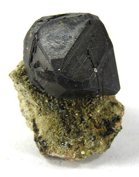


Iron Cap Mine, Landsman Camp, Aravaipa, Aravaipa Mining District, Graham County, Arizona, USA