| Locality type: | Quarry |
| Classification |
|---|
|
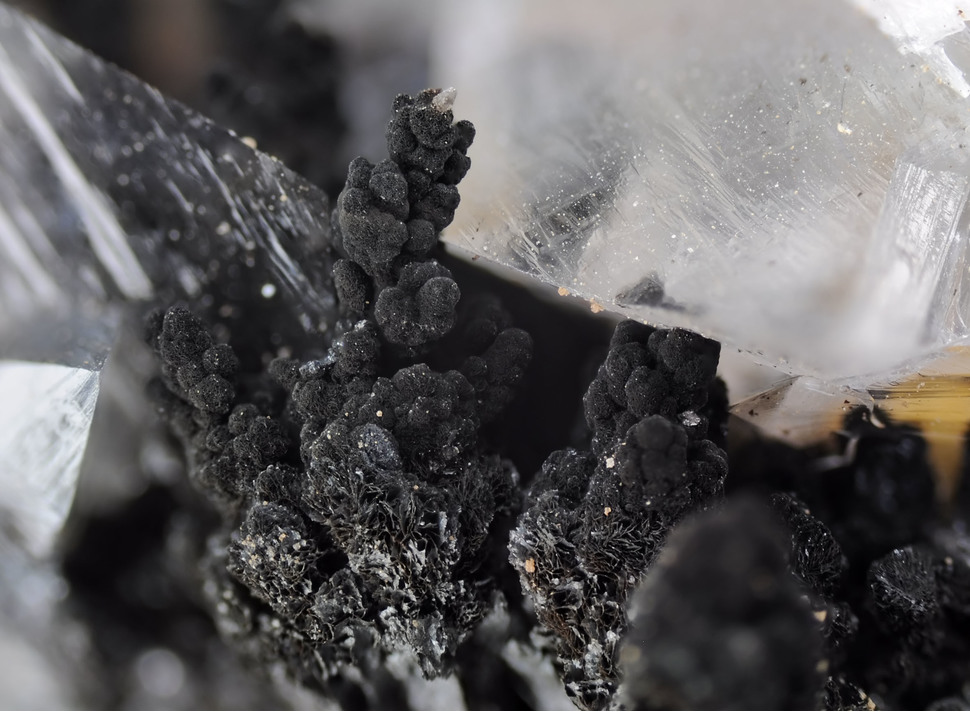
| Species: | Romanèchite |
| Formula: | (Ba,H2O)2(Mn4+,Mn3+)5O10 |
| Confirmation |
|---|
|
| Validity: | Believed Valid |
| Associated Minerals Based on Photo Data: |
|---|
|
| Calcite | ⓘ2 photos of Romanèchite associated with Calcite at this locality. |
| Todorokite | ⓘ2 photos of Romanèchite associated with Todorokite at this locality. |
| Data |
|---|
|
| Mineral Data: | Click here to view Romanèchite data |
| Locality Data: | Click here to view Hufgard quarry, Feldkahl, Hösbach, Aschaffenburg District, Lower Franconia, Bavaria, Germany |
| Data Identifiers |
|---|
|
| Mindat Occurrence Record ID: | 1225999 |
| Long-form Identifier: | 1:3:1225999:1 |
| GUID (UUID V4): | 83117e46-e7a1-4767-83ed-2be3766bae77 |
| Nearest other occurrences of Romanèchite |
|---|
|
|
| 3.8km (2.4 miles) | ⓘFuchs Quarry, Hartkoppe, Sailauf, Aschaffenburg District, Lower Franconia, Bavaria, Germany |
| 4.5km (2.8 miles) | ⓘRhyolite quarry, Rehberg, Sailauf, Aschaffenburg District, Lower Franconia, Bavaria, Germany |
| 5.4km (3.4 miles) | ⓘBeschertglück mine, Schöllkrippen, Aschaffenburg District, Lower Franconia, Bavaria, Germany |
| 8.8km (5.4 miles) | ⓘQuartzite quarry, Hemsbach, Mömbris, Aschaffenburg District, Lower Franconia, Bavaria, Germany |
| 41.2km (25.6 miles) | ⓘBerggeist Mine, Weiße Mauer, Ober-Kainsbach, Reichelsheim, Odenwaldkreis, Darmstadt, Hesse, Germany |
| 41.6km (25.9 miles) | ⓘMichelsberg, Ober-Kainsbach, Reichelsheim, Odenwaldkreis, Darmstadt, Hesse, Germany |
| 42.5km (26.4 miles) | ⓘClay pit, Vierstöck, Reichelsheim, Odenwaldkreis, Darmstadt, Hesse, Germany |
| 99.0km (61.5 miles) | ⓘDr. Geier mine (Amalienhöhe mine; Elisenhöhe mine), Waldalgesheim, Rhein-Nahe, Mainz-Bingen, Rhineland-Palatinate, Germany |
| References |
|---|
|
|


Hufgard quarry, Feldkahl, Hösbach, Aschaffenburg District, Lower Franconia, Bavaria, Germany