| Locality type: | Mine |
| Classification |
|---|
|
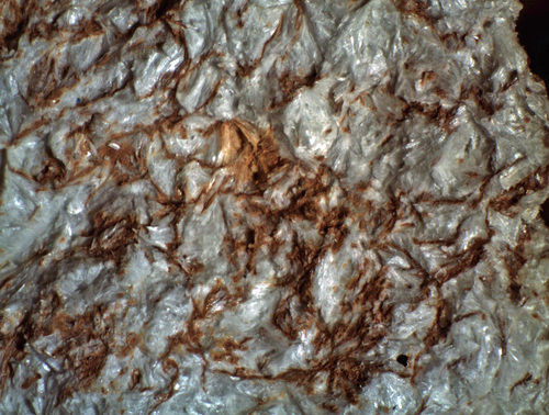
| Species: | Pyrophyllite |
| Formula: | Al2Si4O10(OH)2 |
| Confirmation |
|---|
|
| Validity: | Confirmed |
| Confirmation Methods: | Visually Identified |
| Data |
|---|
|
| Mineral Data: | Click here to view Pyrophyllite data |
| Locality Data: | Click here to view Last Chance Mine (1907 Mine), Casey Hill, Courtland, Turquoise Mining District (Courtland-Gleeson Mining District), Cochise County, Arizona, USA |
| Data Identifiers |
|---|
|
| Mindat Occurrence Record ID: | 952348 |
| Long-form Identifier: | 1:3:952348:7 |
| GUID (UUID V4): | f7f8290e-caf1-4580-b89c-554a583c3160 |
| Nearest other occurrences of Pyrophyllite |
|---|
|
|
| 38.9km (24.2 miles) | ⓘLavender Pit, Bisbee, Cochise County, Arizona, USA |
| 40.9km (25.4 miles) | ⓘWarren, Cochise County, Arizona, USA |
| 51.8km (32.2 miles) | ⓘDos Cabezas project (Gold Prince Mine; Henry Clay Mine; Pat Price Mine; Bain Mine; Murphy Mine; Basin Mine), Dos Cabezas, Dos Cabezas Mining District (Two Heads Mining District), Dos Cabezas Mountains, Cochise County, Arizona, USA |
| 90.7km (56.4 miles) | ⓘRed Mountain Mine (Red Mountain Copper prospect; Gem Mine; Carlton property; Ten Grand Mine; Red Mountain project), Red Mountain, Patagonia Mountains, Santa Cruz County, Arizona, USA |
| 94.2km (58.5 miles) | ⓘBlue Nose Mine (Abe Lincoln Mine; War Horse Mine; Big Chief Mine; Big Jim Mine; Blue Nose Extension Mine; Home Again Virginia Hay claims), Harshaw, Harshaw Mining District, Patagonia Mountains, Santa Cruz County, Arizona, USA |
| 94.5km (58.7 miles) | ⓘBlue Eagle Mine (Blue Eagle 1 and 2 claims; Copper Ledge; Hillside Copper Mine), Blue Eagle and Exposed Reef group, Alum Gulch, Harshaw Mining District, Patagonia Mountains, Santa Cruz County, Arizona, USA |
| 95.3km (59.2 miles) | ⓘSunnyside & Volcano Mines (Sunnyside Mine group; Volcano-Sunnyside Mine; Sunnyside Mine), Alum Gulch, Harshaw Mining District, Patagonia Mountains, Santa Cruz County, Arizona, USA |
| 95.4km (59.3 miles) | ⓘPat Alunite deposit (Pat property; Patagonia property), Palmetto Mining District, Patagonia Mountains, Santa Cruz County, Arizona, USA |
| References |
|---|
|
|


Last Chance Mine, Casey Hill, Courtland, Turquoise Mining District, Cochise County, Arizona, USA