|
USA | |
|
| (2005) Mineral Resources Data System (MRDS), US Geological Survey. |
|
| Cook, Robert B., Smith, W. Everett (1982) Mineralogy of Alabama. Bulletin 120. Geological Survey of Alabama |
|
| Cook, Robert B., Smith, W. Everett (1982) Mineralogy of Alabama. Bulletin 120. Geological Survey of Alabama |
|
| Cook, Robert B., Smith, W. Everett (1982) Mineralogy of Alabama. Bulletin 120. Geological Survey of Alabama |
|
| Rocks & Min 70:5 pp 320-333 |
|
| Cook, Robert B., Smith, W. Everett (1982) Mineralogy of Alabama. Bulletin 120. Geological Survey of Alabama |
|
| Gems and Minerals of America- Jay Ellis Ransom-1974 |
|
| Cook, Robert B., Smith, W. Everett (1982) Mineralogy of Alabama. Bulletin 120. Geological Survey of Alabama |
|
| Cook, Robert B., Smith, W. Everett (1982) Mineralogy of Alabama. Bulletin 120. Geological Survey of Alabama |
|
| Cook, Robert B., Smith, W. Everett (1982) Mineralogy of Alabama. Bulletin 120. Geological Survey of Alabama |
|
| Cook, Robert B., Smith, W. Everett (1982) Mineralogy of Alabama. Bulletin 120. Geological Survey of Alabama |
|
| Cook, Robert B., Smith, W. Everett (1982) Mineralogy of Alabama. Bulletin 120. Geological Survey of Alabama |
|
| Cook, Robert B., Smith, W. Everett (1982) Mineralogy of Alabama. Bulletin 120. Geological Survey of Alabama |
|
| Rocks & Min 70:5 pp 320-333 |
|
| Cook, Robert B., Smith, W. Everett (1982) Mineralogy of Alabama. Bulletin 120. Geological Survey of Alabama |
|
| Cook, Robert B., Smith, W. Everett (1982) Mineralogy of Alabama. Bulletin 120. Geological Survey of Alabama |
|
| wwwdggs.dnr.state.ak.us/scan1/ri/text/RI84-23.PDF. |
- Hoonah-Angoon Census Area
| (2008) Alaska Resource Data File (ARDF) Open-File Report 2008-1225. US Geological Survey |
|
| Econ Geol (1987) 82:894-914 |
- Matanuska-Susitna Borough
| (2008) Alaska Resource Data File (ARDF) Open-File Report 2008-1225. US Geological Survey |
|
| Nokleberg, W. J., & Winkler, G. R. (1982). Stratiform zinc-lead deposits in the Drenchwater Creek area, Howard Pass quadrangle, northwestern Brooks Range, Alaska (p. 22). USGS Professional Paper 1209 |
- Yukon-Koyukuk Census Area
| (2008) Alaska Resource Data File (ARDF) Open-File Report 2008-1225. US Geological Survey |
- Cane Valley Mining District
| Anthony, J.W., et al (1995), Mineralogy of Arizona, 3rd.ed.: 304
Witkind, I.J. & R.E. Thaden (1963), Geology and uranium-vanadium deposits of the Monument Valley area, Apache and Navajo Cos., AZ: 120. |
- Sanders-Defiance Plateau area (Sanders-Cheto District)
| Anthony, J.W., et al (1995), Mineralogy of Arizona, 3rd.ed.: 304
Kiersch, G.A. & W.D. Keller (1955b), Bleaching clay deposits, Sanders-Defiance Plateau district, Navajo Co., AZ, Econ.Geol.: 50: 469-494. |
|
| Anthony, J.W., et al (1995), Mineralogy of Arizona, 3rd.ed.: 304
Kiersch, G.A. & W.D. Keller (1955b), Bleaching clay deposits, Sanders-Defiance Plateau district, Navajo Co., AZ, Econ.Geol.: 50: 469-494. |
|
| Anthony, J.W., et al (1995), Mineralogy of Arizona, 3rd.ed.: 304
Kiersch, G.A. & W.D. Keller (1955b), Bleaching clay deposits, Sanders-Defiance Plateau district, Navajo Co., AZ, Econ.Geol.: 50: 469-494. |
|
| Anthony, J.W., et al (1995), Mineralogy of Arizona, 3rd.ed.: 304
Kiersch, G.A. & W.D. Keller (1955b), Bleaching clay deposits, Sanders-Defiance Plateau district, Navajo Co., Arizona, Econ.Geol.: 50: 469-494. |
|
| Galbraith, F.W. & D.J. Brennan (1959), Minerals of AZ: 109. |
|
| Singer, Donald A., Berger, Vladimir Iosifovich, Moring, Barry C. (2005) Porphyry copper deposits of the world: database, map, and grade and tonnage models. Open-File Report 2005-1060. US Geological Survey doi:10.3133/ofr20051060 |
|
| Galbraith, F.W. & D.J. Brennan (1959), Minerals of AZ: 109. |
|
| Howell, K.K. (1977) Geology and alteration of the Commonwealth mine, Cochise County, Arizona: Tucson, University of Arizona, M.S. thesis, 225 p. |
|
| Anthony, J.W., et al (1995), Mineralogy of Arizona, 3rd.ed.: 304
Pipkin, B.W. (1967), Mineralogy of the 140-ffot core from Willcox Playa, Cochise Co., AZ (abs.), Amer. Assn. Petroleum Geologist Bull., 51:478. |
|
| (2005) Mineral Resources Data System (MRDS), US Geological Survey. |
- Huskon Mines (Huskon group)
| Peirce, H.W., S.B. Keith and J.C.Wilt (1970), Coal, oil, natural gas, helium, and uranium in Arizona, AZ Bur. Mines Bull. 182: 214-234
Hinkley, D.N. (1955), Reconnaissance of the Cameron area, Coconino Co., AZ, US Atomic Energy Comm. USAEC-RME-81. |
|
| Peirce, H.W., S.B. Keith and J.C.Wilt (1970), Coal, oil, natural gas, helium, and uranium in Arizona, AZ Bur. Mines Bull. 182: 103-159 202-289
Bollin & Kerr (1958), Guidebook for New Mexico Geol.Soc., 9th. Field Conference F.P. 164-168. |
|
| Peirce, H.W., S.B. Keith and J.C.Wilt (1970), Coal, oil, natural gas, helium, and uranium in Arizona, AZ Bur. Mines Bull. 182: 118, 214-234
Hinkley, D.N. (1955), Reconnaissance of the Cameron area, Coconino Co., AZ, US Atomic Energy Comm. USAEC-RME-81. |
|
| Peirce, H.W., S.B. Keith and J.C.Wilt (1970), Coal, oil, natural gas, helium, and uranium in Arizona, AZ Bur. Mines Bull. 182
Bollin & Kerr (1958), Guidebook for New Mexico Geol.Soc., 9th. Field Conference F.P.
Hinkley, D.N. (1955), Reconnaissance of the Cameron area, Coconino Co., AZ, US Atomic Energy Comm. USAEC-RME-81
118, 214-234 |
|
| Peirce, H.W., S.B. Keith and J.C.Wilt (1970), Coal, oil, natural gas, helium, and uranium in Arizona, AZ Bur. Mines Bull. 182: 118, 214-234
Bollin & Kerr (1958), Guidebook for New Mexico Geol.Soc., 9th. Field Conference F.P. 164-168. |
|
| Peirce, H.W., S.B. Keith and J.C.Wilt (1970), Coal, oil, natural gas, helium, and uranium in Arizona, AZ Bur. Mines Bull. 182
Bollin & Kerr (1958), Guidebook for New Mexico Geol.Soc., 9th. Field Conference F.P.
Hinkley, D.N. (1955), Reconnaissance of the Cameron area, Coconino Co., AZ, US Atomic Energy Comm. USAEC-RME-81
118, 214-234 |
|
| Anthony, J.W., et al (1995), Mineralogy of Arizona, 3rd.ed.: 304, 305. |
|
| Singer, Donald A., Berger, Vladimir Iosifovich, Moring, Barry C. (2005) Porphyry copper deposits of the world: database, map, and grade and tonnage models. Open-File Report 2005-1060. US Geological Survey doi:10.3133/ofr20051060 |
|
| University of Utah geology department collection |
|
| Yedlin, Neal (1972) Yedlin on Micromounting (Column) The Mineralogical Record, 3 (6) 246-280 |
- Globe-Miami Mining District
- Miami-Inspiration Mining District
- Castle Dome area (Castle Dome Mine area; Pinto Valley Mine area)
| Anthony, J.W., et al (1995), Mineralogy of Arizona, 3rd.ed.: 304
Schwartz, George Melvin (1947) Hydrothermal alteration in the "porphyry copper" deposits. Economic Geology, 42 (4) 319-352 doi:10.2113/gsecongeo.42.4.319
. |
|
| Anthony, J.W., et al (1995), Mineralogy of Arizona, 3rd.ed.: 304
Peterson, N.P. (1962), Geology and ore deposits of the Globe-Miami district, AZ, USGS PP 342: 79. |
|
| Besse, William W. (1981) Mineral Paragenesis of the Grand Reef mine, Aravaipa mining district Graham County, Arizona. M.S. thesis, Department of Geology, California State University, Los Angeles. |
|
| Anthony, J.W., et al (1995), Mineralogy of Arizona, 3rd.ed.: 132, 304
Moolick, R. T., Durek, J. J. (1966) The Morenci District. In Geology of the Porphyry Copper Deposits. The University of Arizona Press, Tucson, AZ. p.221-232.
Schwartz, G.M. (1958), Alteration of biotite under mesothermal conditions, Econ.Geol.: 53: 164-177
Schwartz, George Melvin (1947) Hydrothermal alteration in the "porphyry copper" deposits. Economic Geology, 42 (4) 319-352 doi:10.2113/gsecongeo.42.4.319 |
|
| Singer, Donald A., Berger, Vladimir Iosifovich, Moring, Barry C. (2005) Porphyry copper deposits of the world: database, map, and grade and tonnage models. Open-File Report 2005-1060. US Geological Survey doi:10.3133/ofr20051060 |
|
| Galbraith, F.W. & D.J. Brennan (1959), Minerals of AZ: 109. |
|
| Galbraith, F.W. & D.J. Brennan (1959), Minerals of AZ: 109. |
|
| Anthony, J.W., et al (1995), Mineralogy of Arizona, 3rd.ed.: 305. |
|
| Anthony, J.W., et al (1995), Mineralogy of Arizona, 3rd.ed.: 305
Galbraith, F.W. & Brennan (1959), Minerals of AZ: 109. |
|
| Anthony, John W., Williams, Sidney A., Bideaux, Richard A., Grant, Raymond W. (1995) Mineralogy of Arizona (3rd ed.) University of Arizona Press, Tucson, AZ. |
|
| Anthony, John W., Williams, Sidney A., Bideaux, Richard A., Grant, Raymond W. (1995) Mineralogy of Arizona (3rd ed.) University of Arizona Press, Tucson, AZ. |
- Hopi Buttes Mining District
| Anthony, J.W., et al (1995), Mineralogy of Arizona, 3rd.ed.: 156, 272
Lowell, J.D. (1956), Occurrence of uranium in Seth-La-Kai diatreme, Hopi Buttes, AZ, Amer. Jour. Sci.: 254: 404-412. |
- Monument No. 1 channel (Channel No. 36)
| Witkind, I.J. & R.E. Thaden (1963), Geology and uranium-vanadium deposits of the Monument Valley area, Apache and Navajo Cos., AZ: 80, 135. |
- Pima Mining District (Olive Mining District; Mineral Hill Mining District; Twin Buttes Mining District)
| Singer, D.A., Berger, V.I., Moring, B.C. (2008) Porphyry copper deposits of the world: Database and grade and tonnage models, 2008. Open-File Report 2008-1155 |
|
| Galbraith, F. W. (1947) Minerals of Arizona (Second Edition, Revised) University of Arizona Bulletin 153. Arizona Bureau of Mines |
- Silver Bell Mining District
| Anthony, J.W., et al (1995), Mineralogy of Arizona, 3rd.ed.: 305
Kerr, P.F. (1951), Alteration features at Silverbell, AZ, Geol. Soc. Amer. Bull.: 62: 451-480. |
|
| Bain, Wyatt M, Lecumberri-Sanchez, Pilar, Marsh, Erin E, Steele-MacInnis, Matthew (2022) Fluids and melts at the magmatic-hydrothermal transition, recorded by unidirectional solidification textures at Saginaw Hill, Arizona, USA. Economic Geology, 117 (7) 1543-1571 |
- Florence Mining District (Blackwater Mining District; Black Rock Mining District)
| Singer, Donald A., Berger, Vladimir Iosifovich, Moring, Barry C. (2005) Porphyry copper deposits of the world: database, map, and grade and tonnage models. Open-File Report 2005-1060. US Geological Survey doi:10.3133/ofr20051060 |
|
| Anthony, J.W., et al (1995), Mineralogy of Arizona, 3rd.ed.: 305. |
|
| Jones, R.W. & W.E. Wilson (1983), The Ray mine, Min.Rec.: 14(5): 311-322. |
- adjacent to State Route 177
| Anthony, J.W., et al (1995), Mineralogy of Arizona, 3rd.ed.: 305. |
- Cottonwood Mining District
| MRDS databaase Dep. ID #10037118
MRDS ID #M030480. |
- Bradshaw Mountains (Bradshaw Range)
- Turkey Creek Mining District
| Singer, Donald A., Berger, Vladimir Iosifovich, Moring, Barry C. (2005) Porphyry copper deposits of the world: database, map, and grade and tonnage models. Open-File Report 2005-1060. US Geological Survey doi:10.3133/ofr20051060 |
|
| Anthony, J.W., et al (1995), Mineralogy of Arizona, 3rd.ed.: 305. |
|
| Singer, D.A., Berger, V.I., Moring, B.C. (2008) Porphyry copper deposits of the world: Database and grade and tonnage models, 2008. Open-File Report 2008-1155 |
|
| Anthony, J.W., et al (1995), Mineralogy of Arizona, 3rd.ed.: 305
Norton, J.J. (1965), Lithium-bearing bentonite deposit, Yavapai Co., AZ, USGS PP 525-D: 163-166. |
- Castle Dome Mining District
| Wilson, E.D. (1933), AZ Bur. Mines Bull. 134: 44. |
- Wellton Hills-Copper Mountains
- La Posa Mining District (Wellton Mining District; Wellton Hills Mining District)
| Galbraith, F.W. & Brennan (1959), Minerals of AZ: 109. |
|
| Howard, J. Michael (2007) Bulletin Vol. 23, Mineral Species of Arkansas - A Digest (2nd ed.) Arkansas Geological Commission
Howard, J. Michael (1987) Mineral Species of Arkansas - A Digest. Bulletin Vol. 23 (1st ed.) Arkansas Geological Commission |
|
| Howard, J. Michael (2007) Bulletin Vol. 23, Mineral Species of Arkansas - A Digest (2nd ed.) Arkansas Geological Commission |
|
| Smith, Arthur E. Jr. (1997) Collecting Arkansas Minerals. L. R. Ream Publishing, Coeur d'Alene, ID.
Rocks & Min. (1995): 70: 154-170. |
|
| Howard, J. Michael (2007) Bulletin Vol. 23, Mineral Species of Arkansas - A Digest (2nd ed.) Arkansas Geological Commission
Howard, J. Michael (1987) Mineral Species of Arkansas - A Digest. Bulletin Vol. 23 (1st ed.) Arkansas Geological Commission |
|
| Howard, J. Michael (2007) Bulletin Vol. 23, Mineral Species of Arkansas - A Digest (2nd ed.) Arkansas Geological Commission |
|
| (2005) Mineral Resources Data System (MRDS), US Geological Survey.
(2005) Mineral Resources Data System (MRDS), US Geological Survey.
V.C. Fryklund and D.F. Holbrook (1950) Titanium Ore Deposit of Hot Spring County Arkansas, Bulletin 16 Arkansas Geological Survey |
|
| Howard, J. Michael (2007) Bulletin Vol. 23, Mineral Species of Arkansas - A Digest (2nd ed.) Arkansas Geological Commission |
|
| Arkansas Geological Commission |
|
| (2005) Mineral Resources Data System (MRDS), US Geological Survey. |
- Big Creek-Rush Creek Mining District
| Walstrom, Robert E. (n.d.) Personal communication. |
|
| (2005) Mineral Resources Data System (MRDS), US Geological Survey. |
|
| (2005) Mineral Resources Data System (MRDS), US Geological Survey. |
|
| Murdoch, Joseph, Webb, Robert W. (1966) Minerals of California, Centennial Volume (1866-1966) - California Division Mines and Geology, Bulletin 189. p.1-559.
Wells, R.C. (1937), Analyses of rocks and minerals: USGS Bulletin 878: 101
Melhase, John (1926), Mining bentonite in California: Engineering & Mining Journal: 121: 838 |
|
| Stolburg, Craig S. (1984) The Mines and Minerals of Darwin, California. The Mineralogical Record, 15 (1) 5-18 |
- Darwin Mine (Anaconda; Bernon Mine; Defiance Mine; Essex Mine; Independence Mine; Intermediate Mine; Rip Van Winkle Mine; Thompson Mine)
| Pemberton, H. Earl (1983) Minerals of California. Van Nostrand Reinhold Company Inc.
Hall, Wayne Everett & Edward M. Mackevett (1963), Geology and ore deposits of the Darwin quadrangle, Inyo County, California: USGS PP 368: 63
Van Nostrand Reinholt Press: 439. |
- Deep Springs Lake (Deep Springs Playa)
| Pemberton, H. Earl (1983) Minerals of California. Van Nostrand Reinhold Company Inc.
Gueven, N. and Kerr, P.F. (1966) Selected Great Basin clays. American Mineralogist: 51: 1059-1060
Van Nostrand Reinholt Press: 439. |
- Furnace Creek Mining District (Furnace Creek Borate Mining District)
| J.W. Anthony, R.A. Bideaux, K.W. Bladh, M.C. Nichols: Handbook of Mineralogy, Vol. V (2003) |
|
| Erd, Richard C., McAllister, James F., Eberlein, G. Donald (1979) New data on hungchaoite, the second world occurrence, Death Valley region, California. American Mineralogist, 64 (3-4) 369-375 |
|
| (2005) Mineral Resources Data System (MRDS), US Geological Survey. |
- Panamint Mts (Panamint Range)
- Panamint Mining District (Ballarat Mining District)
| (2005) Mineral Resources Data System (MRDS), US Geological Survey. |
|
| Murdoch, Joseph, Webb, Robert W. (1966) Minerals of California, Centennial Volume (1866-1966) - California Division Mines and Geology, Bulletin 189. p.1-559.
Bradley, W.W. (1941), Thirty-seventh report of the State Mineralogist: California Division Mines Report 37: 602 |
|
| U.S. Borax |
|
| Am Min 49:543-555 |
- El Paso Mountains District
| (2005) Mineral Resources Data System (MRDS), US Geological Survey. |
|
| (2005) Mineral Resources Data System (MRDS), US Geological Survey. |
|
| (2005) Mineral Resources Data System (MRDS), US Geological Survey. |
|
| (2005) Mineral Resources Data System (MRDS), US Geological Survey. |
|
| Pemberton, H. Earl (1983) Minerals of California. Van Nostrand Reinhold Company Inc.
Troxel, Bennie W., Morton, Paul K. (1962) Mines and Mineral Resources of Kern County California. County Report 1. California Division of Mines and Geology
Ross, Clarence Samuel and Hendricks, S.B. (1945) Minerals of the montmorillonite group. USGS Professional Paper 205-B: 42
Kerr, Paul Francis & Eugene Nathan Cameron (1936), Fuller’s earth of bentonitic origin from Tehachapi, California: American Mineralogist: 21: 231
Van Nostrand Reinholt Press: 439. |
|
| Pemberton, H. Earl (1983) Minerals of California. Van Nostrand Reinhold Company Inc.
Ross, Clarence Samuel and Hendricks, S.B. (1945) Minerals of the montmorillonite group. USGS Professional Paper 205-B: 34, 42
Van Nostrand Reinholt Press: 439. |
- Southeast of Tehachapi Pass
| Murdoch, Joseph, Webb, Robert W. (1966) Minerals of California, Centennial Volume (1866-1966) - California Division Mines and Geology, Bulletin 189. p.1-559.
Kerr, Paul Francis & Eugene Nathan Cameron (1936), Fuller’s earth of bentonitic origin from Tehachapi, California: American Mineralogist: 21: 231 |
|
| (2005) Mineral Resources Data System (MRDS), US Geological Survey. |
|
| (2005) Mineral Resources Data System (MRDS), US Geological Survey. |
|
| (2005) Mineral Resources Data System (MRDS), US Geological Survey. |
|
| (2005) Mineral Resources Data System (MRDS), US Geological Survey. |
|
| (2005) Mineral Resources Data System (MRDS), US Geological Survey. |
- Sulphur Creek Mining District (Sulfur Creek Mining District; Wilbur Springs Mining District)
| Erd, R.C., D.E. White, J.J. Fahey & D.E. Lee (1964), Buddingtonite, an ammonium feldspar with zeolitic water: American Mineralogist: 49: 831-850Pemberton, H. Earl (1983), Minerals of California
White, D.E. & C.E. Roberson (1962), Sulphur Bank, California: Geological Society of America Buddington Memorial Volume: Petrologic studies: 408
Van Nostrand Reinholt Press: 439. |
- Amedee Hot Springs (Amedee Springs)
| Pemberton, H. Earl (1983) Minerals of California. Van Nostrand Reinhold Company Inc.
White, D.E. (1967) Mercury and base-metal deposits with associated thermal and mineral waters. In: H.L. Barnes (Editor), Geochemistry of hydrothermal ore deposits. Holt Reinhart and Winston, New York: 597-598
Van Nostrand Reinholt Press: 440. |
|
| Nevada Bureau of Mines and Geology NBMG Open-File Report 96-3 By Stephen B. Castor, Christopher D. Henry, Lisa A. Shevenell |
- Hayden Hill Mining District
| (2005) Mineral Resources Data System (MRDS), US Geological Survey. |
|
| Gay, T.E. and Hoffman, S.R. (1954) Mines and mineral deposits of Los Angeles County, California. California Journal of Mines and Geology, California Division of Mines (Report 50): 50(3&4): 633.
Merrill, Frederick James Hamilton (1919), Los Angeles, Orange and Riverside Counties: California Mining Bureau Report 15: 500 |
|
| Pemberton, H. Earl (1983) Minerals of California. Van Nostrand Reinhold Company Inc.
Murdoch, Joseph & Robert W. Webb (1966), Minerals of California, Centennial Volume (1866-1966): California Division Mines & Geology Bulletin 189: 273
Sharp, W.E. (1959) Minerals from Los Angeles County, California. Printed privately, Los Angeles, California: 42, 90
Laudermilk, Jerome Douglas & Alfred O. Woodford (1934), Secondary montmorillonite in a California pegmatite: American Mineralogist: 19: 260-267
Van Nostrand Reinholt Press: 440. |
- Knoxville Mining District
| Sherlock, R. L. (1996). Hydrothermal alteration of volcanic rocks at the McLaughlin gold deposit, northern California. Canadian Journal of Earth Sciences, 33(3), 493-508. |
|
| San Diego Mining Company (1998), Anita mine field analysis, Jan. |
|
| Cal Div of Mines & Geo Bulletin 189 " Minerals of California" |
|
| Woodford, A.O., Crippen, R.A., and Garner, K.B. (1941) Section Across Commercial Quarry, Crestmore, California. American Mineralogist: 26: 351-381 (366). |
|
| Woodford, A.O., Crippen, R.A., and Garner, K.B. (1941) Section Across Commercial Quarry, Crestmore, California. American Mineralogist: 26: 351-381. |
|
| Erd, Richard C., Bonardi, Maurizio, Criddle, Alan J., Roberts, Andrew C., Page, Yvon Le, Gabe, Eric J. (1993) Edoylerite Hg2+3Cr6+O4S2 a new mineral from the Clear Creek Claim, San Benito County, California. The Mineralogical Record, 24 (6) 471-475 |
|
| www.benitoitemine.com |
|
| (2005) Mineral Resources Data System (MRDS), US Geological Survey. |
|
| King, Van (n.d.) Personal communcation. |
- Calico Mts (Calico Hills)
- Calico District (Daggett District; Calico-Daggett area)
| Murdoch, Joseph, Webb, Robert W. (1966) Minerals of California, Centennial Volume (1866-1966) - California Division Mines and Geology, Bulletin 189. p.1-559.
Davis, C.W. & .C. Vacher (1928), Bentonite: US Bureau Mines Tech. Paper 438: 6
Melhase, John (1926), Mining bentonite in California: Engineering & Mining Journal: 121: 837-842 |
|
| (2005) Mineral Resources Data System (MRDS), US Geological Survey.
(2005) Mineral Resources Data System (MRDS), US Geological Survey. |
- East Kramer Mining District
- East Kramer Borate area (East Kramer Colemanite area)
- Kramer Junction (Beecher's Corners; Beechers Corners; Four Corners)
| Pemberton, H. Earl (1983) Minerals of California. Van Nostrand Reinhold Company Inc.
American Mineralogist (1964): 49: 543-555.
Huggins, Charles W., Marion V. Denny & Haskell R. Shell (1962), Properties of palygorskite, an asbestiform mineral: U.S. Bureau of Mines Report Of Investigation 6071, 17pp.: 15
Benda, William K. Richard C. Erd & Ward C. Smith (1960), Core logs from five test holes near Kramer, California: USGS Bulletin 1045-F: 330
Van Nostrand Reinholt Press: 442 |
|
| MarekC (2018) pers. collection, Raman verified. |
|
| (2005) Mineral Resources Data System (MRDS), US Geological Survey. |
|
| Murdoch, Joseph & Robert W. Webb (1966), Minerals of California, Centennial Volume (1866-1966): California Division Mines & Geology Bulletin 189: 151.
Ames, Lloyd L., Jr., et al (1958), A contribution on the Hector, California bentonite deposit: Economic Geology: 53: 28 |
- Silver Lake Mining District
| (2005) Mineral Resources Data System (MRDS), US Geological Survey. |
|
| (2005) Mineral Resources Data System (MRDS), US Geological Survey. |
|
| Pemberton, H. Earl (1983) Minerals of California. Van Nostrand Reinhold Company Inc.
Wright, L.A., et al (1953), Mines and mineral resources of San Bernardino County, California: California Journal of Mines and Geology: 49(1-2): 161.
Van Nostrand Reinholt Press: 440. |
- Tule Mountain (Mount Tule; Tulley Mountain)
| Todd, V. R. et al. 1987. Mineral Resources of the Sawtooth Mountains and Carrizo Gorge/ Eastern McCain Valley Wilderness Study Areas, San Diego County, California. U.S. Geological Survey Bulletin 1711-B, 26 p., maps. |
|
| Todd, V. R. et al. (1987) Mineral Resources of the Sawtooth Mountains and Carrizo Gorge/ Eastern McCain Valley Wilderness Study Areas, San Diego County, California. U.S. Geological Survey Bulletin 1711-B, 26 p., maps. |
- Mesa Grande Mining District
| Carnahan, V. 1960. The Treasure of the Himalaya Mine. Gems & Minerals magazine, November, pages 21-25, 55-57. |
|
| Murdoch, Joseph, Webb, Robert W. (1966) Minerals of California, Centennial Volume (1866-1966) - California Division Mines and Geology, Bulletin 189. p.1-559.
Kerr, Paul Francis & John Laurence Kulp (1949), Clay localities the United States: American Petroleum Institute Project 49 Preliminary Report No. 2 on clay mineral standards, Columbia Univ., 101 pp.: 51
Hertlein, Leo George & Ulysses S. Grant, IV (1944), The geology and paleontology of the marine Pliocene of San Diego, California, part I, geology: San Diego Society of Natural History Memorandum, vol. 2, 72 pp.: 57
Irelan, William, Jr. (1890a), Ninth annual report of the State Mineralogist: California Mining Bureau. Report 9, 352 pp.: 139 |
|
| Jeffrey E. Patterson analysis |
|
| Osborn, P. (2007), Personal communication between Phil Osborn of Hemet and Scott L. Ritchie
Overview of work including adit development, petrology, lithology, bonanza pocket zone encountered, and gemstones recovered during the Oceanview mining operation. Feb. |
- Pala Chief Mine (Chief mine; MS 6452; Salmons mine)
| Hapeman, Jeffrey R. (2011) |
- Tourmaline Queen Mountain (Pala Mtn; Queen Mtn)
| www.gemandmineral.com/stewartmine.html. |
|
| Sheppard, J. B. (2008), History of the surface prospects and underground mining developments made along the northern portion of the Stewart pegmatite
personal communication with Scott L. Ritchie, San Diego Mining Company (SDMC). June/July. |
|
| Sheppard, J. B. (2008), History of the surface prospects and underground mining developments made along the northern portion of the Stewart pegmatite
personal communication with Scott L. Ritchie, San Diego Mining Company (SDMC). June/July. |
|
| San Diego Mining Company (1998) |
|
| San Diego Mining Company, 2001. |
|
| Kunz, George F. (1905) Gems, Jewelers' Materials, and Ornamental Stones of California. Bulletin 37 (2nd ed.) California State Mining Bureau |
|
| Foord, Eugene E., Martin, Robert F., Spaulding, Louis B., Mason, Roger A. (1989) Mineralogy and Paragenesis of the Little Three Mine Pegmatites, Ramona District, San Diego County, California. The Mineralogical Record, 20 (2) 101-127 |
|
| Foord, Eugene E., Martin, Robert F., Spaulding, Louis B., Mason, Roger A. (1989) Mineralogy and Paragenesis of the Little Three Mine Pegmatites, Ramona District, San Diego County, California. The Mineralogical Record, 20 (2) 101-127 |
|
| San Diego Mining Company, 1995-1997. |
- Warner Springs Mining District
| Ritchie, S. 2000. History of the Carmelita Gem Mine in the 20th Century. Southern California Gem Industries web publication: July. |
- Santa Lucia Mts (Santa Lucia Range)
- Cambria-Oceanic Mining District
| Ernst, W.G. and C.A. Hall (1975) Feldspathic geodes near Black Mountain, western San Luis Obispo County, California. American Mineralogist: 60: 1105-1112 |
|
| Pampeyan, E.H. (2010): USGS Open-File Report 10-1053 |
|
| Pampeyan, E.H. (2010): USGS Open-File Report 10-1053 |
|
| Pampeyan, E.H. (2010): USGS Open-File Report 10-1053 |
|
| Pampeyan, E.H. (2010): USGS Open-File Report 10-1053 |
|
| Pampeyan, E.H. (2010): USGS Open-File Report 10-1053 |
|
| Pampeyan, E.H. (2010): USGS Open-File Report 10-1053 |
|
| USGS MRDS database (2005).
California Journal of Mines and Geology, California Mining Bureau. (Report 21): 21: 546 |
- Lassen Volcanic National Park
| Robert G. Lee, John H. Dilles, David A. John, Tanya L. Abela (2005) The mineralogy and origin of hydrothermally altered Quaternary volcanic rocks on the south flank of Lassen volcano, California: Interim report for USGS Mineral Resource External Research Program grant of $42,000 in FY 2005 |
|
| Weaver, C.E. (1949): Geology and Mineral Deposits of an Area North of San Francisco Bay, California: California Division of Mines Bulletin 149: 98-104.
Laizure, Clyde McK (1927), Solano County: California Journal of Mines and Geology, California Mining Bureau (Report 23): 23(2): 209. |
- Halls Gulch Mining District
| Pemberton, H. Earl (1983) Minerals of California. Van Nostrand Reinhold Company Inc.
Sheppard, R.A. and Gude, A.J. (1969a) Rhodesite from Trinity County, California. American Mineralogist: 54: 251-255
Van Nostrand Reinholt Press: 441
www.mineralsocal.org |
|
| Pemberton, H. Earl (1983) Minerals of California. Van Nostrand Reinhold Company Inc.
Murdoch, Joseph & Robert W. Webb (1966), Minerals of California, Centennial Volume (1866-1966): California Division Mines & Geology Bulletin 189: 273
Kerr, Paul Francis (1931), Bentonite from Ventura, California: Economic Geology: 26: 157 |
|
| Pemberton, H. Earl (1983) Minerals of California. Van Nostrand Reinhold Company Inc.
Murdoch, Joseph & Robert W. Webb (1966), Minerals of California, Centennial Volume (1866-1966): California Division Mines & Geology Bulletin 189: 273
Kerr, Paul Francis (1931), Bentonite from Ventura, California: Economic Geology: 26: 157
Van Nostrand Reinholt Press: 441. |
|
| Murdoch, Joseph, Webb, Robert W. (1966) Minerals of California, Centennial Volume (1866-1966) - California Division Mines and Geology, Bulletin 189. p.1-559.
Kerr, Paul Francis (1931), Bentonite from Ventura, California: Economic Geology: 26: 157 |
|
| Leventhal, Joel S. (1988) The geology, carbonaceous materials, and origin of the epigenetic uranium deposits in the Tertiary Sespe Formation in Ventura County, California. USGS Bull 1771.
Dickinson, Kendell A. |
|
| Anthony, J.W., et al (1995), Mineralogy of Arizona, 3rd.ed.: 304
Schultz, L.G. (1963), Clay minerals in Triassic rocks of the Colorado Plateau, USGS Bull. 1147-C
Keller, W.D. (1962), Clay minerals in the Morrison Formation of the Colorado Plateau, USGS Bull.: 1150. |
- Jamestown Mining District
| Eckel, Edwin Butt , Cobban, Robert R., Mosburg, Shirley K., Foord, Eugene E. (1997) Minerals of Colorado. Fulcrum Publishing. |
- Browns Canyon Mining District
| (2005) Mineral Resources Data System (MRDS), US Geological Survey. |
|
| (2005) Mineral Resources Data System (MRDS), US Geological Survey. |
|
| (2005) Mineral Resources Data System (MRDS), US Geological Survey. |
|
| (2005) Mineral Resources Data System (MRDS), US Geological Survey. |
|
| (2005) Mineral Resources Data System (MRDS), US Geological Survey. |
|
| (2005) Mineral Resources Data System (MRDS), US Geological Survey. |
|
| (2005) Mineral Resources Data System (MRDS), US Geological Survey. |
|
| (2005) Mineral Resources Data System (MRDS), US Geological Survey. |
|
| (2005) Mineral Resources Data System (MRDS), US Geological Survey. |
|
| Eckel, Edwin Butt , Cobban, Robert R., Mosburg, Shirley K., Foord, Eugene E. (1997) Minerals of Colorado. Fulcrum Publishing. |
|
| Eckel, Edwin Butt , Cobban, Robert R., Mosburg, Shirley K., Foord, Eugene E. (1997) Minerals of Colorado. Fulcrum Publishing. |
|
| Eckel, Edwin Butt , Cobban, Robert R., Mosburg, Shirley K., Foord, Eugene E. (1997) Minerals of Colorado. Fulcrum Publishing. |
- Silver Cliff Mining District
| Eckel, Edwin Butt , Cobban, Robert R., Mosburg, Shirley K., Foord, Eugene E. (1997) Minerals of Colorado. Fulcrum Publishing. |
|
| Eckel, Edwin Butt , Cobban, Robert R., Mosburg, Shirley K., Foord, Eugene E. (1997) Minerals of Colorado. Fulcrum Publishing. |
|
| Eckel, Edwin Butt , Cobban, Robert R., Mosburg, Shirley K., Foord, Eugene E. (1997) Minerals of Colorado. Fulcrum Publishing. |
|
| Eckel, Edwin Butt , Cobban, Robert R., Mosburg, Shirley K., Foord, Eugene E. (1997) Minerals of Colorado. Fulcrum Publishing. |
|
| (2005) Mineral Resources Data System (MRDS), US Geological Survey. |
|
| Eckel, Edwin Butt , Cobban, Robert R., Mosburg, Shirley K., Foord, Eugene E. (1997) Minerals of Colorado. Fulcrum Publishing. |
|
| Eckel, Edwin Butt , Cobban, Robert R., Mosburg, Shirley K., Foord, Eugene E. (1997) Minerals of Colorado. Fulcrum Publishing. |
|
| Eckel, Edwin Butt , Cobban, Robert R., Mosburg, Shirley K., Foord, Eugene E. (1997) Minerals of Colorado. Fulcrum Publishing. |
|
| Eckel, Edwin Butt , Cobban, Robert R., Mosburg, Shirley K., Foord, Eugene E. (1997) Minerals of Colorado. Fulcrum Publishing. |
|
| Eckel, Edwin Butt , Cobban, Robert R., Mosburg, Shirley K., Foord, Eugene E. (1997) Minerals of Colorado. Fulcrum Publishing.
USGS Bull 1027E |
|
| Eckel, Edwin Butt , Cobban, Robert R., Mosburg, Shirley K., Foord, Eugene E. (1997) Minerals of Colorado. Fulcrum Publishing. |
|
| Eckel, Edwin Butt , Cobban, Robert R., Mosburg, Shirley K., Foord, Eugene E. (1997) Minerals of Colorado. Fulcrum Publishing. |
|
| Eckel, Edwin Butt , Cobban, Robert R., Mosburg, Shirley K., Foord, Eugene E. (1997) Minerals of Colorado. Fulcrum Publishing. |
|
| USGS Bull 1082F |
|
| USGS Bull 1082F |
|
| Eckel, Edwin Butt , Cobban, Robert R., Mosburg, Shirley K., Foord, Eugene E. (1997) Minerals of Colorado. Fulcrum Publishing. |
|
| Eckel, Edwin Butt , Cobban, Robert R., Mosburg, Shirley K., Foord, Eugene E. (1997) Minerals of Colorado. Fulcrum Publishing. |
|
| Eckel, Edwin Butt , Cobban, Robert R., Mosburg, Shirley K., Foord, Eugene E. (1997) Minerals of Colorado. Fulcrum Publishing. |
|
| Freeport-McMoRan |
|
| (2005) Mineral Resources Data System (MRDS), US Geological Survey. |
|
| (2005) Mineral Resources Data System (MRDS), US Geological Survey. |
|
| Eckel, Edwin Butt , Cobban, Robert R., Mosburg, Shirley K., Foord, Eugene E. (1997) Minerals of Colorado. Fulcrum Publishing. |
|
| Kucera, Ken (2021) The Bulldog Mountain Mine (aka Bulldog Mine), Blocks of Nearly Solid Silver, Creede Mining District, Mineral County, Colorado. CSM-Museum-Newsletter, 1-45 |
|
| Eckel, Edwin Butt , Cobban, Robert R., Mosburg, Shirley K., Foord, Eugene E. (1997) Minerals of Colorado. Fulcrum Publishing. |
|
| Eckel, Edwin Butt , Cobban, Robert R., Mosburg, Shirley K., Foord, Eugene E. (1997) Minerals of Colorado. Fulcrum Publishing. |
|
| Eckel, Edwin Butt , Cobban, Robert R., Mosburg, Shirley K., Foord, Eugene E. (1997) Minerals of Colorado. Fulcrum Publishing. |
|
| Eckel, Edwin Butt , Cobban, Robert R., Mosburg, Shirley K., Foord, Eugene E. (1997) Minerals of Colorado. Fulcrum Publishing. |
|
| Eckel, Edwin Butt , Cobban, Robert R., Mosburg, Shirley K., Foord, Eugene E. (1997) Minerals of Colorado. Fulcrum Publishing. |
|
| USGS Prof Paper 320 |
|
| Eckel, Edwin Butt , Cobban, Robert R., Mosburg, Shirley K., Foord, Eugene E. (1997) Minerals of Colorado. Fulcrum Publishing. |
|
| Eckel, Edwin Butt , Cobban, Robert R., Mosburg, Shirley K., Foord, Eugene E. (1997) Minerals of Colorado. Fulcrum Publishing. |
|
| Eckel, Edwin Butt , Cobban, Robert R., Mosburg, Shirley K., Foord, Eugene E. (1997) Minerals of Colorado. Fulcrum Publishing. |
|
| Eckel, Edwin Butt , Cobban, Robert R., Mosburg, Shirley K., Foord, Eugene E. (1997) Minerals of Colorado. Fulcrum Publishing. |
|
| Eckel, Edwin Butt , Cobban, Robert R., Mosburg, Shirley K., Foord, Eugene E. (1997) Minerals of Colorado. Fulcrum Publishing. |
|
| Eckel, Edwin Butt , Cobban, Robert R., Mosburg, Shirley K., Foord, Eugene E. (1997) Minerals of Colorado. Fulcrum Publishing. |
|
| Eckel, Edwin Butt , Cobban, Robert R., Mosburg, Shirley K., Foord, Eugene E. (1997) Minerals of Colorado. Fulcrum Publishing. |
- Bonanza Mining District (Kerber Creek Mining District; Blake Mining District)
| Eckel, Edwin Butt , Cobban, Robert R., Mosburg, Shirley K., Foord, Eugene E. (1997) Minerals of Colorado. Fulcrum Publishing. |
|
| Rocks & Minerals (July-August, 2002) |
|
| Min Rec (1986) 17:229-236
USGS Prof. Paper 750C |
|
| Carnein, Carl R., Bartos, Paul J. (2005) Famous mineral localities: The Cripple Creek Mining District, Colorado, in March - April 2005. The Mineralogical Record, 36 (2) 143-185 |
|
| Econ Geol (1985) 80:1669-1688 |
|
| Econ Geol (1985) 80:1669-1688 |
|
| Eckel, Edwin Butt , Cobban, Robert R., Mosburg, Shirley K., Foord, Eugene E. (1997) Minerals of Colorado. Fulcrum Publishing. |
|
| Januzzi, Ron E., Seaman, David M. (1976) Mineral Localities of Connecticut and Southeastern New York State and Pegmatite Minerals of the World. The Mineralogical Press, Danbury, Connecticut, USA. |
|
| Shepard, Charles U. (1837), A Report on the Geological Survey of Connecticut. Hamlem, New Haven. |
|
| Schooner, Richard. (1961), The Mineralogy of Connecticut. Fluorescent House, Branford, Connecticut. |
|
| Schooner, Richard. (1958) THE MINERALOGY OF THE PORTLAND-EAST HAMPTON-MIDDLETOWN-HADDAM AREA IN CONNECTICUT (With a few notes on Glastonbury and Marlborough). |
|
| Rocks & Min.: 16: 164-167. |
|
| Schooner, Richard. (1955): 90 Minerals from 1 Connecticut Hill. Rocks & Minerals: 30(7-8): 351-8.
Cameron, Eugene N., , (1954) Pegmatite investigations, 1942-45, in New England. Professional Paper 255. US Geological Survey doi:10.3133/pp255
USGS Professional Paper 255: 333-338. |
|
| Weber, Marcelle H., Sullivan, Earle C. (1995) Connecticut Mineral Locality Index. Rocks & Minerals, 70 (6) 396-409 doi:10.1080/00357529.1995.11761569
Januzzi, Ron E., Seaman, David M. (1976) Mineral Localities of Connecticut and Southeastern New York State and Pegmatite Minerals of the World. The Mineralogical Press, Danbury, Connecticut, USA.
Zodac (1941) |
|
| Rocks & Minerals (1970) 45:595-600 |
|
| (2005) Mineral Resources Data System (MRDS), US Geological Survey. |
|
| (2005) Mineral Resources Data System (MRDS), US Geological Survey. |
|
| Zeitner, June Culp (1968) Appalachian Mineral & Gem Trails. Lapidary Journal, Inc. |
|
| (2005) Mineral Resources Data System (MRDS), US Geological Survey. |
|
| (2005) Mineral Resources Data System (MRDS), US Geological Survey. |
|
| (2005) Mineral Resources Data System (MRDS), US Geological Survey. |
|
| (2005) Mineral Resources Data System (MRDS), US Geological Survey. |
|
| (2005) Mineral Resources Data System (MRDS), US Geological Survey. |
|
| (2005) Mineral Resources Data System (MRDS), US Geological Survey. |
- Hard-Rock Phosphate Mining District
| (2005) Mineral Resources Data System (MRDS), US Geological Survey. |
|
| (2005) Mineral Resources Data System (MRDS), US Geological Survey. |
|
| (2005) Mineral Resources Data System (MRDS), US Geological Survey. |
|
| (2005) Mineral Resources Data System (MRDS), US Geological Survey. |
|
| minerals.er.usgs.gov (n.d.) http://minerals.er.usgs.gov/minerals/pubs/state/981201.pdf. |
|
| (2005) Mineral Resources Data System (MRDS), US Geological Survey. |
|
| Marc V. Hurst (2012) Central Florida Phosphate District. Southeastern Geological Society Field Trip Guidebook No. 57 |
|
| (2005) Mineral Resources Data System (MRDS), US Geological Survey. |
|
| (2005) Mineral Resources Data System (MRDS), US Geological Survey. |
|
| (2005) Mineral Resources Data System (MRDS), US Geological Survey. |
|
| (2005) Mineral Resources Data System (MRDS), US Geological Survey. |
|
| (2005) Mineral Resources Data System (MRDS), US Geological Survey. |
|
| Econ Geol (1991) 86:436-443 |
|
| (2005) Mineral Resources Data System (MRDS), US Geological Survey. |
|
| (2005) Mineral Resources Data System (MRDS), US Geological Survey. |
|
| (2005) Mineral Resources Data System (MRDS), US Geological Survey. |
|
| (2005) Mineral Resources Data System (MRDS), US Geological Survey. |
|
| (2005) Mineral Resources Data System (MRDS), US Geological Survey. |
|
| Schlanger, S. O. (1964) Petrology of the Limestones of Guam. USGS Professional Paper 403D |
|
| Hathaway, J. C., & Schlanger, S. O. (1965). Nordstrandite (A12O3· 3H2O) from Guam. American Mineralogist: Journal of Earth and Planetary Materials, 50(7-8), 1029-1037. |
- Koolau Range (Koolau caldera)
| Fujishima, K.Y. and Fan, P-F (1977) Hydrothermal mineralogy of Keolu Hills, Oahu, Hawaii. American Mineralogist, 62, 574-582. |
- SE Idaho Phosphate Mining District
| Gulbrandsen, R. A. (1974). Buddingtonite, ammonium feldspar, in the Phosphoria Formation, southeastern Idaho. US Geological Survey Journal of Research, 2, 693-697. |
- Bay Horse Mining District
| USGS OFR 2000 - OF-00-239 |
|
| Tschernich, Rudy W. (1992) Zeolites of the World. Geoscience Press, Inc., Phoenix, Arizona. 567pp.
Tschernich, Rudy D., Wise, W. S. (1982) Paulingite: variations in composition. American Mineralogist, 67. 799-803 |
|
| (2005) Mineral Resources Data System (MRDS), US Geological Survey. |
|
| (2005) Mineral Resources Data System (MRDS), US Geological Survey. |
|
| Ream, Lanny R. (1995) Idaho: Mineral Locality Index. Rocks & Minerals, 70 (4) 242-263 doi:10.1080/00357529.1995.9926628 |
- Thunder Mountain Mining District
| (2005) Mineral Resources Data System (MRDS), US Geological Survey. |
|
| Andrew R. Thomas and Haydn H.Murray (1989) Clay Mineral Segregation By Flocculation In The Porters Creek Formation :Clay and Clay Minerals Vol 37,No 2, 179-184,1989 |
|
| www.indiana.edu |
|
| Hattin, D.E., 1982, Stratigraphy and depositional environment of the Smoky Hill Chalk Member, Niobrara Chalk (Upper Cretaceous) of the type area, western Kansas: Kansas Geological Survey Bulletin 225:1-108. |
|
| Olive,Wilds W.,and Flinch,Warren L.,(1969) Stratigraphic and Mineralogic Relations and Ceramic Properties of Clay Deposits of Eocene Age in the Jackson Purchase Region,Kentucky and in Adjacent Parts of Tennessee :USGS Bulletion 1282 |
|
| Olive,Wilds W.,and Flinch,Warren L.,(1969) Stratigraphic and Mineralogic Relations and Ceramic Properties of Clay Deposits of Eocene Age in the Jackson Purchase Region,Kentucky and in Adjacent Parts of Tennessee :USGS Bulletion 1282 |
|
| Olive,Wilds W.,and Flinch,Warren L.,(1969) Stratigraphic and Mineralogic Relations and Ceramic Properties of Clay Deposits of Eocene Age in the Jackson Purchase Region,Kentucky and in Adjacent Parts of Tennessee :USGS Bulletion 1282 |
|
| Olive,Wilds W.,and Flinch,Warren L.,(1969) Stratigraphic and Mineralogic Relations and Ceramic Properties of Clay Deposits of Eocene Age in the Jackson Purchase Region,Kentucky and in Adjacent Parts of Tennessee :USGS Bulletion 1282 |
|
| Olive,Wilds W.,and Flinch,Warren L.,(1969) Stratigraphic and Mineralogic Relations and Ceramic Properties of Clay Deposits of Eocene Age in the Jackson Purchase Region,Kentucky and in Adjacent Parts of Tennessee :USGS Bulletion 1282 |
|
| Olive,Wilds W.,and Flinch,Warren L.,(1969) Stratigraphic and Mineralogic Relations and Ceramic Properties of Clay Deposits of Eocene Age in the Jackson Purchase Region,Kentucky and in Adjacent Parts of Tennessee :USGS Bulletion 1282 |
|
| Olive,Wilds W.,and Flinch,Warren L.,(1969) Stratigraphic and Mineralogic Relations and Ceramic Properties of Clay Deposits of Eocene Age in the Jackson Purchase Region,Kentucky and in Adjacent Parts of Tennessee :USGS Bulletion 1282 |
- East Mount Apatite Mining District
| |
|
| |
- West Mount Apatite Mining District
| |
|
| |
|
| Rocks and Minerals, (1997) 72:44-48
Wilson, W. E. (1977): Famous mineral localities: The Pulsifer Quarry. Mineralogical Record 8 (2), 72-77 |
|
| King, Van (n.d.) Personal communcation. |
|
| W. B. Thompson, D. L. Joyner, R. G. Woodman, and V. T. King (2005) A Collector's Guide to Maine Mineral Localities. Maine Geological Survey Bulletin 41 |
|
| King, Vandall T. (2000) Mineralogy of Maine Vol. 2 - Mining History, Gems, and Geology. Maine Geological Survey. |
|
| King, Vandall T., Foord, Eugene E. (1994) Mineralogy of Maine. Maine Geological Survey. |
|
| Maine Pegmatite Workshop 2004 |
|
| Cameron, Eugene N., , (1954) Pegmatite investigations, 1942-45, in New England. Professional Paper 255. US Geological Survey doi:10.3133/pp255
Cameron, Eugene N. |
|
| King, Vandall T., Foord, Eugene E. (1994) Mineralogy of Maine Vol. 1 - Descriptive mineralogy. Maine Geological Survey.
Mineral News (1993) 9:2 p. 8 |
|
| |
|
| Thompson, Woodrow B., Joyner, Ronald L., Woodman, Raymond G., King, Vandall T. (1998) Bulletin (41), A Collector's Guide to Maine Mineral Localities (3rd ed.) Maine Geological Survey |
|
| King, Vandall T. (2000) Mineralogy of Maine Vol. 2 - Mining History, Gems, and Geology. Maine Geological Survey.
King, Vandall T., Foord, Eugene E. (1994) Mineralogy of Maine Vol. 1 - Descriptive mineralogy. Maine Geological Survey. |
|
| King, Van (n.d.) Personal communcation. |
|
| King, Vandall T. (2000) Mineralogy of Maine Vol. 2 - Mining History, Gems, and Geology. Maine Geological Survey.
King, Vandall T., Foord, Eugene E. (1994) Mineralogy of Maine Vol. 1 - Descriptive mineralogy. Maine Geological Survey. |
|
| King, V. T., 2006, Minerals of Halls Ridge and Plumbago-Puzzle Mountain, Newry, ... Maine, Mineral News, v. 22(6): p. 1-3. |
|
| |
|
| |
|
| Thompson, Woodrow B., Joyner, Ronald L., Woodman, Raymond G., King, Vandall T. (1998) Bulletin (41), A Collector's Guide to Maine Mineral Localities (3rd ed.) Maine Geological Survey
King, Vandall T., Foord, Eugene E. (1994) Mineralogy of Maine Vol. 1 - Descriptive mineralogy. Maine Geological Survey. |
|
| www.mindat.org (2003) https://www.mindat.org/min-2821.html
www.mindat.org (2003) https://www.mindat.org/min-2821.html
www.mindat.org (2003) https://www.mindat.org/min-2821.html
webmineral.com (2000) http://webmineral.com/data/Montmorillonite.shtml#.XvptLy2z0W8
www.mindat.org (n.d.) https://www.mindat.org/photo-1030305.html
Id and Photo by Lloyd W. Alexander. Confirmed by Al Falster at MMGM Lab.
www.mindat.org (n.d.) https://www.mindat.org/photo-1030305.html
Id and Photo by Lloyd W. Alexander. Confirmed by Al Falster at MMGM Lab. |
|
| Dionne, Dick & Birtic, Cal & Jacobson, Mark. (2014) The Perry petalite prospect of Peru, Maine.. Mineral News. 30. 6,8,9,11,13. |
|
| |
|
| W. B. Thompson, D. L. Joyner, R. G. Woodman, and V. T. King (2005) A Collector's Guide to Maine Mineral Localities. Maine Geological Survey Bulletin 41 |
|
| Bastin, Edson Sunderland (1911) Geology of the pegmatites and associated rocks of Maine, including feldspar, quartz, mica, and gem deposits. USGS Bulletin 445. |
|
| |
|
| "Western Massachusetts Mineral Localities" by Plante, A.R., Valley Geology Press, 1992 |
|
| Emerson, Benjamin K. (1895) A mineralogical lexicon of Franklin, Hampshire, and Hampden counties, Massachusetts. Bulletin Vol. 126. US Geological Survey doi:10.3133/b126 |
|
| "Western Massachusetts Mineral Localites" by Plante, A.R., Valley Geology Press, 1992 |
|
| Gleba, Peter P. (2008) Massachusetts Mineral and Fossil Localities. Kreueger Enterprises, Inc. |
|
| Harvard Mineralogical Museum |
|
| www.deq.state.mi.us/documents/deq-glm-rcim-geology-Minerals_Found_In_Michigan.Pdf. |
|
| Heinrich, E. W., Robinson, George Willard (2004) Mineralogy of Michigan (2nd ed.) A.E. Seaman Mineral Museum and Michigan Technological University. 252pp. |
|
| Heinrich, E. W., Robinson, George Willard (2004) Mineralogy of Michigan (2nd ed.) A.E. Seaman Mineral Museum and Michigan Technological University. 252pp. |
|
| Heinrich, E. W., Robinson, George Willard (2004) Mineralogy of Michigan (2nd ed.) A.E. Seaman Mineral Museum and Michigan Technological University. 252pp. |
|
| Heinrich, E. W., Robinson, George Willard (2004) Mineralogy of Michigan (2nd ed.) A.E. Seaman Mineral Museum and Michigan Technological University. 252pp. |
|
| Heinrich, E. W., Robinson, George Willard (2004) Mineralogy of Michigan (2nd ed.) A.E. Seaman Mineral Museum and Michigan Technological University. 252pp. |
|
| www.deq.state.mi.us/documents/deq-glm-rcim-geology-Minerals_Found_In_Michigan.Pdf. |
|
| Morris Jr., T. (1983) Michigan Mineralogy: A Locality Index. Rocks & Minerals: 58(3): 109. |
|
| Heinrich, E. W., Robinson, George Willard (2004) Mineralogy of Michigan (2nd ed.) A.E. Seaman Mineral Museum and Michigan Technological University. 252pp. |
|
| www.deq.state.mi.us/documents/deq-glm-rcim-geology-Minerals_Found_In_Michigan.Pdf. |
|
| Heinrich, E. W., Robinson, George Willard (2004) Mineralogy of Michigan (2nd ed.) A.E. Seaman Mineral Museum and Michigan Technological University. 252pp. |
|
| www.deq.state.mi.us/documents/deq-glm-rcim-geology-Minerals_Found_In_Michigan.Pdf. |
|
| Heinrich, E. W., Robinson, George Willard (2004) Mineralogy of Michigan (2nd ed.) A.E. Seaman Mineral Museum and Michigan Technological University. 252pp. |
|
| Heinrich, E. W., Robinson, George Willard (2004) Mineralogy of Michigan (2nd ed.) A.E. Seaman Mineral Museum and Michigan Technological University. 252pp. |
|
| Heinrich, E. W., Robinson, George Willard (2004) Mineralogy of Michigan (2nd ed.) A.E. Seaman Mineral Museum and Michigan Technological University. 252pp. |
|
| Heinrich, E. Wm. (1976) The Mineralogy of Michigan. Bulletin 6 (1st ed.) Michigan Geological Survey Division |
|
| Heinrich, E. W., Robinson, George Willard (2004) Mineralogy of Michigan (2nd ed.) A.E. Seaman Mineral Museum and Michigan Technological University. 252pp. |
|
| Heinrich, E. W., Robinson, George Willard (2004) Mineralogy of Michigan (2nd ed.) A.E. Seaman Mineral Museum and Michigan Technological University. 252pp. |
|
| (2005) Mineral Resources Data System (MRDS), US Geological Survey. |
|
| (2005) Mineral Resources Data System (MRDS), US Geological Survey. |
|
| (2005) Mineral Resources Data System (MRDS), US Geological Survey. |
|
| (2005) Mineral Resources Data System (MRDS), US Geological Survey. |
|
| (2005) Mineral Resources Data System (MRDS), US Geological Survey. |
|
| (2005) Mineral Resources Data System (MRDS), US Geological Survey. |
|
| (2005) Mineral Resources Data System (MRDS), US Geological Survey. |
|
| (2005) Mineral Resources Data System (MRDS), US Geological Survey. |
|
| (2005) Mineral Resources Data System (MRDS), US Geological Survey. |
|
| (2005) Mineral Resources Data System (MRDS), US Geological Survey. |
|
| Yale Peabody Museum |
|
| (2005) Mineral Resources Data System (MRDS), US Geological Survey. |
|
| (2005) Mineral Resources Data System (MRDS), US Geological Survey. |
|
| (2005) Mineral Resources Data System (MRDS), US Geological Survey. |
|
| (2005) Mineral Resources Data System (MRDS), US Geological Survey. |
|
| minerals.usgs.gov (n.d.) http://minerals.usgs.gov/minerals/pubs/state/982801.pdf. |
|
| (2005) Mineral Resources Data System (MRDS), US Geological Survey. |
|
| (2005) Mineral Resources Data System (MRDS), US Geological Survey. |
|
| (2005) Mineral Resources Data System (MRDS), US Geological Survey. |
|
| (2005) Mineral Resources Data System (MRDS), US Geological Survey. |
|
| (2005) Mineral Resources Data System (MRDS), US Geological Survey. |
|
| (2005) Mineral Resources Data System (MRDS), US Geological Survey. |
- Colorado Mining District (Prickly Pear Mining District; Corbin Mining District)
| Econ Geol (1985) 80:1707-1721 |
- Whitehall Mining District (Cardwell Mining District)
| Gnanou, Hamadou (2018) Mineralogy and sulfur isotope geochemistry of the Apex and Bonanza prospects at the Golden Sunlight mine, Montana. Montana Tech of The University of Montana. 78pp. |
|
| Gnanou, Hamadou (2018) Mineralogy and sulfur isotope geochemistry of the Apex and Bonanza prospects at the Golden Sunlight mine, Montana. Montana Tech of The University of Montana. 78pp. |
- Golden Sunlight Mine (Telluride and Excelsior; Moonlight Buffalo; Blue Moose; Minera Hill; Sunlight)
| Gnanou, Hamadou (2018) Mineralogy and sulfur isotope geochemistry of the Apex and Bonanza prospects at the Golden Sunlight mine, Montana. Montana Tech of The University of Montana. 78pp. |
- Seven-Up Pete Mining District
| Szarkowski, J. (2019). Resource Estimation and Simulation at West Butte in the McDonald Gold Deposit Near Lincoln, Montana. Montana Tech of The University of Montana. Masters thesis. |
|
| American Mineralogist 47:59-66 |
|
| (2005) Mineral Resources Data System (MRDS), US Geological Survey. |
|
| (2005) Mineral Resources Data System (MRDS), US Geological Survey. |
|
| (2005) Mineral Resources Data System (MRDS), US Geological Survey. |
|
| (2005) Mineral Resources Data System (MRDS), US Geological Survey. |
- Pioneer Mining District (Gold Creek Mining District)
| (2005) Mineral Resources Data System (MRDS), US Geological Survey. |
|
| The Mineralogy of The Butte District, Montana
Guilbert and Zeihen |
|
| Anaconda Mining Company Collection |
|
| (2005) Mineral Resources Data System (MRDS), US Geological Survey. |
- Bell Mountain Mining District
| (2005) Mineral Resources Data System (MRDS), US Geological Survey. |
|
| Castor, Stephen B., Ferdock, Gregory C. (2004) Minerals of Nevada. Special Publication 31. Nevada Bureau of Mines and Geology |
- Dixie Valley Mining District
| Econ Geol (1994) 89:707-719 |
|
| (2005) Mineral Resources Data System (MRDS), US Geological Survey. |
|
| Castor, Stephen B., Ferdock, Gregory C. (2004) Minerals of Nevada. Special Publication 31. Nevada Bureau of Mines and Geology |
|
| Castor, Stephen B., Ferdock, Gregory C. (2004) Minerals of Nevada. Special Publication 31. Nevada Bureau of Mines and Geology |
|
| Castor, Stephen B., Ferdock, Gregory C. (2004) Minerals of Nevada. Special Publication 31. Nevada Bureau of Mines and Geology |
- Muddy Mountains Mining District
| (2005) Mineral Resources Data System (MRDS), US Geological Survey.
Castor, Stephen B., Ferdock, Gregory C. (2004) Minerals of Nevada. Special Publication 31. Nevada Bureau of Mines and Geology |
|
| Stephen B. Castor (1990) Borates in the Muddy Mountains, Clark County NBMG Nevada Geology |
|
| Castor, Stephen B., Ferdock, Gregory C. (2004) Minerals of Nevada. Special Publication 31. Nevada Bureau of Mines and Geology |
- Buckskin Mining District (Smith Valley Mining District)
| Gibson, P. C. (1987). Geology of the Buckskin Mine, Douglas County, Nevada (Masters thesis, University of Nevada, Reno). |
|
| (2005) Mineral Resources Data System (MRDS), US Geological Survey.
(2005) Mineral Resources Data System (MRDS), US Geological Survey. |
- Gold Circle Mining District (Midas Mining District)
| Economic Geology (2004) Vol. 99, pp. 1665–1686. |
|
| Leavitt, E. D., Spell, T. L., Goldstrand, P. M., & Arehart, G. B. (2004). Geochronology of the Midas low-sulfidation epithermal gold-silver deposit, Elko County, Nevada. Economic Geology, 99(8), 1665-1686. |
- Huntington Creek Mining District
| LaPointe, Daphne D., Tingley, Joseph V., Jones, Richard B. (199) Mineral resources of Elko County, Nevada. Bulletin 106. Nevada Bureau of Mines
USGS Open-File Report 76-56 |
- Independence Mountains Mining District
| Castor, Stephen B., Ferdock, Gregory C. (2004) Minerals of Nevada. Special Publication 31. Nevada Bureau of Mines and Geology |
|
| LaPointe, Daphne D., Tingley, Joseph V., Jones, Richard B. (199) Mineral resources of Elko County, Nevada. Bulletin 106. Nevada Bureau of Mines
USGS Open-File Report 76-56 |
|
| (2005) Mineral Resources Data System (MRDS), US Geological Survey. |
|
| USGS Bull 1162B |
- Swales Mountain Mining District
| (2005) Mineral Resources Data System (MRDS), US Geological Survey. |
- Black Horse Mining District
| (2005) Mineral Resources Data System (MRDS), US Geological Survey. |
|
| (2005) Mineral Resources Data System (MRDS), US Geological Survey.
NBMG Bull 78 Geology and Mineral Deposits of Esmeralda County, Nevada |
|
| (2005) Mineral Resources Data System (MRDS), US Geological Survey. |
|
| Econ Geol (1989) 84:2115-2138 |
|
| Econ Geol (1989) 84:2115-2138 |
|
| Econ Geol (1989) 84:2115-2138 |
- Rock Hill Mining District
| (2005) Mineral Resources Data System (MRDS), US Geological Survey. |
|
| (2005) Mineral Resources Data System (MRDS), US Geological Survey. |
|
| (2005) Mineral Resources Data System (MRDS), US Geological Survey. |
|
| (2005) Mineral Resources Data System (MRDS), US Geological Survey. |
|
| (2005) Mineral Resources Data System (MRDS), US Geological Survey. |
|
| (2005) Mineral Resources Data System (MRDS), US Geological Survey. |
- Tule Canyon Mining District
| (2005) Mineral Resources Data System (MRDS), US Geological Survey. |
|
| Cole, D.R., Ravinsky, L.I. (1984) Hydrothermal alteration zoning in the Beowawe geothermal system, Eureka and Lander counties, Nevada. Economic Geology: 79(4): 759–767. |
|
| (2005) Mineral Resources Data System (MRDS), US Geological Survey. |
- Maggie Creek Mining Subdistrict
| Newmont Mining Corporation |
|
| J.B. Harlan, D.A. Harris, P.M. Mallette, J.W. Norby, J.C. Rota, and J.J. Sagar (2002) Geology and Mineralization of the Maggie Creek District. in Gold Deposits of the Carlin Trend , NBMG Bulletin 111 pp 115-142. |
|
| (2005) Mineral Resources Data System (MRDS), US Geological Survey. |
|
| (2005) Mineral Resources Data System (MRDS), US Geological Survey. |
|
| (2005) Mineral Resources Data System (MRDS), US Geological Survey. |
|
| NBMG Bull 64 Geology and Mineral Resources of Eureka County, Nevada |
- Maggie Creek Mining District
| (2005) Mineral Resources Data System (MRDS), US Geological Survey. |
|
| John W. Norby and Michael J.T. Orobona (2002) Geology and Mineral Systems of the Mike Deposit. in Gold Deposits of the Carlin Trend , NBMG Bulletin 111 pp 143-167 |
|
| Castor, Stephen B., Ferdock, Gregory C. (2004) Minerals of Nevada. Special Publication 31. Nevada Bureau of Mines and Geology |
- Modarelli-Frenchie Creek Mining District
| Castor, Stephen B., Ferdock, Gregory C. (2004) Minerals of Nevada. Special Publication 31. Nevada Bureau of Mines and Geology |
|
| Barrick Gold Corporation |
- Awakening Mining District
| Jackson, R. G., & Chevillon, C. V. (2007) 3D Geochemical and Mineralogical Model of the Sleeper Low Sulphidation Gold System, Nevada. Poster presentation - Exploration 07. Toronto |
- Bottle Creek Mining District
| Castor, Stephen B., Ferdock, Gregory C. (2004) Minerals of Nevada. Special Publication 31. Nevada Bureau of Mines and Geology
Nevada Bureau of Mines and Geology NBMG Open-File Report 96-3 By Stephen B. Castor, Christopher D. Henry, Lisa A. Shevenell |
|
| (2005) Mineral Resources Data System (MRDS), US Geological Survey. |
|
| (2005) Mineral Resources Data System (MRDS), US Geological Survey. |
|
| (2005) Mineral Resources Data System (MRDS), US Geological Survey. |
|
| Castor, Stephen B., Ferdock, Gregory C. (2004) Minerals of Nevada. Special Publication 31. Nevada Bureau of Mines and Geology |
|
| Econ Geol (1997) 92:578-600 |
|
| Castor, Stephen B., Ferdock, Gregory C. (2004) Minerals of Nevada. Special Publication 31. Nevada Bureau of Mines and Geology |
|
| Castor, Stephen B., Ferdock, Gregory C. (2004) Minerals of Nevada. Special Publication 31. Nevada Bureau of Mines and Geology |
|
| USGS Bull 1538D |
- Battle Mountain Mining District
| (2005) Mineral Resources Data System (MRDS), US Geological Survey. |
|
| Singer, Donald A., Berger, Vladimir Iosifovich, Moring, Barry C. (2005) Porphyry copper deposits of the world: database, map, and grade and tonnage models. Open-File Report 2005-1060. US Geological Survey doi:10.3133/ofr20051060 |
|
| Clark, L. R. (2012). Ore and gangue mineral paragenesis of the Cortez Hills Carlin-type gold deposit, Nevada: evidence for coincident high-grade gold deposition and collapse brecciation. MS Thesis, University of Nevada |
- Iowa Canyon Mining District
| Castor, Stephen B., Ferdock, Gregory C. (2004) Minerals of Nevada. Special Publication 31. Nevada Bureau of Mines and Geology |
|
| U. S. Geological Survey Open-File Report 02-195 |
- Bristol and Jackrabbit Mining Districts
| Castor, Stephen B., Ferdock, Gregory C. (2004) Minerals of Nevada. Special Publication 31. Nevada Bureau of Mines and Geology |
|
| Castor, Stephen B., Ferdock, Gregory C. (2004) Minerals of Nevada. Special Publication 31. Nevada Bureau of Mines and Geology |
- Pahranagat Mining District
| (2005) Mineral Resources Data System (MRDS), US Geological Survey. |
|
| (2005) Mineral Resources Data System (MRDS), US Geological Survey. |
|
| (2005) Mineral Resources Data System (MRDS), US Geological Survey. |
|
| (2005) Mineral Resources Data System (MRDS), US Geological Survey. |
|
| Econ Geol (1994) 89:639-646 |
- Desert Mountains Mining District
| (2005) Mineral Resources Data System (MRDS), US Geological Survey.
NBMG Bull 73 Geology and Mineral Deposits of Lyon, Douglas, and Ormsby Counties, Nevada |
|
| Ken Coleman Collection |
|
| Ken Coleman Collection |
|
| Ken Coleman Collection |
- Talapoosa Mining District
| (2005) Mineral Resources Data System (MRDS), US Geological Survey. |
- Washington Mining District
| (2005) Mineral Resources Data System (MRDS), US Geological Survey. |
|
| (2005) Mineral Resources Data System (MRDS), US Geological Survey. |
- Broken Hills Mining District
| Castor, Stephen B., Ferdock, Gregory C. (2004) Minerals of Nevada. Special Publication 31. Nevada Bureau of Mines and Geology |
|
| (2005) Mineral Resources Data System (MRDS), US Geological Survey. |
|
| Castor, Stephen B., Ferdock, Gregory C. (2004) Minerals of Nevada. Special Publication 31. Nevada Bureau of Mines and Geology |
|
| (2005) Mineral Resources Data System (MRDS), US Geological Survey. |
|
| Castor, Stephen B., Ferdock, Gregory C. (2004) Minerals of Nevada. Special Publication 31. Nevada Bureau of Mines and Geology |
|
| Castor, Stephen B., Ferdock, Gregory C. (2004) Minerals of Nevada. Special Publication 31. Nevada Bureau of Mines and Geology |
- Silver Star Mining District
| (2005) Mineral Resources Data System (MRDS), US Geological Survey. |
|
| Castor, Stephen B., Ferdock, Gregory C. (2004) Minerals of Nevada. Special Publication 31. Nevada Bureau of Mines and Geology |
|
| (2005) Mineral Resources Data System (MRDS), US Geological Survey. |
|
| NBMG Bull 77 Geology and Mineral Resources of Southern Nye County, Nevada |
|
| Pemberton, H. Earl (1983) Minerals of California. Van Nostrand Reinhold Company Inc.
Norman, L.A. & Richard M. Stewart (1951), Mines and mineral resources of Inyo County, California: California Journal of Mines and Geology: 47(1): 99
Van Nostrand Reinholt Press: 439. |
|
| (2005) Mineral Resources Data System (MRDS), US Geological Survey. |
|
| Castor, Stephen B., Ferdock, Gregory C. (2004) Minerals of Nevada. Special Publication 31. Nevada Bureau of Mines and Geology |
|
| (2005) Mineral Resources Data System (MRDS), US Geological Survey. |
- Bare Mountain Mining District (Fluorine Mining District)
| (2005) Mineral Resources Data System (MRDS), US Geological Survey. |
|
| (2005) Mineral Resources Data System (MRDS), US Geological Survey. |
|
| (2005) Mineral Resources Data System (MRDS), US Geological Survey. |
|
| (2005) Mineral Resources Data System (MRDS), US Geological Survey. |
|
| Baldwin, D. (2014). Evidence for rapid epithermal mineralization and coeval bimodal volcanism, Bruner Au-Ag property, NV USA. University of Nevada, Reno. |
|
| Castor, Stephen B., Ferdock, Gregory C. (2004) Minerals of Nevada. Special Publication 31. Nevada Bureau of Mines and Geology |
|
| (2005) Mineral Resources Data System (MRDS), US Geological Survey. |
|
| Castor, Stephen B., Ferdock, Gregory C. (2004) Minerals of Nevada. Special Publication 31. Nevada Bureau of Mines and Geology |
|
| (2005) Mineral Resources Data System (MRDS), US Geological Survey.
Castor, Stephen B., Ferdock, Gregory C. (2004) Minerals of Nevada. Special Publication 31. Nevada Bureau of Mines and Geology |
- Clarkdale Mining District
| (2005) Mineral Resources Data System (MRDS), US Geological Survey.
Castor, Stephen B., Ferdock, Gregory C. (2004) Minerals of Nevada. Special Publication 31. Nevada Bureau of Mines and Geology |
|
| (2005) Mineral Resources Data System (MRDS), US Geological Survey.
Castor, Stephen B., Ferdock, Gregory C. (2004) Minerals of Nevada. Special Publication 31. Nevada Bureau of Mines and Geology |
- Paradise Peak Mining District
- Paradise Peak Mine (Goose Mine; Granny Goose; Paradise; FMC deposit; NBMG Sample Sites 1472 - 1473; Goose claims; Gabbs Mine; Nody prospect; Finger Rock prospect; County Line; Ketchup Flat; Paradise Peak project; Sullivan/Paradise Peak)
| John, D.A., Thomason, R.E., McKee, E.H. (1989) Geology and K-Ar geochronology of the Paradise Peak Mine and the relationship of pre-Basin and Range extension to early Miocene precious metal mineralization in west-central Nevada. Economic Geology: 84: 631-649. |
- Willow Creek Mining District
| (2005) Mineral Resources Data System (MRDS), US Geological Survey. |
- Round Mountain Mining District
| (2005) Mineral Resources Data System (MRDS), US Geological Survey. |
|
| (2005) Mineral Resources Data System (MRDS), US Geological Survey. |
|
| (2005) Mineral Resources Data System (MRDS), US Geological Survey. |
|
| Castor, Stephen B., Ferdock, Gregory C. (2004) Minerals of Nevada. Special Publication 31. Nevada Bureau of Mines and Geology
Nevada Bureau of Mines and Geology NBMG Open-File Report 96-3 By Stephen B. Castor, Christopher D. Henry, Lisa A. Shevenell |
|
| Jensen, Martin (1993) Update on the Mineralogy of the Majuba Hill Mine, Pershing County, Nevada. The Mineralogical Record, 24 (3) 171-180 |
|
| (2005) Mineral Resources Data System (MRDS), US Geological Survey.
Johnson, Maureen G. (1977) Geology and Mineral Resources of Pershing County, Nevada. Bulletin 89. Nevada Bureau of Mines |
|
| (2005) Mineral Resources Data System (MRDS), US Geological Survey.
Johnson, Maureen G. (1977) Geology and Mineral Resources of Pershing County, Nevada. Bulletin 89. Nevada Bureau of Mines |
|
| (2005) Mineral Resources Data System (MRDS), US Geological Survey.
Johnson, Maureen G. (1977) Geology and Mineral Resources of Pershing County, Nevada. Bulletin 89. Nevada Bureau of Mines |
|
| (2005) Mineral Resources Data System (MRDS), US Geological Survey.
Johnson, Maureen G. (1977) Geology and Mineral Resources of Pershing County, Nevada. Bulletin 89. Nevada Bureau of Mines |
|
| (2005) Mineral Resources Data System (MRDS), US Geological Survey.
Johnson, Maureen G. (1977) Geology and Mineral Resources of Pershing County, Nevada. Bulletin 89. Nevada Bureau of Mines |
- Muttlebury Mining District
| (2005) Mineral Resources Data System (MRDS), US Geological Survey. |
|
| (2005) Mineral Resources Data System (MRDS), US Geological Survey. |
- Rabbit Hole Mining District
| (2005) Mineral Resources Data System (MRDS), US Geological Survey.
Castor, Stephen B., Ferdock, Gregory C. (2004) Minerals of Nevada. Special Publication 31. Nevada Bureau of Mines and Geology |
- Table Mountain Mining District
| (2005) Mineral Resources Data System (MRDS), US Geological Survey. |
|
| Castor, Stephen B., Ferdock, Gregory C. (2004) Minerals of Nevada. Special Publication 31. Nevada Bureau of Mines and Geology |
|
| Ken Coleman Collection |
|
| Castor, Stephen B., Ferdock, Gregory C. (2004) Minerals of Nevada. Special Publication 31. Nevada Bureau of Mines and Geology
Nevada Bureau of Mines and Geology NBMG Open-File Report 96-3 By Stephen B. Castor, Christopher D. Henry, Lisa A. Shevenell |
|
| Castor, Stephen B., Ferdock, Gregory C. (2004) Minerals of Nevada. Special Publication 31. Nevada Bureau of Mines and Geology |
|
| Castor, Stephen B., Ferdock, Gregory C. (2004) Minerals of Nevada. Special Publication 31. Nevada Bureau of Mines and Geology |
- Lake Range Mining District
| Castor, Stephen B., Ferdock, Gregory C. (2004) Minerals of Nevada. Special Publication 31. Nevada Bureau of Mines and Geology |
|
| Lapointe, D. D., Price, J. G., Faulds, J. E., DePolo, C. M., & Davis, D. A. (2012). " Tuff All Over", Exploring Faulted Volcanic Terrain in the Painted Hills, Virginia Mountains, West of Pyramid Lake. Nevada Bureau of Mines and Geology.
(2005) Mineral Resources Data System (MRDS), US Geological Survey.
NBMG Bull 70 Geology and Mineral Resources of Washoe and Storey Counties, Nevada
Nevada Bureau of Mines and Geology NBMG Open-File Report 96-3 By Stephen B. Castor, Christopher D. Henry, Lisa A. Shevenell |
- San Emidio Mining District
| Castor, Stephen B., Ferdock, Gregory C. (2004) Minerals of Nevada. Special Publication 31. Nevada Bureau of Mines and Geology |
- Sheephead Mining District
| (2005) Mineral Resources Data System (MRDS), US Geological Survey. |
|
| Castor, Stephen B., Ferdock, Gregory C. (2004) Minerals of Nevada. Special Publication 31. Nevada Bureau of Mines and Geology |
|
| Castor, Stephen B., Ferdock, Gregory C. (2004) Minerals of Nevada. Special Publication 31. Nevada Bureau of Mines and Geology |
|
| Singer, Donald A., Berger, Vladimir Iosifovich, Moring, Barry C. (2005) Porphyry copper deposits of the world: database, map, and grade and tonnage models. Open-File Report 2005-1060. US Geological Survey doi:10.3133/ofr20051060 |
|
| Rocks & Min.: 15: 124. |
|
| Peter Cristofono collection
collected by Wayne Corwin |
|
| Smith, Arthur E. (2005) New Hampshire mineral locality index. Rocks & Minerals, 80 (4) 242-261 doi:10.3200/rmin.80.4.242-261 |
|
| Rocks & Min.: 14:252. |
|
| Smith, Arthur E. (2005) New Hampshire mineral locality index. Rocks & Minerals, 80 (4) 242-261 doi:10.3200/rmin.80.4.242-261
Morrill. P., 1960, New Hampshire Mines and Mineral Localities. |
- Great Bay National Wildlife Refuge
| Nora K. Foley, Robert A. Ayuso, Joseph D. Ayotte, Denise L. Montgomery, and Gilpin R. Robinson, Jr. (2006): Geological Assessment of Cores from the Great Bay National Wildlife Refuge, New Hampshire (USGS Scientific Investigations Report 2006-5203). |
|
| Francis, C. A. (1985): Minerals of the Chandler Mine, A Zoned Lithium Rich Pegmatite (Rocks and Minerals, 60:263-264) |
|
| Rocks & Min.:64:504. |
|
| Rumrill, James E., Montmorillonite, Saponite, and Natronite from Millington Quarry, Morris Museum Minerlogical Society, Rockhound Register, April 2012, pages 5-6 |
|
| Northrop, Stuart A., LaBruzza, F.A. (1996) Minerals of New Mexico (3rd ed.) University of New Mexico Press, Albuquerque, NM. |
|
| Northrop, Stuart A., LaBruzza, F.A. (1996) Minerals of New Mexico (3rd ed.) University of New Mexico Press, Albuquerque, NM. |
|
| Northrop, Stuart A., LaBruzza, F.A. (1996) Minerals of New Mexico (3rd ed.) University of New Mexico Press, Albuquerque, NM. |
|
| R. Moench (1962) PROPERTIES AND PARAGENESIS OF COFFINITE FROM FROM THE WOODROW MINE, NEW MEXICO American Mineralogist 47:26-33 |
|
| Northrop, Stuart A., LaBruzza, F.A. (1996) Minerals of New Mexico (3rd ed.) University of New Mexico Press, Albuquerque, NM. |
|
| Northrop, Stuart A., LaBruzza, F.A. (1996) Minerals of New Mexico (3rd ed.) University of New Mexico Press, Albuquerque, NM. |
- Carlsbad Caverns National Park
| Northrop, Stuart A., LaBruzza, F.A. (1996) Minerals of New Mexico (3rd ed.) University of New Mexico Press, Albuquerque, NM. |
|
| Northrop, Stuart A., LaBruzza, F.A. (1996) Minerals of New Mexico (3rd ed.) University of New Mexico Press, Albuquerque, NM. |
- Carlsbad Potash Mining District
| (2005) Mineral Resources Data System (MRDS), US Geological Survey. |
|
| Philip, Simmons (2013) The Carlsbad Potash Basin, Carlsbad, New Mexico, in January-February 2013. The Mineralogical Record, 44 (1) 13-49 |
|
| Northrop, Stuart A., LaBruzza, F.A. (1996) Minerals of New Mexico (3rd ed.) University of New Mexico Press, Albuquerque, NM. |
|
| (2005) Mineral Resources Data System (MRDS), US Geological Survey. |
- Hanover-Fierro Mining District
| (2005) Mineral Resources Data System (MRDS), US Geological Survey. |
|
| (2005) Mineral Resources Data System (MRDS), US Geological Survey. |
|
| Northrop, Stuart A., LaBruzza, F.A. (1996) Minerals of New Mexico (3rd ed.) University of New Mexico Press, Albuquerque, NM. |
- Santa Rita Mining District
| Singer, D.A., Berger, V.I., Moring, B.C. (2008) Porphyry copper deposits of the world: Database and grade and tonnage models, 2008. Open-File Report 2008-1155 |
|
| Northrop, Stuart A., LaBruzza, F.A. (1996) Minerals of New Mexico (3rd ed.) University of New Mexico Press, Albuquerque, NM. |
|
| Northrop, Stuart A., LaBruzza, F.A. (1996) Minerals of New Mexico (3rd ed.) University of New Mexico Press, Albuquerque, NM. |
|
| Northrop, Stuart A., LaBruzza, F.A. (1996) Minerals of New Mexico (3rd ed.) University of New Mexico Press, Albuquerque, NM. |
|
| NMBMMR Memoir 38 Geology and Technology of the Grants Uranium Region 1979 |
|
| NMBMMR Memoir 38 Geology and Technology of the Grants Uranium Region 1979 |
|
| Northrop, Stuart A., LaBruzza, F.A. (1996) Minerals of New Mexico (3rd ed.) University of New Mexico Press, Albuquerque, NM. |
|
| Northrop, Stuart A., LaBruzza, F.A. (1996) Minerals of New Mexico (3rd ed.) University of New Mexico Press, Albuquerque, NM. |
|
| Northrop, Stuart A., LaBruzza, F.A. (1996) Minerals of New Mexico (3rd ed.) University of New Mexico Press, Albuquerque, NM. |
|
| Elston, Wolfgang E. (1968) Summary of the mineral resources of Bernalillo, Sandoval, and Santa Fe Counties, New Mexico. Bulletin 81. New Mexico Bureau of Geology and Mineral Resources doi:10.58799/b-81 |
|
| Northrop, Stuart A., LaBruzza, F.A. (1996) Minerals of New Mexico (3rd ed.) University of New Mexico Press, Albuquerque, NM. |
|
| Northrop, Stuart A., LaBruzza, F.A. (1996) Minerals of New Mexico (3rd ed.) University of New Mexico Press, Albuquerque, NM. |
|
| Northrop, Stuart A., LaBruzza, F.A. (1996) Minerals of New Mexico (3rd ed.) University of New Mexico Press, Albuquerque, NM. |
|
| Northrop, Stuart A., LaBruzza, F.A. (1996) Minerals of New Mexico (3rd ed.) University of New Mexico Press, Albuquerque, NM. |
|
| Northrop, Stuart A., LaBruzza, F.A. (1996) Minerals of New Mexico (3rd ed.) University of New Mexico Press, Albuquerque, NM. |
|
| Northrop, Stuart A., LaBruzza, F.A. (1996) Minerals of New Mexico (3rd ed.) University of New Mexico Press, Albuquerque, NM. |
|
| Northrop, Stuart A., LaBruzza, F.A. (1996) Minerals of New Mexico (3rd ed.) University of New Mexico Press, Albuquerque, NM. |
|
| Northrop, Stuart A., LaBruzza, F.A. (1996) Minerals of New Mexico (3rd ed.) University of New Mexico Press, Albuquerque, NM. |
|
| (2005) Mineral Resources Data System (MRDS), US Geological Survey. |
|
| Jahns, Richard H., Ewing, Rodney C. (1977) The Harding Mine, Taos County, New Mexico. The Mineralogical Record, 8 (2) 115-126 |
|
| Northrop, Stuart A., LaBruzza, F.A. (1996) Minerals of New Mexico (3rd ed.) University of New Mexico Press, Albuquerque, NM. |
|
| Jensen (1978) Minerals of New York State |
|
| DeRudder & Beck 11th National Conference on clay minerals 188-199 |
|
| NY State Museum spec. no. 12921 |
|
| |
- North Carolina Phosphate Mining District
| (2005) Mineral Resources Data System (MRDS), US Geological Survey. |
|
| (2005) Mineral Resources Data System (MRDS), US Geological Survey. |
|
| (2005) Mineral Resources Data System (MRDS), US Geological Survey. |
|
| (2005) Mineral Resources Data System (MRDS), US Geological Survey.
U.S Geological Survey,Reston,Virginia |
|
| Malcoln,R.L.,Nettleton,W.D and McCracken,R.J (1969) Pedogenic Formation of Montmorillonite From a 2:1-2:2 Intergrade Clay Mineral
Clays and Clay Minerals, Vol.16,pp.405-414 |
|
| Smithsonian Institution Mineral Reference Collection No.118787-00 |
|
| Heron,Jr,S.Duncan ( ) Clay Minerals Of The Outcropping Basil Cretaceous Beds Between The Cape Fear River ,North Carolina ,and Lynches River,South Carolina:Department Of Geology ,Duke University,Durham,North Carolina |
|
| Malcolm,R.L.,Nettleton, W.D and McCracken,R.J (1969) Pedogenic Formation of Montmorillonite From a 2:1-2:2 Intergrade Clay Mineral
Clays and Clay Minerals,Vol.16,pp.405-414 |
|
| S.Duncan Heron ,Jr. ( ) Clay minerals Of The Outcropping Basal Cretacaous Beds Between The Cape Fear River,North Carolina And Lynches River ,South Carolina |
|
| S.Duncan Heron Jr. ( ) Clay Minerals Of The Outcropping Basal Cretaceous Beds Between The Cape Fear River, North Carolina And Lynches River, South Carolina |
|
| Mineral Resources On-Line Spatial Data ( MRDS) USGS File # 10272588 |
|
| Wilson,W.E,1984,Whats New in Minerals,North Carolina Kutnahorite,pg # 497 |
|
| (2005) Mineral Resources Data System (MRDS), US Geological Survey. |
|
| (2005) Mineral Resources Data System (MRDS), US Geological Survey. |
|
| Dana, Edward Salisbury (1892) A System of Mineralogy (6th ed.) |
|
| S.Duncan Heron ,Jr. ( ) Clay Minerals Of The Outcropping Basal Cretaceous Beds Between The Cape Fear River, North Carolina And Lynches River, South Carolina |
|
| S. Duncan Heron, Jr. ( ) Clay Minerals Of The Outcropping Basal Cretaceous Beds Between The Cape Fear River, North Carolina And Lynches River, South Carolina |
|
| Malcolm,R.L.,Nettleton,W.D and McCracken,R.J (1969) Pedogenic Formation of Montmorillonite From a 2:1-2:2 Intergrade Clay Mineral: Clays and Clay Minerals,Vol.16,pp.405-414 |
|
| www.dmr.nd.gov (n.d.) https://www.dmr.nd.gov/ndfossil/education/trunks/Trunk%20030609.html |
|
| vulcan.wr.usgs.gov (n.d.) http://vulcan.wr.usgs.gov/LivingWith/VolcanicPast/Places/volcanic_past_north_dakota.html. |
|
| (2005) Mineral Resources Data System (MRDS), US Geological Survey. |
- Clackamas River localities
| Tschernich, Rudy W. (1992) Zeolites of the World. Geoscience Press, Inc., Phoenix, Arizona. 567pp. |
|
| (2005) Mineral Resources Data System (MRDS), US Geological Survey. |
|
| Rudy Tschernich Zeolite Collection |
|
| Marshall W. Gannett and Keith E. Bargar
1981 Volcanic stratigraphy and secondary mineralization of USGS Pucci geothermal test well, Mount Hood, Oregon, Open-File Report 81-1330. |
|
| USGS Bull 969 |
|
| (2005) Mineral Resources Data System (MRDS), US Geological Survey. |
|
| Nevada Bureau of Mines and Geology NBMG Open-File Report 96-3 By Stephen B. Castor, Christopher D. Henry, Lisa A. Shevenell |
- Opalite Mining District (McDermitt Mining District)
| Nevada Bureau of Mines and Geology NBMG Open-File Report 96-3 By Stephen B. Castor, Christopher D. Henry, Lisa A. Shevenell |
|
| Altaner, S.P., Grim, R.E. (1990) Mineralogy, chemistry, and Diagenesis of tuffs in the Sucker Creek Formation (Miocene), eastern Oregon. Clays & Clay Minerals 38:6, 561-572. |
|
| Rocks & Minerals 81:229-234 |
|
| Lapham & Geyer, 1965. Mineral Collecting in Pennsylvania |
|
| Singer, Donald A., Berger, Vladimir Iosifovich, Moring, Barry C. (2005) Porphyry copper deposits of the world: database, map, and grade and tonnage models. Open-File Report 2005-1060. US Geological Survey doi:10.3133/ofr20051060
Cox, D.P. (1985) Geology of the Tanama and Helecho porphyry copper deposits and vicinity, Puerto Rico. Professional Paper 1327. US Geological Survey doi:10.3133/pp1327 |
|
| |
|
| Miller, 1971. RI Minerals & Their Locations |
|
| Miller, C. E. (1971) Rhode Island Minerals and Their Locations, O. D. Hermes, Ed., University of Rhode Island, Kingston |
|
| Rocks & Minerals (1986): 61: 286-289 |
|
| Rocks & Minerals (1986): 61: 247-250 |
|
| (2005) Mineral Resources Data System (MRDS), US Geological Survey. |
|
| (2005) Mineral Resources Data System (MRDS), US Geological Survey. |
|
| (2005) Mineral Resources Data System (MRDS), US Geological Survey. |
|
| (2005) Mineral Resources Data System (MRDS), US Geological Survey. |
- Charleston Mining District
| (2005) Mineral Resources Data System (MRDS), US Geological Survey. |
|
| S. Duncan Heron Jr. ( ) Clay Minerals Of tHe Outcropping Basal Cretaceous Beds Between The Cape Fear River, North Carolina And lynches River, South Carolina |
|
| S. Duncan Heron, Jr. ( ) Clay Minerals Of The Outcropping Basal Cretaceous Beds Between The Cape Fear River , North Carolina And Lynches River, South Carolina |
|
| (2005) Mineral Resources Data System (MRDS), US Geological Survey. |
|
| (2005) Mineral Resources Data System (MRDS), US Geological Survey. |
|
| S.Duncan Heron, Jr. ( ) Clay Minerals Of The Outcropping Basal Cretaceous Beds Between The Cape Fear River, North Carolina And lynches River,South Carolina |
|
| (2005) Mineral Resources Data System (MRDS), US Geological Survey. |
- Belle Fourche Mining District
| Anthony, John W., Bideaux, Richard A., Bladh, Kenneth W., Nichols, Monte C. - Eds. (2016) Handbook of Mineralogy. https://www.handbookofmineralogy.org/
Soil Sci Soc Am J 42:524-528 (1978) |
|
| Rocks & Minerals: 60: 117-118. |
|
| Roberts, Willard Lincoln, Rapp, George Jr. (1965) Mineralogy of the Black Hills. Bulletin 18. South Dakota School of Mines and Technology |
|
| Roberts, Willard Lincoln, Rapp, George Jr. (1965) Mineralogy of the Black Hills. Bulletin 18. South Dakota School of Mines and Technology |
|
| Roberts, Willard Lincoln, Rapp, George Jr. (1965) Mineralogy of the Black Hills. Bulletin 18. South Dakota School of Mines and Technology |
|
| Rocks & Minerals: 67(6): 380-388. |
|
| Smith, Arthur E., Fritzsch, Eric (2000) SOUTH DAKOTA. Rocks & Minerals, 75 (3) 156-169 doi:10.1080/00357520009605635 |
|
| Rock & Minerals Vol. 84 No. 4 Jul/Aug 2011 |
|
| Nandi,A.,Liutkus,C.M.,and Whitelaw,M.J.(2009) Geotechnical Characterization of Sevier and Rome Shale,East Tennessee :American Rock Mechanics Association |
|
| (2010) Material Safety Data Sheet for Thrifty-Sorb , Moltan Company, Memphis, Tennessee |
|
| Andrew R.Thomas and Haydn H. Murray (1989) Clay Mineral Segregation By Flocculation In The Porter Creek Formation :Clay and Clay Minerals Vol.37,No.2,179-184,1989 |
|
| Carmchael, S.K., Doctor, D.H., Wilson, C.G., Feierstein, J., and McAleer, R.J., (2017), New insight into the origin of manganese oxide deposits in the Appalachian Valley and Ridge of northeastern Tennessee and northern Virginia USA: Geological Society of America Bulletin 129 (9-10) p.1158-1180. |
|
| Olive, Wilds W. and Flinch, Warren L.,(1969) Stratigraphic and Mineralogic Relations and Ceramic Properties of Clay Deposits of Eocene Age in the Jackson Purchase Region, Kentucky and in Adjacent Parts of Tennessee :USGS Bulletion 1282 |
|
| Nandi, A.,Liutkus,C.M.,and Whitelaw,M.J, (2009) Geotechnical Characterization of Sevier and Rome shale,East Tennessee: American Rock Mechanics Association |
|
| Mineralogical Magazine 1979 43 : 479-482. |
|
| Morgan, L. A., & Shanks, W. C. (2008). Where magma meets limestone: Dagger Flats, an example of skarn deposits in Big Bend National Park. Geological, Geochemical and Geophysical Studies by the US Geological Survey in Big Bend National Park. US Geological Survey Circular, 1327, 43-55. |
|
| Marvin J. Droddy and John C. Butler (1979) A Note on Low-Grade Contact Metamorphism—Southwestern Brewster County, Texas. Mineralogical Magazine 43:479-482. |
|
| cms.lanl.gov (n.d.) http://cms.lanl.gov/chem.htm. |
|
| Smith, Arthur E. (1991) Texas Mineral Locality Index. Rocks & Minerals, 66 (3) 196-224 doi:10.1080/00357529.1991.11761622 |
|
| BEG Min Res Circ 73 |
|
| BEG Min Res Circ 73 |
|
| Am Min 72:1122-1130 |
|
| Smith, Arthur E. (1991) Texas Mineral Locality Index. Rocks & Minerals, 66 (3) 196-224 doi:10.1080/00357529.1991.11761622 |
|
| Smith, Arthur E. (1991) Texas Mineral Locality Index. Rocks & Minerals, 66 (3) 196-224 doi:10.1080/00357529.1991.11761622 |
- Karnes Uranium Mining District
| Dickinson,K.A. and Sullivan,M.W.(1976), Geology of the Brysch uranium mine,Karnes County, Texas ,USGS Journal Volume 44 |
- Ray Point Mining District
| Hubbard, Bernard E., Tanya J. Gallegos, and Victoria Stengel. (2023) "Mapping Abandoned Uranium Mine Features Using Worldview-3 Imagery in Portions of Karnes, Atascosa and Live Oak Counties, Texas" Minerals 13, no. 7: 839. https://doi.org/10.3390/min13070839 |
|
| Anthony, J. W. et al. (1997): Handbook of Mineralogy, Vol. 3, 50 |
|
| (2005) Mineral Resources Data System (MRDS), US Geological Survey. |
|
| (2005) Mineral Resources Data System (MRDS), US Geological Survey. |
|
| (2005) Mineral Resources Data System (MRDS), US Geological Survey. |
|
| (2005) Mineral Resources Data System (MRDS), US Geological Survey. |
|
| BEG Min Res Circ 73 |
|
| BEG Min Res Circ 73 |
|
| BEG Min Res Circ 73 |
|
| BEG Min Res Circ 73 |
|
| Smith, Arthur E. (1991) Texas Mineral Locality Index. Rocks & Minerals, 66 (3) 196-224 doi:10.1080/00357529.1991.11761622 |
|
| Young, R. G., Million, I., Hausen, D. M. (1960) Geology of the Green River Mining District, Emery and Grand Counties, Utah, AEC RME-98. |
- Bear Creek-Sandy Creek Area
| (2005) Mineral Resources Data System (MRDS), US Geological Survey. |
- Escalante Mining District
| Bullock, Kenneth C. (1981) Minerals and mineral localities of Utah. Bulletin 117. Utah Geological and Mineral Survey |
|
| (2005) Mineral Resources Data System (MRDS), US Geological Survey. |
|
| Bullock, Kenneth C. (1981) Minerals and mineral localities of Utah. Bulletin 117. Utah Geological and Mineral Survey |
- Spor Mountain Mining District
| Bullock, Kenneth C. (1981) Minerals and mineral localities of Utah. Bulletin 117. Utah Geological and Mineral Survey |
|
| Bullock, Kenneth C. (1981) Minerals and mineral localities of Utah. Bulletin 117. Utah Geological and Mineral Survey |
|
| Bullock, Kenneth C. (1981) Minerals and mineral localities of Utah. Bulletin 117. Utah Geological and Mineral Survey |
|
| Bullock, Kenneth C. (1981) Minerals and mineral localities of Utah. Bulletin 117. Utah Geological and Mineral Survey |
|
| Bullock, Kenneth C. (1981) Minerals and mineral localities of Utah. Bulletin 117. Utah Geological and Mineral Survey |
|
| Bullock, Kenneth C. (1981) Minerals and mineral localities of Utah. Bulletin 117. Utah Geological and Mineral Survey |
|
| Bullock, Kenneth C. (1981) Minerals and mineral localities of Utah. Bulletin 117. Utah Geological and Mineral Survey |
|
| Bullock, Kenneth C. (1981) Minerals and mineral localities of Utah. Bulletin 117. Utah Geological and Mineral Survey |
|
| Bullock, Kenneth C. (1981) Minerals and mineral localities of Utah. Bulletin 117. Utah Geological and Mineral Survey |
|
| Bullock, Kenneth C. (1981) Minerals and mineral localities of Utah. Bulletin 117. Utah Geological and Mineral Survey |
|
| Bullock, Kenneth C. (1981) Minerals and mineral localities of Utah. Bulletin 117. Utah Geological and Mineral Survey |
|
| Bullock, Kenneth C. (1981) Minerals and mineral localities of Utah. Bulletin 117. Utah Geological and Mineral Survey |
|
| Bullock, Kenneth C. (1981) Minerals and mineral localities of Utah. Bulletin 117. Utah Geological and Mineral Survey |
|
| Bullock, Kenneth C. (1981) Minerals and mineral localities of Utah. Bulletin 117. Utah Geological and Mineral Survey |
|
| Bullock, Kenneth C. (1981) Minerals and mineral localities of Utah. Bulletin 117. Utah Geological and Mineral Survey |
|
| Bullock, Kenneth C. (1981) Minerals and mineral localities of Utah. Bulletin 117. Utah Geological and Mineral Survey |
|
| Min News 9:9 p6-8 |
|
| makalu.jpl.nasa.gov (n.d.) http://makalu.jpl.nasa.gov/docs/workshops/00_docs/Hauff_web.pdf. |
|
| Bullock, Kenneth C. (1981) Minerals and mineral localities of Utah. Bulletin 117. Utah Geological and Mineral Survey |
|
| gsa.confex.com (n.d.) http://gsa.confex.com/gsa/2002RM/finalprogram/abstract_33477.htm. |
|
| Wyant, D. G., 1954, The East Slope No. 2 uranium prospect, Piute County, Utah: U. S. Geol. Survey Circ. 322, 6 p. |
|
| (2005) Mineral Resources Data System (MRDS), US Geological Survey.
(2005) Mineral Resources Data System (MRDS), US Geological Survey. |
|
| Singer, D.A., Berger, V.I., Moring, B.C. (2008) Porphyry copper deposits of the world: Database and grade and tonnage models, 2008. Open-File Report 2008-1155 |
|
| Bullock, Kenneth C. (1981) Minerals and mineral localities of Utah. Bulletin 117. Utah Geological and Mineral Survey |
|
| Bullock, Kenneth C. (1981) Minerals and mineral localities of Utah. Bulletin 117. Utah Geological and Mineral Survey |
|
| Bull. Minéral. , 1987, 110, pp. 145-156. |
|
| Finnell, T. L., Franks, P. C., & Hubbard, H. A. (1963). Geology, ore deposits, and exploratory drilling in the Deer Flat area, White Canyon district, San Juan County, Utah USGS Bulletin 1132 |
|
| Finnell, T. L., Franks, P. C., & Hubbard, H. A. (1963). Geology, ore deposits, and exploratory drilling in the Deer Flat area, White Canyon district, San Juan County, Utah USGS Bulletin 1132 |
- Montezuma Canyon Mining District
| Chukanov, Nikita V., Pushcharovsky, Dmitry Y.u., Pasero, Marco, Merlino, Stefano, Barinova, Anna V., Möckel, Steffen, Pekov, Igor V., Zadov, Aleksandr E., Dubinchuk, Viktor T. (2004) Larisaite, Na(H3O)(UO2)3(SeO3)2O2 · 4H2O, a new uranyl selenite mineral from Repete mine, San Juan County, Utah, U.S.A. European Journal of Mineralogy, 16 (2) 367-374 doi:10.1127/0935-1221/2004/0016-0367 |
|
| Bullock, Kenneth C. (1981) Minerals and mineral localities of Utah. Bulletin 117. Utah Geological and Mineral Survey |
- Park City Mining District
| Bullock, Kenneth C. (1981) Minerals and mineral localities of Utah. Bulletin 117. Utah Geological and Mineral Survey |
|
| Bullock, Kenneth C. (1981) Minerals and mineral localities of Utah. Bulletin 117. Utah Geological and Mineral Survey |
|
| (2005) Mineral Resources Data System (MRDS), US Geological Survey. |
|
| Bullock, Kenneth C. (1981) Minerals and mineral localities of Utah. Bulletin 117. Utah Geological and Mineral Survey |
|
| Bullock, Kenneth C. (1981) Minerals and mineral localities of Utah. Bulletin 117. Utah Geological and Mineral Survey |
- Lake Mountains Mining District
| (2005) Mineral Resources Data System (MRDS), US Geological Survey.
Bullock, Kenneth C. (1981) Minerals and mineral localities of Utah. Bulletin 117. Utah Geological and Mineral Survey |
|
| (2005) Mineral Resources Data System (MRDS), US Geological Survey. |
- North Tintic Mining District
| Lovering, T. S., & SHEPAKD, A. O. (1960). Hydrothermal argillic alteration on the Helen claim, East Tintic district, Utah. In Clays and clay minerals (pp. 193-202). Pergamon. |
|
| (2005) Mineral Resources Data System (MRDS), US Geological Survey. |
|
| (2005) Mineral Resources Data System (MRDS), US Geological Survey. |
|
| (2005) Mineral Resources Data System (MRDS), US Geological Survey. |
|
| (2005) Mineral Resources Data System (MRDS), US Geological Survey. |
|
| (2005) Mineral Resources Data System (MRDS), US Geological Survey. |
|
| (2005) Mineral Resources Data System (MRDS), US Geological Survey. |
|
| Singer, D.A., Berger, V.I., Moring, B.C. (2008) Porphyry copper deposits of the world: Database and grade and tonnage models, 2008. Open-File Report 2008-1155 |
|
| Bullock, Kenneth C. (1981) Minerals and mineral localities of Utah. Bulletin 117. Utah Geological and Mineral Survey |
|
| Bullock, Kenneth C. (1981) Minerals and mineral localities of Utah. Bulletin 117. Utah Geological and Mineral Survey |
- Amelia (Amelia Court House)
| Dietrich, R. V. (1990) Minerals of Virginia. Virginia Geological Survey.
Am Min 50:231-235 |
|
| Dietrich, R. V. (1990) Minerals of Virginia. Virginia Geological Survey. |
|
| Dietrich, R. V. (1990) Minerals of Virginia. Virginia Geological Survey. |
|
| Dietrich, R. V. (1990) Minerals of Virginia. Virginia Geological Survey. |
|
| Dietrich, R. V. (1990) Minerals of Virginia. Virginia Geological Survey. |
|
| Dietrich, R. V. (1990) Minerals of Virginia. Virginia Geological Survey. |
|
| Dietrich, R.V. (1985) Lone Jack Quarry, Rockbridge County, Virginia. Rocks & Minerals: 60(4): 157-163. |
|
| Dietrich, R. V. (1990) Minerals of Virginia. Virginia Geological Survey. |
- Northern Section-Blue Ridge Province
| Rocks&Min. 47:596 (1972) |
|
| Dietrich, R. V. (1990) Minerals of Virginia. Virginia Geological Survey. |
|
| Tschernich, Rudy W. (1992) Zeolites of the World. Geoscience Press, Inc., Phoenix, Arizona. 567pp. |
|
| Singer, D.A., Berger, V.I., Moring, B.C. (2008) Porphyry copper deposits of the world: Database and grade and tonnage models, 2008. Open-File Report 2008-1155 |
|
| Rocks & Minerals (1991) 66:474-484 |
- Springdale Mining District
| Derkey, Robert E., Joseph, Nancy L., Lasmanis, Raymond (1990, November) Metal Mines of Washington - Preliminary Report. Open File Report 90-18. Washington Division of Geology and Earth Resources
Derkey, Robert E., Joseph, Nancy L., Lasmanis, Raymond (1990, November) Metal Mines of Washington - Preliminary Report. Open File Report 90-18. Washington Division of Geology and Earth Resources
von Backstrom, J. W. (1974). Other uranium deposit. In IAEA Symposium on the formation of uranium ore deposits. Athens, Greece (pp. 605-624).
Barrington, J., & Kerr, P. F. (1961). Uranium mineralization at the Midnite mine, Spokane, Washington. Economic Geology, 56(2), 241-258. |
- Mount Baker Mining District
| Frank, David (1983) Origin, distribution, and rapid removal of hydrothermally formed clay at Mount Baker, Washington. Professional Paper 1022e. US Geological Survey doi:10.3133/pp1022e |
|
| Rocks & Min. Vol. 73 (1998) |
- Upper Mississippi Valley Mining District
| Cordua, W. (1998) Minerals of Wisconsin: Rocks and Minerals: 73 (6): 378 - 399 |
|
| Heyl, A., Agnew, A., Lyons, E. & Behre C. JR, (1959), The geology of Upper Mississippi Valley Zinc-Lead District: U.S. Geological Survey Professional Paper 309: 219-220. |
- Ladysmith-Rhinelander Metavolcanic Complex
| DeMatties, T. A. (2018). Effects of paleoweathering and supergene activity on volcanogenic massive sulfide (VMS) mineralization in the Penokean Volcanic Belt, northern Wisconsin, Michigan and east-central Minnesota, USA: Implications for future exploration. Ore Geology Reviews, 95, 216-237. |
|
| 55TH INSTITUTE ON LAKE SUPERIOR GEOLOGY (2009) PROCEEDINGS VOLUME 55 p. 7 |
|
| Goodman, B.A. (1978) The Mössbauer spectra of nontronites: consideration of an alternative assignment. Clays and Clay Minerals: 26(2): 176-177. |
|
| Hanley, J.B., Heinrich, E.W., Page, L.R. (1950) Pegmatite investigations in Colorado, Wyoming, and Utah, 1942-1944. Professional Paper 227. US Geological Survey doi:10.3133/pp227 |
- Southern Powder River Basin Mining District
| (2005) Mineral Resources Data System (MRDS), US Geological Survey. |
|
| (2005) Mineral Resources Data System (MRDS), US Geological Survey. |
|
| (2005) Mineral Resources Data System (MRDS), US Geological Survey. |
|
| Van Rythoven, A. D., Pfaff, K., & Clark, J. G. (2020). Use of QEMSCAN® to characterize oxidized REE ore from the Bear Lodge carbonatite, Wyoming, USA. Ore and Energy Resource Geology, 2, 100005. |
|
| (2005) Mineral Resources Data System (MRDS), US Geological Survey. |
|
| Coopersmith, H. G., Mitchell, R. H., & Hausel, W. D. (2003, June). Kimberlites and lamproites of Colorado and Wyoming, USA. In Guidebook for the VIIIth International Kimberlite Conference, Colorado and Wyoming Field Trip (Vol. 32). |
|
| Hanley, J.B., Heinrich, E.W., Page, L.R. (1950) Pegmatite investigations in Colorado, Wyoming, and Utah, 1942-1944. Professional Paper 227. US Geological Survey doi:10.3133/pp227 |
|
| Bargar, Keith E., Beeson, Melvin H., Keith, Terry E. C. (1981) Zeolites in Yellowstone National Park. The Mineralogical Record, 12 (1) 29-38
Bargar, K.E. |
|
| Fahey, Joseph J., Tunell, George (1941) Bradleyite, a new mineral, sodium phosphate-magnesium carbonate. American Mineralogist, 26 (11) 646-650 |
|
| Bargar, K.E., Beeson, M.H., Fournier, R.O., Muffler. L.J.P. (1973) Present-Day Deposition of Lepidolite from Thermal Waters in Yellowstone National Park. American Mineralogist: 58(9-10): 901–904. |
|
| Tschernich, Rudy W. (1992) Zeolites of the World. Geoscience Press, Inc., Phoenix, Arizona. 567pp. |
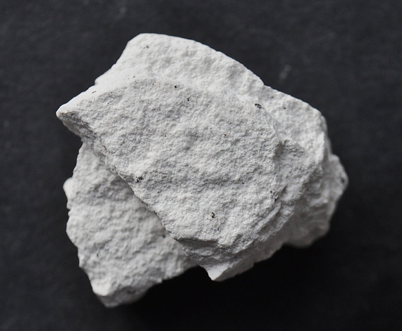
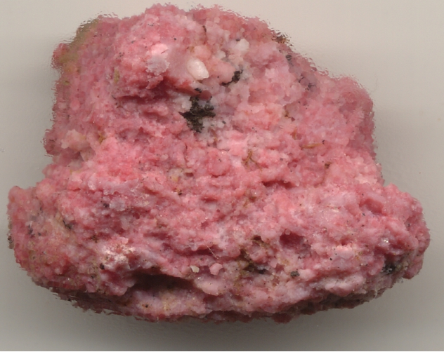


Sanders-Defiance Plateau area, Apache County, Arizona, USA