|
USA | |
- Campo Seco Mining District
| Murdoch, Joseph & Robert W. Webb (1966), Minerals of California, Centennial Volume (1866-1966): California Division Mines & Geology Bulletin 189: 336. |
|
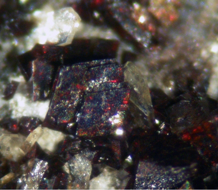
| Visual ID of material field collected by claim owner. |
|
| www.gia.edu (2022) https://www.gia.edu/gems-gemology/fall-2017-microworld-silvery-rutile-inclusions-quartz |
|
| Murdoch, Joseph & Robert W. Webb (1966), Minerals of California, Centennial Volume (1866-1966): California Division Mines & Geology Bulletin 189: 337. |
|
| McLaughlin, R.J., Sorg, D.H., Morton, J.L., Theodore, T.G., Meyer, C.E., Delevaux, M.H. (1985) Paragenesis and tectonic significance of base and precious metal occurrences along the San Andreas Fault at Point Delgada, California. Economic Geology, 80:2, 344-359. |
|
| McLaughlin, R.J., Sorg, D.H., Morton, J.L., Theodore, T.G., Meyer, C.E., Delevaux, M.H. (1985) Paragenesis and tectonic significance of base and precious metal occurrences along the San Andreas Fault at Point Delgada, California. Economic Geology, 80:2, 344-359. |
|
| Murdoch, Joseph & Robert W. Webb (1966), Minerals of California, Centennial Volume (1866-1966): California Division Mines & Geology Bulletin 189: 337. |
- Reilly (Anthony Mill ruins)
| (2005) Mineral Resources Data System (MRDS), US Geological Survey. |
|
| Stolburg, Craig S. (1984) The Mines and Minerals of Darwin, California. The Mineralogical Record, 15 (1) 5-18 |
|
| Stolburg, Craig S. (1984) The Mines and Minerals of Darwin, California. The Mineralogical Record, 15 (1) 5-18
Pemberton, H. Earl (1983) Minerals of California. Van Nostrand Reinhold Company Inc.
Van Nostrand Reinholt Press: 212 |
- Cerro Gordo Mining District
| USGS Bull 625 |
- Kearsarge Mining District [2]
| David W. Reynolds Collection--San Jose, CA. No. 1018 |
- Panamint Mts (Panamint Range)
- Panamint Mining District (Ballarat Mining District)
| Pemberton, H. Earl (1983) Minerals of California. Van Nostrand Reinhold Company Inc.
Murdoch, Joseph & Robert W. Webb (1966), Minerals of California, Centennial Volume (1866-1966): California Division Mines & Geology Bulletin 189: 337
Sampson, Reid J. (1932b), Mineral resources of a part of the Panamint Range: California Mining Bureau. Report 28: 371
Murphy, Franklin Mac (1930), Geology of the Panamint silver district, California: Economic Geology: 25: 314
Van Nostrand Reinholt Press: 212. |
- South Park Mining District
| Pemberton, H. Earl (1983) Minerals of California. Van Nostrand Reinhold Company Inc.
Murdoch, Joseph & Robert W. Webb (1966), Minerals of California, Centennial Volume (1866-1966): California Division Mines & Geology Bulletin 189: 337
Sampson, Reid J. (1932), Mineral resources of a part of the Panamint Range: California Journal of Mines and Geology, California Mining Bureau. (Report 28): 28: 370-371
Van Nostrand Reinholt Press: 212. |
- Sulphur Creek Mining District (Sulfur Creek Mining District; Wilbur Springs Mining District)
| |
|
| DeVito, A. N. (1997), Minerals of the Canwood construction site, Agoura Hills, California. Micro Probe: 8(5): 2-10. |
- Denver group (Denver Mining and Milling Company; Ore Hill group; Red Ledge Mine; Fenner Mine; Chance Mine; Pacoima Canyon Mine)
| Pemberton, H. Earl (1983) Minerals of California. Van Nostrand Reinhold Company Inc.
Sharp, W.E. (1959) Minerals from Los Angeles County, California. Printed privately, Los Angeles, California: 30-31
Van Nostrand Reinholt Press: 212. |
|
| Murdoch, Joseph & Robert W. Webb (1966), Minerals of California, Centennial Volume (1866-1966): California Division Mines & Geology Bulletin 189: 77, 311, 337.
D’Arcy, N.A., Jr. (1939), Geology of a field trip to San Fernando Valley and Pacoima Canyon, California: Rocks & ins.: 14: 267-269 |
|
| Pemberton, H. Earl (1983) Minerals of California. Van Nostrand Reinhold Company Inc.
Sharp, W.E. (1959) Minerals from Los Angeles County, California. Printed privately, Los Angeles, California: 30-31
Van Nostrand Reinholt Press: 212, 321. |
|
| Murdoch, Joseph & Robert W. Webb (1966), Minerals of California, Centennial Volume (1866-1966): California Division Mines & Geology Bulletin 189: 337.
Hanks, Henry Garber (1884), Fourth report of the State Mineralogist: California Mining Bureau. Report 4, 410 pp.: 354 |
|
| Pelletier, 1962. Mineral Species & Localities of Marin County |
- Hite Cove Mining District
| Murdoch, Joseph & Robert W. Webb (1966), Minerals of California, Centennial Volume (1866-1966): California Division Mines & Geology Bulletin 189: 337. |
|
| Robert Muir Wood (1982) The Laytonville Quarry (Mendocino County California) Exotic Block: Iron-rich Blueschist-Facies Subduction-Zone Metamorphism. Mineralogical Magazine 45:87-99.
Wood, R. W. (1979) The iron-rich blueschist facies minerals: 2. Howieite. Mineralogical Magazine 43:363-370. |
- Blind Spring Mining District (Blind Spring Hill Mining District; Benton Mining District)
| King, Van (n.d.) Personal communcation. |
|
| |
|
| Murdoch, Joseph & Robert W. Webb (1966), Minerals of California, Centennial Volume (1866-1966): California Division Mines & Geology Bulletin 189: 337.
Ransome, Alfred Leslie (1940), General geology and ores of the Blind Spring Hill mining district, Mono County, California: California Division Mines Report 36: 190 |
- Knoxville Mining District
| www.mineralsocal.org |
|
| (2005) Mineral Resources Data System (MRDS), US Geological Survey. |
|
| (2005) Mineral Resources Data System (MRDS), US Geological Survey. |
|
| (2005) Mineral Resources Data System (MRDS), US Geological Survey. |
|
| (2005) Mineral Resources Data System (MRDS), US Geological Survey. |
- Nevada City Mining District
| (2005) Mineral Resources Data System (MRDS), US Geological Survey. |
|
| (2005) Mineral Resources Data System (MRDS), US Geological Survey. |
|
| (2005) Mineral Resources Data System (MRDS), US Geological Survey. |
- North Columbia Mining District (Columbia Hill Mining District)
| (2005) Mineral Resources Data System (MRDS), US Geological Survey. |
- Washington Mining District (Omega Mining District)
| (2005) Mineral Resources Data System (MRDS), US Geological Survey. |
|
| (2005) Mineral Resources Data System (MRDS), US Geological Survey. |
|
| (2005) Mineral Resources Data System (MRDS), US Geological Survey. |
|
| (2005) Mineral Resources Data System (MRDS), US Geological Survey. |
- Taylorsville Mining District
- Lights Creek Copper deposits (Moonlight Mine; Sulfide Ridge deposits; Lights Canyon deposits)
| Murdoch, Joseph & Robert W. Webb (1966), Minerals of California, Centennial Volume (1866-1966): California Division Mines & Geology Bulletin 189: 337.
Graton, Louis Caryl & D.H. McLaughlin (1917), Ore deposition and enrichment at Engels, California: Economic Geology: 12: 19 |
|
| King, Van (n.d.) Personal communcation. |
|
| CDMG OFR 94-11 " Mineral Land Classification of the Eastern Half of Riverside Co. CA" |
|
| CDMG OFR 94-11 " Mineral Land Classification of the Eastern Half of Riverside Co. CA" |
|
| CDMG OFR 94-11 Mineral Land Classification of the Eastern Half of Riverside Co. California |
|
| Murdoch, Joseph & Robert W. Webb (1966), Minerals of California, Centennial Volume (1866-1966): California Division Mines & Geology Bulletin 189: 312, 337.
Larsen, Esper Signius, Donald L. Everhart & Richard H. Merriam (1951), Crystalline rocks of southwestern California: California Division Mines Bulletin 159, 136 pp.: 48 |
|
| Murdoch, Joseph & Robert W. Webb (1966), Minerals of California, Centennial Volume (1866-1966): California Division Mines & Geology Bulletin 189: 337. |
|
| CDMG OFR 94-11 " Mineral Land Classification of the Eastern Half of Riverside Co. CA" |
|
| CDMG OFR 94-11 " Mineral Land Classification of the Eastern Half of Riverside Co. CA" |
|
| CDMG OFR 94-11 " Mineral Land Classification of the Eastern Half of Riverside Co. CA" |
|
| CDMG OFR 94-11 " Mineral Land Classification of the Eastern Half of Riverside Co. CA" |
|
| Pemberton, H. Earl (1983) Minerals of California. Van Nostrand Reinhold Company Inc.
Wright, L.A., et al (1953), Mines and mineral resources of San Bernardino County, California: California Journal of Mines and Geology: 49(1-2): 143
Van Nostrand Reinholt Press: 212. |
- Calico Mts (Calico Hills)
| Mayo, Alan L. (1972) Geology And Ore Deposits Of The South-Central Calico Mountains. California State University. San Diego. |
- Clark Mts (Clark Mountain Range)
- Clark Mountain District (Clark District)
| (2005) Mineral Resources Data System (MRDS), US Geological Survey. |
|
| USGS Open File report 2010-5220 |
|
| Vanrusselt, Vik (2023) Personal Communication. |
- Halloran Springs District
- Yucca Grove (Pass Alto; Halloran Summit)
| (2005) Mineral Resources Data System (MRDS), US Geological Survey. |
|
| American Mineralogist (1930) 15: 1-22 |
|
| Jahns, Richard Henry & Wright, Lauren A. (1951), Gem and lithium-bearing pegmatites of the Pala district, San Diego County, California. California Division of Mines Special Report 7-A: p. 31. |
- Black Wonder Mining District
| Murdoch, Joseph & Robert W. Webb (1966), Minerals of California, Centennial Volume (1866-1966): California Division Mines & Geology Bulletin 189: 337. |
|
| Murdoch, Joseph & Robert W. Webb (1966), Minerals of California, Centennial Volume (1866-1966): California Division Mines & Geology Bulletin 189: 337. |
- Alleghany Mining District (Forest Mining District)
- 16 to 1 Mine (Sixteen-to-One Mine; Original Sixteen-to-One Mine)
| (2005) Mineral Resources Data System (MRDS), US Geological Survey. |
|
| (2005) Mineral Resources Data System (MRDS), US Geological Survey. |
|
| Pemberton, H. Earl (1983) Minerals of California. Van Nostrand Reinhold Company Inc.
Ferguson, Henry G. & R.W. Gannett (1932), Gold quartz veins of the Alleghany district, California: USGS PP 172: 113
Ferguson, Henry G. (1914b), Lode deposits of the Alleghany district, California: USGS Bulletin 580: 153-182 |
|
| (2005) Mineral Resources Data System (MRDS), US Geological Survey. |
|
| Econ Geol (1992) 87:1795-1812 |
|
| American Mineralogist, Volume 94, pages 1325–1332, 2009 |
|
| King, Van (n.d.) Personal communcation. |
- Coffee Mining District (Coffee Creek Mining District)
| (2005) Mineral Resources Data System (MRDS), US Geological Survey. |
|
| Leicht, Wayne C., Nelson, Genne Myers (1994) Native Gold from the Jamestown Mine, Tuolumne County, California. The Mineralogical Record, 25 (1) 7-14 |


Blind Spring Mining District, Benton Range, Mono County, California, USA