| Classification |
|---|
|
| Species: | Andradite |
| Formula: | Ca3Fe23+(SiO4)3 |
| Confirmation |
|---|
|
| Validity: | Believed Valid |
| Associated Minerals Based on Photo Data: |
|---|
|
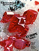
| Hematite | ⓘ1 photo of Andradite associated with Hematite at this locality. |
| Data |
|---|
|
| Mineral Data: | Click here to view Andradite data |
| Locality Data: | Click here to view Leilenkopf, Brohl-Lützing, Bad Breisig, Ahrweiler, Rhineland-Palatinate, Germany |
| Photo Gallery | View Gallery (2 photos) |
| Data Identifiers |
|---|
|
| Mindat Occurrence Record ID: | 348407 |
| Long-form Identifier: | 1:3:348407:4 |
| GUID (UUID V4): | 95f309ef-46ef-4b35-b6e0-8b39e46f8d38 |
| Nearest other occurrences of Andradite |
|---|
|
|
| 3.4km (2.1 miles) | ⓘHerchenberg, Burgbrohl, Brohltal, Ahrweiler, Rhineland-Palatinate, Germany |
| 4.0km (2.5 miles) | ⓘKunkskopf, Wassenach, Brohltal, Ahrweiler, Rhineland-Palatinate, Germany |
| 6.3km (3.9 miles) | ⓘNickenicher Sattel, Nickenich, Pellenz, Mayen-Koblenz, Rhineland-Palatinate, Germany |
| 7.3km (4.5 miles) | ⓘGleeser Felder, Glees, Brohltal, Ahrweiler, Rhineland-Palatinate, Germany |
| 7.8km (4.8 miles) | ⓘHüttenberg, Glees, Brohltal, Ahrweiler, Rhineland-Palatinate, Germany |
| 8.4km (5.2 miles) | ⓘNickenicher Weinberg, Nickenich, Pellenz, Mayen-Koblenz, Rhineland-Palatinate, Germany |
| 8.6km (5.4 miles) | ⓘKrufter Ofen, Kruft, Pellenz, Mayen-Koblenz, Rhineland-Palatinate, Germany |
| 9.6km (5.9 miles) | ⓘIn den Dellen quarries, Mendig, Mendig, Mayen-Koblenz, Rhineland-Palatinate, Germany |
| 9.7km (6.0 miles) | ⓘRothenberg Quarry, Bell, Mendig, Mayen-Koblenz, Rhineland-Palatinate, Germany |
| 9.9km (6.2 miles) | ⓘPumice quarries, Wingertsberg, Mendig, Mendig, Mayen-Koblenz, Rhineland-Palatinate, Germany |
| References |
|---|
|
|
| Reference Search (possible matching items) |
|---|
 | | Journal (issue) | | Minerals from the Volcanic District of Laacher See, Germany..................................................Lieber Heidelberg, West Germany Olaf Medenbach Bochum-Querenburg, West Germany Eric Offermann Arlesheim...desire is to visit Norway on collecting tours. In Germany there are still more, also with their own jour...from earlier visitors. A “Director of Studies” in Germany has given out, despite Norwegian protests, a guide...Valley and to develop them. Two Dr. Krantz of Germany, has survived and is still in use. Boring was done |  | | Book | | Rocks of the Laacher See and Other Areas of West Germany ............... 5.13 Leucite-Bearing Rocks of the...197 17.2 Tectonics in the East Eifel Area ofW. Germany ... 198 17.3 Plate Tectonic Model for the Generation...Manchuria (China; Ogura et al. 1939), E. Eifel (West Germany; Duda and Schminke 1978), Birunga (east and equatorial...Wyoming Navajo-Hopi, Arizona East Eifel, West Germany Vico, Italy Si0 2 Number of analyses Locality...Veitskoff, East Eifel; West Germany Eppe1sberg, East Eifel, West Germany e e 21 3 6 2.3 17 trace |
|


Leilenkopf, Brohl-Lützing, Bad Breisig, Ahrweiler, Rhineland-Palatinate, Germany