| Locality type: | Dam |
| Classification |
|---|
|
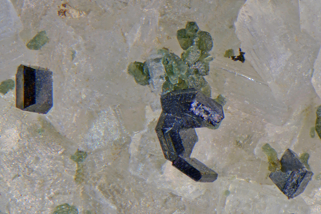
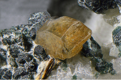
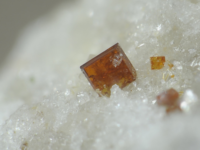
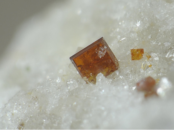
| Species: | Anatase |
| Formula: | TiO2 |
| Confirmation |
|---|
|
| Validity: | Believed Valid |
| Associated Minerals Based on Photo Data: |
|---|
|
| Rutile | ⓘ3 photos of Anatase associated with Rutile at this locality. |
| Chlorite Group | ⓘ2 photos of Anatase associated with Chlorite Group at this locality. |
| Synchysite | ⓘ1 photo of Anatase associated with Synchysite at this locality. |
| Data |
|---|
|
| Mineral Data: | Click here to view Anatase data |
| Locality Data: | Click here to view Bärenfall dam, Naßfeld valley, Bad Gastein, St. Johann im Pongau District, Salzburg, Austria |
| Photo Gallery | View Gallery (4 photos) |
| Data Identifiers |
|---|
|
| Mindat Occurrence Record ID: | 210254 |
| Long-form Identifier: | 1:3:210254:2 |
| GUID (UUID V4): | 5a225663-e28d-4cd1-844d-ec059fe89c8d |
| Nearest other occurrences of Anatase |
|---|
|
|
| 0.1km (0.0 miles) | ⓘPower station, Sportgastein, Naßfeld valley, Bad Gastein, St. Johann im Pongau District, Salzburg, Austria |
| 0.1km (0.1 miles) | ⓘGotelinde tunnel (Kolm-Saigurn-Naßfeld water tunnel), Bad Gastein, St. Johann im Pongau District, Salzburg, Austria |
| 0.4km (0.2 miles) | ⓘSchöneck Alp, Naßfeld valley, Bad Gastein, St. Johann im Pongau District, Salzburg, Austria |
| 0.4km (0.2 miles) | ⓘSchleierfall tunnel, Naßfeld valley, Bad Gastein, St. Johann im Pongau District, Salzburg, Austria |
| 2.7km (1.7 miles) | ⓘBockhartsee reservoir, Bad Gastein, St. Johann im Pongau District, Salzburg, Austria |
| 3.0km (1.8 miles) | ⓘOrtbergschartl, Naßfeld valley, Bad Gastein, St. Johann im Pongau District, Salzburg, Austria |
| 3.2km (2.0 miles) | ⓘWeißenbach, Naßfeld valley, Bad Gastein, St. Johann im Pongau District, Salzburg, Austria |
| 4.1km (2.5 miles) | ⓘEvianwand, Böckstein, Bad Gastein, St. Johann im Pongau District, Salzburg, Austria |
| 4.4km (2.7 miles) | ⓘGewerkenwald, Naßfeld valley, Bad Gastein, St. Johann im Pongau District, Salzburg, Austria |
| 5.0km (3.1 miles) | ⓘWurten glacier, Wurten, Flattach, Spittal an der Drau District, Carinthia, Austria |
| References |
|---|
|
|


Bärenfall dam, Naßfeld valley, Bad Gastein, St. Johann im Pongau District, Salzburg, Austria