| Locality type: | Quarry |
| Classification |
|---|
|
| Species: | Almandine |
| Formula: | Fe32+Al2(SiO4)3 |
| Confirmation |
|---|
|
| Validity: | Believed Valid |
| Data |
|---|
|
| Mineral Data: | Click here to view Almandine data |
| Locality Data: | Click here to view Belvidere Mountain Quarries, Lowell & Eden, Orleans & Lamoille Cos., Vermont, USA |
| Data Identifiers |
|---|
|
| Mindat Occurrence Record ID: | 720513 |
| Long-form Identifier: | 1:3:720513:2 |
| GUID (UUID V4): | 3cfb6183-d6fe-45fc-959f-185b86adddec |
| Nearest other occurrences of Almandine |
|---|
|
|
| 4.8km (3.0 miles) | ⓘTillotson Peak area, Orleans County, Vermont, USA |
| 76.3km (47.4 miles) | ⓘDalton, Coos County, New Hampshire, USA |
| 80.5km (50.0 miles) | ⓘPike Hill Mines, Corinth, Orange County, Vermont, USA |
| 81.6km (50.7 miles) | ⓘLancaster, Coos County, New Hampshire, USA |
| 81.7km (50.8 miles) | ⓘPond Hill locality, Lisbon, Grafton County, New Hampshire, USA |
| 83.2km (51.7 miles) | ⓘGarnet Hill locality, Sugar Hill, Grafton County, New Hampshire, USA |
| 93.4km (58.0 miles) | ⓘOliverian Station locality, Haverhill, Grafton County, New Hampshire, USA |
| 98.7km (61.3 miles) | ⓘCottonstone Mountain, Orford, Grafton County, New Hampshire, USA |
| References |
|---|
|
|
| Reference Search (possible matching items) |
|---|
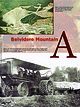 | Carlsen, Kenneth S., Gale, Marjorie H., Thompson, Woodrow B., Kierstead, Matthew (2015) Belvidere Mountain Asbestos Quarries, Lowell/Eden, Vermont. Rocks & Minerals, 90 (6) 510-551 doi:10.1080/00357529.2015.1080535 | Journal (article/letter/editorial) | | mine, ca. 1960. Frank L. Forward photo. A Belvidere Mountain Figure 2. In 1920 this traction engine and...Box 295 Shaftsbury, Vermont 05262 kencarlsen@ymail.com MARJORIE H. GALE Vermont Geological Survey Department...Conservation 1 National Life Drive, Davis 2 Montpelier, Vermont 05620 marjorie.gale@state.vt.us WOODROW B. THOMPSON...Besse. B elvidere Mountain, Quarries Lowell/Eden, Vermont in northern Vermont, is known to generations...postcard of the initial three-story mill at the Eden mine that opened in May 1902 but closed later in |
|


