| Classification |
|---|
|
| Species: | Elyite |
| Formula: | Pb4Cu(SO4)O2(OH)4 · H2O |
| Confirmation |
|---|
|
| Validity: | Believed Valid |
| Associated Minerals Based on Photo Data: |
|---|
|
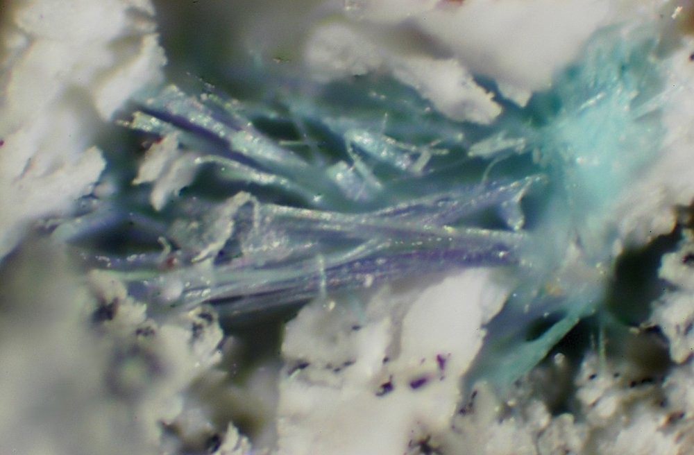
| Caledonite | ⓘ1 photo of Elyite associated with Caledonite at this locality. |
| Data |
|---|
|
| Mineral Data: | Click here to view Elyite data |
| Locality Data: | Click here to view Slag localities, Kolm-Saigurn, Alteck - Hoher Sonnblick area, Rauris, Zell am See District, Salzburg, Austria |
| Data Identifiers |
|---|
|
| Mindat Occurrence Record ID: | 264010 |
| Long-form Identifier: | 1:3:264010:5 |
| GUID (UUID V4): | 177a5e99-1f6c-4072-b9d8-e1e35af508a5 |
| Nearest other occurrences of Elyite |
|---|
|
|
| 6.2km (3.9 miles) | ⓘAstenschmiede slag locality, Rauris, Zell am See District, Salzburg, Austria |
| 9.1km (5.7 miles) | ⓘSchreiberhäusl slag locality, Rauris, Zell am See District, Salzburg, Austria |
| 44.6km (27.7 miles) | ⓘSchellgaden, Muhr, Tamsweg District, Salzburg, Austria |
| 90.4km (56.2 miles) | ⓘSlag dumps, Walchen, Öblarn, Liezen District, Styria, Austria |
| 94.4km (58.6 miles) | ⓘMontanwerke Brixlegg slag locality, Brixlegg, Kufstein District, Tyrol, Austria |
| References |
|---|
|
|
| Reference Search (possible matching items) |
|---|
 | | Book | | remains of the Meadowfoot Lead Smelter are in an area of the Lowther Hills, adjacent to Wenlock Water...village areas as it was in 1859 (Fig 1). The general area is now largely used for sheep grazing and grouse...Wanlockhead being an important old major lead mining area it is a stop off point along the Southern Upland...slopes of Sowen Dod (Fig 14) The slag dump occupies the relatively flat area below the Dod adjacent to Wanlock...century when the discovery of lead ore around the area is often wrongly attributed to a Dutch gold prospector |  | | Journal (article/letter/editorial) | | tunnel walls; weathering products of mine dumps and slag). A second human influence on the distribution of...Zalasiewicz et al. 2008; Waters et al. 2016; however, see Finney and Edwards 2016 for a contrary view). The...0003-004X/17/0003–595$05.00/DOI: http://dx.doi.org/10.2138/am-2017-5875 Anthropocene Epoch, based on terminology...Commission has addressed this question in some detail (see Text Box 1). Their statement highlights the varied...of localities I. Mine-associated (“post-mine”) minerals Formula Type locality; other localities A |  | | Book (edition) | | away beforc wc could finish this collaboration. I am pleased to have been able to finish lhis Glossary...Pierre-Jacques Chiappero (France). G. Daxner (Austria). M. Dcliens (Belgium). Giancarlo Delia Ventura... Keams (USA). Elisabeth Kirchner (Austria), Uwe Kolitsch (Austria). Werner Krause (Gennany). Andre Lalonde...Lalonde (Canada), P. Leblhuber (Austria), Andrew Locock (Canada). J.A. Mandarino (deceased) (Canada),...Filippo Olmi (deccased) (ltaly). Werner H. Paar (Austria). Gian Carlo Parodi (France). Marco Pa ero (ltaly) |
|


Slag localities, Kolm-Saigurn, Alteck - Hoher Sonnblick area, Rauris, Zell am See District, Salzburg, Austria