 | | Report (issue) | | Selected Mining Districts of Utah by Carl L. Ege Headframe of Centennial Eureka mine, Tintic mining district...MISCELLANEOUS PUBLICATION 05-5 UTAH GEOLOGICAL SURVEY a division of 2005 Utah Department of Natural Resources...Resources STATE OF UTAH Jon Huntsman, Jr., Governor DEPARTMENT OF NATURAL RESOURCES Michael Styler, Executive...Executive Director UTAH GEOLOGICAL SURVEY Richard G. Allis, Director PUBLICATIONS contact Natural Resources...toll-free: 1-888-UTAH MAP website: http://mapstore.utah.gov email: geostore@utah.gov THE UTAH GEOLOGICAL SURVEY |  | | Report (issue) | | CALITI ES OF UTAH by Kenneth C. Bullock UTAH GEOLOGICAL AND MINERAL SURVEY a division of the UTAH DEPARTMENT...JANUARY 1981 MINERALS AND MINERAL LOCALITIES OF UTAH by Kenneth C. Bullock Nature displays her most.... . . . . . 1 Chapter I. Mining Districts of Counties and the State of Utah. . . . . . . . . . . . .... . . . . . . . . . . . . . . . . . . . . . . 1 County Listings. . . . . . . . . . . . . . . . . . . .... . . . . . . . . . . . 1 Chapter II. Mining Districts of Utah . . . . . . . . . . . . . . . . . . . |  | | Report (volume) | | ............ r ............................. 45 Gold..........................................................:..................................... Stibnite.................................................elongated rhombic crystal faces, from Nugget mine, Gilpin County, Colo.-................... II. A, Wedge-shaped...from Hoosier mine, Nederland, Colo.; B, Cuboid ferberite crystals from Georgia A. mine, Nederland. Colo...Nugget mine, Gilpin County, Colo.............................. IV. A, Hiibnerite from Birdie mine, Butte |  | | Report (issue) | | limestone or dolomite. It is a useful ore guide in many mining districts UNITED STATES GOVERNMENT PRINTING OFFICE...printing 1978 For sale by the Branch of Distribution, U.S. Geological Survey, 1200 South Eads Street, Arlington........... Characteristics of jasperoid in major mining districts of the United States ..................................................... Tri-State district, Oklahoma, Kansas, and Missouri .................... Clifton-Morenci district, Arizona .............................. Bisbee (Warren) district, Arizona |  | | Journal (article/letter/editorial) | | of native gold and electrum, the gold telluride calaverite may well be the most important gold ore mineral...Cripple Creek district, essentially subsequent to the development of all other Colorado gold districts.... Unlike most gold deposits, weathering of those characterized by relatively abundant telluride minerals...fine-grained and dull, mustard-colored secondary gold that is disbursed as tiny particles as the individual...most exciting gold occurrences are either dominated by or contain significant amounts of gold tellurides |  | | Report (issue) | | Mountains Wilderness Study Area, Juab and Tooele Counties, Utah U.S. GEOLOGICAL SURVEY BULLETIN 1745-C ...Mountains Wilderness Study Area, Juab and Tooele Counties, Utah By CONSTANCE J. NUTT, DAVID R. ZIMBELMAN...and JOSEPH S. DUVAL U.S. Geological Survey BRIAN J. HANNIGAN U.S. Bureau of Mines U.S. GEOLOGICAL SURVEY...AREAS NORTHWESTERN UTAH DEPARTMENT OF THE INTERIOR MANUEL LUJAN, JR., Secretary U.S. GEOLOGICAL SURVEY...purposes only and does not imply endorsement by the U.S. Government. UNITED STATES GOVERNMENT PRINTING OFFICE: |  | | Report (volume) | | Volcanic-Hosted Disseminated Gold Deposits Search for an Occurrence Model U.S. GEOLOGICAL SURVEY BULLETIN...following pages replace pages 97 through 102 in U.S. Geological Survey Bulletin 1646. I6Li61 101....east-west, northwest, and northeast within the district. Hawkins (1982) postulated that the east-west...scale east-west-trending faults in the Enfield Bell mine are are the Marlboro Canyon, Bell, and Ridge faults...upper- and lower-plate rocks in the Jerritt Canyon district is thought to be a high-angle fault. Exposure |  | | Report (issue) | | Professional Paper Ill THE ORE ~DEPOSITS OF UTAH BY B. S. BUTLER, G. F. LOUGHLIN, V. C. HEIKES...81 83 84 84 85 87 87 87 87 THE ORE DEPOSITS OF UTAH. By B. S. BuTLER. PART !._:_GENERAL FEATURES. INTRODUCTION...INTRODUCTION. reports are those on the Mercur district, by J. E. Spurr and S. F. Emmons; the Bingham... began district, by J. M. Boutwell, Arthur Keith, and field work on the ore deposits of Utah in the S...S. F. Emmons; the Park City district, by J. M. FIELD .WORK AND AUTHORSHIP. summer of 1908 by making |  | | Journal (article/letter/editorial) | | stannite. Mineralsother than sulphidesincludenative gold, tellurides,arsenides,metallicoxides,especiallyhematite...Ak-tyus, Russia (xoo) .................. Alamo District, Lower California ,.• • ,.• 0 x x x x x...(65) .... x x x x x x x x x x x x x Ashley Mine, Ont. (95) ................. Atikokan, Ont. (45)...(9) ..................... x x x x x x x Beattie Mine, Que. (30) ................ x x x x x Several...x Altenberg, Saxony, Germany (58) ....... Alexo Mine, Ont. (97) .................. Anyox, B.C. (II3) |  | | Report (issue) | | Principal Gold-Producing Districts of the United States By A. H. KOSCHMANN and M. H. BERGENDAHL GEOLOGICAL...description of the geology, mining history, and production of the major gold-mining districts in 21 States...68-341 For sale by the Superintendent of Documents, U.S. Government Printing Office Wl\shington, D.C. 20402...relations ---------------------------History of gold mining and trends in production_ J\labama ---------...--------------Cleburne County ----------~----------------- Tallapoosa County --------------------------Alaska |  | | Report (issue) | | 31 University of Nevada Press, Reno, Nevada 89557 USA Copyright © 2004 by University of Nevada Press Photographs...copyright © 2004 unless otherwise noted Map of Mining Districts and significant mineral occurrences of...Olivenite, 1.6-cm cluster, Majuba Hill Mine, Antelope district, Pershing County. N. Prenn collection. Photograph...production of environmental protection equipment. Mining and the discovery, identification, and development...1929 and was actively involved in mining in the state and the western U.S. for the rest of his has, and |  | | Report (issue) | | Idaho Mining and Exploration, 2016-2017 Virginia S. Gillerman Earl H. Bennett Alexis Clark Mark Barton...University of Idaho Moscow, Idaho 83844-3014 Idaho Mining and Exploration, 2016-2017 Virginia S. Gillerman...…………………………………………………………………………..... 4 Metal Mining ……………………………………………………………………………7 Phosphate Mining ……………………………………………………………………...2017…….…….............5 Figure 2. Location of active mining areas .…….…......................................vein, 4900 level, Galena mine ……………...………..……8 Figure 5. Golden Chest mine, Murray, overview……. …………………… |  | Long, Keith R., DeYoung,, John H., Ludington, Stephen (1998) Database of significant deposits of gold, silver, copper, lead, and zinc in the United States. Open-File Report Vol. 1998 (98-206) US Geological Survey doi:10.3133/ofr98206ab | Report (issue) | | of the East Shasta copper-zinc district, Shasta County, California: U.S. Geological Survey Professional...1972, Geology and mineral deposits of Esmeralda County, Nevada: Nevada Bureau of Mines and Geology Bulletin...1940, Reconnaissance of gold mining districts in the Black Hills, South Dakota: U.S. Bureau of Mines Bulletin...Wilderness Study Area (AZ-020-024), Mohave County, Arizona: U.S. Bureau of Mines Mineral Land Assessment...Plumas County, California; Venture 63: San Francisco, Calif., American Exploration and Mining Co., unpaginated | 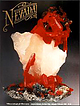 | | Journal (issue) | | B & B mine, Esmeralda County CALIFORNIA: burnt ore dump, Oceanic mine, San Luis Obispo County TEXAS:...TEXAS: Chisos furnace, Terlingua district, Brewster County The Texan material was used in the initial X-ray...lection of the U.S. National Museum. The mineral is named for Curt N. Schuette, a mining geologist who...H ) 7 Status: valid Type Locality: Belmont, Nye County Further analysis of the type material showed it...Mason and Vitaliano (1953) refer to specimens at the U.S. National Museum (#104763) and at Harvard University | | | Report (issue) | | 3i University of Nevada Press, Reno, Nevada 89557 USA Copyright© 2004 by Uni versity of Nevada Press Photographs...te, r.6-cm cluster, Majuba Hill Mine, Antelope district, Pershing County. N. Prenn coJlection. Photograph...involved in n1ining 1n the state and the v,estern U.S. for the rest of his life. Hb sons tred Gibson Jr...Bureau of Land Managen1ent (BLM), an agency of the U.S. Department of the Interior. 'this land comprises...percent of the state. Nevada's public lands offer mining, livestock grazing, wild horse viewing, .scenic |  | | Book | | stumble over a valuable nugget and stake your own mining claim? Indeed it to is, and author book Jay...prospecting, he points out, is in abandoned mining districts, where valuable mineral ores are present...commercial ores and secondary minerals by state, county, township, and geologic range. For easy identification...RANSOM 1875-1948 An to the Eastern '‘Schoolmarm” Mining Camps of the Old West I I a s I \ h K... CONTENTS Preface ix PART I 1 Introduction to Mining and Mineralogy 2 Preparation for Mineral Collecting |  | Zimbelman, David R., Meier, Allen L., Carlson, Robert R. (1992) Analytical results for platinum, palladium, rhodium, ruthenium, and iridium in rock samples from selected mines and prospect areas, Delta 1 degree x 2 degrees Quadrangle, Utah. Open-File Report Vol. 1992 (92-370) US Geological Survey doi:10.3133/ofr92370 | Report (issue) | | UNITED STATES DEPARTMENT OF THE INTERIOR U.S. GEOLOGICAL SURVEY Analytical results for platinum, palladium...mines and prospect areas, Delta 1° x 2° quadrangle, Utah by David R. Zimbelman1 , Alien L. Meier1 , and...preliminary and has not been reviewed for conformity with U.S. Geological Survey editorial standards or with the...location map of mining districts prospect areas in and close to the Delta 1° x 2° quadrangle, Utah ...........mines and prospect areas, Delta 1° x 2° quadrangle, Utah .............. 5 APPENDICES Appendix 1. Brief |  | | Report (issue) | | conformity with U.S. Geological Survey editorial standards and stratigraphic nomenclature. 1. U.S. Geological...here are data on sulfide and nonsulfide mineralogy, gold and silver grades and deposit tonnage. A discussion...name, country, local geographical area, mineralogy, gold and silver grades, tonnage, and references are given...deposit. Table 4, part B, gives an alphabetic list of mine and properties followed by the deposit name. CHARACTERISTICS...1980)). These deposits are primarily worked for gold. Silver is a minor byproduct; about 14 percent of |  | | Report (issue) | | Idaho Mining and Exploration, 2014-2015 Virginia S. Gillerman Alexis Clark Mark Barton Earl H. Bennett...University of Idaho Moscow, Idaho 83844-3014 Idaho Mining and Exploration, 2014-2015 Virginia S. Gillerman...……………………………………………………………………………...5 Metal Mining ………………………………………………………………………….....8 Phosphate Mining ………………………………………………………………………11...2015.……………...8 Figure 3. Map of the Coeur d’Alene district, or Silver Valley…………………………..9 Figure 4. View...at Hecla’s Lucky Friday mine ………………………..…..10 Figure 5. Thompson Creek mine, September 2014…………………………………… |  | | Report (issue) | | Director Professional Paper 177 THE GOLD HILL MINING DISTRICT U'TAH BY T. B. NOLAN UNItED STATES GOVERNMI£NT...sedimentary rocks in eastern Nevada and western Utah __________ _ Carboniferous system____ __ __ _ _...___ ___ _ __ ____ ___ ______ Clifton district _ _ __ History of mining and production__ ___ __ __ __...(Ida Lull) _ __ __________ Napoleon Mining Co_________ __ __ Gold Bond_ _____ ______ ___________ Copper...119 119 II Mines and prospects-Continued. Clifton district-Continued. Mines and prospects-Continued. |  | | Report (issue) | | INTERIOR GEOLOGICAL SURVEY MINERAL RESOURCES OF ELKO COUNTY, NEVADA By Roscoe M. Smith Prepared in cooperation...Acknowledgment -Mining districts Commodities Production Descriptions of mining districts . Alder district-Aura district...district -Beaver district Black Mountain district Bootstrap district Burner district Burns Basin district--...-Carlin district Cave Creek district ----Charleston district_--Coal Mine district~ Contact district Cornucopia...Cornucopia district - -Corral Creek district - Decoy district Delano district Delker districtDivide district |  | | Book | | OF UTAH'S MINING INDUSTRY By Utah Mining Association 918 Kearns Building Salt Lake City, Utah MILES P...material was available to give Utah citizens an account of their mining industry. Most of the available...segments of mining activity. We have attempted in the following pages to discuss mining in all phases...picture of the mineral deposits and of the mining activity in Utah as time and effort permit. In the writing...the person interested in, but unacquainted with mining, mineral processing, and mineral economics, could |  | | Report (volume) | | Epithermal Deposits of Antimony, Mercury and Silver and Gold GEOLOGICAL SURVEY BULLETIN 11 12-A Selenium...Epithermal Deposits of Antimony, Mercury and Silver and Gold By D. F. DAVIDSON V CONTRIBUTIONS TO ECONOMIC...seleniferous in contrast to similar deposits of gold and mercury UNITED STATES GOVERNMENT PRINTING OFFICE...Director For sale by the Superintendent of Documents, U.S. Government Printing Office Washington 25, D.C. -..._____________ Epithermal deposits of silver and gold,__________________ Selenium in epithermal deposits |  | | Journal (issue) | | Mineral Collector's Newsletter $3.00 The Rock Dam Gold Prospect A New Quartz Locality, Dickinson Co., Mich~g_an...markelder@juno.com The Rock Dam gold prospect is located in central Dickinson County, Michigan, approximately...the dominant exposed bedrock in this part of the county. Excavated near the tum of the 20th century, the...these quartz veins contain small quantities of free gold, as does also the quartzite in their vicinity."...obvious even when visiting some of the Garland County mines. I also planned to do some Magnet Cove collecting |  | Roberts, Ralph J., Radtke, Arthur S., Coats, R. R., Silberman, Miles L., McKee, Edwin H. (1971) Gold-bearing deposits in north-central Nevada and southwestern Idaho; with a section on periods of plutonism in north-central Nevada. Economic Geology, 66 (1) 14-33 doi:10.2113/gsecongeo.66.1.14 | Journal (article/letter/editorial) | | Vol. 66, 1971, pp. 14-33 Gold-Bearing Depositsin North-CentralNevadaand Southwestern Idaho R, nPri J...MILES L. SILBERMAN AND EDWIN H. MCKEE Abstract Gold-bearingdepositsin north-centralNevadaoccurin a wide... late Tertiary. Three major epigenefic groupsof gold-bearing deposits are recognized:replacement deposits...and peripheralgold-silverdeposits.The disseminated gold depositsseemto be intermediate in mineralogy betweenthe...ve yielded significant production in only one district, Battle Mountain (Copper Canyonand CopperBasin) |
|


U.S. Mine, Gold Hill, Gold Hill Mining District, Tooele County, Utah, USA