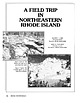
 | | Journal (article/letter/editorial) | | NORTHEASTERN RHODE ISLAND 286 ROCKS AND M I N E R A L S The adjacent towns of Cumberland and Lincoln...northeastern Rhode Island offer col lecting in several localities, including the Conklin Limestone quarry, the...the Old Dexter quarry, Diamond Hill, the Route 114 road cut, and the Iron Hill mine. T H E T O W N S H...northeast corner of Rhode Island is not so famous mineralogically as Cumberland in England; however,...both the state mineral and the state rock of Rhode Island. Much of this area coincides with the Pawtucket |  | | Report (volume) | | deposits of some others, such as clay, coal, and iron ore, are mentioned only in general terms. One material...North Carolina.. .Dr. Joseph Hyde Pratt, Chapel Hill. North Dakota... .Dr. A. G. Leonard, Grand Forks...Florence Bascom, Bryn Mawr. Rhode Island.... .Prof. Charles W. Brown, Providence. South Carolina.. .Dr. Earle...See Bauxite and Hallpysite. Asbestos. Tallapoosa County, with corundum deposits near Dudleyville; not found...commercial quantity or quality. Asphalt. Colbert County, small quantity has been shipped from near Leighton; |  | | Report (volume) | | ........................................... Rhode Island...............................................deposits of some others, such as clay, coal, and iron ore, are mentioned only in general terms. One material...Albany. North Carolina_.Dr. Joseph Hyde Pratt, Chapel Hill. North Dakota_.Dr. A. G. Leonard, Grand Forks. Mr...University, South Bethlehem. Rhode Island__Prof. C. W. Brown, Providence. South Carolina__.Dr. Earle Sloan...See Bauxite and Halloysite. Asbestos. Tallapoosa County, with corundum deposits near Dudleyville; not found |  | | Book (edition) | | though the more exten sive deposits, such as coal and iron fields, gold belts, etc., are mentioned in general...mmed at Broken Arrow aud Trout creek, in Sc. Clair county. The strata in this field are more faulted und...prong of Canoe creek, in St. Clair county, to Ha\sop creek, in Bibb county, a distance of 60 miles. Down to...to Helena, in Shelby county, the field has an average width of 5 or 6 miles. Below that point the width...miles being in the latitud" of Blocton, in Bibb county. The south ern end of this field has a greater |  | | Journal (article/letter/editorial) | | be recorded." Pala is in northwestern San Diego County of Southern California. COLORADO: Prof. Richard..., Conn. DELAWARE: A nice specimen of cellular limonite (brown and yellowbrown in color) was sent R &...specimen came from Iron Hill, New Castle Co., Del. Writes Mr. Pickett: "Iron Hill and Mine Hill are one and...and the same with Iron Hill being the proper name. The U. S. Geological Folio, Elkton-Wilmington N o . 211...211 says that Iron Hill and Chestnut Hill were worked as early as the 18th century and as late as 1891 |  | | Report (volume) | | Bedrock Geology of Rhode Island o GEOLOGICAL 5. I 09 8* Ci PI O i o TJ i i I to & Ol BULLETIN...State of Rhode Island Development Council i M SURVEY I C.to 1295 Bedrock Geology of Rhode Island...1295 Prepared in cooperation with the State of Rhode Island Development Council Lithology, structure, and...geological studies in Rhode Island____._.________.-__.-_-____. Position of Rhode Island in the Appalachian...Schist___---_--_-____--__--_-_----_-_----_ Hunting Hill Greenstone_______________________________ Blackstone |  | | Book (volume) | | in the production of clays. Lesser production of iron, petroleum, natural gas and coal from thick beds...the western counties, especially the Clay Center Quarry 12 miles southeast of Toledo but in Ottawa Co....ASHTABULA COUNTY CONNEAUT, area pits, quarries, rd. cuts, etc.⎯cone-in-cone Calcite. CLERMONT COUNTY MILFORD...CLINTON COUNTY WILMINGTON, area of Todd’s Ford, a mineral deposit⎯Hematite. COSHOCTON COUNTY AREA, townships...CUYAHOGA COUNTY CHAGRIN FALLS (on Geauga Co. line), area quarries⎯oilstone. DELAWARE COUNTY DELAWARE |  | | Book (volume) | | in the production of clays. Lesser production of iron, petroleum, natural gas and coal from thick beds...the western counties, especially the Clay Center Quarry 12 miles southeast of Toledo but in Ottawa Co....ASHTABULA COUNTY CONNEAUT, area pits, quarries, rd. cuts, etc.⎯cone-in-cone Calcite. CLERMONT COUNTY MILFORD...CLINTON COUNTY WILMINGTON, area of Todd’s Ford, a mineral deposit⎯Hematite. COSHOCTON COUNTY AREA, townships...CUYAHOGA COUNTY CHAGRIN FALLS (on Geauga Co. line), area quarries⎯oilstone. DELAWARE COUNTY DELAWARE |  | | Book (volume) | | Plains state varies from nearly level farmland to hill ridges, increasing steadily in elev. From 1,000’...instance, a single Spodumene crystal from the Etta Mine near Keystone on the east side of the Mount Rushmore...production of minerals, principally Gold, Silver, Copper, Iron, Lead, Manganese and Zinc, along with lesser amounts...beds, excavations, etc.Selenite roses. BRULE COUNTY AREA: in the Oacoma zone of the Pierre Fm. On Elm...gray Barite rosette up to 5 or 6 inches. CAMPBELL COUNTY MOUND CITY, W to the Missouri R., regional hillsides |  | | Book (volume) | | chalcedony, jasper and gem petrified wood. BUFFALO COUNTY KEARNEY, area gravel bars and pits along the Platte...petrified wood. CASS COUNTY WEEPING WATER, SE, on rd. to Nehawka, in the Snyderville Quarry chalcedony, jasper...jasper, fossils. CHERRY COUNTY VALENTINE, in the Sandhills county along the Niobrara R. and Minnechaduza...gem qualityagatized and opalized wood. DAWES COUNTY CHADRON, in N part of Co. and as far W as Crawford...cuts, cut banks, breaks, draws and washes, gullies, hill slopes, etc.chalcedony roses, Celestite crystals |  | | Journal (article/letter/editorial) | | enabling its members 603 to visit the Hunting Hill Quarry, near Rockville, Md. Richard Haefner of the Department...finding of zircons at the Cedar Hill Quarry — a first for this quarry, — The Pennsylvania Earth Sciences...Mineral and Mineral Club MAINE The Lincoln County Gem and Society, Litchfield, is cooperating Mineral...the part of the quarry or mine in which located as well as the name of the quarry or mine. — - The Water...Miss Cicada. —- Sidney D . Apt, member of the Rock County. dttions it can be shaped, then distorted, and |  | | Report (volume) | | Bibliography of Iron Ore Resources of the World (To January 1955) GEOLOGIC.AL SURVEY BULLETIN 1019-·D...1019-·D Bibliography of Iron Ore Resources of the World (To January 1955)By GWENDOLYN W. LUTTRELL CONTRIBUTIONS...BIBLIOGRAPHY .OF MINERAL RESOURCES BIBLIOGRAPHY OF IRON ORE RESOURCES OF THE WORLD (TO JANUARY 1955) By...references to much of the important literature on iron ore deposits of the world. Abstracts of reports...Ark. Geol. Survey County Min. Rept.; Ann. Rept. -Arkansas Geological Survey, County Mining Report; Annual |  | | Report (issue) | | survey of iron-ore resources of the United States, with selected bibliography and tables of iron-ore reserves...al sources of iron ore___________________________________ Geographi c pattern of iron and steel industry...History of iron-ore production_________________________________ Mineralogy and geology of iron ores-___..._______---_-_____ 62 63 63 64 66 68 Principal iron-ore minerals.. i ' \ _ -_--__ ____ 68 Impurities...______ Types of iron-ore deposits.------------------------.--.--------Principal iron-ore deposits--------- |  | | Report (issue) | | Otis Smith, Director Bulletin 795 D THE BROWN IRON ORES OF WESTMIDDLE TENNESSEE BY ERNEST F. BURCHARD...geologic work The early iron industry Geography Geology. _ Stratigraphy Structure_ The iron ores _ _ 53 55..._______________ 74 Typical deposits _ ____ __ 77 Stewart County : _ 77 Deposits near Bear Spring _________________...Montgomery County __ _ ______________ 84 Deposits near Louise _ _ _ __ 84 Dickson County ___________________________...___________________________ 86 Deposits near Cumberland Furnace______________ 86 Hickman County___ ____________ |  | | Book | | commercial ores and secondary minerals by state, county, township, and geologic range. For easy identification...61 232 PART The Making 43 II 5 7 3 III Mine PART 267 IV Glossary 279 Bibliography 291...cities, and many of today’s prosperous western county seats began as mining-boom camps. trating sand...Whether you such as those listed alphabetically by county, township, and range in Part II of this book. Where...minerals which make lovely cabinet specimens. old mine western states, to kick up and oxidation, |  | | Book (volume) | | geologic ages and under varied conditions: the Cumberland Plateau, the Appalachian Valley, the Appalachian...Dahlonega Co. and Rabum Co., and the McDuffie County Belt extending through portions of McDuffie, Warren...Sphalerite. BALDWIN COUNTY MILLEDGEVILLE, at state farmjasper. BANKS COUNTY COMMERCE, along Hwy. 59...along adjoining Co. linerock crystal. BARROW COUNTY WINDER, along rd. to Jefferson and 1½ mi. inside...Guide for Rock Hounds in the United States BARTOW COUNTY AREA, Saltpeter Cave, as floatjasper. CARTERSVILLE: |  | | Book (volume) | | 600 to 800 feet thick in the north. ALEXANDER COUNTY FAYVILLE, area stream gravels⎯agate, jasper, rare...⎯agate, jasper; d RR siding of Clay⎯agate. CALHOUN COUNTY AREA, shores of the Mississippi R., in the Warsaw...crystals). CRAWFORD COUNTY PALESTINE, area deposits⎯Siderite. EDWARDS COUNTY AREA, T. 1 S, R. 10 E...deposits⎯Siderite. FULTON COUNTY FARMINGTON, W 6 mi. on Rte. 116 to the Rapatee No. 5 strip mine⎯pyritized gastropods...gastropods (Pennsylvanian age). GRUNDY COUNTY AREA: c Regional rd. and RR cuts and banks of Mason Cr.⎯fossils; |  | | Book (volume) | | 600 to 800 feet thick in the north. ALEXANDER COUNTY FAYVILLE, area stream gravels⎯agate, jasper, rare...⎯agate, jasper; d RR siding of Clay⎯agate. CALHOUN COUNTY AREA, shores of the Mississippi R., in the Warsaw...crystals). CRAWFORD COUNTY PALESTINE, area deposits⎯Siderite. EDWARDS COUNTY AREA, T. 1 S, R. 10 E...deposits⎯Siderite. FULTON COUNTY FARMINGTON, W 6 mi. on Rte. 116 to the Rapatee No. 5 strip mine⎯pyritized gastropods...gastropods (Pennsylvanian age). GRUNDY COUNTY AREA: c Regional rd. and RR cuts and banks of Mason Cr.⎯fossils; |  | | Journal (issue) | | MONTHLY CONTENTS FOR JUNE, 1937 Chips from the Quarry ........................................................................ A collecting trip to Cumberland and Durham Counties, England in 1912. By Paul.............................. A visit to an amber mine in East Prussia. By Miss Gertrude Schmidt ........Aaodatlon 162 ROCKS and MINERALS - CHIPS FROM THE QUARRY (Formerly the Bullettin Board) R. E. Myers to Represent...In due time. Ten mineral collectors hiked to a mine One fell down a shaft then there were nine. Extensive |  | | Book | | volume is dedicated is four-fold: (1) To locate by mine, deposit, or community those mineralized areas of...Co. Hematite CALERA, Shelby Co. Wavkllite CLAY COUNTY, Sec. 24. T. 19 S R., 7 E. STATUARY, Coosa Co...Co., (W. border of* Marble Crystalline TALLADEGA COUNTY Marble, (crystalline) VALLEY HEAD, DeKalb Co. Hematite...VILLAGE SPRINGS, Blount Co. Hematite WOODS COPPER MINE, Cloaburne Co. Sphalerite ARIZONA COVEI.I.ITE...Feldspar HISSOP, Coosa Co., (near) Beryl JACKSON COUNTY Hematite KENNEDYS, Clay Co., (near) Magnetite MILLERVILLE |  | | Book | | Buffalo, New York 14205 66 Leek Crescent Richmond Hill, Ontario L4B 1H1 Design and Layout: Joseph Gisini/PageWave...be minerals. Microcline, Crystal Peak, Colorado, USA * 12 x 9x 5 om MINERALS: PRODUCTS OF A CHANGING...zeolites. Calcite (septarian nodule), San Juan County, Utah, USA * 18 x 24x Bem 14 | MINERALS: PRODUCTS...Territories, Canada * 9 x 9 x 6 cm. Located on an island about 300 km (185 miles) north of Yellowknife,...three basic types of meteorites: stony, stony iron and iron-nickel. Stony meteorites, as you might guess |  | | Book (edition) | | II. ORE DEPOSITS XIV. Ore Deposits XV. 429 Iron Ores 502 XVI. Copper 568 XVII. Lead and Zinc...anthracite region 10. Structure section in Tazewell County, east of Richlands, southwest 8. 9. 12. 13. ...coal field Shaft house and tipple, bituminous coal mine, Spring Valley, 111 Northern Interior coal field...asphalt . showing cleavage and bedding in slate quarry with cleavage parallel to bedding Map showing distribution...Ritchie County, W. Va Plan of Trinidad pitch lake Section of gilsonite vein, Utah Gilsonite mine at Dragon |  | | Book | | was m e r e l y p a r t o f t h e waste o f t h e mine. W h a t t h e y needed was h i g h grade ore o...Washington D.C. area visit Virginia's noted Rutherford Mine. Photograph by Dr. Virginia Lee Blackford. ical...dollars at the noted locality of Cowee Valley, Macon County, North Carolina. An enthusiastic family found and...trippers visited the well known old Rutherford mine in Amelia County, Virginia, and found bright spessartine...green gem spodumene, was discovered in Alexander County, North Carolina, in 1880 and named for one of its |  | | Book | | HfiRIN COUNTY FREE LIBRfiRY 311110G386652Q I V Russell P MacFal A COLOR TREASUF FOR COLLECTORS...it a veritable not just a picof informa- is mine tion, telling everything the collector needs to...are 100 maps geared to leading the "hunter to his quarry" and more than eighty photographs of minerals in...to Hunting Locations ? i 9 GIVEN TO THE MARIN COUNTY LIBRARY BY MARI N L MTNF.RAT. SOCTETY DAVID...you can use a mountaineering bag or a mili- quarry or mine where a permit tary bag; make it it should |  | | Report (volume) | | recently found in the Tenmile district, Summit County. In his booklet, which today would be classed as...silver," "ruby silver," "sulphates of copper," "limonite" and others. Few of these notes can be translated...feldspar, and mica, occur in some form in every county in the State. Among mineralogists, Colorado is...mineral belt that extends southwestward from Boulder County to the southern limits of the San Juan Mountains... lefferson County, the contact-metamorphic minerals of Italian Mountain, Gunnison County and elsewhere |
|


