| Classification |
|---|
|
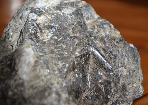
| Species: | Schorl |
| Formula: | NaFe32+Al6(Si6O18)(BO3)3(OH)3(OH) |
| Confirmation |
|---|
|
| Validity: | Confirmed |
| Confirmation Methods: | Visually Identified |
| Data |
|---|
|
| Mineral Data: | Click here to view Schorl data |
| Locality Data: | Click here to view Tour de la Massane (Torre de la Maçana), Argelès-sur-Mer, Céret, Pyrénées-Orientales, Occitanie, France |
| Data Identifiers |
|---|
|
| Mindat Occurrence Record ID: | 1019712 |
| Long-form Identifier: | 1:3:1019712:9 |
| GUID (UUID V4): | e183bac8-7565-465a-a409-03fc5912b5ed |
| Nearest other occurrences of Schorl |
|---|
|
|
| 2.6km (1.6 miles) | ⓘEl Rimbau, Pegmatite field, Collioure, Céret, Pyrénées-Orientales, Occitanie, France |
| 2.7km (1.7 miles) | ⓘPuig de Sallfort, Argelès-sur-Mer, Céret, Pyrénées-Orientales, Occitanie, France |
| 4.4km (2.7 miles) | ⓘPegmatite field, Collioure, Céret, Pyrénées-Orientales, Occitanie, France |
| 4.4km (2.8 miles) | ⓘLe Ravaner, Pegmatite field, Collioure, Céret, Pyrénées-Orientales, Occitanie, France |
| 6.7km (4.2 miles) | ⓘPuig Neulos (Pic Néoulous), Sorède, Céret, Pyrénées-Orientales, Occitanie, France |
| 7.1km (4.4 miles) | ⓘBalma del Moro, Laroque-des-Albères, Céret, Pyrénées-Orientales, Occitanie, France |
| 13.1km (8.2 miles) | ⓘMas d'en Freixa, Montesquieu-des-Albères, Céret, Pyrénées-Orientales, Occitanie, France |
| 26.3km (16.3 miles) | ⓘSainte-Marie Plage beach alluvial deposits, Sainte-Marie-la-Mer, Perpignan, Pyrénées-Orientales, Occitanie, France |
| 29.0km (18.0 miles) | ⓘTorreilles-Plage beach alluvial deposits, Torreilles, Perpignan, Pyrénées-Orientales, Occitanie, France |
| 31.0km (19.3 miles) | ⓘCap de Creus, Cadaqués, Girona, Catalonia, Spain |
| References |
|---|
|
|


Tour de la Massane, Argelès-sur-Mer, Céret, Pyrénées-Orientales, Occitanie, France