 | | Report (issue) |
| decide whether a certain metalliferous deposit or district should be included or not. The problem was also...other forms) since 1935 is reviewed. New sulfur mining and recovery projects in the United States and...chemical properties of sulfur, the geology and mining operations of the salt-dome sulfur deposits, the...sulfur by superheated water through wells at Sulphur mine, Louisiana, are fully detailed. Exploration and...Swager, W. L. , and Sullivan, J. D. , 1951, Sulphur: Mining Engineering, vol. 3. , pp. 403409. The history |
 | | Report (volume) |
| it helpful to refer to Survey Bulletin 507, "The mining districts of the western United States," and to...abundant, it may have been completely exhausted by mining or quarrying. Deposits of minerals of wide distribution...because they occur in sufficient quantity to warrant mining for their usual products but because they furnish...Morgantown. Wisconsin.........Prof. W. 0. Hotchkiss, Madison. Wyoming.........Mr. C. E. Jamison, Cheyenne. ...See Bauxite and Hallpysite. Asbestos. Tallapoosa County, with corundum deposits near Dudleyville; not found |
 | | Report (volume) |
| ....................................... 102 District of Columbia ......................................... 139 144 146 153 158 163 169 . 172 174 Montana..................................................to refer to Geological Survey Bulletin 507, "The mining districts of the western United States," and to...abundant it may have been completely exhausted by mining or quarrying. Deposits of minerals that are widely...because they occur in sufficient quantity to warrant mining for their usual products, but because they furnish |
 | | Journal (article/letter/editorial) |
| Al-RICH CHROMIUM-DRAVITE FROM THE #1 MINE, BALMAT, ST. LAWRENCE COUNTY, NEW YORK Marian V. LUPULESCU§ New...Research and Collections, 3140 CEC, Madison Avenue, Albany, New York 12230, USA Ralph ROWE Canadian Museum of...cummingtonite schist at the #1 mine at Balmat in the Adirondack Lowlands, St. Lawrence County, New York. The mineral...l’assemblage talc – trémolite – cummingtonite à la mine #1 à Balmat, Basse-Terres des Adirondack, comté...from the chromite deposits of Nausahi, Keonjhar District, Orissa, India (proposal approved, IMA#2009–088) |
 | | Journal (article/letter/editorial) |
| Lowlandsregion. The earliestpyrite mining in the region was in 1883-4 at the Stella mine; it ceasedin 1921, at which...MITCHELL 14 15 IG 17 18 19 FARR OREBEDSCHOOL STELLA pYRITES SRICKCHAPEL LITTLERIVER Map showinglocationof...material and left behindscouredand polishedbedrock. Mining and dairy farmingare the principalindustriesof... Biotitic quartz-microdine Marble Northwest gneiss in feet 500-1,000 (mostly dolomitic), with interlayered...and feldspathic gneisses 4.000 Quartz-biotite gneiss, largely migmatitic, with occasional interlayers |
 | | Report (volume) |
| ........................ 5 5 Distribution of mining districts..................................................................................... Montana.......................................................................... PART II. Catalogue of mining districts, by J. M. Hill..................................................... Classification of mining districts..................................................................................... Montana............................................... |
 | | Report (volume) |
| Deposits Of the Lawson-DumontFall River District Clear Creek County Colorado By C. C. HAWLEY and FRANK BAKER...of the general geology and ore deposits of the district which forms the northwestern part of the important...---------------------------------------Biotite gneiss.________________________________________ Quartz...gneiss______________________________________ (}ranite gneiss and pegmatite___________________________ Origin...--------------------------------Quartz diorite gneiss and related rocks_ _ ___ ___ ___________ Quartz |
 | | Book |
| international exploration entities, namely, Goldstream Mining NL/IMX Resources Ltd, Australia, and Binani Industries...Jordan, and Israel. He is a life fellow of The Mining Geological and Metallurgical Institutes (MGMI)...veteran in the field of Mineral Exploration and Metal Mining for the past four and one-half decades. He received...been focused on base and noble metals exploration/mining with short stopovers at Standard Oil (ESSO) Petroleum...born hills appear parallel to Mahagiri range due to mine-waste dumping. Unpaved roads serve the movement |
 | | Report (volume) |
| Coast region................................. 61 District of Columbia.................................................................................. Montana............................................................................................... Montana .......................................................................................... 302 District of Columbia......................................:.........'........................... 303 Montana............................................... |
 | | Report (issue) |
| Geological Survey Board and the Colorado Metal Mining Fund PAPER 289 Geology and Ore Deposits of...schist _______ _ Quartz-hornblende gneiss _______ _ Granite gneiss _________________ _ Gneissic granite...______ _ Hornblende diorite __________________ Silver Plume(?) granite ______________ ______ _ 1 ____...________ -----_-------------------------Location of mining districts _____ ---- __ ----------- ~~~~~i~~~...--- - - - -- -- -- - - -- -- - --- Tincup mining district ________ ------------------Chief economic s |
 | | Report (issue) |
| . . . . . . . . . . . . . . . . . . Falcon gold mine . . . . . . . . . . . . . . . . . . . . . . . ..... . .. . . . . . . . . . . . . . . . . McMillan Mine . . . . . . . . . . . . . . . . . . . . . . . ..... . . . . . . . . . . . . . . . . . . .. Massey mine .. .. . . . . . . . ..... ... .. . . . . . . . ...Pronto uranium mine . . . . . . . . . . . . . . . . . . . . . . . . . . . . . Cheney mine . . . . . . ...conglomerate) . . . . . . . . . . . . . . Havilah mine . . . . . . . . . . . . . . . . . . . . . . . . |
 | | Book |
| many years the mines and fields of St. Lawrence County have furnished museums and many lucky mineral col...been depleted through the the years, St. Lawrence County continues to supply many beautiful specimens to...types and mineralized zones of the St, Lawrence County area, A detailed discussion of the geology is beyond...and metamorphic rocks are found throughout the county, the latter prevails. Since more than three-fourths...(metamorphosed gabbro) is present locally across the county. Gabbro is a dark igneous rock composed chiefly |
 | | Report (issue) |
| Headframe, concentrator and waste dump at the Lacarne mine of Molybdenite Corporation of Canada, Limited (June...information supplied by officials of mining companies and provincial mining departments have enhanced the value...and other economic aspects (by R. J. Jones) World mine production......... .. .............. .. ... . United......... .... ..... .... .... .... ... . Kenora district (Patricia portion) .... ... .... . Red Lake area... .. .. .. .... .. .... .. ...... ... . Kenora district...................... .... .. ............. . |
 | | Report (volume) |
| accompanying map and is given by commodity and county in a locality list. Fuels, sand and gravel, and...commodities in each county. For example, both the iron and limestone localities in Clinton County are numbered...with number one. ome numbers are missing where one mine has produced two commodities or where two mines...1921, Geology of the Mount Marcy quadrangle, Essex County, New York: New York State Mus. Bull. 229, 230,...1916, The quarry materials of New York-granite, gneiss, trap and marble: ew York State Mus. Bull. 181 |
 | | Journal (article/letter/editorial) |
| Rift-Related Echo Lake Intrusion in Northern Michigan, USA Alexander James Koerber and Joyashish Thakurta *...University, 1903 W Michigan Ave, Kalamazoo, MI 49008, USA; alexander.j.koerber@wmich.edu * Correspondence:...intrusion in the Upper Peninsula (UP) of Michigan, USA, was formed during the 1.1 Ga Midcontinent Rift event...associated with the Baraga dike swarm in Marquette County, Michigan [13]. The U-Pb baddeleyite age of the...the area of the intrusion is an Archean granite‐gneiss [19], which is overlain by the Paleoproterozoic |
 | | Report (issue) |
| PROSPECTS, LAWSON-DUMONT-FALL RIVER DISTRICT, CLEAR CREEK COUNTY, COLORADO By C. C. Hawley and Frank...and summary of geology Production References cited Mine descriptions « Lawson area, north of Clear Creek...ClevelandC?) mine Flat Iron vein Mines east of Red Elephant Hill Central America (Tinker) mine-Comstock vein...Dexter mine i Johnson group Last Chance mine « r Little Giant mine Little Superior (Jack Rabbit) mine Orient...Orient mine Panama group ; Young America vein Mines west of Red Elephant Hill Amboy mine Girard mine Kanawha |
 | | Report (volume) |
| ___________________________________________ 32 Silver _______________________ ______________________________...___________________________________________________ 33 Mining claims ___________________________________________________..._____________________________ 34 Cornucopia mining district ________________________________________ 35..._____________________________________________ 38 Stella vein ________________________________________________..._____________________________ ______________ 43 Simons mine _______________________________________________ |
 | | Report (issue) |
| Ore Deposits of the St. Lawrence County Magnetite District Northwest Adirondacks New York GEOLOGICAL...377 Ore Deposits of the St. Lawrence County Magnetite District Northwest Adirondacks New York By B. F...____________________________ Rocks of the St. Lawrence County magnetite district. Metasedimentary rocks and migmatites____...and amphibolite_________________ Quartz syenite gneiss series._________________ Hypersthene metadiaba...metadiabase__________________ Granite and granite gneiss series._____________ Main types and their occurrence________ |
 | | Report (issue) |
| stockwork molybdenum deposits Vein deposits Gold-silver quartz vein deposits Epithermal vein deposits Vein-type...deposits Gneiss-hosted disseminated gold mineralization Volcanic-hosted disseminated gold-silver deposits...provided us with the descriptive model for the gneiss-hosted gold deposits. These people also critically...About 200 km northeast of the quadrangle in Gila County, Ariz., the Dripping Spring Quartzite, one formation...K-Ar biotite age of 23.8 m.y. Recent work (L.T. Silver, oral conmun., 1984) indicates a middle Tertiary |
 | | Journal (issue) |
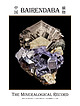
| KRISTALLE Est.1971 Laguna Beach, California, USA • Tel: +1 949 494 5155 • Email: info@kristalle.com...2023 Articles The Bairendaba Deposit, Keshiketen District, Inner Mongolia, China................................363 by C. J. Stefano The Nakhlak Mine, Anarak District, Esfahan Province, Iran...................only): $139/one year (Canada) $231/one year, (outside USA other than Canada) $325 for one year Subscription...species hauckite (type locality: the Sterling Hill mine) was named in his honor in 1980, in recognition |
 | | Book (volume) |
| Liguria. The Carrara, Massa, and Versilia Marble District (Apuan Alps), with Petrographic Note . PART XI...deposits near Varese, and to others in the Ivrea district. In Lombardy the shell-bearing deposits rest directly...that, of the moraine walls, those of the Como district are continuous, because the Adda eroded its bed...throughout the morainic littoral and the whole lake district, are only some of the direct and indirect effects... I. INTRODUCTORY. ite a paper on the Marble District of the Apuan Alps or Carrara Mountains ! I showed |
 | | Book |
| published in 1973 by The Viking Press, Inc. 625 Madison Avenue, New York, N.Y. 10022 Published simultaneously...and Collecting Hazards A Third Dimension Map of Mining Locations The Gallery List of Plates The Plates...Sydney, AUSTRALIA Ye M. DUSTERUD, Museum Manager, Mining Museum, Kongsberg, NORWAY }& PAUL FRAENKEL, collector...but selection was by quality, not locality. The Mining Location Map on pages 24 and 25 indicates the country...of them; many superb clusters are destroyed in mining; poor handling causes a major portion of all specimens |
 | Leclerc, F., Harris, L. B., Bedard, J. H., van Breemen, O., Goulet, N. (2012) Structural and Stratigraphic Controls on Magmatic, Volcanogenic, and Shear Zone-Hosted Mineralization in the Chapais-Chibougamau Mining Camp, Northeastern Abitibi, Canada(,) Economic Geology, 107 (5) 963-989 doi:10.2113/econgeo.107.5.963 | Journal (article/letter/editorial) |
| Zone-Hosted Mineralization in the Chapais-Chibougamau Mining Camp, Northeastern Abitibi, Canada(1,2) François...structure and stratigraphy of the Chapais-Chibougamau mining camp in the Archean Abitibi greenstone belt of...the Blondeau Formation of the Roy Group and the Stella Formation of the Opémisca Group (which unconformably...host early polymetallic (AuAg-Cu-Zn-Pb) veins. The Stella Formation is <2704 ± 2 Ma and is unaffected by...Au deposits in the Stella Formation. Introduction The Chapais-Chibougamau mining camp in the northeastern |
 | | Report (volume) |
| 74, Ph miles east of Dutchtown, Cape Girardeau County, Mo. Type section cut by northtrending fault with...stream in NEIA sec. 33, T. 16 N., R. 14 E, Wayne County. Named after village of Abington, about 3 miles...Named for Adam Peak in Osgood Mountains, Humboldt County. Occupies belt about 21f2 miles long on western...Portlandian) age. Mapped around Adobe Flat in Stanislaus County. Well exposed west of Wilcox Ridge in sec. 23,...Airport, sec. 30, T. 19 N., R. 103 W., Sweetwater County. Akah Substage Pennsylvanian (Desmoinesian): Utah |
 | | Book |
| PISTOLS i !?' A J.-. N ; 'jxt . 1 — \ MINING DISTRICTS and MINERAL RESOURCES of NEVADA by ...present authentic infor mation concerning the mining districts and mineral resources of Nevada. No comprehensive...United States Geological Survey in 1912. Plan. “Mining Districts and Mineral Resources of Nevada”, as...parts:—one on mining districts and the other on mineral resources. The section on mining districts is...but gives more extended descriptions and includes mining as well as geological information. The map which |


