| Locality type: | Mine |
| Classification |
|---|
|
| Species: | Tremolite |
| Formula: | ◻Ca2Mg5(Si8O22)(OH)2 |
| Confirmation |
|---|
|
| Validity: | Believed Valid |
| Data |
|---|
|
| Mineral Data: | Click here to view Tremolite data |
| Locality Data: | Click here to view National Graphite Mine, Monteagle Township, Hastings Highlands Municipality, Hastings County, Ontario, Canada |
| Data Identifiers |
|---|
|
| Mindat Occurrence Record ID: | 1093435 |
| Long-form Identifier: | 1:3:1093435:3 |
| GUID (UUID V4): | 781ba360-3792-489d-a98f-4000315d0b33 |
| Nearest other occurrences of Tremolite |
|---|
|
|
| 5.2km (3.2 miles) | ⓘGraphite Road roadcut, Monteagle Township, Hastings Highlands Municipality, Hastings County, Ontario, Canada |
| 6.5km (4.0 miles) | ⓘMaple Leaf, Monteagle Township, Hastings Highlands Municipality, Hastings County, Ontario, Canada |
| 19.5km (12.1 miles) | ⓘYork River skarn, York River area, Dungannon Township, Town of Bancroft, Hastings County, Ontario, Canada |
| 19.9km (12.4 miles) | ⓘHighway 28 East tourmaline occurrence, Dungannon Township, Town of Bancroft, Hastings County, Ontario, Canada |
| 21.7km (13.5 miles) | ⓘJeffrey Lake occurrences, Faraday Township, Hastings County, Ontario, Canada |
| 22.7km (14.1 miles) | ⓘPipe Lake, Faraday Township, Hastings County, Ontario, Canada |
| 23.4km (14.5 miles) | ⓘJeffrey (Jefrey Deposit) occurrence, Faraday Township, Hastings County, Ontario, Canada |
| 23.8km (14.8 miles) | ⓘLockwoods Farm occurrence, Faraday Township, Hastings County, Ontario, Canada |
| 25.7km (16.0 miles) | ⓘFaraday Hill Roadcut, Faraday Township, Hastings County, Ontario, Canada |
| 26.1km (16.2 miles) | ⓘCombermere area (Palmer Rapids area), Radcliffe Township, Madawaska Valley, Renfrew County, Ontario, Canada |
| References |
|---|
|
|
| Reference Search (possible matching items) |
|---|
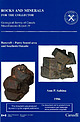 | | Report (issue) | | Survey of Canada Miscellaneous Report 39 Bancroft - Parry Sound area and Southern Ontario Ann P. Sabina...Sabina L 1*1 Natural Resources Canada Ressources naturelles Canada 1986 CanadZ L COVER Left: Betafite...crystals, Silver Crater Mine, Cardiff. Specimen measures 6 cm by 4 cm by 3 cm. National Mineral Collection...Collection specimen No. 42584. National Museum of Canada photo No. 1168B. Note: actual specimen is dark brown....cm by 20 cm. National Mineral Collection specimen No. 36463. National Museum of Canada photo No. 1361 |  | | Report (issue) | | GOVERN YOUR USE OF THIS DOCUMENT Your use of this Ontario Geological Survey document (the “Content”) is governed... copyright is held by the Queen’s Printer for Ontario. It is recommended that reference to the Content... . ; Ontario Geological Survey, ...670-5691 Toll Free: 1-888-415-9845, ext. 5691 (inside Canada, United States) Local: (705) 670-5691 Toll Free:...(inside Canada, United States) Local: (416) 326-2678 Toll Free: 1-800-668-9938 (inside Canada, United |  | | Report (issue) | | but is not labelled. - BANCROFT TRlP 1 - This mine is closed and most of the Photo 27, p. 59 buildings...now Highway 28. - From Stop 11, Craigmont Corundum Mine, to Combermere, take Highway 517; the road as illustrated...Geological Guide Book No. 3 ONTARIO DEPARTMENT OF MINES Reprinted by Ontario Ministry of Northern Development...Mines (iii) ©1969 Government of Ontario Printed in Ontario, Canada Reprinted 1974 Second Reprinting...published with the permission of V.G. Milne, Director, Ontario Geological Survey, Ministry of Northern Development |  | | Report (issue) | | GOVERN YOUR USE OF THIS DOCUMENT Your use of this Ontario Geological Survey document (the “Content”) is governed... copyright is held by the Queen’s Printer for Ontario. It is recommended that reference to the Content... . ; Ontario Geological Survey, ...670-5691 Toll Free: 1-888-415-9845, ext. 5691 (inside Canada, United States) Local: (705) 670-5691 Toll Free:...(inside Canada, United States) Local: (416) 326-2678 Toll Free: 1-800-668-9938 (inside Canada, United |  | | Report (Issue volume) | | ieod ad 11tt~ e~ i# {1anada Volume II ONTARIO and QUEBEC Ann P. Sabina MISCELLANEOUS REPORT 8 Issued...Issued by THE GEOLOGICAL SURVEY OF CANADA Department of Mines and Technical Surveys, Ottawa $1.65 © Crown...Queen's Printer, Ottawa, the Geological Survey of Canada, 601 Booth St., Ottawa, and at the following Canadian...available for reference in public libraries across Canada. Price $ l.65 Catalogue No . M41-8 / 8-2 Price...Queen's Printer and Controller of Stationery Ottawa, Canada 1964 Page • INTRODUCTION 2 • A note on Canadian |  | | Book (edition) | | INDUSTRIES in the areas served by the Canadian National Railways THE LIBRARY OF York University SPECIAL...INDUSTRIES IN THE AREAS SERVED BY THE CANADIAN NATIONAL RAILWAYS C. By PRICE-GREEN, F.R.G.S. Member...COMMISSIONER DEPARTMENT OF NATURAL RESOURCES CANADIAN NATIONAL RAILWAYS Digitized by the Internet Archive in...94 95 97 98 Actinolite Mineral Production of Canada Gold Production of the World Silver Production... Saskatchewan Manitoba 17 18 19 21 22 23 25 Ontario Quebec New Brunswick Nova Scotia Prince Edward |  | | Report (volume) | | anticline__--_-----_---___-__-__-___-_-___---_. Mine Ridge anticline__---___-_-__--_---_______-___-_-_...____________________________________________________ Graphite..___________________-__________--.__ Soils_________________...__________________ 2. Map of the Appalachian Highlands, showing physiographic divisions and relations...________________________ 5. Ideal section across Mine Ridge uplift, showing deposition of Conestoga limestone...___________ 14. Geologic map of western part of Mine Ridge anticline and Chester Valley syncline, showing |
|


