 | | Report (issue) | | WILDERNESS AND ADJACENT AREAS, NORTHERN CASCADES, WASHINGTON By Arthur B. Ford Open-File Report 83-97 1983...vicinity in the northern Cascade Mountains of Washington (fi...addition of references by Peter Misch (University of Washington, Seattle, Wash.), Ronald B. Stotelmeyer (U.S...-48° 30* SKAGIT v- CO. SNOHOMISH 48°00' Washington State ^-WILDERNESS RECOMMENDATION (D-1. etc...Pass to Rainy Pass: The Mountaineers, Seattle, Washington, p. 84-94. Becky, Fred, and Rands, Gary, 1977 |  | | Report (issue) | | GLACIER CHELAN, GEOLOGY DATA FOR THE PEAK WILDERNESS, SNOHOMISH, AND SKAGIT COUNTIES, WASHINGTON By...Mountain.................................. 4. Milt Creek......................................... 5. Red....................................... 7. Canyon Creek....................................... 8. Sitting........... 10. Pass Creek......................................... 11. Company Creek..................................................... 18. Nine Mile Creek.................................... 19. Red Cap |  | | Journal (article/letter/editorial) | | that occur in beautiful specimens in Washington. minerals Washington Mineral Locality Index L A N N Y R...okanoganite-(Y), and zektzerite, all from Washington Pass in Okanogan County —which are known only from the state;...Mackinaw mine in Snohomish County, ferritungstite from Germania mine near Fruitland in Stevens County, and...from Rock Island Dam near Wenat chee in Douglas County. In addition, many localities pro duce fine-quality...only been known for a decade or two. Whereas metal mining has led to the discovery of some of these mineral |  | | Report (issue) | | GEOLOGICAL SURVEY Acid mine drainage at the Holden deposit, Chelan County, Washington By J.E. Kilburn,*...................................... 4 PORTAL OR MINE WATERS ................................... 5 SECONDARY...ILLUSTRATIONS Figure 1. Location of the Holden mine, Chelan County, Washington................................................. 2 INTRODUCTION The Holden orebody is a relatively low-grade, copper-zincsilver-gold...northcentral Washington (see fig. 1) (Nold, 1983; Dragovich and Derkey, 1994). The mine, which began |  | | Report (issue) | | OVERVIEW OF GEOCHEMICAL STUDIES CONDUCTED AT THE HOLDEN MINE, SPRING 1996 By J.E. Kilburn* and SJ. Sutley*...INTRODUCTION................^ 1 Site Description and Mining History.................................................................................... Railroad Creek..............................................for untreated water samples collected at the Holden mine, May 1996 (anion analysis by ion chromatography)...and acidified water samples collected at the Holden mine, May 1996................................... |  | | Report (issue) | | Characterization of acid mine drainage at the Holden mine, Chelan County, Washington By I.E. Kilburn* and..........................^ Site Description and Mining History .........................................Copper Creek.................................................... 10 Seepage West of Copper Creek.........for untreated water samples collected at the Holden mine, July 1995.....................................and acidified water samples collected at the Holden mine, July 1995 ................................. |  | | Book | | Bart Cannon 1975 CORD ILLERAN Mercer Island, Washington Lilli liliiiLt' 111? KLi-KlLLLIlrVlIlI Copyright...Cordilleran 18 Holly Hill Drive Mercer Island, Washington 98040 COVER ILLUSTRATION: Amethyst scepter heads...milky quartz stems. Denny Mountain area of King County. Specimen from the collection of Cary A. Maykut...publications dealing with the various aspects of Washington State's diverse mineral wealth exist, but none..."Minerals of Washington" represents an attempt to begin such a cata logue. "Minerals of Washington" shall |  | | Report (issue) | | GEOLOGY AND EARTH RESOURCES DIVISION OLYMPIA, WASHiNGTON 98504 METAL MINES OF WASHINGTONPRELIMINARY REPORT...DERKEY NANCY L. JOSEPH and RAYMOND LASMANIS WASHINGTON DIVISION OF GEOLOGY AND EARTH RESOURCES OPEN...Earth Resources standards and nomenclature. 1, WASHINGTON STATE DEPARTMENT OF Natural Resources Brian...DERKEY NANCY L. JOSEPH and RAYMOND LASMANIS WASHINGTON DIVISION OF GEOLOGY AND EARTH RESOURCES OPEN...standards and nomenclature. • CONTENTS Page Page County and site name Kelly Camp Kettle Key East Knob |  | Kilburn, James E., Whitney, C.G., d'Angelo, W. M., Fey, D.L., Hopkins, R.T., Meier, A.L., Motooka, J.M., Roushey, B.H., Sutley, S.J. (1994) Geochemical data and sample locality maps for stream-sediment, heavy-mineral-concentrate, mill tailing, water, and precipitate samples collected in and around the Holden mine, Chelan County, Washington. Open-File Report Vol. 1994 (94-680) US Geological Survey doi:10.3133/ofr94680a | Report (issue) | | samples collected in and around the Holden mine, Chelan County, Washington By J.E. Kilburn*, G.C. Whitney**............................................... 1 Mining History........................................... 3 Local Geology and Mineralization at the Holden Mine. ........ .3 METHODS OF STUDY..................ILLUSTRATIONS Figure 1. Location of the Holden mine, Chelan County, Washington..................................of samples collected in the Holden quadrangle, Chelan County, Washington............................ |  | | Journal (article/letter/editorial) | | GEOLOGY OF THE A. YOUNGBERG AND HOLDEN THOMAS No. 1 MINE. L. WILSON. ABSTRACT. The Holdenmineproduces...bytheHoweSoundCompany,is located in Chelan County, Washington at Holden(Fig. 1). This smallminingcamp(pop...eastslopeof the Cascade Mountainson Railroad Creek,whichflowseastwardinto Lake Chelan. The minemaybereached by...andthence by automobileelevenmilesfrom Lucerneto Holden. Theredoutcrops of theHoldenMinewerenotedbyMaiorRodgers...ofSeattle, whoin 1892grubstaked J. H. Holden toprospectthearea. Mr. Holden,in Julyof thatyear,stakedtheclaimswhichare |  | | Report (issue) | | Conceptual Model of Mine Drainage at the Holden Mine, Chelan County, Washington By I.E. Kilburn*, D...ABSTRACT...1 INTRODUCTION...! Site Description and Mining History...3 Geologic Setting...4 Summary of USGS...CONCEPTUAL MODEL...6 Major Controls of Mine Drainage at the Holden Site...6 Geologic Controls... 6 External...for untreated water samples collected at the Holden mine, September 1996...26 Table 2. ICP-AES analysis...and acidified water samples collected at the Holden mine, Sept. 1996...27 Table 3. ICP-MS analysis of |  | | Report (Issue volume) | | State of Washington ARTHUR B. LANGLIE, Governor Department of Conservation and Development W. A. GALBRAITH...GLOVER, Supervisor Bulletin No. 37 INVENTORY OF WASHINGTON MINERALS PART II METALLIC MINERALS By MARSHALL...Volume 2 - MAPS STATE PRINTING PLANT. OLYMPIA, WASHINGTON lll!UI For sale by Department of Conservation...volumes-text and maps) $4.50. INVENTORY OF WASHINGTON MINERALS PART II METALLIC MINERALS Volume 1...Bulletin 33, "Nonmetallic Mineral Resources of Washington," published in 1936. Since then the catalogue |  | | Report (issue) | | WASHINGTON . GEOLOGICAL SURVEY. HENRY LANDES, STA TE GEOLOGIST. VOLUME I. ANNUAL REPORT FOR 1901... . . . . . . . . . . . . . . . . . . . Stevens County..................... ... . . . . . . . . . . ....Northport District. .... . ........ . .. ... . . . .. . . . ............ . Myers Fa.Us District . . . .... . . . . . . . . . . . . . . . . Fla.t C1·eek District . . . . . . . . . . . . . . . . . . . . . . .... . . . . . . . . . . . . . . . . . Colville District . . . . . . . . . . . . . . . . . . . . . . . . |  | Church, S.E, Lehuray, A.P, Grant, A.R, Delevaux, M.H, Gray, J.E (1986) Lead-isotopic data from sulfide minerals from the Cascade Range, Oregon and Washington. Geochimica et Cosmochimica Acta, 50 (2) 317-328 doi:10.1016/0016-7037(86)90180-8 | Journal (article/letter/editorial) | | sulfide minerals from the Cascade Range, Oregon and Washington S. E. CHURCH, A. P. LEHURAY,’ A. R. GRANT,’...plutons found in the Cascade Range of Oregon and Washington demonstrate a rather uniform isotopic composition... 206Pb/mPb is greater than 18.92 in northern Washington and southern Oregon where deposits have intruded...types occur in the Cascade Range of Oregon and Washington. They are generally younger than the porphyry...studied in the Cascade mineral belt, Oregon and Washington. Note that the deposits intersect the trend of |  | | Journal (article/letter/editorial) | | North America; the rare earth pegmatitesb of Llano County (Texas), Minas Geraes(BraziI), Ytterby (Sweden)...2, pp. 104-105, 1907. la Reid, A. Mclntosh, The mining fields of Morina, Mt. Claude, and Lorinna: Tasmania...pp. 300-311. t6 Dolmage, Victor, Finlay River district, British Columbia:' Canad'ian l[i'n. TH E AM...A. L Genesis of mica pegmatite deposits, Latah County, Idaho: , Econ. Geology,vol. 28, no. 1, pp. 41-58... 20Barrell, Joseph, Geology of Marysville mining district, Montana: U.S. Geol,. Suntey, Prof . Paper |  | | Report (volume) | | Reconnaissance for Radioactive Minerals in Washington, Idaho, and Western Montana 1952-1955 By PAULL...Commission UNITED STATES GOVERNMENT PRINTING OFFICE, WASHINGTON : 1958 ,- '• UNITED STATES DEPARTMENT OF...1922Reconnaissance for radioactive minerals in Washington,. Idaho, and western Montana, 1952-1955, by Paul...Weis, Frank C. Armstrong, and Samuel Rosenblum. Washington, U. S. Govt. Print. Off., 1958. iv, 7-48 p. plate...Documents, U. S. Gonrnme'b.t Prlnt'lna Office Washington 25, D. C. - Price 35 cents (paper cover) CONTENTS |  | | Journal (article/letter/editorial) | | when a new pocket was broken into in the Mammoth Mine, Tiger, (Pinal Company), Arizona." ARKANSAS — Another...St., Oakland, Calif., and its locality was Clear Creek, San Benito Co., Calif. A very nice light greenish...xled cyrtolite was found last year in the Pine District, Jefferson Co., Colo., so we were informed by...locality in the State is Russell Gulch in Gilpen County. A small but very fine crystal group from Russell... June 26-29, 1952. CONNECTICUT — The old copper mine near Bristol, Hartford Co., Conn., used to produce |  | | Book | | PUBLISHED BY Western Mineral Exchange Seattle, Washington 1941 t Copyright 1941 WESTERN MINERAL EXCHANGE...volume is dedicated is four-fold: (1) To locate by mine, deposit, or community those mineralized areas of...Co. Hematite CALERA, Shelby Co. Wavkllite CLAY COUNTY, Sec. 24. T. 19 S R., 7 E. STATUARY, Coosa Co...Co., (W. border of* Marble Crystalline TALLADEGA COUNTY Marble, (crystalline) VALLEY HEAD, DeKalb Co. Hematite...VILLAGE SPRINGS, Blount Co. Hematite WOODS COPPER MINE, Cloaburne Co. Sphalerite ARIZONA COVEI.I.ITE | 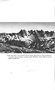 | | Report (volume) | | narrow chutes between towering spires . McMillan Creek behind the low ridge in foreground . :.;-·- .,...MINERAL RESOURCES, NORTH CASCADES NATIONAL PARK, WASHINGTON JOO~a r; I J>.!:J f ~eology and Mineral...Northern Part of the North Cascades National Park, Washington B'Y MORTIMER H. STAATZ, ROWLAND W. rABOR, PAULL...park UNITED STATES GOVERNMENT PRINTING OFFICE, WASHINGTON : 1972 UNITED STATES DEPARTMENT OF THE INTERIOR..._________ Silver Creek area ___________________ ~______________________ Pass Creek area_____________ |  | | Report (issue) | | description of the geology, mining history, and production of the major gold-mining districts in 21 States...States UNITED STATES GOVERNMENT PRINTING OFFICE, WASHINGTON 1968 UNITED STATES DEPARTMENT OF THE INTERIOR...relations ---------------------------History of gold mining and trends in production_ J\labama -----------...--------------Cleburne County ----------~----------------- Tallapoosa County --------------------------Alaska...------------------Cochise County -----------------------------Gila County --------------------------------Greenlee |  | | Report (edition) | | Quarry, Buckfield, Maine. Mined in 1996 by Holden !Jrothers Mining and currently in the Jim Mann collection...I 900 ' s, showing Loren Merrill 's tourmaline mining operation at Mount Mica. Table of Contents CHAPTER...much information on collecting sites in Oxford County. Numerous other collectors of Maine minerals also...Hart (Maine State Museum), Ronald Holden, Jr. (Holden Brothers Mining), Gary Hoyle (Maine State Museum)...Fisheries and Wildlife, Phillip McCrillis (Plumbago Mining Corporation), Jane Perham, John Raymond, and Neil |  | | Journal (article/letter/editorial) | | grandeur, and even the climate. THE GEOLOGY OF WASHINGTON RAYMOND LASMANIS D e p a r t m e n t of Natural...Geology and Earth R e s o u r c e s Olympia, Washington 98504 W A S H I N G T O N S T A T E IS A D V...features of the adjacent regions all ter minate in Washington. The state's uniqueness is further enhanced by...by two major geologic conditions. First, Washington is impacted by crus tal tectonics as the oceanic...figures 1 and 2.) Second, the Columbia Basin in Washington and adjacent Oregon was subjected to one of the |  | | Report (volume) | | AND SAMUEL SANFORD A revision of Bulletin 585 WASHINGTON GOVERNMENT FEINTING OFFICE 1917 CONTENTS........................................... 102 District of Columbia ................................................................................ Washington................................................to refer to Geological Survey Bulletin 507, "The mining districts of the western United States," and to...abundant it may have been completely exhausted by mining or quarrying. Deposits of minerals that are widely |  | | Book | | AGRICULTURE; AND PROFESSOR OF MINERAL– oGY, GEology, AND MINING, IN THE DEPARTMENT OF SCIENCE OF the COLLEGE OF...OF CALIFORNIA. ANTISELL, THoMAs. U. S. Pacific Railroad Reports; vol. 6. BLAKE, WILLIAM P. Report upon...York; H. Bailliére. Also, in vol. 5 U. S. Pacific Railroad Reports. - Silver Ores, and Silver Mines. 8vo...of the Mechanics' Fair Exhibition, California. Mining and Scientific Press, Octo ber, 1864; vol. 10,...the United States Exploring Expedition. 4to. Washington. Manual of Mineralogy. — System of Mineralogy |  | | Report (issue) | | FROM THE GLACIER PEAK WILDERNESS STUDY AREA, WASHINGTON By S. E. Church, E. L. Mosier, and J. G. Frisken...the location of the Glacier Peak study area, Washington............................................................ Localities having identifiable molybdenite in the nonmagnetic, heavy-mineral fraction from...Wenatchee National Forests, Chelan, Skagit, and Snohomish Counties, Washington. The Glacier Peak Wilderness...the Monte Cristo and Eagle Rocks study areas, Washington: U.S. Geological Survey Open-File Report 82-303 |
|


