 | | Report (issue) |
| INTRODUCTION. The area here called the Cosna-Nowitna region extends southward from Yukon and Tanana rivers...general way the 1 Hcrron, J. S., Explorations in Alaska, 1899: War Dept., Adjt. General's Office, No. 31... 1901. 211 212 MINERAL RESOURCES OF ALASKA, 1915. Yukon-Kuskokwim divide. A pack train of seven...the Yukon and Kuskokwim were mapped. Geologic mapping was extended over practically the same area. The...the eastern part. Still farther east, beyond the area surveyed, several small isolated ranges and hills |
 | | Report (issue) |
| RUBY-KUSKOKWIM REGION ALASKA BY J. B. MERTIE, Jr. Mineral resources of Alaska, 1933 (Pages 115-245)...________-___ Ruby district._______-___-____--._-_--.-__---_--__._______ Ruby area.______-_____--_---...area____-______.__--_-___--__-_-___-_________ 145 Long Creek and Bear Gulch..____________________ Fifth of July...______________________ Greenstone Creek.._______._________._._-_._.___._ Monument Creek.______________________________...Meketchum Creek._______________________________ Trail Creek____.________________________ Flint Creek and tributaries |
 | | Report (volume) |
| FINENESS OF GOLD FROM ALASKA PLACERS BY PHILIP S. SMITH Mineral resources of Alaska, 1937 (Pages 147-272)...__-_____Metals other than gold in bullion from Alaska placers________ Descriptions of regions in relation...placer gold Southeastern Alaska region__________________________ Juneau district ____________________ Porcupine...Slate Creek area__________________________ Middle Fork area___________________________ Rainy Creek area___...district_________________________________ Nelchimi district ______________________________ Cook Inlet-Snsitna |
 | | Report (issue) |
| MINERAL RESOURCES OF ALASKA, 1914. By ALFRED H. BROOKS and others. PREFACE. By ALFRED H. BROOKS. This...resources during 1914 and of the status of the mining industry in the Territory. It is the eleventh of...particular district are therefore urged to procure a copy of the complete report on that district as soon...statistical data is impaired by the fact that some of the mine operators, notably the placer miners, fail to report...production of many of the districts or to summarize the mining development. There are now nearly 450 operators |
 | | Report (issue) |
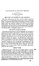
| PLACERS OF THE RUBY DISTRICT. By HENRY M. EAKIN. LOCATION AND EXTENT OF THE DISTRICT. The chief settlement...settlement of the Ruby district is Ruby, situated on the south bank of Yukon River opposite the mouth of Melozitna...Melozitna River. The principal placer mines of the district are about 25 miles south of Ruby on a number of...streams that belong to the Nowitna River system. The area that includes the mines is small, but auriferous...in the surrounding territory extending from the Yukon southward 50 miles or more, with a width somewhat |
 | | Report (volume) |
| Director Bulletin 933 4 * MINERAL RESOURCES OF ALASKA REPORT ON PROGRESS OF INVESTIGATIONS IN PAPERS...industry of Alaska in 1940, by Philip S. Smith (B) Geology of the Nutzotin Mountains, Alaska .: _ __ (C)...at the Independence mine, Alaska : _ (D) Reconnaissance of Porcupine Valley, Alaska ) . 1 103 201 219...PLATE 1. Map of Alaska, showing areas covered by selected available reports and maps of Alaska _ __ _ 1 In...sedimentary members of the Permian rocks on Baultoff Creek, about 4 miles southeast of the pass to East Fo |
 | | Report (volume) |
| Mcndenhall, Director Bulletin 926 MINERAL RESOURCES OF ALASKA REPORT ON PROGRESS OF INVESTIGATIONS IN 1939 PAPERS...industry of Alaska in 1939, by Philip S. Smith_____ .._._. (B) Geology of the Gerstle River district, Alaska...molybdenum minerals in Alaska, by Philip S. Smith.._ (D) Geology of the Portage Pass area, Alaska, by F. F. Barnes...107 161 211 ILLUSTRATIONS PLATE Page 1. Map of Alaska, showing areas covered by selected available reports...Topographic reconnaissance map of the Gerstle River district, Alaska _ _______________ _____l_______-_-__________ |
 | | Report (issue) |
| OF THE NOBTHEKN KOYUKUK VALLEY, ALASKA BY ROBERT MARSHALL Mineral resources of Alaska, 1931 (Pages 247-256)...drainage in northern Koyukuk region__.____._ Page 252 RECONNAISSANCE OF THE NORTHERN KOYUKUK VALLEY By ROBERT...conducting investigations of the mineral resources of Alaska, about one half of the Territory has been surveyed...the headwater region of the Koyukuk River, the large tributary of the Yukon from the north that rises in...into the Arctic Ocean. Surveys of parts of the Koyukuk region have been made by the Geological Survey |
 | | Report (issue) |
| Director. Bulletin 868 MINERAL RESOURCES OF ALASKA REPORT ON PROGRESS OF INVESTIGATIONS IN 1934 BY...separate publication] Page (A) Mineral industry of Alaska in 1934, by P. S. Smith (published Jan. 25, 1936)_______...3. 4. Topographic map of Kodiak and vicinity, Alaska. ___________ Geologic map of Kodiak and vicini...upper Ugak Bay_ _______________________ 7. Kodiak, Alaska, in August 1912, several months after the explosion...sketch map of the Kaiyuh Hills and part of the Ruby district- ______________________________________________ |
 | | Report (volume) |
| Placer Deposits of Alaska By EDWARD H. COBB GEOLOGICAL SURVEY BULLETIN 1374 An inventory of the...the placer mines and prospects of Alaska, their history and geologic setting UNITED STATES GOVERNMENT...and method of presentation __ Definitions _-____ Alaska Peninsula region Aleutian Islands region ________...Anchorage district _ Redoubt district ___-_ _ Valdez Creek district __ _ Willow Creek district Yentna district...district _____________ _ ____ __________ _____ Copper River region __ _ _ _ Chistochina district Nelchina |
 | | Report (issue) |
| Director °\ Bulletin 880 MINERAL RESOURCES OF ALASKA REPORT ON PROGRESS OF INVESTIGATIONS IN 1935 ...separate publication] Page (A) Mineral industry of Alaska in 1935, by P. S. Smith (published in March 1937)...Capps (published in January 1938). Ill (D) The Eska Creek coal deposits, Matanuska Valley, by Ralph Tuck (published...publications on Alaska..___0n back of plate 1 ILLUSTRATIONS Page PLATB 1. Map of Alaska, showing areas...covered by selected available reports and maps of Alaska.._-______----___________ In pocket 2. Reconnaissance |
 | | Report (volume) |
| Director Bulletin 754 THE RUBY-KUSKOKWIM REGION ALASKA BY J. B. MERTIE, JR. ' AND G. L. HARRINGTON...Local details____ ___________ Yukon River______ _________ Poorman Creek _____ Nowitna and Susulatna valleys...district__________________________ 32 Iditarod district__________________________ 33 Iditarod to Kuskokwim River__________________...fish____ _ Other mining factors __________________________ Gold placers _ _ _ Ruby district _______________________________..._______________________________ History of mining ______________________ General character of placers________________ |
 | | Report (volume) |
| Mendenhall, Director Bulletin 910 MINERAL RESOURCES OF ALASKA REPORT ON PROGRESS OF INVESTIGATIONS IN 1937 PAPERS...separate publication Page (A) Mineral industry of Alaska in 1937, by P. S. Smith (published in May 1939...(B) Platinum deposits of the Goodnews Bay district, Alaska, by J. B. Mertie, Jr. (published in January..._________________ 115 (C) Fineness of gold from Alaska placers, by P. S. Smith, (published in 1941)._...publications on Alaska. _ On back of plate 1 ILLUSTRATIONS Page PLATE 1. Map of Alaska, showing areas |
 | | Report (volume) |
| separate publication ) (A) Mineral industry of Alaska in 1936, by P. S. Smith (published in March 1938)...--------------------_1 (B) 'The Valdez Creek mining district in 1936, by Ralph Tuck (published in March...publications on Alaska. _ _ _ _ _ On back of plate 1 ILLUSTRATIONS Page PLATE 1. Map of Alaska, showing areas...and maps of Alaska.___________________________ In pocket 2. Sketch map of Fortymile district, showing location...gold placer-mining operations.____--__-__-______-_-__--_---_160 3. Sketch map of Eagle district, showing |
 | | Report (issue) |
| Mendenhall, Director Bulletin 864 MINERAL RESOURCES OF ALASKA REPORT ON PROGRESS OF INVESTIGATIONS IN 1933 BY...separate publication] Page (A) Mineral industry of Alaska in 1933, by P. S. Smith_________ Selected list...publications on Alaska______ (B) The Willow Creek-Kashwitna district, by S. R. Capps and Ralph Tuck_______...gold placer-mining operations___________________ 3. Sketch showing location of placer-mining claims on...on Long Creek, in the Ruby district___________________ 4. Sketch map of Cripple, Ophir, Tolstoi, Nixon |
 | | Report (issue) |
| MINERAL INDUSTRY OF ALASKA IN 1926 By PHILIP S. SMITH* INTRODUCTION Records of what has been done in...The investigations of the imineral resources of Alaska which the Geological Survey has been [carrying...755, 773, 783, and 792. 2 MINERAL RESOURCES OF ALASKA, 1926 generously put at the disposal of the Geological...obtained from other sources. Many of the important Alaska newspapers are courteously sent toj the Geological...year] sends to each person known to be operating a mine or prospect sched-J ules on .which are queries to |
 | Cathrall, J.B., Antweiler, J.C., VanTrump, George, Mosier, E.L. (1990) Gold analytical results and gold signatures from the Anchorage, Charley River, Healy, Iditarod, Juneau, Mt. Hayes, Mt. McKinley, Ophir, Ruby, and Talkeetna quadrangles, Alaska. Open-File Report Vol. 1990 (90-210) US Geological Survey doi:10.3133/ofr90210 | Report (issue) |
| McKinley, Ophir, Ruby, and Talkeetna quadrangles, Alaska By John B. Cathrall,* John C. Antweiler,* George...Healy, Iditarod, Juneau, Mt. Hayes, Mt. McKinley, Ophir, Ruby, and Talkeetna quadrangles, Alaska.........Healy, Iditarod, Juneau, Mt. Hayes, Mt. McKinley, Ophir, Ruby, and Talkeetna quadrangles, Alaska.........Healy, Iditarod, Juneau, Mt. Hayes, Mt. McKinley, Ophir, Ruby, and Talkeetna quadrangles, Alaska.........Healy, Iditarod, Juneau, Mt. Hayes, Mt. McKinley, Ophir, Ruby, and Talkeetna quadrangles, Alaska INTRODUCTION |
 | | Report (issue) |
| Mendenhall, Director Bulletin 917 MINERAL RESOURCES OF ALASKA REPORT ON PROGRESS OF INVESTIGATIONS IN 1938 PAPERS...advance publication:] Page (A) Mineral industry of Alaska in 1938, by Philip S. Smith...-_._.__-_. (B) Geology...Geology of the upper Tetling River district, Alaska, by Fred H. Moffit____-._---...I-..-..---.-....--...production from Alaska, by Philip S. Smith._________ (D) Tertiary deposits of the Eagle-Circle district, Alaska...PLATE 1. Map of Alaska, showing areas covered by selected available reports and maps of Alaska._________________________ |
 | | Report (issue) |
| H. MANNING. Director I HE MINING INDUSTRY IN THE TERRITORY OF ALASKA DURING THE CALENDAR YEAR 1915... BY SUMNER S. SMITH United States Mine Inspector for Alaska ENGINEERING \Y* WASHINGTON GOVERNMENT...MINES H. MANNING. Director THE MINING INDUSTRY IN THE TERRITORY OF ALASKA DURING THE CALENDAR YEAR 1915... BY SUMNER S. SMITH United Stales Mine Inspector for Alaska WASHINGTON GOVERNMENT PRINTING 1917 ...prohibits the CONTENTS. Page. Introduction New gold-mining districts Mineral production Placer gold Lode gold |
 | | Report (issue) |
| MINERAL RESOURCES OF ALASKA, 1929 MINERAL INDUSTRY OF ALASKA IN 1929 By PHILIP S. SMITH* INTRODUCTION...INTRODUCTION The mineral industry of Alaska was for many years the dominant incentive for the development of the...formerly held by mining, though they have by no means displaced the hold that mining still has on the...the minerals produced in Alaska is second to that of the fish products, mining developments still hold...most of the residents. Assistance to the mining industry of Alaska has therefore long been recognized as |
 | | Report (issue) |
| SELECTED NONMETALLI FERGUS MINERAL DEPOSITS IN CENTRAL ALASKA TO ACCOMPANY OPEN-FILE MAP 77-1680 This report...SELECTED NONMETALLI FERGUS MINERAL DEPOSITS IN CENTRAL ALASKA (To accompany Open-file Map 77-168D) By G. Donald...accompanying map have been prepared under the Regional Alaska Mineral Resource Appraisal Program (RAMRAP) to...nonmetal1iferous deposits, both lode and placer, in central Alaska. Specifically excluded are the fossil fuels (petroleum...government and private sectors, discussions with mine operators, and the firsthand knowledge of the authors |
 | | Report (issue) |
| INDUSTRY OF ALASKA IN 1931 AND ADMINISTRATIVE REPORT BY PHILIP S. SMITH Mineral resources of Alaska, 1931...separate chapters. CONTENTS Mineral industry of Alaska in 1931---_---------------__------------- Page...districts._______-______ __-_-_.______ Southeastern Alaska.-.-.-.____________________ Copper River region...-Cook Inlet-Susitna region_____^--__----__--__-Yukon region..------------------------------Kuskokwim...Peninsula.__-__-_---_-_-__--__--__-___ Northwestern Alaska._-____-_____--_______-__Dredging.._____-______ |
 | | Report (volume) |
| Metalliferous Lode Deposits of Alaska By HENRY C. BERG and EDWARD H. COBB . G E O L O G I C A L S...A n inventory of the mines and )- grosfiects of Alaska and their ' f geologic settings UNITED STATES...acknowledgments--- - - - - - ----- - - - -- - -- 4 Alaska Peninsula region- - - - - - - - -- - - - - - -...- - - _ - - - _ - - - - - - - - - - 16 Redoubt district--- - - - - - - - - - - - - - - - - - - - - - -...- - - - - - - - - - - - - - - - - ---20 Valdez Creek district_--. . . . . . . . . . . . . . . . . . |
 | | Report (issue) |
| RESOURCES OF THE LAKE CLARK-IDITAROD REGION. By PHILIP S. SMITH. INTRODUCTION. The area described in this report...has for convenience been called the Lake Clark-Iditarod region. It is roughly quadrilateral and is bounded...Lake Clark and on the northwest by the town of Iditarod that is, it extends from latitude 60° to 62° 30'...270) shows the relation of this area to the southwestern part of Alaska. Different parts of this region...degrees of thoroughness. Thus the region around Iditarod was examined by Maddren in 1910 and by Eakin in |
 | | Report (issue) |
| MINERAL INDUSTRY OF ALASKA IN 1930 By PHILIP S. SMITH 1 The mineral industry of Alaska was for many years...the preeminence of mining, though they have by no means displaced the hold that mining has on the welfare...the minerals produced in Alaska is second to that of the fish products, mining developments still hold...most of the residents. Assistance to the mining industry of Alaska has therefore long been recognized as...describing the different mineral commodities or mining camps and setting forth, both in the text and by |


