| Locality type: | Deposit |
| Classification |
|---|
|
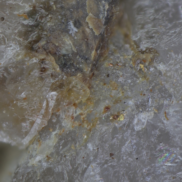
| Species: | Gold |
| Formula: | Au |
| Confirmation |
|---|
|
| Validity: | Confirmed |
| Confirmation Methods: | Visually Identified |
| Data |
|---|
|
| Mineral Data: | Click here to view Gold data |
| Locality Data: | Click here to view Henry's Hill Wolfram Deposit, Avoca, Pyrenees Shire, Victoria, Australia |
| Data Identifiers |
|---|
|
| Mindat Occurrence Record ID: | 1227662 |
| Long-form Identifier: | 1:3:1227662:4 |
| GUID (UUID V4): | df4e4c38-c890-498a-94c0-6f3d34840074 |
| Nearest other occurrences of Gold |
|---|
|
|
| 8.9km (5.5 miles) | ⓘFiddlers Creek Reef, Percydale, Pyrenees Shire, Victoria, Australia |
| 20.6km (12.8 miles) | ⓘSedimentary Holdings alluvial gold operations, Amphitheatre, Pyrenees Shire, Victoria, Australia |
| 23.2km (14.4 miles) | ⓘGrand Duke Mine, Timor, Central Goldfields Shire, Victoria, Australia |
| 26.0km (16.1 miles) | ⓘMaryborough, Central Goldfields Shire, Victoria, Australia |
| 26.6km (16.5 miles) | ⓘDunolly, Central Goldfields Shire, Victoria, Australia |
| 32.4km (20.1 miles) | ⓘBlack Lead, Moliagul, Central Goldfields Shire, Victoria, Australia |
| 32.9km (20.4 miles) | ⓘStuart Mill workings, Northern Grampians Shire, Victoria, Australia |
| 33.1km (20.6 miles) | ⓘUnion mine, Dunach, Central Goldfields Shire, Victoria, Australia |
| 36.4km (22.6 miles) | ⓘAlluvial gold mine, Carapooee, Northern Grampians Shire, Victoria, Australia |
| 36.7km (22.8 miles) | ⓘFiery Creek, Beaufort, Pyrenees Shire, Victoria, Australia |
| References |
|---|
|
|


Henry's Hill Wolfram Deposit, Avoca, Pyrenees Shire, Victoria, Australia