| Classification |
|---|
|
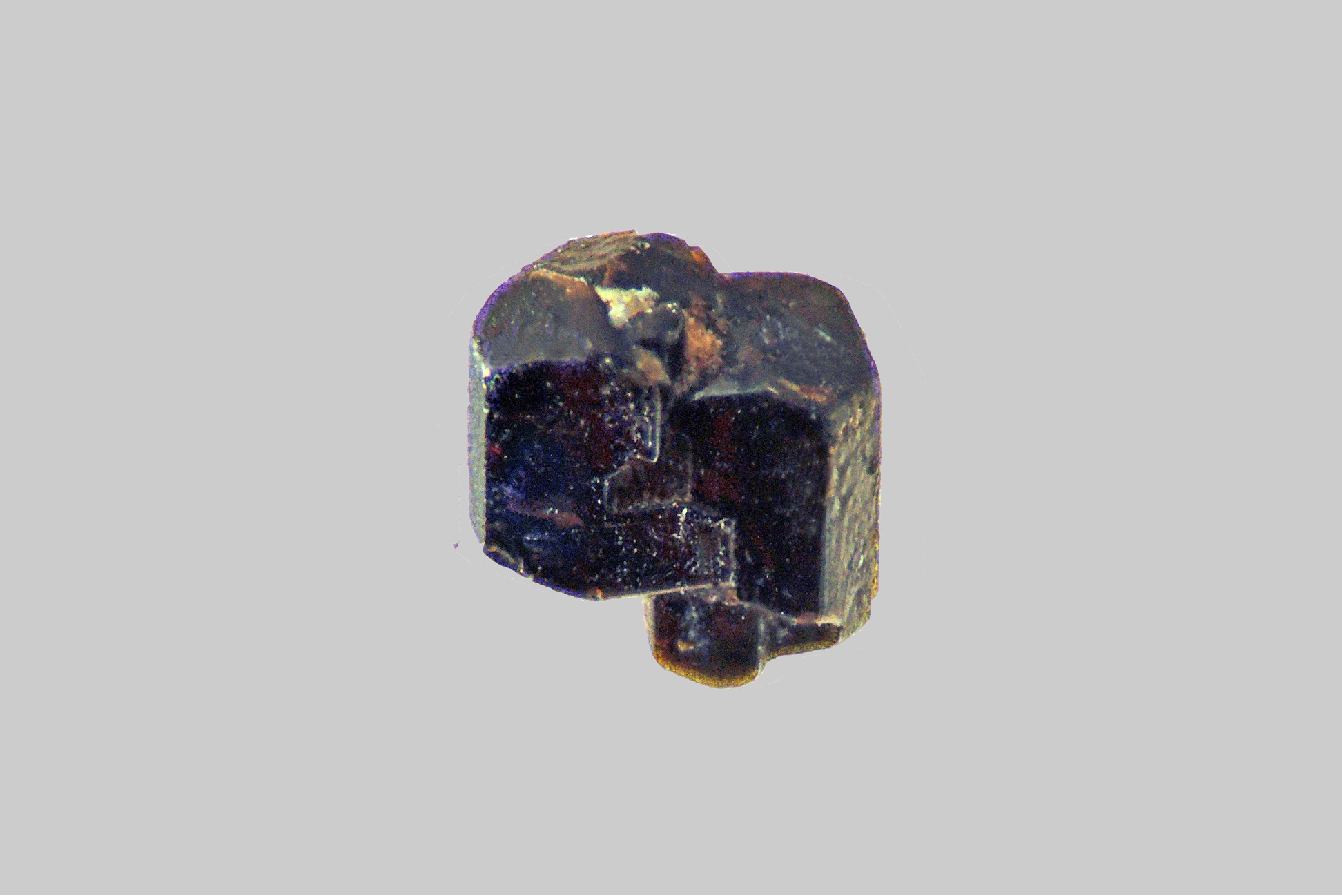
| Species: | 'Hornblende Root Name Group' (not an IMA approved species) |
| Formula: | ◻Ca2(Z42+Z3+)(AlSi7O22)(OH,F,Cl)2 |
| Confirmation |
|---|
|
| Validity: | Confirmed |
| Confirmation Methods: | Visually Identified |
| Data |
|---|
|
| Mineral Data: | Click here to view Hornblende Root Name Group data |
| Locality Data: | Click here to view La Roche stream alluvial deposits, Saint-Christophe-sur-Dolaison, Le Puy-en-Velay, Haute-Loire, Auvergne-Rhône-Alpes, France |
| Data Identifiers |
|---|
|
| Mindat Occurrence Record ID: | 1249337 |
| Long-form Identifier: | 1:3:1249337:3 |
| GUID (UUID V4): | 48795c24-6fb2-467e-8cc2-5cc0d85c6c79 |
| Nearest other occurrences of Hornblende Root Name Group |
|---|
|
|
| 1.9km (1.2 miles) | ⓘDolaison stream alluvial deposits, Vals-près-le-Puy, Le Puy-en-Velay, Haute-Loire, Auvergne-Rhône-Alpes, France |
| 2.0km (1.3 miles) | ⓘMont Croustet, Ceyssac, Le Puy-en-Velay, Haute-Loire, Auvergne-Rhône-Alpes, France |
| 3.4km (2.1 miles) | ⓘRiou stream alluvial deposits, Le Riou, Le Puy-en-Velay, Le Puy-en-Velay, Haute-Loire, Auvergne-Rhône-Alpes, France |
| 3.8km (2.4 miles) | ⓘRiou Pezzouliou alluvial deposits, Espaly-Saint-Marcel, Le Puy-en-Velay, Haute-Loire, Auvergne-Rhône-Alpes, France |
| 4.4km (2.7 miles) | ⓘTaulhac stream alluvial deposits, Le Puy-en-Velay, Le Puy-en-Velay, Haute-Loire, Auvergne-Rhône-Alpes, France |
| 4.9km (3.0 miles) | ⓘMont Denise, Espaly-Saint-Marcel, Le Puy-en-Velay, Haute-Loire, Auvergne-Rhône-Alpes, France |
| 6.2km (3.9 miles) | ⓘFarnier stream alluvial deposits, Ours, Le Puy-en-Velay, Le Puy-en-Velay, Haute-Loire, Auvergne-Rhône-Alpes, France |
| 6.6km (4.1 miles) | ⓘSainte-Anne volcano, Sinzelles, Polignac, Le Puy-en-Velay, Haute-Loire, Auvergne-Rhône-Alpes, France |
| 6.7km (4.2 miles) | ⓘLatour brook alluvial deposits, Coubon, Le Puy-en-Velay, Haute-Loire, Auvergne-Rhône-Alpes, France |
| 9.4km (5.9 miles) | ⓘCommunac stream alluvial deposits, Rochelimagne, Polignac, Le Puy-en-Velay, Haute-Loire, Auvergne-Rhône-Alpes, France |
| References |
|---|
|
|


La Roche stream alluvial deposits, Saint-Christophe-sur-Dolaison, Le Puy-en-Velay, Haute-Loire, Auvergne-Rhône-Alpes, France