| Locality type: | Mine |
| Classification |
|---|
|
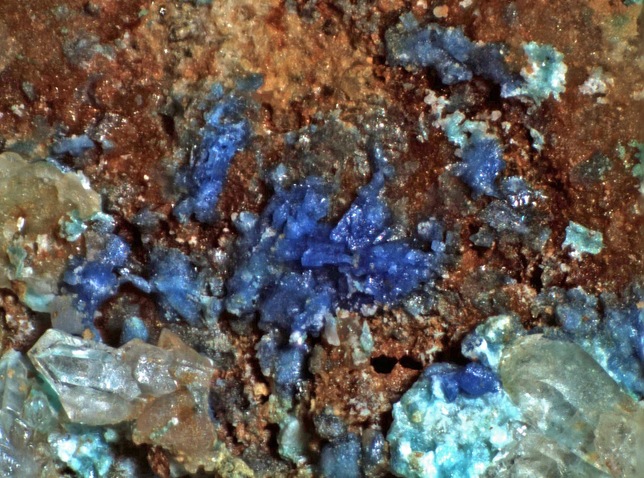
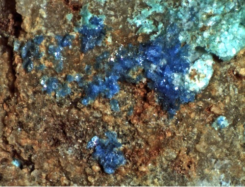
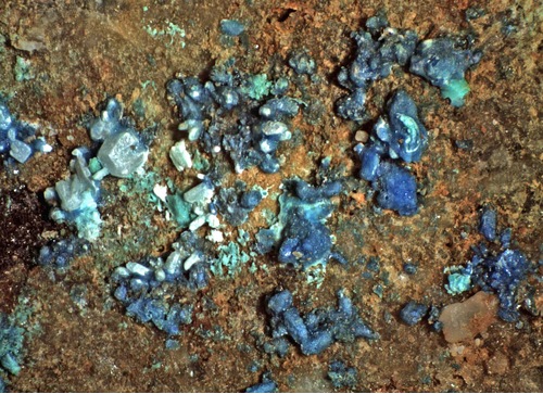
| Species: | Caledonite |
| Formula: | Pb5Cu2(SO4)3(CO3)(OH)6 |
| Confirmation |
|---|
|
| Validity: | Confirmed |
| Confirmation Methods: | Visually Identified |
| Associated Minerals Based on Photo Data: |
|---|
|
| Cerussite | ⓘ3 photos of Caledonite associated with Cerussite at this locality. |
| Quartz | ⓘ1 photo of Caledonite associated with Quartz at this locality. |
| Data |
|---|
|
| Mineral Data: | Click here to view Caledonite data |
| Locality Data: | Click here to view Festerling Mine (Elsicor Mine; Cora Mine), Black Diamond Peak, Middle Pass Mining District, Cochise County, Arizona, USA |
| Photo Gallery | View Gallery (3 photos) |
| Data Identifiers |
|---|
|
| Mindat Occurrence Record ID: | 1253449 |
| Long-form Identifier: | 1:3:1253449:4 |
| GUID (UUID V4): | 87dfe02d-57c7-4b12-b365-99e748168f55 |
| Nearest other occurrences of Caledonite |
|---|
|
|
| 16.4km (10.2 miles) | ⓘBurrito de Fierro Mine, Cochise Mining District, Cochise County, Arizona, USA |
| 18.8km (11.7 miles) | ⓘGolden Rule Mine, Dragoon District (Golden Rule District), Cochise County, Arizona, USA |
| 20.4km (12.7 miles) | ⓘToughnut Mine, Tombstone, Tombstone Mining District, Cochise County, Arizona, USA |
| 20.7km (12.9 miles) | ⓘSan Diego Mine, Tombstone Extension Mines, Tombstone Mining District, Cochise County, Arizona, USA |
| 24.6km (15.3 miles) | ⓘTexas Arizona Mine, Gunnison Hills, Cochise Mining District, Cochise County, Arizona, USA |
| 30.6km (19.0 miles) | ⓘGallagher Vanadium & Rare Minerals Corp Mine, Tombstone Mining District, Cochise County, Arizona, USA |
| 31.8km (19.8 miles) | ⓘManila Mine, Tombstone Mining District, Cochise County, Arizona, USA |
| 32.4km (20.1 miles) | ⓘBrunckow Mine, Tombstone Mining District, Cochise County, Arizona, USA |
| 33.3km (20.7 miles) | ⓘCharleston, Cochise County, Arizona, USA |
| 54.5km (33.9 miles) | ⓘApache Pass, Teviston Mining District, Dos Cabezas Mountains, Cochise County, Arizona, USA |
| References |
|---|
|
|


Festerling Mine, Black Diamond Peak, Middle Pass Mining District, Cochise County, Arizona, USA