| Locality type: | Dam |
| Classification |
|---|
|
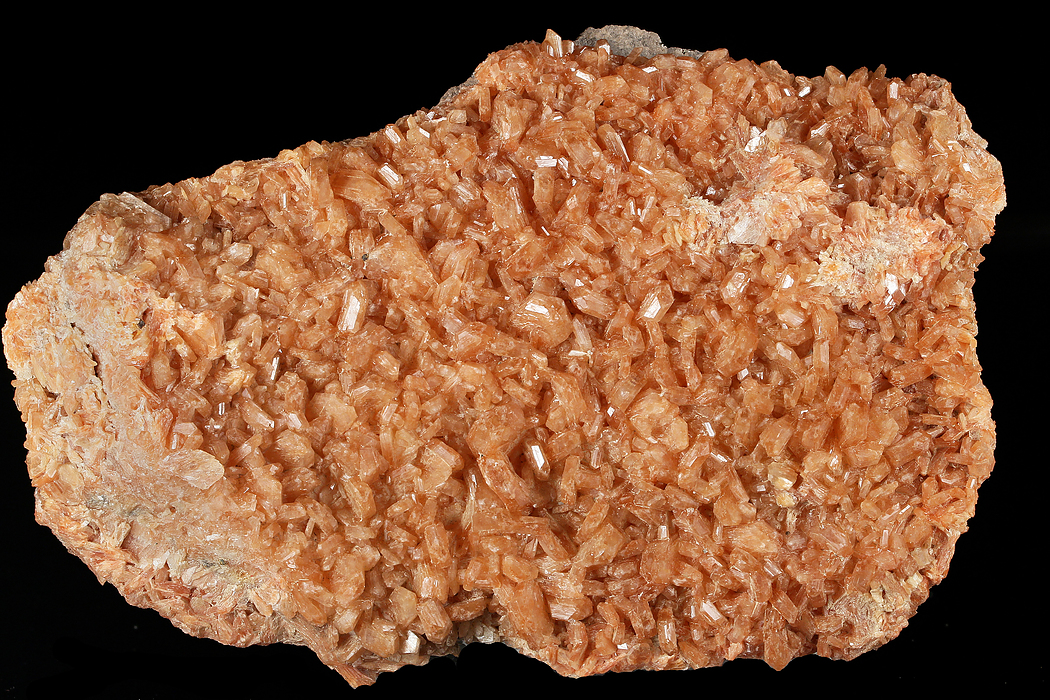
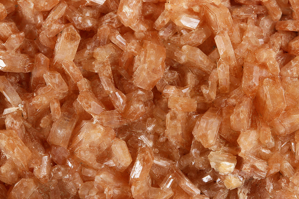
| Species: | Stellerite |
| Formula: | Ca4(Si28Al8)O72 · 28H2O |
| Formation: | Secondary |
| Comments: | Crystals to 1 cm coating brecciated gneiss. A sample https://www.mindat.org/photo-709453.html analyzed by SEM-EDS determined to be most likely stellerite because of total lack of Na and K. |
| Habit: | tabular prisms |
| Colour: | orange |
| Confirmation |
|---|
|
| Validity: | Unconfirmed/Questioned |
| Data |
|---|
|
| Mineral Data: | Click here to view Stellerite data |
| Locality Data: | Click here to view Goodwin Dam (Hogback Dam), Hartland, Hartford County, Connecticut, USA |
| Data Identifiers |
|---|
|
| Mindat Occurrence Record ID: | 1286787 |
| Long-form Identifier: | 1:3:1286787:9 |
| GUID (UUID V4): | c2cf39d4-598b-4318-85c5-c7116d6c5556 |
| Nearest other occurrences of Stellerite |
|---|
|
|
| 32.7km (20.3 miles) | ⓘThomaston Dam railroad cut, Thomaston Dam, Thomaston, Litchfield County, Connecticut, USA |
| 43.4km (26.9 miles) | ⓘState Route 8 exit 37, Watertown, Litchfield County, Connecticut, USA |
| 51.8km (32.2 miles) | ⓘO & G Woodbury Traprock Quarry (Orenaug Quarry; O & G No. 1 Quarry), Orenaug Hills, Woodbury, Litchfield County, Connecticut, USA |
| References |
|---|
|
|


Goodwin Dam, Hartland, Hartford County, Connecticut, USA