 | | Report (issue) | | No. 12: Bolivia ht of Mineral Collecting N 978-0-9790998-5-4 Publisher Lithographie, LLC Denver, Colorado...specimen 'being sold with the shrine when he was in Bolivia buying mineral specimens in the 1970s. He took...ophyllite; 5. 2 cm tall Cerro Rico, Potosi, B,atillo province, Potosi Andy Seibel col/action Jejf-SC,m/.plwto...wp11�. Yaalte: 12.5 cm wide Siglo XX Mine, ,U� Bustillo province, Potosi Malty Zinn colkdknt (ex Marv...640 200 100 600 The Political Divisions of Bolivia (after United Nations Map No. 3875, Peacekeeping | 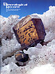 | | Journal (issue) | | Articles Famous mineral localities: The Bristol copper mine, Connecticut......................................in the U.S.A. notesfrom th r EDITORS OLD YUMA MINE Another great mineral locality has now been closed...longfamous Old Yuma mine near Tucson (see R. L. Jones, “Famous mineral localities: the Old Yuma mine,” in vol....period of activity, access to the mine was cut off in 1984. In 1996 the mine area was absorbed into the Saguaro...and Mining Company for the sum of $558,000. The mine is now owned outright by the Federal Government |  | | Book | | quantities of land and Il water, but no gold, silver, or precious stones The myth of Paititi, Father-Tiger...V_ in the swamps of the Mojos. The citizens of Santa Cruz — eleven disorderly streets — look for slaves...of the Indios seized in the 1667 expedition from Santa Cruz Population of the Missions, 1696-1831 Demographic...late, and it was long considered a mysterious province inhabited by a people possessing a wealth of gold... land of the Mojos — in what is today eastern Bolivia — was the farthest and latest goal of these expeditions |  | | Book | | 11atives implied the nearby presen ce of a gold mine and he built a fort on Esp anola of the rernains...behind to trad e for gold and look for the gold mine. Cipangu and Cathay h ad perhap s eluded him, but...destroyed. No gold mine was waiting. The Spaniards soon learned that there was no mine at all on Espanola...Royal consent was needed in order even to look for a mine, a reg ulation which remained in effect until 1504...America until the 18th century. Collected on gold, silver, mercury, precious stones, and pearls, the quinto |  | | Journal (article/letter/editorial) | | km. of an industrial line connecting the lignite mine of Loreto with Punta Arenas (Sandy Point), within...Arica, the starting-point of the Arica-La Paz (Bolivia) Railway. The war has temporarily stopped construction...of Chile (the Arica-La Paz, the Antofagasta and Bolivia, and the Chilean Transandine), the following are...and ascends the Andes to La Paz, has supplied Bolivia with its latest and shortest Pacific coast outlet...cancellation of all claims to a coast frontage by Bolivia, to construct and pay for the AricaLa Paz railway |  | | Journal (article/letter/editorial) | | the Arequipa-Antofalla terrane (in Peru, western Bolivia, and northern Chile), the southwestern Amazonian...faunal similarities between Oaxaca (Mexico) and Bolivia. Interaction between eastern Laurentia and western...respectively (U-Pb zircon ages from Anderson and Silver, 1977a, 1977b; Anderson et al., 1979; Rodriguez-Castafieda... 1993; Rudnick and Cameron, 1991; Anderson and Silver, unpubl. data reported in Sedlock et al., 1993)...is from Hart (1984). Bass, 1969; Anderson and Silver, 1971; OrtegaGutiérrez et al., 1977; Robinson et |  | | Journal (article/letter/editorial) | | GEOLOGY AND THE MINE, ORE DEPOSITS ZACATECAS, OF THE CANTERA MEXICO JOHN G. STONE CONTENTS...ABSTRACT The Cantera mine is one of the few operating mines of the formerly great silver campof Zacatecas...Zacatecas,Mexico. The mine consistsof a seriesof sulphideorebodies alongthe CanteraFault, about5 km east of the...indicatethat the vein consists of twoparts--a silver-richquartzhangingwallvein,anda sulphide footwallvein...CANTERA MINE 81 is: quartz, sphalerite-chalcopyrite, galena, pyrite, quartz, pyrite, calcite. Silver sulphidesare |  | Hodges, C.A., Cox, D.P., Singer, D.A., Case, J.E., Berger, B.R., Albers, J.P. (1984) U.S. Geological Survey-INGEOMINAS mineral resource assessment of Colombia. Open-File Report Vol. 1984 (84-345) US Geological Survey doi:10.3133/ofr84345 | Report (issue) | | quartz-adularia type (5.4) 30 Hot springs gold-silver deposits (5.6) 32 Emerald veins (5.10) 34 Volcanic-hosted...quartz-adularia type 29 14. Hot springs gold-silver deposits 31 ii Contents (Supplement) Page Figure...deposit types. In addition to new deposits of gold, silver, and platinum group elements, significant resources...Central are favorable hosts for hot spring gold-silver deposits and should be an immediate focus for exploration...discoveries of large-tonnage, shale-hosted lead-zinc-silver, bedded barite, and sedimentary manganese deposits |  | | Book | | Gorgona Island, Chocó Arc, Sierra Nevada de Santa Marta, La Macarena, and the Guiana Shield: remote regions...Geologie und Petrographie der Sierra Nevada de Santa Marta (Kolumbien, Südamarika). Schweiz, Mineralogische...Continental Sub-Plate Chocó Arc Caribbean Large Igneous Province Central Tectonic Realm circa, approximately centimeter...Pacific Terranes Romeral Mélange Sierra Nevada de Santa Marta W-E Tectono-Sedimentary Anomaly Western Tectonic...morpho-structural features, including the Sierra Nevada de Santa Marta (SM), the Sierra de Mérida (ME, the “Venezuelan |  | | Report (issue) | | and 3, respectively. Arituzar Mine Calichar Caftuelas Daniel Mine San Marcos Volcanclto Salar Centenario...Mucar Laguna Guacha|ayte Laguna Guayatayoc Baratoyoc Mine Grupo Cordoba Laguna Vilama Adriana Lari Los Bayos...Bayos Tropa Pete 3erta Prospect 3lanca Lila Mine Boratera de Antuco Celti Occurrence Coyaguaima Archibarca...Pozuelos Margarita San Mateo Mine Salar de Pucar Salar de Rio Grande Betina Mine Boratera Blanca Lila Coronel...Coronel Gorrotti Salar de Pocitos o Quiron Santa Ines Yacaro Salar de Pastos Grandes Adela Salar de Olaroz |  | | Journal (article/letter/editorial) | | Sciences Department, Uni6ersity of California, Santa Cruz, California, CA 95064, USA b Geology Department...Elzevirian arcs, \ 1230 Ma, in Texas and the Grenville Province). A subset of the Grenvillian samples contains...although there are some similarities with the Santa Marta massif of Colombia and the Cordillera de Merida...interpretation favored by a number of previous authors (Silver and Anderson, 1974; Anderson and Schmidt, 1983;...the west coast 208Pb/235U isotopic tracer from UC Santa Barbara. All other fractions were analyzed using |  | | Report (issue) | | THE MINERAL RESOURCES OF THE SIERRA NEVADA de SANTA MARIA, COLOMBIA (ZONE I) by Charles M. Tschanz U...Reconnaissance geologic map of the Sierra Nevada de Santa Marta, Colombia............................. Figure... THE MINERAL RESOURCES OF THE SIERRA NEVADA de SANTA MARTA, COLOMBIA (ZONE I) By Charles M. Tschanz U. S...Geologico-Mineras ABSTRACT The Sierra Nevada de Santa Marta on the north coast of Colombia is an isolated...report, which includes the Sierra Nevada de Santa Marta, consists of 22,500 square kilometers on the |  | | Journal (article/letter/editorial) | | circles: 1, Atrato; 2, Romeral; 3, Palestina; 4, Santa Marta; 5, Cuisa; 6, Oka; 7, Bocono; 8, El Pilar); 10)...including the Maracaibo, Guajira-Paraguana, Santa Marta, and others that developed individually. Paleomagnetic...north to south, are located in the range. The Santa Marta massif occupies an isolated position on the Caribbean...Perija Range, beyond the Cesar Valley, is the Santa Marta massif, composed of Precambrian granulites and...monzonites are seen on the Guajira Peninsula in the Santa Marta massif and in the Sierra de Perija. In the.Eastern |  | | Journal (article/letter/editorial) | | represented the areally most extensive basement age province of the Amazon Shield. The Late Paleozoic suture...Piedmont suture Early Proterozoic (Southwestern Province, U.S.A.)-Metasedimentary and metavolcanicsuite...masses, including the Oca (of), Bocono (bf) and Santa Marta (sm) of Colombia and Venezuela, the Montagua...Oca (65 km), the Bocono ( ~ 100 kin), and the Santa Marta (110 km) faults (Dewey and Pindell, 1986 and...Faults, which bound the rocks of the Upper Paleozoic Santa Rosa Group as exposed in the Chuacus (K) and Cuchumantes |  | | Book | | Professor of Botany Gemological Institute of America Santa Monica, California Director, Harvard Botanical...ancient peoples of the New World. An acquaintance of mine since the early 1970’s, Alec Bright, the Exhibit...towns arose, such as San Sebastian de Uraba and Santa Maria le Antigua del Darién (1509-1514), in order...exaggerated words of Vasco Nunez de Balboa. Santa Marta sprang up (1525) to snatch the riches of the...plunder the legendary riches of the Sint tombs, and Santa Fé and Tunja were created between 1538-1539 to grab |  | | Book | | Malambo Neguanje Tairona Sierra Nevada de Santa Marta Early Period La Loma El Horno Late Period Los...Holmes wrote, The antiquarian literature of the province is extremely meager, being conf ined to brief...discovered that at some period of the past the province was thickly populated, and by races possessed...contemporary Kogi peoples of the Sierra Nevada de Santa Marta. Bray’s contribution provides a wealth of information...Austin. HOLMES, W. H. 1888 Ancient Art of the Province of Chiriquí, Colombia: Sixth Annual Report. Smithsonian |  | | Journal (article/letter/editorial) | | interested primarily in regions containing gold and silver. Transportation had as its chief duty the bringing...in Venezuela, from Tucacas to the famous copper mine at Aroa. This line was built in 1835, and although...Aohrpueyarclurlrira a FIGURE 8.-The wearisome trails of eastern Bolivia follow the flat valley floors durin g the dry season;...America. This little Indian village in southeastern Bolivia has a considerable herd. The llamas are adapted...that portion known as the Gran Chaco in eastern Bolivia, finds itself still with FIGURE 6 The trail that |  | | Book | | Kimmeridgian? to Paleocene Tectonic Evolution of Bolivia T. Sempere • . . . . . . • . . . . • • . . • ....refers to the evolution of the Cretaceous basin in Bolivia, and is the work of Thierry Sempere. The next paper...' 200KM SHIELD GUYANA Maracaibo Block ~ Santa Marta Block Central/Eastern Cordillera Q~=e5> Guajira/Orchila...Cenozoic thrust belt which extends from the Santa Marta Massif of Colombia to the north coast of the...diachronous from west to east, and occurred in Santa Marta/Guajira Peninsula in the latest Cretaceous? and |  | | Report (issue) | | QUELCCAYA ICE CAP By STEFAN L. HASTENRATH GLACIERS OF BOLIVIA By EKKEHARD JORDAN GLACIERS OF CHILE AND ARGENTINA...towns and killed tens of thousands of inhabitants. Bolivia has a total glacier-covered area of more than 560...volcanoes of the Cordillera Occidental in northern Bolivia. Ice caps, valley glaciers, and mountain glaciers...Ice Cap, by Stefan Hastenrath 1-5. Glaciers of Bolivia, by Ekkehard Jordan 1-6. Glaciers of Chile and...nevados in four areas within the Sierra Nevada de Santa Marta, Cordillera Oriental, and Cordillera Central |  | | Report (volume) | | mine________________________________-_______ Guayaquil mine ___________________________________________ Cau...11. Plan and sections of the lower adits, Quindfo mine, municipio of Cajamarca, Tolima, Colombia____________________...Map and sections of the Alumbral quartz crystal mine, municipio of Muzo, Boyacd, Colombia_-________--___-_-_____...In pocket FIGUEE 2. Sketch of the Quindfo mercury mine area, municipio of Cajamarca, Tolima, Colombia_...Colombia. __ 169 4. Sketch map and section of the Santa Maria quartz crystal prospect, municipio of Maceo |  | | Journal (article/letter/editorial) | | terranes and the entire Western Mediterranean province, which are characterized by lengthy crustal histories...occurrences in the Ossa Morena zone. Only the Cala iron mine is currently (2004) operating, but the area has...are Maria Luisa and nearby showings (including Santa Ana) and Puebla de la Reina (15 in Fig. 1). The...setting (Aracena belt; Fig. 1). The Maria Luisa mine, which was worked for Cu-Zn, consists of several...Monchi (type 7). 11. Abundancia (type 13). 12. Santa Marta (type 20). 13. Usagre (type 19) and Las Minas |  | Gleichen, Edward, E., H., Graham, R. Cunninghame, Longstaff, Dr., Galway, Henry (1925) The Sierra Nevada of Santa Marta, Colombia: Discussion. The Geographical Journal, 66 (2) 106 doi:10.2307/1782608 | Journal (article/letter/editorial) | | The Sierra Nevada of Santa Marta, Colombia: Discussion Author(s): Edward Gleichen, H. E., R. Cunninghame...http://about.jstor.org/terms 106 THE SIERRA NEVADA OF SANTA MARTA, COLOMBIA when it is possible to traverse the...with Mrs. Wollaston to the Santa Marta Range in Colombia. This Santa Marta Range, in the extreme north-east...thousand feet or so higher. There is snow on the Santa Marta Range during a large part of the year, although...is very different from the Sierra Nevada de Santa Marta. Elsewhere you will find richer lands and much |  | | Journal (article/letter/editorial) | | Venezuela. Using the method proposed by Wolfe and Silver (1998), SKS waveforms from 2 to 36 earthquakes...edge of South America as proposed by Russo and Silver (1994), forming an eastward flow beneath the southern...(MB), bounded by the left-lateral strike– slip Santa Marta–Bucaramanga (SMB) Fault to the southwest, by...straddling the Venezuelan–Colombian border, and the Santa Marta block in Colombia (e.g., Audemard and Audemard...starts to subduct beneath SA at offshore of the Santa Marta Massif with a very low angle (Malave and Suarez |  | | Journal (article/letter/editorial) | | among the Indians of the ancient Spanish Province of Santa Marta, Colombia (see map, page 649), where I...the title Floresta de Za Santa IgZesia Catcdral de la Ciudad de Santa Marta, written by Father Alvarez...the history of the Roman Catholic Church in Santa Marta, and was authorized t o be published by the ecclesiastical...the work relating t o the Indians of the Province of Santa Marta : Customs of the PeaceabZe Imfians and...the names of those Indians found in our Province of Santa Marta. Before discussing their names it will |  | Silin, Ivan, Hahn, Klaus, Gürsel, Devrim, Kremer, Dario, Gronen, Lars, Stopić, Srećko, Friedrich, Bernd, Wotruba, Hermann (2020) Mineral Processing and Metallurgical Treatment of Lead Vanadate Ores. Minerals, 10 (2) 197 doi:10.3390/min10020197 | Journal (article/letter/editorial) | | 0.084 13.6 13.60 South Africa Mapochs Mine Rhovan Mine 1.5 0.52 1.5 1.06 1.60 Generally, VTM...Furthermore, native gold-, silver-, and silver-containing minerals (silver-bearing galena) are part of...mixtures” [33–35]. In very complex ores, such as gold-silver-molybdenum-vanadium ores, lead vanadates occur...vanadate ore from Abenab West Mine, Namibia. After the closure of the Berg Aukas Mine and stoppage of the flotation...plants at Broken Hill (Zambia), Berg Aukas Mine, and Abenab West Mine in Otavi Mountainland (Namibia) were |
|


