Log InRegister
Quick Links : The Mindat ManualThe Rock H. Currier Digital LibraryMindat Newsletter [Free Download]
Home PageAbout MindatThe Mindat ManualHistory of MindatCopyright StatusWho We AreContact UsAdvertise on Mindat
Donate to MindatCorporate SponsorshipSponsor a PageSponsored PagesMindat AdvertisersAdvertise on Mindat
Learning CenterWhat is a mineral?The most common minerals on earthInformation for EducatorsMindat ArticlesThe ElementsThe Rock H. Currier Digital LibraryGeologic Time
Minerals by PropertiesMinerals by ChemistryAdvanced Locality SearchRandom MineralRandom LocalitySearch by minIDLocalities Near MeSearch ArticlesSearch GlossaryMore Search Options
Search For:
Mineral Name:
Locality Name:
Keyword(s):
 
The Mindat ManualAdd a New PhotoRate PhotosLocality Edit ReportCoordinate Completion ReportAdd Glossary Item
Mining CompaniesStatisticsUsersMineral MuseumsClubs & OrganizationsMineral Shows & EventsThe Mindat DirectoryDevice SettingsThe Mineral Quiz
Photo SearchPhoto GalleriesSearch by ColorNew Photos TodayNew Photos YesterdayMembers' Photo GalleriesPast Photo of the Day GalleryPhotography

Sylvite from
Laguna Ramaditas, Sud Lípez Province, Potosí, Bolivia


Locality type:Lake
Classification
Species:Sylvite
Formula:KCl
Confirmation
Validity:Believed Valid
Data
Mineral Data:Click here to view Sylvite data
Locality Data:Click here to view Laguna Ramaditas, Sud Lípez Province, Potosí, Bolivia
Data Identifiers
Mindat Occurrence Record ID:1321194
Long-form Identifier:1:3:1321194:3
GUID (UUID V4):819f9daa-2c39-40ff-8099-f494a2dcf337
Nearest other occurrences of Sylvite
6.7km (4.1 miles) Laguna Chiar Khota, Sud Lípez Province, Potosí, Bolivia
23.4km (14.5 miles) Laguna Chulluncani, Sud Lípez Province, Potosí, Bolivia
76.2km (47.3 miles) El Tatio geothermal field, El Loa Province, Antofagasta, Chile
References
Reference Search (possible matching items)
Journal (article/letter/editorial)
were: Laguna Canapa (CAN), Laguna Hedionda (HED), Laguna Ramaditas (RAM), Laguna Honda (HON), Laguna Chiar...Chiar Khota (CHKT), and Laguna Chulluncani (CHU) (Fig. 1). Detailed descriptions of the salars can be found...study site in the Sur Lipez region of Potosi, Bolivia, and the locations of the six salars. Image of...evaporites including calcite, gypsum, halite, and sylvite (Table 2). The sediments are well sorted, sub-angular...mirabilite, authigenic quartz, authigenic cristobalite, sylvite, and ulexite (Table 2). They consist of an extremely
Report (issue)
EIToro 1 La Mucar Laguna Guacha|ayte Laguna Guayatayoc Baratoyoc Mine Grupo Cordoba Laguna Vilama Adriana...Centenario Salar Centenario Salar Centenario Laguna Vilama Laguna Vilama 066-27- W 067-00-02W 066-45- W 066-42-...22-34-05S Laguna Vilama D W 066-55- 22-36- S Laguna Guayatayoc Laguna Guayatayoc Laguna Guayatayoc...Chojllas Laguna Colorado Laguna Chulluncani Laguna Laguna Laguna I Laguna Cuevitas Laguna Busch o Kalina...Kalina Laguna Cnchi Bolivia Dzhulfa area Armenia Socacastro Unnamed Santa Elena Santa Elvira Santa
Report (issue)
S. Geological Survey and Servicio Geologico de Bolivia in cooperation with the Trade Development Program...the U.S. Geological Survey-Servicio Geol6gico de Bolivia as part of the Mineral Resource Evaluation of the...reports in the files of the Servicio Geologico de Bolivia located in their main office in La Paz. All of...States, and the Servicio Geol6gico de Bolivia in La Paz, Bolivia. This report is an edited version of...to which the deposit belongs. 11 PROVINCE The Republic of Bolivia is divided into 9 departments, three
Report (volume)
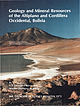
Cordillera Occidental, Bolivia By U.S. GEOLOGICAL SURVEY and SERVICIO GEOLOGICO DE BOLIVIA With a section on...Cordillera Occidental, Bolivia I by U.S. Geological Survey and Servicio Geol6gico de Bolivia; with a section...mineral resources-Bolivia-Cordillera Occidental. 3. Geology-Altiplano. 4. Geology-Bolivia-Cordillera Occidental...Geological Survey (U.S.) II. Servicio Geol6gico de Bolivia. Ill. Series. QE75.B9 no. 1975 [TN39.A4] 557.3s--dc20...cooperation between the Servicio Geologico de Bolivia and the U.S. Geological Survey. The geologic research
 
Mineral and/or Locality  
Mindat Discussions Facebook Logo Instagram Logo Discord Logo
Mindat.org is an outreach project of the Hudson Institute of Mineralogy, a 501(c)(3) not-for-profit organization.
Copyright © mindat.org and the Hudson Institute of Mineralogy 1993-2024, except where stated. Most political location boundaries are © OpenStreetMap contributors. Mindat.org relies on the contributions of thousands of members and supporters. Founded in 2000 by Jolyon Ralph.
Privacy Policy - Terms & Conditions - Contact Us / DMCA issues - Report a bug/vulnerability Current server date and time: April 19, 2024 11:41:16
Go to top of page