 | | Report (issue) | | AND MAPS OF THE GLACIER PEAK WILDERNESS AND ADJACENT AREAS, NORTHERN CASCADES, WASHINGTON By Arthur B....Miscellaneous topics Glacier Peak volcano, volcanism, and thermal springs Quaternary geology and glacier studies Regional...Location of the Glacier Peak Wilderness Index to geologic mapping in and near the Glacier Peak Wilderness...Index to topographic map quadrangles of the Glacier Peak Wilderness and vicinity -- 2 3 5 INTRODUCTION...aspects of the Glacier Peak Wilderness and vicinity in the northern Cascade Mountains of Washington (fi |  | | Report (issue) | | SUMMARY OF ECONOMIC GLACIER CHELAN, GEOLOGY DATA FOR THE PEAK WILDERNESS, SNOHOMISH, AND SKAGIT COUNTIES...COUNTIES, WASHINGTON By Alan Robert Grant Open-File Report 82-408 This report was prepared under contract...mineralized areas described in this report..... 1. Glacier Peak....................................... 2. Buckindy................................. 12. S. Cascade Glacier................................ 13. Suiattle River........... 16. Martin Peak........................................ 17. Riddle Peak.................... |  | Church, S.E, Lehuray, A.P, Grant, A.R, Delevaux, M.H, Gray, J.E (1986) Lead-isotopic data from sulfide minerals from the Cascade Range, Oregon and Washington. Geochimica et Cosmochimica Acta, 50 (2) 317-328 doi:10.1016/0016-7037(86)90180-8 | Journal (article/letter/editorial) | | sulfide minerals from the Cascade Range, Oregon and Washington S. E. CHURCH, A. P. LEHURAY,’ A. R. GRANT,’...plutons found in the Cascade Range of Oregon and Washington demonstrate a rather uniform isotopic composition... 206Pb/mPb is greater than 18.92 in northern Washington and southern Oregon where deposits have intruded...types occur in the Cascade Range of Oregon and Washington. They are generally younger than the porphyry...studied in the Cascade mineral belt, Oregon and Washington. Note that the deposits intersect the trend of |  | | Book | | Bart Cannon 1975 CORD ILLERAN Mercer Island, Washington Lilli liliiiLt' 111? KLi-KlLLLIlrVlIlI Copyright...Cordilleran 18 Holly Hill Drive Mercer Island, Washington 98040 COVER ILLUSTRATION: Amethyst scepter heads...milky quartz stems. Denny Mountain area of King County. Specimen from the collection of Cary A. Maykut...publications dealing with the various aspects of Washington State's diverse mineral wealth exist, but none..."Minerals of Washington" represents an attempt to begin such a cata logue. "Minerals of Washington" shall |  | | Report (issue) | | NORTHWESTERN CALIFORNIA, WESTERN OREGON, AND WESTERN WASHINGTON Michael F. Diggles1 , editor U.S. Geological...plutons..................................... Washington..................................... Oregon....geochemical data from stream-sediment samples from Washington........................... Statistical summary... Numerically determined magnetic boundaries, Washington......... Numerically determined magnetic boundaries.... Localities of stream-sediment samples from Washington . ......... Localities of gridded geochemical |  | | Report (Issue volume) | | State of Washington ARTHUR B. LANGLIE, Governor Department of Conservation and Development W. A. GALBRAITH...GLOVER, Supervisor Bulletin No. 37 INVENTORY OF WASHINGTON MINERALS PART II METALLIC MINERALS By MARSHALL...Volume 2 - MAPS STATE PRINTING PLANT. OLYMPIA, WASHINGTON lll!UI For sale by Department of Conservation...volumes-text and maps) $4.50. INVENTORY OF WASHINGTON MINERALS PART II METALLIC MINERALS Volume 1...Bulletin 33, "Nonmetallic Mineral Resources of Washington," published in 1936. Since then the catalogue |  | Church, S.E., Mosier, E.L., Tabor, R.W., Willison, W.R., McDougal, C.M. (1983) Analytical results and statistical analyses of rocks, ores, and stream pebbles from the Eagle Rock and Glacier Peak Roadless Areas, Snohomish and King counties, Washington. Open-File Report Vol. 1983 (83-342) US Geological Survey doi:10.3133/ofr83342 | Report (issue) | | the Eagle Rock and Glacier Peak Roadless Areas, Snohomish and King Counties, Washington by S. E. Church...rocks, ores, and stream pebbles, Eagle Rock and Glacier Peak Roadless Areas ...............................collected for background values, Eagle Rock and Glacier Peak Roadless study areas................ 4. Fisher-K...collected for background values, Eagle Rock and Glacier Peak Roadless study areas..........................collected for background values, Eagle Rock and Glacier Peak Roadless study areas................ 6. ICP |  | | Report (issue) | | Mines UNITED STATES GOVERNMENT PRINTING OFFICE, WASHINGTON : 1984 IDAHO 116° 48° - Location of areas...See Oregon 10 Idaho Wilderness 11 Italian Peak and Italian Peak Middle Roadless Areas, Idaho and Montana...Salmo Priest Wilderness study area, Washington and Idaho See Washington 7 Salmon River Breaks Primitive Area...eastern part 14 Sawtooth Wilderness 4 Scotchman Peak Wilderness study area, Montana and Idaho See Montana...Selway-Bitterroot Wilderness, Idaho and Montana 9 Special Mining Management Zone Clear Creek 13 2 18 15 Ten Mile |  | | Journal (issue) | | Weber by the Natural History Museum of Los Angeles County (see February 2005 Mineral News - Ed.). Between...noted for the mounted specimens acquired by the LA County Museum, the collection provides a solid reference...unpublished 'skorpionite' from the new Skorpion Mine near Rosh Pinah in Southwest Namibia were offered...or tarbuttite. Skorpion Mine is expected to become the world's largest zinc mine, covering 15% of our zinc...smitbsonite and tarbuttite being the chief ores. Sphalerite, the traditional zinc ore mineral, is practically |  | | Report (issue) | | LODE DEPOSITS OF EUEEKA AND VICINITY KANTISMA DISTRICT, ALASKA BY FRANCIS G. WELLS Investigations in...PRINTING OFFICE WASHINGTON : 1933 For sale by the Superintendent of Documents, Washington, D. C. ------...___________-______-__.__-...._-_..____..__ History of mining.____________________________________________ Character...veins._____--___----__--_--_-______----_-_ Galena-sphalerite veins._______________________________ Stibnite...and Pythias and Merry Widow._________________ Glacier Creek___________________________________________ |  | | Report (issue) | | 192 B1tlletin No. 23, Washington Geologicat Survey MOUNTAIN BOY These workings·which are credited with... page 207. The Metai .Mines of Washington 193 SHERIDAN DISTRICT GENERAL FEATURES Ten miles by air...Cascade) District. Most of the holdings are in T. 38 N., R. 31 E., just across the Ferry County line into...into Okanogan County. The first location was made during 1897 and a year later the Zalia M property made...from th.e Phil Sheridan and Toroda mines, the district was dormant tmtil 1917. The total production has |  | | Journal (issue) | | Cave in Rock, Illinois By Alan Goldstein 1607 Washington Blvd. Louisville, KY 40242-3539 Although the...the mines of the Illinois-Kentucky fluorite district are no longer active, the thrill of discovery is still...article was made in early May at the Hastie ' s Mining Co. quarry near Cave in Rock. I have vis ited this...during the preparation of my major article on the district (Goldstein, 1997). Geophysics professor Hal Noltimier...on the Hastie's property as well as several other mine dumps to o btain samples. In addition to Hal and |  | | Journal (issue) | | bright orange wavellite crystals from the Phosphoria mine south of Bartow was a piece I had collected. (Continues...on page 2) Zalesiite frolll the Gold Hill Mine Toole County, Utah Paul M. Adams 126 South Helberta Avenue...California 90277-3448 Introduction The Gold Hill mine is located in northwest Utah about 30 miles southwest...in the south pit or on the dumps. The Gold Hill mine is also the type locality for the new copper bismuth...Phosphoria, and Norlyn mines, but Clear Springs mine seems to have produced the greatest assortment ofwavellites |  | | Report (volume) | | Geological Society of CIM as VOLUME 46 by the OF MINING, METALLURGY SPECIAL CANADIAN INSTITUTE NORTHWEST...PETROLEUM COPYRIGHT © 1995 BY CANADIAN INSTITUTE OF MINING, METALLURGY AND PETROLEUM Suite 1210, 3400 de Maisonneuve...Canadian Cordillera, and regional overviews of Washington, British Columbia, Yukon, and Alaska; Part B...and 1970s were decades of mineral exploration and mine development unprecedented in the northwestern Cordillera...the world. The modern era of copper-molybdenum mining in British Columbia dawned in 1954 when Bethlehem |  | | Report (issue) | | and 1904 the great gold rush to the Fairbanks district took place and prospecting was stimulated throughout...disappointed, but a few located paying ground, and the district has been producing since that time. Furthermore... MINERAL RESOURCES OF THE KANTISHNA REGION. 281 district. The beginning of vigorous construction work on... has made it likely that many mining claims in the Kantishna district which were not worked under the...mapping westward to include the Kantishna mining district. The geologic party, in charge of the writer |  | | Report (issue) | | GEOLOGY AND EARTH RESOURCES DIVISION OLYMPIA, WASHiNGTON 98504 METAL MINES OF WASHINGTONPRELIMINARY REPORT...DERKEY NANCY L. JOSEPH and RAYMOND LASMANIS WASHINGTON DIVISION OF GEOLOGY AND EARTH RESOURCES OPEN...Earth Resources standards and nomenclature. 1, WASHINGTON STATE DEPARTMENT OF Natural Resources Brian...DERKEY NANCY L. JOSEPH and RAYMOND LASMANIS WASHINGTON DIVISION OF GEOLOGY AND EARTH RESOURCES OPEN...standards and nomenclature. • CONTENTS Page Page County and site name Kelly Camp Kettle Key East Knob |  | | Journal (issue) | | Cooper Nottingham, England Anthony R. Kampf L.A. County Mus. of Nat. Hist. Los Angeles, CA Joseph A. Mandarino...from the C en ten n ia l Eureka m in e, T intic district, Juab C ounty, U ta h ..........................published, a sample article (the recent Red Cloud mine article— click on the specimen photos and blow them...family, which had owned and operated the Las Chispas mine near Arizpe, Sonora. The family sent Schmitter a...trained as a geological engineer specializing in mining geology. His first job took him to Madagascar, | 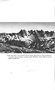 | | Report (volume) | | MINERAL RESOURCES, NORTH CASCADES NATIONAL PARK, WASHINGTON JOO~a r; I J>.!:J f ~eology and Mineral...Northern Part of the North Cascades National Park, Washington B'Y MORTIMER H. STAATZ, ROWLAND W. rABOR, PAULL...park UNITED STATES GOVERNMENT PRINTING OFFICE, WASHINGTON : 1972 UNITED STATES DEPARTMENT OF THE INTERIOR...resources-Continued Description of mineralized ar~a~ontinued Bacon Peak area ______ ..: __________________________________..._____________________________ _ 25 9. Map of Bacon Peak-Hagan Mountain area _____________ _ 26 10. Map of |  | | Report (issue) | | WASHINGTON GEOLOGICAL SURVEY HENRY LANDES, State Geologist BULLETIN No. 23 THE METAL MINES OF WASHINGTON...herewith a report entitled "Tl1e lVfetal lVIines 0£ Washington," by Ernest N. Patty, with the recommendation... . . . . . . . . . . . History of metal mining in Washington . . . . . . . . . . . . . . . . . . . ..... . . . . . . . . . . . . . . . . . . . . . 67 Mining methods .. . ................ ·· . . . . . . ..... . . . . . 69 PAR,T II. DESCRIPTION OF THE MINING DISTRICTS A.ND INDIVIDUAL ORE DEPOSITS , , , |  | | Journal (article/letter/editorial) | | Lode, Tonopah, Goldfield, Aurora, Bodie, Paradise Peak, and Rawhide deposits. Low-sulfidation Au-Ag deposits...Basin and elsewhere. 112° 120° 128° Canada Washington cade s 48° Montana CRB Cas Ro ck y M...shown by vee pattern; feeder dikes in Oregon and Washington indicated by heavy lines. East-west lines along...in the Atlanta, Fairview, Tuscarora, and Wonder mining districts that are hosted by late Eocene to early...View, N = National, OL = Olinghouse, PP = Paradise Peak, PW = Peavine-Wedekind, QM = Quartz Mountain, R |  | Venugopal, Swetha, Moune, Séverine, Williams-Jones, Glyn, Druitt, Timothy, Vigouroux, Nathalie, Wilson, Alexander, Russell, James K. (2020) Two distinct mantle sources beneath the Garibaldi Volcanic Belt: Insight from olivine-hosted melt inclusions. Chemical Geology, 532. 119346 doi:10.1016/j.chemgeo.2019.119346 | Journal (article/letter/editorial) | | the Garibaldi Volcanic Belt (GVB) from northwest USA to southwest Canada. There is a distinct geochemical...beneath the Garibaldi Volcanic Belt (GVB) in NW Washington (USA) and SW British Columbia (Canada) has been...California to northern Washington and the Garibaldi Volcanic Belt (GVB) from northwest Washington to southwest...de Fuca Plate youngs in age from 10 Ma below Glacier Peak to 5 Ma beneath Mount Meager where it terminates...terminates against the Nootka Fault beneath Salal Glacier and Bridge River. The relatively older Juan de Fuca |  | | Journal (issue) | | of Victoria Melbourne, Australia Pete J. Dunn Washington, DC Peter G. Embrey London, England Richard C...Famous mineral localities: The Rush Creek District, Marion County, Arkansas ...............................CHALCOPYRITE on TETRAHEDRITE, 15 cm, from the Herodsfoot mine, Liskeard, Cornwall, England. Collection of the...Forcenturies, the copper and tin mines in Cornwall County, England, have proved to be as rich as any in the...the world. During the last 200 years this mining region has produced an incredible variety of spectacular |  | | Journal (article/letter/editorial) | | prices. For free list, write to: BLAINE REED, 907 County Rd., 207 #17, Durango, Colorado 81301. MACAJAC—Crystals...FLUORTTES with pedigree. Free List. NEW MEXICO MINING AND MILLING, INC., Los Cordovas Rt., Box 14, Taos...IRON"—Minerals from historic Pennsylvania mining district, list $1.00. JOSEPH DAGUE, 208 Old Mill Rd...following: FRANKLINITE, WILLEMITE, HARDYSTONITE, SPHALERITE, RHODONITE, CLINOHEDRITE, CALCITE, GARNET, and...with illustrated guide, minerals and cut gems. GLACIER PEAK, Box 25583, Colorado Springs, Colo rado 80936 |  | | Report (issue) | | San Isabel and White River National Forests Lake County Land Exchange Offer (Iocmin40) ......................... 47 White River National Forest Dillon District Land Exchange Joint Venture (Iocmin38) .........mines and prospects and locations of Parcels A-D. Mine and prospect locations from USGS (1998a,b) .......National Forests Lake County Land Exchange Offer 1. Exhibit A: Property that Lake County will consider exchanging...National Forest Dillon District Land Exchange Joint Venture 1. List of Summit County Tax Default Lands (for |  | | Catalog/List | | labels. 90x40x40mm max. £18. 3) ARSENOLITE. Levant Mine, Pendeen, Cornwall. An intergrown group oflight...40x20mm. £325. 8) BINDHEIMITE on JAMESONITE. Bodannon Mine, Endellion, Cornwall. A flattish mass of jamesonite...with MARCASITE INCLUSIONS. North Vernon, Indiana, USA. A buff limestone matrix with several semi-transparent...£8. 12) CASSITERITE. 255 Fm level, South Crofty Mine, Pool, Cornwall. Rich mass of needly cassiterite...Collections. 90x60>�4-0mm. £95. 14) CHALCOCITE. Tincroft Mine, Illogan, Cornwall. About eight chunky lead grey |
|


