| Locality type: | Mine |
| Classification |
|---|
|
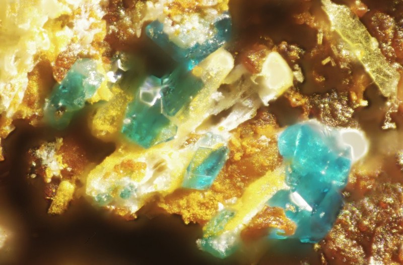
| Species: | Cumengeite |
| Formula: | Pb21Cu20Cl42(OH)40 · 6H2O |
| Confirmation |
|---|
|
| Validity: | Believed Valid |
| Data |
|---|
|
| Mineral Data: | Click here to view Cumengeite data |
| Locality Data: | Click here to view Cuddrabridge Mine (Guddrabridge Mine; Padstow Consols; Trevone Consols; Wheal Galway), Gunver Head, Padstow, Cornwall, England, UK |
| Photo Gallery | View Gallery (2 photos) |
| Data Identifiers |
|---|
|
| Mindat Occurrence Record ID: | 15693 |
| Long-form Identifier: | 1:3:15693:8 |
| GUID (UUID V4): | 514cc2d4-9aea-43b5-9de4-1a33f51d5289 |
| Nearest other occurrences of Cumengeite |
|---|
|
|
| 3.3km (2.0 miles) | ⓘDaymer Bay, Trebetherick, St Minver, Cornwall, England, UK |
| 15.2km (9.5 miles) | ⓘFlory Island, Trevelgue, Newquay, Cornwall, England, UK |
| 16.9km (10.5 miles) | ⓘTolcarne Beach, Newquay, Cornwall, England, UK |
| 17.1km (10.7 miles) | ⓘGreat Western Beach, Newquay, Cornwall, England, UK |
| 19.0km (11.8 miles) | ⓘThe Gannel Smelter slag locality, Crantock, Cornwall, England, UK |
| 26.5km (16.5 miles) | ⓘWheal Droskyn, Perran St George and Droskyn Mines, Perranporth, Perranzabuloe, Cornwall, England, UK |
| 30.1km (18.7 miles) | ⓘPar Smelter (Slag Locality), Tywardreath and Par, Cornwall, England, UK |
| 39.2km (24.4 miles) | ⓘPenpol smelter slag locality, Penpol, Feock, Cornwall, England, UK |
| 47.7km (29.7 miles) | ⓘNewporth Beach, Falmouth, Cornwall, England, UK |
| 69.1km (42.9 miles) | ⓘLoe Warren Zawn, Botallack, St Just, Cornwall, England, UK |
| References |
|---|
|
|


Cuddrabridge Mine, Gunver Head, Padstow, Cornwall, England, UK