 | | Book |
| caves and karst of indiana Samuel S. Frushour IN coNJUNctIoN WItH tHe Indiana Geological Survey WItH...coNtrIBUtIoN BY Julian J. Lewis and Salisa L. Lewis INDIANA UNIVERSITY PR ESS Bloomington & Indianapolis GuideTCAKOI...publication of Indiana University Press 601 North Morton Street Bloomington, Indiana 47404-3797 USA iupress...800-842-6796 Fax orders 812-855-7931 © 2012 by The Indiana Geological Survey All rights reserved No part of...1 What Is a Cave? 2 Formation of Indiana Caves 3 Cave Deposits and Cave Minerals 8 Cave Climate 13 The |
 | | Report (issue) |
| MINERALS OF INDIANA by RICHARD C. ERD AND SEYMOUR S. GREENBERG Indiana Department of Conservation GEOLOGICAL...GEOLOGICAL SURVEY Bulletin No. 18 1960 STATE OF INDIANA HAROLD W. HANDLEY, GOVERNOR DEPARTMENT OF CONSERVATION...________________________________ MINERALS OF INDIANA BY RICHARD C. ERD AND SEYMOUR S. GREENBERG PRINTED...PRINTED BY AUTHORITY OF THE STATE OF INDIANA BLOOMINGTON, INDIANA September 1060 _____________________...______________ For sale by Geological Survey, Indiana Department of Conservation, Bloomington, Ind. Price |
 | | Journal (article/letter/editorial) |
| INDIANA CAVES For the trained and the equipped, Indiana offers more than 2,000 caverns to enjoy and explore...Bloomington, Indiana 47401 T H E M I T C H E L L P L A I N in central southern Indiana is characterized...and partially explored more than 2,000 caves in Indiana. About 650 caves have been surveyed or mapped for...for a total of 193 miles of passages. Blue Spring Cave, near Bedford, contains more than 18 miles of mapped...mapped passages, and there are at least 34 caves in Indiana with a mapped length in excess of one mile. Origin |
 | | Report (issue) |
| Indiana Geological and and Water Survey Indiana University Revised 2021 DEDICATION To the memory of...efforts in cave safety. Devil's Graveyard Cave, Harrison County (front cover) Ladder Cave, Washington...Washington County (back cover) IN DIANA GEOLOGICAL IND I ANA UNIVERS I TY Circular 8, "Caves of Indiana,"...is an iconic publication of Indiana geology for the general public and cave enthusiasts. For decades, worn...many, it was a pathway to understanding caves in Indiana. For others, it paved a pathway toward degradation |
 | | Report (issue) |
| the Mitchell Plain and Crawford Upland in Southern Indiana STATE OF INDIANA Department of Natt1ral...Hydrology of the Mitchell Plain and Crawford Upland in Southern Indiana By HENRY H. GRAY AND RICHARD L. POWELL...AUTHORITY OF THE STATE OF INDIANA BLOOMINGTON, INDIANA: 1965 STATE OF INDIANA Roger D. Branigin, Governor...Cannelton locks a nd dam - 24 Stop 4 . Marengo Cave - - - - - - - - L iterature cited - - - - - - -...7. Map and ge neralized profile of the Marengo Cave area - - - - - - - - - - - - - - - - - - 12 8. |
 | | Journal (article/letter/editorial) |
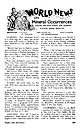
| NITRATES IN CAVE EARTHS A NEWtheory of the origin of nitrates in cave earths has been recently propounded...bacteria in the soil above, and that they enter the cave with the seepage through the roof and are deposited...dryer parts of the cave. In other words the dry galleries and chambers of a cave serve as a gigantic...statement that bats never go far from the mouth of the cave, while many analyses (not quoted) show that the...are distributed through the dry chambers of the cave. This would seem to be decisive if rigorously verified |
 | | Report (volume) |
| ............................................... Cave niter.............................................Gerlach, in the northern Granite Range, Washoe County, Nev.: A, Upper claims; B, Lower claims..........prospects in Greenwich Canyon, near Grass Valley, Piute County, Utah................ 2. Map showing location of...lower groups of niter claims near Gerlach, Washoe County, Nev.................................. 3 Page...has the same crystalline form and cleavage as calcite; that is, it is rhombohedral. Composition, NaN03 |
 | | Journal (article/letter/editorial) |
| had time to identify, assume some dolomite xls, calcite and fluorite. Rock formation is Madison limestone...Pale brown xline calcite (fl. yellow under both lamps, l.w. and s.w.). The calcite is on pale pinkish...have found in the Magnet Cove area of Hot Spring County, Arkansas. I am sending you a specimen under separate...on Delaware Bay, is in the N / E part of Sussex County, Del. From this beach, Bob and Hazel Reynolds,...yellow-brown mineral is xline sphalerite with xline white calcite, and both on dark gray limestone. You should find |
 | | Book |
| ACPL ITEM DISCARDED Indiana I■ 3 1833 04665 0583 ROADSIDE EOLOGY Of INDIANA Mark J. Camp Graham...n Data Camp, Mark J., 1947Roadside geology of Indiana / Mark J. Camp, Graham T. Richardson. p. cm. —...paper) 1. Geology—Indiana Guidebooks. I. Richardson, GrahamT., 1946QE109.36 . 2. Indiana Guidebooks. II...made our work possible, and to the citizens of Indiana. . . I_ake Michigan , Michigan / MICHIGAN...sections of Roadside Geology of Indiana. CONTENTS Preface ix 1 Indiana Rocks and Landscapes 1 The |
 | | Report (issue) |
| AND ROCKS IN INDIANA SEYMOUR S. GREENBERG WAYNE M. BUNDY DUNCAN J. McGREGOR Indiana Department of...SURVEY Circular No. 4 1958 ' . ' STATE OF INDIANA Harold W. Handley, Governor DEPARTMENT OF CONSERVATION...ular No. 4 GUIDE TO SOME MINERALS AND ROCKS IN INDIANA by Seymour S. Greenberg Wayne M. Bundy Dunc an...Printed by authority of the State of Indiana BLOOMINGTON, INDIANA Mar c h 1958 For sal e by Geo logi...localities listed by county - - - - - - 26 Cross index of some minerals found in Indiana - - - - 42 Rocks |
 | | Journal (issue) |
| Oliver Cumaungs Farrington. LONG ISLAND, PHILLIPS COUNTY, KANSAS. MUSEUM NUMBER Me. 420. of this great...one-half mile east of the west line of Phillips County and three miles It is from the neighboring south...metearticle follows: Weinschenk's Island, Phillips County, Kansas, occurrence I Meteorite Studies, May...and the highest yet reported in meteorites. NESS COUNTY, KANSAS. MUSEUM Of this fall the Museum having...silicates of small size. On the whole the Ness County meteorite should probably be classed as a crystalline |
 | | Report (issue) |
| Annotated Bibliography of Indiana Geology 1956 Through 1975 State of Indiana Department of Natural Resources...sketch of Cataract Falls on Mill Creek in Owen County by David Dale Owen (1807-60) . The original engraving...in " Report of a Geological Reconnaissance of Indiana, Made During the Years 1859 and 1860 Under the...1862 by Richard Owen. Annotated Bibliography of Indiana Geology 1956 Through 1975 By NANCY R. HASENMUELLER...AUTHORITY OF THE STATE OF INDIANA BLOOMINGTON , INDIANA: 1987 STATE OF INDIANA Robert D. Orr, Governor |
 | | Report (issue) |
| BIBLIOGRAPHY OF INDIANA GEOLOGY THROUGH 1955 by GEORGE M. NEVERS AND RICHARD D. WALKER Indiana Department...has been intentionally left blank. STATE OF INDIANA MATTHEW E. WELSH, GOVERNOR DEPARTMENT OF CONSERVATION...BLOOMINGTON BULLETIN NO . 24 ANNOTATED BIBLIOGRAPHY OF INDIANA GEOLOGY THROUGH 1955 BY GEORGE M. NEVERS AND RICHARD...STATE OF INDIANA BLOOMINGTON, INDIANA JA NU ARY 196 2 For sale by Geological Survey, Indiana Department...intentionally left blank. ANNOTATED BIBLIOGRAPHY OF INDIANA GEOLOGY THROUGH 1955 BY GEORGE M. NEVERS1 AND RICHARD |
 | | Journal (issue) |
| Oolite, State Collece, Pa. NECKLACE OF HERKIMER COUNTY QUARTZ CRYSTALS. Collection of Akteur Chamberlain...in its native condition, it is unique. Herkimer County crystals are sold at Hot Springs, Ark., as being...cavities evidently due to the dissolving out of calcite crystals. These displace ment pseudomorphs are...calcareous oolite contain ing occasional crystals of calcite disseminated through it, pseudo morphism would...abound, and that many caverns in the best studied cave districts of Austria are still known only in name |
 | | Book |
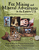
| Fossil and Mineral Trails Lakes States Wisconsin, Indiana, Illinois, Michigan, by June Culp Zeitner $5...species of fossils have been collected in Illinois, Indiana, and Michigan. Dow Chemical has reported finding...and Huron virtually surrounding it. Illinois and Indiana are bordered in part by Lake Michigan, and Ohio...peninsula of Michigan. Southern Illinois, southern Indiana and southern Ohio have milder winters than the...through Itasca and St. Louis Counties into Lake County. Hibbing is about the center of this historic area |
 | | Report (issue) |
| ............................................. 3 Cave Management and Conservation in the Philippines...... 11 Do Dye Tracers Harm Cave Bacteria?......................... 12 Cave Geomorphology of the Klamath............................................... 20 Cave and Karst Studies at NMT..........................Lab......................................... 21 Cave and Karst Research Fellowships for NMT Undergraduates...Program.............. 23 Transitioning to a New Cave Management Scientist at NCKRI.................. |
 | | Journal (article/letter/editorial) |
| AFFECTING STALACTITIC DEPOSITION HAS REACHED THE CAVE AFTER THE LIME SOLUTION STALACTITES Growth of...Dawkins examined certain lime deposits in Ingleborough Cave, Devonshire, and came to the conclusion, "It may...Hovey, in writing of the stalagmites in Mammoth Cave, says, "Hence any estimate as to their age in years...Paris (1900), pp. 102, 103. 7"Observations on Indiana Caves," Field Columbian Museum, Pub. 53, Geol....HAS REACHED THE CAVE I. Drip. Size of feeders.' 2. Rate of evaporation within the cave." Air circulation |
 | | Book |
| 238 Main Street Cambridge, Massachusetts 02142, USA All rights reserved. Except for the quotation of...Acknowledgements ONE The Cave System and Karst What is Karst? What is a Cave? Where are the Deepest and...Caves as Geomorphic Systems Now the Details... TWO Cave Hydrology Basic Concepts in Karst Drainage Systems...Karst Drainage System Defining the Catchment of a Cave Hydraulics of Groundwater Flow in Karst Diffuse...Hydrology of the Mammoth Cave Plateau, Kentucky Contents THREE Processes of Cave Development Introduction |
 | | Book (volume) |
| Dahlonega Co. and Rabum Co., and the McDuffie County Belt extending through portions of McDuffie, Warren...Sphalerite. BALDWIN COUNTY MILLEDGEVILLE, at state farmjasper. BANKS COUNTY COMMERCE, along Hwy. 59...along adjoining Co. linerock crystal. BARROW COUNTY WINDER, along rd. to Jefferson and 1½ mi. inside...Hounds in the United States BARTOW COUNTY AREA, Saltpeter Cave, as floatjasper. CARTERSVILLE: area...occurrences are in the vicinity of Cartersville and Cave Springs (NW Polk Co. and 147 Georgia SW Floyd |
 | | Book |
| Health, but It Doesn’t Have to Be.101 Chapter 7 Cave Rescue.107 Chapter 8 Taking It Home on Film.117...Carlsbad Caverns, possibly the most incredible of all cave formations in the United States. The National Speleological...perspective. While some caves are indeed cold, the average cave temperature is about 50° F., and this temperature...Each process creates a different size and form of cave, from large, rounded caverns to systems of long...enter a cave. Walking on flat land is different from walking on the rough terrain of a cave floor; using |
 | | Book (volume) |
| 600 to 800 feet thick in the north. ALEXANDER COUNTY FAYVILLE, area stream gravels⎯agate, jasper, rare...⎯agate, jasper; d RR siding of Clay⎯agate. CALHOUN COUNTY AREA, shores of the Mississippi R., in the Warsaw...Quartz crystals). CRAWFORD COUNTY PALESTINE, area deposits⎯Siderite. EDWARDS COUNTY AREA, T. 1 S, R.... 10 E, regional deposits⎯Siderite. FULTON COUNTY FARMINGTON, W 6 mi. on Rte. 116 to the Rapatee No....mine⎯pyritized gastropods (Pennsylvanian age). GRUNDY COUNTY AREA: c Regional rd. and RR cuts and banks of Mason |
 | | Book |
| “COSMIC Cavers <..cs.dc.soaie ~Hurricame:/ River Cave iis. iisser-ceectosossee sete eee pete eee seq sete...ea cca aatsaenes 48 vecsevoceeatersecteean Onyx Cave Parke ..is.cccccceccshasscoce “War Magle Caverns...PAK cu csissnadscensasvin eM ele a CR eee 80 INDIANA ULE UTTEG ST) € I 2 ee ale ne ee Re ene TE RO...oot ti tet etandeee tees:saae te 85 Sites. erence. Cave. National, Landimarle.:.s5.296 tic 200cs. oe SON...ues entstoceaee seeramnta outsocseuc Grystal Lake Cave uvcevsssssnsascsacucssiegheted cesre sginars90 esr |
 | | Report (issue) |
| RICHARD F. DALTON Senior Geologist with Sections on CAVE BIOLOGY by BROTHER NICHOLAS, F.S.C. HISTORY AND...Acknowledgements .................................... Cave Geology ..........................................of New Jersey Caves ............................ Cave Patterns .........................................Exploring Caves ........................................ Cave Conservation ............................................ Francisco's Cave .................................... Franklin Mine Cave ................... |
 | | Journal (issue) |
| trying to get it out but it will be cemented), calcite, feldspars in several shades, garnets in mica schist...in the first place. And if you want to know the county (foreign money orders demand it), it is Westchester...SOURCES 1 By RONALD L. IVES Dept. of Geography, Indiana University, Bloomington , Ind . 1rts, uch 1ca-...cavities and veins. bi such workings, although actual cave-ins are uncommon, miners are exposed to falling...east of Asheboro, in the southern part of Randolph County, North Carolina, is a prominence that rises above |


