 | | Book | | siderite, Force Crag Mine, Braithwaite (MNS 4491) Back cover-'Daisy' gypsum, Birks Head Mine, Long Marton (MNS...Gill Mine, Caldbeck Fells (MNS 4492) (top right) Quartz, variety rock crystal, Carrock Fell Mine, Mosedale...(bottom left) Hematite, variety kidney ore, Nab Gill Mine, Boot (MNS 4490) (bottom right) ISBN O 85272 099...District , the hematite ore bodies of west and south Cumbria and the evaporitesof the Vale of Eden. A detailed...extensive hematite deposits of west and south Cumbria has also long been the subject of speculation. |  | Cooper, D. C., Cameron, D. G., Young, B., Cornwell, J. D., Bland, D. J. (1991) Mineral exploration in the Cockermouth area, Cumbria. Part 1: regional surveys. Mineral Reconnaissance Programme Report 118. British Geological Survey | Report (issue) | | Exploration in the .· . ·_.:C:orikerrn.outh area, Cumbria. ·_ · · ·P·a rt ·1:·· Regional surveys _ • ,:... Mineral exploration in the Cockermouth area, Cumbria. Part 1: regional surveys D C Cooper, D G Cameron... Mineral exploration in the Cockermouth area, Cumbria. Part 1: regional surveys DC Cooper, D G Cameron... Mineral exploration in the Cockermouth area, Cumbria. Part 1: regional surveys. British Geological Survey...Survey Keyworth Nottingham NG12 5GG Printed in England for the British Geological Survey by Saxon Printing |  | | Journal (article/letter/editorial) | | Australia (Fig. 1 ), extends the work of Schmidt and Embleton (1985 ) on the underlying Fortescue Group and...were studied by Chamalaun and Dempsey (1978) and Embleton et al. t 2~ Wyloo Group ,~1 TureeCreekGroup...and the Boolgeeda Iron Formation. The Wittenoom Dolomite occurs between the lowest two BIFs. The BIFs are...Conglomerate without ore pebbles Dolerite ~ Dolomite Unconformity Fig. 2. Stratigraphy and key geological...these ores. The Hamersley BIFs above the Wittenoom Dolomite are thought to be slightly younger than 2500 Ma |  | | Journal (article/letter/editorial) | | Chamalaun (1968), Chamalaun & Dempsey (1978), Embleton et al. (1979), Clark & Schmidt (1986, 1994), and...the Marra Mamba Iron Formation, the Wittenoom Dolomite, the Mount Sylvia Formation, the Mount McRae Shale...Basalt, the Mount McGrath Formation, the Duck Creek Dolomite, and the Ashburton Formation. The Wyloo Group...number Samples Lithology Wyloo Duck Creek Dolomite Mount McGrath Fm Cheela Spring Basalt 2 1 2 2...205 9 28 76 50 69 6 Dolomite, sandstone Hematite conglomerate Basalt Dolomite BIF, siltstone Rhyolite |  | | Report (chapter) | | s Fms., TN St George Fm., Newfoundland Oncota Dolomite, IA, MN, WI CS CN PS PE AN KS Du Du DI? Su/DI...et al. (1987) Embleton (1972) Hargraves et al. (1987) Bachtadse et al. (1987) Embleton (1972) Manzoni...RO Su/D1 xxxxxx Southern Ireland, Southern England and Wales (south poles) Old Red Sandst., Wales...of the Royal Astronomical Society, 91,521-550. EMBLETON, B. J. J. 1972. The palaeomagnetism of some Palaeozoic...Ordovician paleDmagnetic pole from the Oneota Dolomite, Upper Mississippi Valley. Journal of Geophysical |  | | Book | | ' Frontispiece Landsat imagery of north-west England taken from a height of 900 km. Photograph: National...Geological Society 1978 ISBN 0 9501656 2 X PRINTED IN ENGLAND BY W. S. MANEY AND SON LIMITED LEEDS CONTENTS...Geology 15 Epigenetic Mineralization 16 Offshore Cumbria 17 Hydrogeology C. K. Patrick 18 Environmental...placed the greater part of Scotland in ‘America’, England a :■ dies in ‘Europe’, and regarded the Southern...ccid on or near to the Solway, descending beneath England and Wales. Fitton and Hughes (op. cit.) also noted |  | | Journal (article/letter/editorial) | | reddish and pale gray carbonate of the Todd River Dolomite, which gradationally overlies the Allua Formation..." Giles Creek Formofion / 5 o bJ Todd River Dolomite Allua FormoJion I - .............. ~:,. ~...than other units in the sequence. Limestone and dolomite both possessed each type of magnetization, so...red limestone from the base of the Todd River Dolomite at Ross River. Each plot has two paths, labelled...TRR-44 and TRR-45 are dolomites from the Todd River Dolomite. PRR-106 is a gray limestone from the Julie member |  | | Report (chapter) | | near the base of the formation included blocks of dolomite and rare boulders of granite. Similarly Von der...grey-green fine sandstone, quartzite, marble and dolomite, and an upper member forming most of the section...lonestones, up-section, with angular sub-rounded yellow dolomite and grey limestone fragments common along with...available for the correlative Bonney Sandstone (Embleton & Giddings 1974; McWilliams & McElhinny 1980)...Sandstone and Todd River Dolomite of the Amadeus Basin central Australia (Embleton 1972; Kirschvink 1978) |  | | Journal (article/letter/editorial) | | Formation Tapley Hill Tapley Hill Wooca, lla Dolomite t" Member ,, Formation " ~ & Sturt ~ • Formation...diagenesis at low temperatures ( < 135160°C), Embleton and Williams [12] concluded that the remanence...mean cleaned remanence direction determined by Embleton and Williams [12] for the rhythmite member at...closely to the structurally corrected result of Embleton and Williams [12], namely a declination of 191...longitude = 347. I°E (dp = 3.7, dm = 7.4) cf. Embleton and 191.9 -9.6 3.4 WiUiams [12] N = Number |  | | Journal (article/letter/editorial) | | a distinctive tungussiform type in the Amelia Dolomite invites comparison with Grey's (1984) Nabberu...lithostratigraphy (c.f. Amelia Dolomite, Balbirini Dolomite, and Mara Dolomite Member, in Muir, 1983), b u...sequences which cover substantial intervals of time (Embleton, 1981). This section aims to highlight some recent...inferred for Australia (McElhinny and Embleton, 1976; Embleton, 1981; Giddings, 1983a, b. Fig. 6). The...relative to each other (McElhinny and Embleton, 1976; Embleton, 1981). Ideally, this should be tested |  | | Journal (article/letter/editorial) | | evidenced by negative fold tests. McElhinny and Embleton (1976) reviewed the Proterozoic to Early Palaeozoic...American pole made that grade). McElhinny and Embleton (1976) relented on the third criterion, the timing...be a problem throughout Australia (Schmidt and Embleton, 1976; Idnurm and Schmidt, 1986; Schmidt and Williams...ratios). The palaeomagnetic pole (Schmidt and Embleton, 1985) is based on extremely stable remanent magnetisations...2329 ± 89 Ma when studied palaeomagnetically (Embleton, 1978), it has now been precisely dated using |  | | Journal (article/letter/editorial) | | The Croxteth Park Inlier, near Liverpool 64 EMBLETON, C. Late-Glacial Drainage in part of North-East...Minerals in the Permian and Trias of N orth-East England 251 HANCOCK, J . M., B. H . MOTTRAM & M. R. HOUSE...Great Rock Mine, Hennock, South DeVOn} 6. B. Part of micaceous haematite lode from Great Rock Mine, 90 { Hennock...Buckinghamshire) 210 228 A. Barite replacing oolitic dolomite (Co. Durham) ... ... } 9. B. Barite (white) and...and calcite (grey) in yellow oolitic dolomite 254 { (Co. Durham) ... ... ... .. . .. . ... ... } A. Fluorite |  | | Report (issue) | | published Sheet 27 of the One-inch Geological Map of England and Wales. In the north-west it includes part ...locally by the effects of mining. Quarrying of dolomite in huge quarries along the Permian escarpment...account of the district. Jacket picture: Reef dolomite, Black Halls Rocks 60s. net LIBRARY |COUNTY... SCIENCES OF THE GEOLOGICAL OF GREAT BRITAIN ENGLAND AND SURVEY WALES Geology of the Country between...Belfast 2 or through any bookseller Printed in England PREFACE The country between Durham and West Hartlepool | 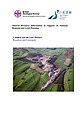 | Young, B., Highley, D. E., Cameron, D. G., Millward, D., Harrison, D. J., Henney, P. J., Holloway, S., Lott, G. K., Warrington, G. (2001) Mineral Resource Information for Development Plans: Phase One Cumbria and the Lake District (Cumbria, Lake District National Park and part of Yorkshire Dales National Park) Resources and Constraints. Mineral Resources Series WF/01/02. British Geological Survey | Report (issue) | | Support of National, Regional and Local Planning Cumbria and the Lake District: Resources and Constraints...for Development Plans: Phase One Cumbria and the Lake District (Cumbria, Lake District National Park and...for Development Plans: Phase One Cumbria and the Lake District (Cumbria, Lake District National Park and...This report accompanies the 1:100 000 scale maps: Cumbria and the Lake District Mineral Resources (North...Photograph Aerial View of Shap Beck Quarry, Shap, Cumbria, showing aggregate workings in the Knipe Scar Limestone |  | | Journal (article/letter/editorial) | | diverse non-skeletal grains and abundant micrite and dolomite, similar to those of modern warm water carbonates...undergoing marine to meteoric diagenesis. Key words: dolomite, Gordon Group, Ordovician carbonates, oxygen and...uncertain and was considered to be either ~10°N (Embleton 1973) or ~25°N, with a wide margin of error extending...reaction was taken as having been derived from dolomite. This sequential procedure is based on the method...and non-skeletal grains, abundant micrite and dolomite, and sparry calcite cement. Algae occur alone |  | | Journal (article/letter/editorial) | | galena using lattice dynamics Embleton, B J J , see Duff, B A and Embleton, B J J Estbve, J -P , see Recq...reactions at high pressures and possible presence of dolomite and magneslte m the upper mantle Le PIchon, X...fission track dates of apatltes from northern New England 254 121 459 181 |  | | Report (chapter) | | from different tectonic units (e.g. McElhinny & Embleton 1976; Veevers & McElhinny 1976; Idnurm & Giddings...syn-folding overprint pole (JO on Fig. 5; Schmidt & Embleton 1985) was acquired during the 1.83-1.79Ga Capricorn...Combined data from the upper and lower Balbirini Dolomite indicate a pre-folding age for the magnetization...and mafic dykes (GA and GB on Fig. 5; Giddings & Embleton 1976). Collectively, the data suggest that the...Dempsey 1978) and the 1589__+3 Ma upper Balbirini Dolomite of the McArthur Basin (BDu on Fig. 5; Idnurm 2000) |  | | Journal (article/letter/editorial) | | fine sand-dunes of Embleton Bay was encouraged by the prospect of tea at Embleton, after which the return...finally tracked and dug out of the mud. Tea at Embleton and a pleasant run home completed the day. Sunday...the Nenthead road the party visited the old Haggs Mine, where the leader, Mr. Dunham, gave a general account...dominant minerals were galena, blende, fluor, quartz, dolomite and chalcopyrite, and the leader took occasion |  | | Book | | pleasecontact the publishers. Beamish, The North of England Open Air Museum,County Durham [Beamish]: pages................... 201 72 Foreword ORTHERN England, an area of great natural beauty, is additionally...District, the north Pennines, Cumbria, various regions of north-east England, and North Yorkshire. Such...ground; trial workings, mine dumps, mine buildings and smeltings, plus mine location maps and a wealth...bibliography concludes the work. Minerals of Northern England will rate as one of the classic works on British |  | Williams, George E., Gostin, Victor A., McKirdy, David M., Preiss, Wolfgang V. (2008) The Elatina glaciation, late Cryogenian (Marinoan Epoch), South Australia: Sedimentary facies and palaeoenvironments. Precambrian Research, 163 (3) 307-331 doi:10.1016/j.precamres.2007.12.001 | Journal (article/letter/editorial) | | coarse-grained feldspathic quartzite, with local thin dolomite beds. 5.1.6. Balparana Sandstone (130 m) The...Williams (1981) during an inspection of the Cattle Grid mine in January 1981, and he continued to study the structures...that are widely distributed in polar regions (Embleton and King, 1975; White, 1976; Washburn, 1980)....below the ground surface, occurs in southeast England, Spitsbergen, and Melville Island in the Canadian...(Murton, 1996). Brecciated Chalk in southeast England exhibits small, open folds and is capped by an |  | | Journal (article/letter/editorial) | | considered by many authors (e.g., Irving, 1964; Embleton, 1973) to have been in the vicinity of the Great...pole for Gondwanaland may have been further east (Embleton and Schmidt, 1977; Austin and Williams, 1978)...rare-common 5. Reef structures grains 4. Terrigenous dolomite 3. Evaporites absent absent 2. Non-skeletal...Australia (Queensland Division), pp. 305-316. Embleton, B.J.J., 1973. The palaeolatitude of Australia...Phanerozoic time. J. Geol. Soc. Aust., 19: 475-482. Embleton, B.J.J. and Schmidt, P.W., 1977. Revised palaeomagnetic |  | | Catalog/List | | RICHARD ’ BYWAYS, , COBHAM ENGLAND MINERALS T AY L E R C L 0 00 E 2 0 B U R S T E A D P h one SURREY...Cu UO PO/4 slightly radioactive. (Old Gunislake Mine Cornwall) a) green 3mm area on ropk, £3 ( b) IxhaJ...Phlogopite Mica. (Possibly slightly radioactive)(Palabora Mine,S.Africa lxl £5 1x2 £10 WITH UNUSUAL ELEMENTS...sections in matrix with Eudialyte.Rare not Rich (Umba Mine,Lovozero Massif,Kola Russia) lxl £4 1x2 £7.50 239...silvery areas in matrix with Tellurite. (La Bambolla Mine Moctezuma, Sonora Mexico) lxl £10 14 x 54 ins £5 |  | | Report (chapter) | | conferences on Palaeoclimates in Newcastle-upon-Tyne, England (1963), and Köln, Germany (1964). The radiation...interpretation of a Permian-age diamictite in England (Ramsay 1855) that proved to be non-glacial in...blanket more necessary to the vegetable life of England than clothing is to man’. Radiative energy balance...predominate, but which also carry smaller clasts of dolomite with facets and nonparallel striations identical...a Neoproterozoic periglacial marine formation (Embleton & Williams 1986). Palaeomagnetists have long been |  | | Catalog/List | | matrix hl !3 5 AGARDITE (Ce) r ...fe green micro's Mine, Wolf;_n, West Germany) 'h ins f.3. 60 6 ALBITE...sphere shaped botryoidal nodule,(Newhaven Sussex. England) 1" -10p 2"90p 3" !1.40 4" !3,30 13 ALUNITE pure... /' pale blue-gny ~;ssi\·c. (Staffordshire England) :::-::1 !:;1 2x4 tt.20 2;-;2 60µ e2S ANTARCTICITE...Grey-white crystals with terminations.(Sheppey Kent,England) lxl cm !1.80 43 BARYTES orange brownto fawn attractively...BARVTOCALCITE rich creamy massive. (Near Alston Cumbria) 1x2 40p 2x2 80p 2x3 :t1.20 B) showing small crystals |  | | Journal (article/letter/editorial) | | and arsenides near the south shaft at South Terras mine, St. Stephen-in-Brannell, Cornwall. R. J. Davis...white massive from a vein in a dolerite sill at Embleton quarry, near Cockermouth, Cumberland. A. W. G...baryte, with tennantite in limestone, at Gortdrum mine, Oola, Co. Tipperary, Ireland. BM(NH) specimens...ochreous, at West Turf Pits mine, Grassington Moor, Yorkshire. Also, at Treore mine, St. Teath, Cornwall. A...Ganophyllite Some of the ganophyllite at Benallt mine, Rhiw, Caernarvonshire (W. Campbell Smith et al |
|


