| Locality type: | Mine |
| Classification |
|---|
|
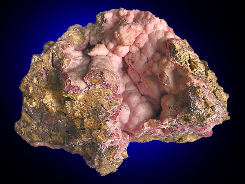
| Species: | Rhodochrosite |
| Formula: | MnCO3 |
| Confirmation |
|---|
|
| Validity: | Believed Valid |
| Associated Minerals Based on Photo Data: |
|---|
|
| Dolomite | ⓘ1 photo of Rhodochrosite associated with Dolomite at this locality. |
| Quartz | ⓘ1 photo of Rhodochrosite associated with Quartz at this locality. |
| Data |
|---|
|
| Mineral Data: | Click here to view Rhodochrosite data |
| Locality Data: | Click here to view Dr. Geier mine (Amalienhöhe mine; Elisenhöhe mine), Waldalgesheim, Rhein-Nahe, Mainz-Bingen, Rhineland-Palatinate, Germany |
| Photo Gallery | View Gallery (18 photos) |
| Data Identifiers |
|---|
|
| Mindat Occurrence Record ID: | 178080 |
| Long-form Identifier: | 1:3:178080:2 |
| GUID (UUID V4): | c6dc9b02-4836-4e93-a230-1c239c96c29b |
| Nearest other occurrences of Rhodochrosite |
|---|
|
|
| 24.4km (15.2 miles) | ⓘWerlau, Sankt Goar, Hunsrück-Mittelrhein, Rhein-Hunsrück-Kreis, Rhineland-Palatinate, Germany |
| 41.0km (25.5 miles) | ⓘReich Geschiebe Mine, Imsbach, Winnweiler, Donnersbergkreis, Rhineland-Palatinate, Germany |
| 41.3km (25.6 miles) | ⓘGrauer Hecht Mine, Imsbach, Winnweiler, Donnersbergkreis, Rhineland-Palatinate, Germany |
| 44.3km (27.5 miles) | ⓘRothenberg Mine (Seitersfeld), Oberneisen, Aar-Einrich, Rhein-Lahn-Kreis, Rhineland-Palatinate, Germany |
| 49.5km (30.7 miles) | ⓘHambach - Gückingen area, Diez, Rhein-Lahn-Kreis, Rhineland-Palatinate, Germany |
| 62.3km (38.7 miles) | ⓘKrufter Ofen, Kruft, Pellenz, Mayen-Koblenz, Rhineland-Palatinate, Germany |
| 62.3km (38.7 miles) | ⓘIn den Dellen quarries, Mendig, Mendig, Mayen-Koblenz, Rhineland-Palatinate, Germany |
| 62.3km (38.7 miles) | ⓘThelenberg, Mendig, Mendig, Mayen-Koblenz, Rhineland-Palatinate, Germany |
| 62.5km (38.9 miles) | ⓘPumice quarries, Wingertsberg, Mendig, Mendig, Mayen-Koblenz, Rhineland-Palatinate, Germany |
| 64.6km (40.2 miles) | ⓘLinck marble works, Auerbach, Bensheim, Bergstraße, Darmstadt, Hesse, Germany |
| References |
|---|
|
|


Dr. Geier mine, Waldalgesheim, Rhein-Nahe, Mainz-Bingen, Rhineland-Palatinate, Germany