 | | Journal (article/letter/editorial) | | Caldwell Stone Company quarry, Danville, Boyle County. Terry Huizing specimen and photo. K entucky...Commonwealth is Black Mountain in the Appalachians (Harlan County) at 4,139 feet. The lowest point is the floor of...of the Reed quarry near Grand Rivers (Livingston County) in western Kentucky, at 100 feet below sea level...small, nondiamondiferous kimberlite in Elliott County in eastern Kentucky and alnöite intrusions in Crittenden...Greb, Kentucky Geological Survey. in Crittenden County has one major shaft called the “Rock shaft.” The |  | | Report (volume) | | J. B. Hoeing, Frankfort. Mr. J. H. Gardner, Lexington. Louisiana........Prof. Gilbert D. Harris, Baton... Mississippi.......Prof. E. N. Lowe, Jackson. Missouri..........Dr. H. A. Buehler, Rolla. Nebraska.....See Bauxite and Hallpysite. Asbestos. Tallapoosa County, with corundum deposits near Dudleyville; not found...commercial quantity or quality. Asphalt. Colbert County, small quantity has been shipped from near Leighton;...following localities: Bibb County, Pratts Ferry; Calhoun County, near Tampa; Clay County, T. 20, Pv. 7 E.; Jefferson |  | | Journal (article/letter/editorial) | | MINERALS KENTUCKY DENNIS COSKREN 849 L y n n Drive Lexington, Kentucky 40504 T o those interested in minerals...Green River and also Buck Creek, both in Lincoln County near Halls Gap, are traditionally good places to...Middle F o r k of Station Camp Creek in Estill County. More geode information will be found in another...wouldn't give more precise information than the county o f origin, but similar specimens are known from...the Bourbon Limestone Company quarry i n Bourbon County near Paris (now closed to collecting). T o my knowledge |  | | Report (volume) | | ............................................. Missouri................................................. J. B. Hoeing, Frankfort. Mr. J. H. Gardner, Lexington. Louisiana____Prof. Gilbert D. Harris, Baton Rouge...See Bauxite and Halloysite. Asbestos. Tallapoosa County, with corundum deposits near Dudleyville; not found...commercial quantity or quality. Asphalt. Colbert County, small quantity has been shipped from near Leighton;...following localities : Bibb County, Pratts Ferry; Calhoun County, near Tampa; Clay County, T. 20 S., R. 7 E.; | 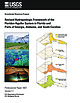 | | Report (issue) | | FRANKLIN P4 P725 (Brooks, 1981) P506 OCG-S-2486 LAFAYETTE C-0606 OCG-S-2490 C' P116 PortSTJoe P32 P89 P536... MONROE PUTNAM BALDWIN EDGEFIELD SUMTER LEXINGTON DU WARREN Oge TALLAPOOSA COOSA CHILTON ... UNION CLAY 0 20 250 350 FO ST JOHNS D LAFAYETTE A 0 SUWANNEE TAYLOR Tallahassee 0 30 200...EDGEFIELD LINCOLN D A LE Atlanta WILKES LEXINGTON TO O DOUGLAS OCONEE WALTON DE KALB SUMTER...Tallahassee FO R 00 UNION D –1 TAYLOR LAFAYETTE FRANKLIN ST JOHNS CLAY BR A GULF DUVAL |  | | Report (issue) | | Urbana, University of Illinois Library Indiana Lafayette, Purdue University Library Iowa ""Ames, Iowa State...State College Library Kentucky Lexington, University of Kentucky Liurary Louisiana Baton Rouge, Louisiana...Minnesota Minneapolis, University of Minnesota Library Missouri Kansas City, Linda Hall Library St. Louis, Washington...Waldemere, Geology of the Ruin Basin area, Gila County, Ariz.: 134 pp., 36 pls., 1 fig. May 7, 1951. Geology...D. C. Brokaw, A. L., Green Monster mine, Clark County, Nevada: 9 pp., 7 pls. Oct. 4, 1951. U. S. Geological |  | | Report (issue) | | Mineral Resources Bldg. University of Kentucky Lexington, KY 40506 'Indiana Geological Survey 611 N. Walnut...Callis, and J.A. Rupp, Coal Resources of Daviess County, Indiana: AGIS-Based Resource Assessment H. Cetin...of Part of the La Salle Anticlinorium, Lawrence County, Dlinois. 8:30am J.A. Drahovzal, Basin-Floor... v. 72, p. 263-276. Coal Resources of Daviess County, Indiana: a CIS-based Resource Assessment Joseph... Daviess County, Indiana, is located in the eastern part of the Illinois Basin. The county has an area |  | | Book (edition) | | mmed at Broken Arrow aud Trout creek, in Sc. Clair county. The strata in this field are more faulted und...prong of Canoe creek, in St. Clair county, to Ha\sop creek, in Bibb county, a distance of 60 miles. Down to...to Helena, in Shelby county, the field has an average width of 5 or 6 miles. Below that point the width...miles being in the latitud" of Blocton, in Bibb county. The south ern end of this field has a greater...Jefferson county; Helena, Montevallo, and Brierfield, Shelby county; and at Blocion. Bibb county. The Warrior |  | | Report (issue) | | Indiana showing thickness of the Trenton and Lexington Limestones ................32 16 Map of Indiana...system. A locally disturbed area in southern Newton County, the Kentland Dome of Gutschick (1983), has been...rocks Limestone and dolomite Maquoketa Group and Lexington Limestone Shale and limestone Kentland disturbed...lateral equivalents, the Kope Formation and the Lexington Limestone, variably overlie the Black River (Shaver...the lower part of the Kope Formation and the Lexington Limestone (Keith, 1985b, 1989). Trenton-equivalent |  | | Journal (article/letter/editorial) | | 00:11 06 November 2014 Eagle Mine, Cilman, Eagle County, Colorado W orld production of zinc is enormous...associated with blue fluorite, galena, and water-clear gypsum have been found in recent years in the Dolomite...of the BalmatEdwards district in Saint Lawrence County (Smith and Figure 1. A fine example of jet-black...in the zinc ores of the Franklin mines, Sussex County, New Jersey (Palache, 1937).Although approximately...Morgantown (twins to 2 cm) in Berks County; the Thomasville quarry, York County (bright green crystals to 4 cm); |  | | Report (issue) | | A NEW GYPSUM DEPOSIT IN IOWA.1 By GEORGE F. KAY. INTRODUCTION. For many years Iowa has ranked among...from which all the output has come are in Webster County, in the vicinity of Fort Dodge, where an area comprising...location of gypsum area at Centerville, Appanoose County, Iowa, and its relation to the gypsum area of Fort...Fort Dodge. regarded as available for gypsum mining. The gypsum is confined to a single bed, which is...mantle of drift 60 to 80 feet thick covers the gypsum except along Des Moines River and its tributaries |  | | Book (edition) | | MISSOURI HANDBOOK NUMBER ONE THE COMMON ROCKS AND MINERALS OF MISSOURI W. D. KELLER UNIVERSITY OF...OF MISSOURI PRESS MISSOURI HANDBOOK NUMBER ONE THE COMMON ROCKS AND MINERALS OF MISSOURI WrDsKELEER... OF MISSOURI PRESS * COLUMBIA ABOUT THIS BOOK The Common Rocks and Minerals of Missouri was first...first published in 1945 as part of the Missouri Handbook series, a project of the College of Arts and...1948 and 1961. Subsequently, the University of Missouri Press became the publisher of the series. Although |  | | Book (volume) | | ASHTABULA COUNTY CONNEAUT, area pits, quarries, rd. cuts, etc.⎯cone-in-cone Calcite. CLERMONT COUNTY MILFORD...CLINTON COUNTY WILMINGTON, area of Todd’s Ford, a mineral deposit⎯Hematite. COSHOCTON COUNTY AREA, townships...CUYAHOGA COUNTY CHAGRIN FALLS (on Geauga Co. line), area quarries⎯oilstone. DELAWARE COUNTY DELAWARE...nodules⎯Pyrite (crystals sharply cubic). FRANKLIN COUNTY COLUMBUS, area countywide exposures of blue clay...HIGHLAND COUNTY SINKING SPRING, area ore deposit (most important in Ohio) ⎯Hematite. HOCKING COUNTY AREA |  | | Book (volume) | | ASHTABULA COUNTY CONNEAUT, area pits, quarries, rd. cuts, etc.⎯cone-in-cone Calcite. CLERMONT COUNTY MILFORD...CLINTON COUNTY WILMINGTON, area of Todd’s Ford, a mineral deposit⎯Hematite. COSHOCTON COUNTY AREA, townships...CUYAHOGA COUNTY CHAGRIN FALLS (on Geauga Co. line), area quarries⎯oilstone. DELAWARE COUNTY DELAWARE...nodules⎯Pyrite (crystals sharply cubic). FRANKLIN COUNTY COLUMBUS, area countywide exposures of blue clay...HIGHLAND COUNTY SINKING SPRING, area ore deposit (most important in Ohio) ⎯Hematite. HOCKING COUNTY AREA |  | | Book (volume) | | BRULE COUNTY AREA: in the Oacoma zone of the Pierre Fm. On Elm Cr. Near its jct. with the Missouri River...rosette up to 5 or 6 inches. CAMPBELL COUNTY MOUND CITY, W to the Missouri R., regional hillsides, ridges,...gravels, etc.petrified wood, wood opal. CORSON COUNTY LITTLE EAGLE: area ridges, slopes, stream beds...Guide for Rock Hounds in the United States CUSTER COUNTY AREA: The November Mine, 1.2 mi. SE of the Needles...of rd. a few yds., outcropRose Quartz. DOUGLAS COUNTY CORSICA, S on US 281 to Armour, area rd. cuts, |  | | Journal (article/letter/editorial) | | the Ute Mountain Gem & Mineral Society. Montezuma County Annex Bldg., 103 N. Chestnut. Info.—John Ferrin...Mineral & Jewelry Festival sponsored by the Oxford County Mineral & Gem Association. Oxford Fair ground...Pinebridge Inn (wholesale). Info.—Jim Burgess, Mitchell County Chamber of Commerce, Rte. 1, Box 7%, Spruce Pine... PARK OF THE 3rd MINE 1 2 IN THE LARGEST GYPSUM DIAMONDS STATE PARK, DIALERS SPACES AVAILABLE...be on Display. THE "AZTEC SUN" returns to the USA for the first time in ten years. SHOW INFO: P.O |  | | Journal (article/letter/editorial) | | SHERWOOD 106A East 25th, P. 0. Box 436 Oak Grove, Missouri 64075-0436 Downloaded by [Brown University Library]...Louis, Missouri 63129-2704 Figure 1. Counties in Missouri. N o comprehensive list of Missouri mineral...found in Missouri; two of these, fletcherite and starkeyite, were first described from Missouri mines....location a~ included at the end of each entry. Adair County Chariton River (40-04-05N 92-4 I -23W). septarian...septarian concretions about 2 miles north of the Macon county line. CALCITE crystals enclosing bundles of acicular |  | | Book (volume) | | 600 to 800 feet thick in the north. ALEXANDER COUNTY FAYVILLE, area stream gravels⎯agate, jasper, rare...⎯agate, jasper; d RR siding of Clay⎯agate. CALHOUN COUNTY AREA, shores of the Mississippi R., in the Warsaw...crystals). CRAWFORD COUNTY PALESTINE, area deposits⎯Siderite. EDWARDS COUNTY AREA, T. 1 S, R. 10 E...E, regional deposits⎯Siderite. FULTON COUNTY FARMINGTON, W 6 mi. on Rte. 116 to the Rapatee No. 5 strip...mine⎯pyritized gastropods (Pennsylvanian age). GRUNDY COUNTY AREA: c Regional rd. and RR cuts and banks of Mason |  | | Book (volume) | | 600 to 800 feet thick in the north. ALEXANDER COUNTY FAYVILLE, area stream gravels⎯agate, jasper, rare...⎯agate, jasper; d RR siding of Clay⎯agate. CALHOUN COUNTY AREA, shores of the Mississippi R., in the Warsaw...crystals). CRAWFORD COUNTY PALESTINE, area deposits⎯Siderite. EDWARDS COUNTY AREA, T. 1 S, R. 10 E...E, regional deposits⎯Siderite. FULTON COUNTY FARMINGTON, W 6 mi. on Rte. 116 to the Rapatee No. 5 strip...mine⎯pyritized gastropods (Pennsylvanian age). GRUNDY COUNTY AREA: c Regional rd. and RR cuts and banks of Mason | | | Book (edition) | | MISSOURI HANDBOOK NUMBER ONE THE COMMON ROCKS AND MINERALS OF MISSOURI W. D. KELLER UNIVERSITY OF...OF MISSOURI PRESS ON Dr ictin eee Aint . = 1 edt ee Se pe ae ey em aai B o ee peesps eo EY rat...J ; a - MISSOURI HANDBOOK NUMBER ONE THE COMMON ROCKS AND MINERALS OF MISSOURI W. D. KELLER...UNIVERSITY OF MISSOURI PRESS *« COLUMBIA ABOUT THIS BOOK The Common Rocks and Minerals of Missouri was first...first published in 1945 as part of the Missouri Handbook series, a project of the College of Arts and |  | | Book (volume) | | Dahlonega Co. and Rabum Co., and the McDuffie County Belt extending through portions of McDuffie, Warren...Sphalerite. BALDWIN COUNTY MILLEDGEVILLE, at state farmjasper. BANKS COUNTY COMMERCE, along Hwy. 59...along adjoining Co. linerock crystal. BARROW COUNTY WINDER, along rd. to Jefferson and 1½ mi. inside...Guide for Rock Hounds in the United States BARTOW COUNTY AREA, Saltpeter Cave, as floatjasper. CARTERSVILLE:...agate, (banded, various colors), jasper. BIBB COUNTY MACON: at Holton Quarry, 7½ mi. NWagate; N |  | | Report (issue) | | site of the former town of Alum Cave, Sullivan County, in the NW¼NE¼ sec. 25, T. 9 N., R. 8 W. Description...outcrop in northern Vigo County and Vermillion County. South of Sullivan County , the limestone is thin... 8 N ., R. 8 W., near Antioch Church, Sullivan County. This unit lies 2 feet below the Bucktown Coal...south of Knox County but is present northward from its type area to Vermillion County. Antrim Shale,...the St. Clair, that was well exposed in Antrim County, Mich., and Lane ( 1902, map) later actually adopted |  | | Book | | Interstate 30 are visible from a number of State and county roads. Ark. 183, which intersects Interstate 30...of Hot Springs, and 2 miles north of Magnet on a county road, is the largest barite mine in America (map...operated. but may be viewed from a eastward trending county road. The mine is one of several in what at one...a point 5 miles south of Magnolia on U.S. 79, a county road to the west passes just north of the bromine...camp and zinc mines and mills are at Ruch, Marion County, which is 4 miles east of Ark. 14 at a point 14 |  | | Journal (article/letter/editorial) | | Wollastonite and Titanite Near Natural Bridge, Lewis County, New York, 78; 13th Rochester Academy of Science...Pegmatite Bodies in the Wausaw Pluton, Marathon County, Wisconsin, 188 Fascinating Story of Mount Mica's...Localities in the Beaver Creek Area of St. Lawrence County, New York, W. S. Condon, S. C. Chamberlain, 105... 399 Four Obscure Mineral Localities in Oxford County, Maine, M. I . Jacobson, 401 Fox, R. A . , 334...Specimen Miner alogy, 114 Garnets from Delaware County, Pennsyl vania, R. L . Lindsley, J . J . Peters |  | | Journal (article/letter/editorial) | | Quarry BOYLE COUNTY, KENTUCKY KENTUCKY WARREN H. ANDERSON Kentucky Geological Survey Lexington, Kentucky...located near Danville along Route 150 in Boyle County. This is near the southern tip of the central Kentucky...1900. The Lexington Dome, a structural high along the Cincinnati Arch, extends from Owen County in north-central...north-central Kentucky southward 100 miles to Lincoln County in southcentral Kentucky. Several major fault systems...galena, and such secondary sulfate minerals as gypsum, cerussite, and anglesite (Anderson 1982). The |
|


