| Locality type: | Area |
| Classification |
|---|
|
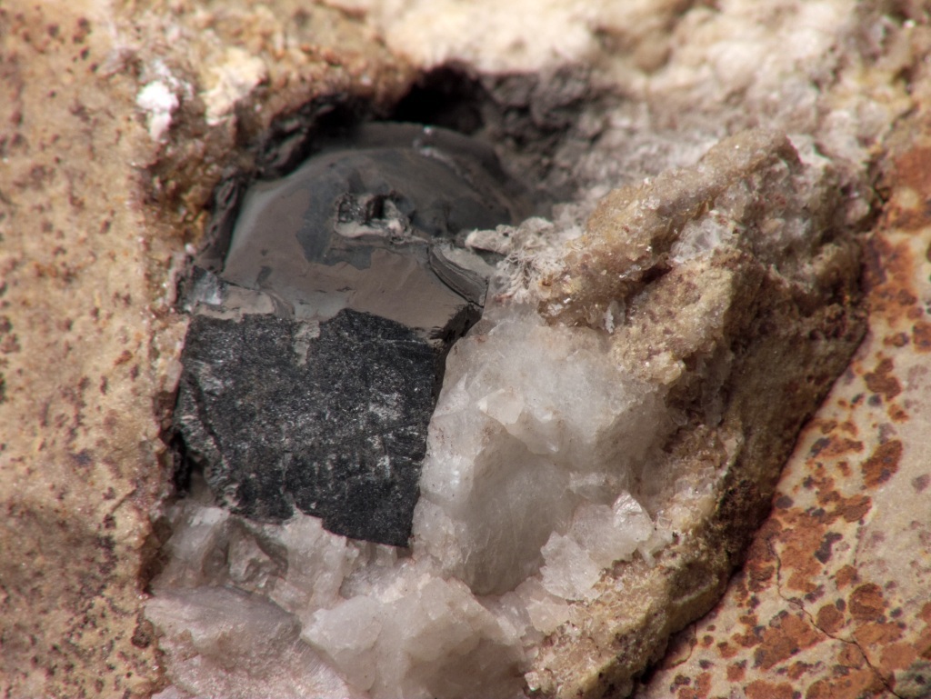
| Species: | Galena |
| Formula: | PbS |
| Confirmation |
|---|
|
| Validity: | Believed Valid |
| Associated Minerals Based on Photo Data: |
|---|
|
| Calcite | ⓘ2 photos of Galena associated with Calcite at this locality. |
| Baryte | ⓘ2 photos of Galena associated with Baryte at this locality. |
| Data |
|---|
|
| Mineral Data: | Click here to view Galena data |
| Locality Data: | Click here to view Old Mines area, Bliss, Washington County, Missouri, USA |
| Data Identifiers |
|---|
|
| Mindat Occurrence Record ID: | 209697 |
| Long-form Identifier: | 1:3:209697:1 |
| GUID (UUID V4): | 6c0b55b7-641a-4f6f-b817-40f189d487e1 |
| Localities for Galena in this Region |
|---|
|
| State highway 47 roadcut, Old Mines area, Bliss, Washington County, Missouri, USA |
| Nearest other occurrences of Galena |
|---|
|
|
| 2.0km (1.2 miles) | ⓘOld Mines Mine, Washington County, Missouri, USA |
| 3.6km (2.3 miles) | ⓘShibboleth Mine, Cadet, Washington County Barite Mining District, Washington County, Missouri, USA |
| 5.6km (3.5 miles) | ⓘArnault Branch, Washington County, Missouri, USA |
| 5.9km (3.7 miles) | ⓘCadet Barite Mine, Cadet, Washington County Barite Mining District, Washington County, Missouri, USA |
| 6.3km (3.9 miles) | ⓘG.P. Materials South Quarry, Washington County, Missouri, USA |
| 6.7km (4.2 miles) | ⓘWashington County Aggregates Quarry, Washington County, Missouri, USA |
| 6.7km (4.2 miles) | ⓘBuckman Laboratories Inc., Washington County, Missouri, USA |
| 7.3km (4.5 miles) | ⓘKeyes Branch, Washington County, Missouri, USA |
| 7.7km (4.8 miles) | ⓘBlackwell area, Washington County, Missouri, USA |
| 7.7km (4.8 miles) | ⓘPotosi Barite Mining District, Washington County, Missouri, USA |
| References |
|---|
|
|
| Reference Search (possible matching items) |
|---|
 | | Report (volume) | | in a major productive area UNITED STATES GOVERNMENT PRINTING OFFICE, WASHINGTON : 1964 UNITED STATES...mines_______________________________________ Boulder CountY----------------------------------~-----------Jamestown... CONTENTS IV Description of principal mines-Continued Boulder County-Continued Other areas __________________________...Moore______________________________ Clear Creek CountY------------------------------------------Idaho...__________ ------_____________________ 71 72 Gilpin CountY-----------------------------------------------Central |  | | Report (volume) | | of Documents, U.S. Government Printing Office Washington, D.C. 20402. Price $4.75 (paper cover) CONTENTS...obtained by writing to the U.S. Geological Survey, Washington, D.C. 20242. The principal contributors to this...published by the American Geological Institute. Washington, D.C. , Acta Cryst. - Acta Crystallographica... BIBLIOGRAPHY OF NORTH AMERICAN GEOLOGY, 1966 Alaska Div. Mines pnd Minerals Geochem. Rept. - State of Alaska Department...Resources, Division of Mines and Minerals Geochemical Report. Juneau, Alaska. Alaska Div. Mines and Minerals Geol |
|


State highway 47 roadcut, Old Mines area, Bliss, Washington County, Missouri, USA