 | | Journal (article/letter/editorial) |
| long rectangular building at center of complex. Argentine shaft house (with a \tair-stepped roof line. stepping...back and above Argentine shaft house. Photo hy Uycrs, CB.1904. courtcs\ Ouraj County Historical Society...campaign (Nevins Figure 2. Map of the Telluride district showing the principal veins, adits, and shafts...researches Colorado ‘s geology, mineralogy, and mining history, is part owner of FRS Geotech, Inc., an...historic preservation efforts in the Leadville mining district. Downloaded by [UZH Hauptbibliothek / Zentralbibliothek |
 | | Report (volume) |
| Bulletin 732 GEOLOGY AND ORE DEPOSITS OF SHOSHONE COUNTY, IDAHO BY JOSEPH B. UMPLEBY AND E. L. JONES...Creek______ ___________ Other lead-silver lodes of Shoshone County_______ 70 82 84 Pine Creek________________________...Interstate-Callahan mine_________________ Success mine __________________________ Rex mine____________________________...deposits to other deposits in the Coeur d'Alene district ___________________ 120 Antimony deposits_____...ILLUSTEATIONS. Pa pe PLATE. I. Geologic map of Shoshone County_________ ____ In pocket. II. Geologic |
 | | Journal (issue) |
| R. Kampf Natural History Museum of Los Angeles County George Robinson National Museums of Canada Arthur...the “famous locality” series: the Home Sweet Home mine and Mount Antero. A fine mineralogical study of...you belong to, and where you come from. American mining schools and professional organizations have long... centering on some of the nostalgic aspects of mining in Arizona and beautifully illustrated with paintings...“Missing and presumed lost” by the wellknown lost-mine author Kearney Egerton; “El Dorado’s children” by |
 | | Report (issue) |
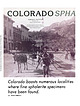
| zinc, tungsten, and copper. In 1896 world-renowned mining engineer Thomas ''T.A." Rickard called the San...San Juans one of Colorado's four great mining regions along with Leadville, Cripple Creek, and Central City...during the eighteenth century, were the first to mine in the San Juans. One of the earliest recorded expeditions...Rockies, but as areas such as Central City and Idaho Springs were "staked out," prospectors fanned out...Above: August sunrise on middle Blue Lake, Ouray County Photo Jack Brauer/WideRange Photo LLC, 2010 Facing |
 | | Journal (article/letter/editorial) |
| noted Figure 1. Camp Bird mine, level 2, Sneffels district, Ouray County. Raines-Pettem collection,...from the Leadville district, with another 50 million pounds mined in San Juan County (Henderson 1926).... During the twentieth century, the Gilman district surpassed Leadville in total copper production with...the Eagle mine’s (Gil304 ROCKS & MINERALS man district) production. This does not mean that copper has...chimneys are limited to the Red Mountain district in Ouray County. Figure 2. Colorado mineral belt (COMB) |
 | | Report (issue) |
| Generalized rock types of central Colorado, and mining districts and mineralized areas of central Colorado............................................... 9 Mining districts and geologic formations associated with.............................................. 11 Mining districts and rock units associated with the element.............................................. 13 Mining districts and rock units associated with the element.............................................. 15 Mining districts and rock units associated with the element |
 | | Report (issue) |
| Geological Survey Board and the Colorado Metal Mining Fund ~ oopr is PUBliC P[O'J>ERTY aud 1• DOt ~re~~o~...__________________________________________ _ 1 Summary of mining districts---.---------------------Introduction..._ Metamorphic rocks ________________________ _ Idaho Springs formation _______________ _ Swandy ke hornblende...Pre-Cambrian deposits _________________________ _ Mine descriptions __________________________ _ 39 39...disseminations_ Cotopaxi mine _____________________ _ Copper deposits in Jefferson County __ _ F. M.D. property |
 | | Journal (article/letter/editorial) |
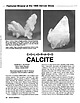
| inches; a floater specimen, Cross vein, Idarado mine, Ouray and San Miguel countries. Figure 2 (right)... Howard, Fremont County. C-O-L-O-R-A-O-O CALCITE BARBARA L. MUNTYAN Ouray County Museum Ouray, Colorado...Tennessee; the Viburnum Trend district, southeastern Missouri; the Tri-State district (Missouri-Kansas-Oklahoma);...marble (from the Yule quarry at Marble in Gunnison County) that has been used for many of the great monuments...Calcite occurs in significant amounts in many of the mining districts of the Colorado mineral belt. [The Colorado |
 | | Report (issue) |
| description of the geology, mining history, and production of the major gold-mining districts in 21 States...relations ---------------------------History of gold mining and trends in production_ J\labama -----------...--------------Cleburne County ----------~----------------- Tallapoosa County --------------------------Alaska...------------------Cochise County -----------------------------Gila County --------------------------------Greenlee...ee County ----------------------------R[aricopa County ----------------------------R[ohave County -- |
 | | Report (issue) |
| Geology of the Coeur dl\lene District Shoshone County Idaho GEOLOGICAL SURVEY PROFESSIONAL PAPER ...' . Geology of the Coeur di\lene District Shoshone County Idaho By S. WARREN HOBBS, ALLAN B. GRIGGS...world's largest lead-, zinc-, and silverproducing mining districts UNITED STATES GOVERNMENT PRINTING OFFICE...Subdivisipn of the Belt Series in the Coeur d'Alene district _____________________________________ _ Correlation...the Belt Series in and around the Coeur d'Alene district ________________________ _ Problems in mapping |
 | | Journal (article/letter/editorial) |
| Investigation of Gilley Fluorspar Deposits in Cherokee County, Alabama, by James F. O'Neill. It is interesting... 50 miles northeast of Birmingham, in Cherokee County, located in West 1/2, West V2 of Section 16, Township...crystal'ized cinnabar which comes from the Culver-Baer mine, Sonoma Co., Calif. Colorado—An interesting article...Mich.) The Micanite pegmatite district lies across the Park-Fremont County line in south-central Co'crado...village of Micanite. The pegmatite of the Micanite district contains unusually large 378 ROCKS AND MINERALS |
 | | Journal (article/letter/editorial) |
| Elmwood, Tennessee; the mines of the Tri-State district of Missouri-OklaDownloaded by [University of Nebraska...Barbara L. Muntyan, former director of the Ouray County Museum in Ouray, Colorado, is a frequent contributor...Portland mine, Ouray County 2. Camp Bird mine, Ouray County 3. Idarado mine, San Miguel County 4. Bachelor...Bachelor mine, Creede, Mineral County 5. Bulldog mine, Creede, Mineral County 6. Grizzly Bear mine, Ouray...Ouray County 7. Eagle mine, Gilman, Eagle County One of the most common sulfide minerals in Colorado and |
 | | Journal (article/letter/editorial) |
| vein formationat Ca- mineralization in the Rico district, and to look for sapalca,Peru. Minor magmatic...interactionamongthese fluids in also been detected in the Creede district, Colorado the hydrothermalsystem.Oxygen and hydrogen...porphyrymineralization. Geologyof the Rico District The Rico district(Fig. 1) is locatedin the western San...Juanvolcanic field. From 1879 through 1968 the district produced 76,064 metric tons of lead, 75,309 tons...McKnight (1974). Excellent geologic mapsof the district are provided by Pratt et al. (1969) and McKnight |
 | | Report (issue) |
| Geology and Ore Deposits of the Rico District, Colorado GEOLOGICAL SURVEY PROFESSIONAL PAPER 723...723 Geology and Ore Deposits of the Rico District, Colorado By EDWIN T. McKNIGHT GEOLOGICAL SURVEY ...------------------------------------Location and geography of district -----------History --------------------------...Louis tunnel ----------------------------Rico Argentine group -----------------------Log Cabin (Blackhawk)...----------Blacksmith tunnel ----------------------Argentine tunnel -----------------------Rico Consolidated |
 | | Report (issue) |
| GEOLOGY AND ORE DEPOSITS OF THE OCEUR D'ALENE DISTRICT, IDAHO BY RANSO~IE FREDERICK LESLIE AND FRANK CATHCART...Outline of the geography and geology of northern Idaho and adjacent parts of Montana and Washington __.... ..... . . 65 Structural subdivisions of the district. . ................................•.. .. ......-Structure-Continued. Structural subdivisions of the district-Continued. Page. Southeastern area ... _. ___..._________ . _..... __ ._ .... _.... __ 78 History of mining development .. ______ .. ___ . __________ . _______ |
 | | Report (issue) |
| 1. 2. 3. 4. 5. A sbestos ore Lead ore, Balmat mine, N . Y. Chromite-chromium ore, Washington Zinc ore...Survey in accordance with the provisions of the Mining and Minerals Policy Act of 1970 (Public Law 91-631...discovered or not presently profitable to mine. The mining of mineral deposits, once discovered, depends...groups of vanadate deposits, those in the Otavi district, Namibia (formerly South-West Africa), and those...Wulfenite was an ore mineral at the St. Anthony mine, Arizona (Creasey, 1950), and in some deposits in |
 | | Book (volume) |
| ...........................................139 Idaho...................................................rights, so remember you were told. If in doubt, a county map will tell you who the legal owner is. Good...gemmy qualities for cutting and polishing. AUTAUGA COUNTY PRATTVILLE, N. 6 mi., and just E of the Birmingham...were well known to prehistoric Indians.) BARBOUR COUNTY BAKER HILL, SE 1 mi. : 1 in a deep ravine, as a...deep red to variegated⎯ocher. BIBB COUNTY GENERAL AREA: c county gravel pits along the Cahaba R.⎯gemmy |
 | | Report (issue) |
| San Isabel and White River National Forests Lake County Land Exchange Offer (Iocmin40) ......................... 47 White River National Forest Dillon District Land Exchange Joint Venture (Iocmin38) .................................................. 137 Shoshone National Forest Dunrud Land Exchange Offer (Iocmin47)...mines and prospects and locations of Parcels A-D. Mine and prospect locations from USGS (1998a,b) .......National Forests Lake County Land Exchange Offer 1. Exhibit A: Property that Lake County will consider exchanging |
 | | Journal (article/letter/editorial) |
| 11 October 2014 A Historical Overview of t h e District and the Smuggler Union and Associated Mines and...history have called Leadville the quintessential mining camp of the frontier. If that is true-and it probably...Telluride was the scene of many encounters that the mining frontier had with its own destiny. From its struggle...here, too, the goals of frontier precious-metal mining shifted in midtwentieth century as the quest for...125 years of mining, are still capable of inspiring wonder at the inventiveness of the mining men and road |
 | | Report (issue) |
| GEORGETOWN QlJADRANGLE (TOGETHER 'VITH THE EMPIRE DISTRICT) COLORADo· BY JOSIAH E. SPURR AND GEORGE H............................................... Evolution of the topographic forms ........................ . . . . . . . . . . . . . . . . . . . . . 97 Idaho Springs auriferous area. __ ............. _.. _...Boulder County.............. . . . . . . . . . . . ......... . ....... . 103 Ores in Gilpin County .......Creek County ............................ . 103 Ores from the Argentine to the Tenmile district .. : |
 | | Book |
| enter must be obtained to prevent trespass. Old mine workings are dangerous and entering underground...oFtne ato aa Gem Ghd nQkTeane Uva a nes ly ia" mine Ui nrobs inesob cere ts ou ioe tok us 'aaieomolitt...exception of the rhodochrosites of the Sweet Home Mine, Alma, Colorado, which were loaned for photography...and the Central Mining District, Grant County Burro Mountains Apache No, 2 District Lake Valley Caballo...Mountains Chloride District Hansonburg District Socorro Area New Placers District Grants Area Nacimiento |
 | | Journal (article/letter/editorial) |
| Introduction depositsin pipesin the Red Mountain district were minedfor oresvaluedin excess of $10million(Fisher...Productionfrom theseveins Most samples are from the Idarado mine and were exceeds$300 million (Burbankand Luedke...detailedstudiesunder1448 FLUID INCLUSION way by the Idarado Mining Companyand Frederick S. Fisher, U.S. GeologicalSurvey...andcanyon about2,200 feet (670 m) thick in the mine area and cutting." dipsabout5øE. Lava flows,breccias...typesof fluid inclusions have Idaratio mine; 2, Camp Bird mine. (After Burbank and breccia pipes studied |
 | | Report (issue) |
| Replacement Deposits Part II Gold in the Tintic Mining District, Utah By HALT. MORRIS Gold Deposits in the...Bird Mining Districts, San Juan Mountains, Colorado By FREDERICKS. FISHER Gold in the Alma Mining District...R. SHAWE Precious Metals in the Leadville Mining District, Colorado By TOMMY B. THOMPSON Part I is Chapter...bibliographies. Contents: pt. 1. Bald Mountain gold mining region, northern Black Hills, South Dakota / by...Tintic Mining District, Utah / by Hal T. Morris. Gold in the Sneffels-Telluride and Camp Bird mining districts |
 | | Report (volume) |
| it helpful to refer to Survey Bulletin 507, "The mining districts of the western United States," and to...abundant, it may have been completely exhausted by mining or quarrying. Deposits of minerals of wide distribution...because they occur in sufficient quantity to warrant mining for their usual products but because they furnish...See Bauxite and Hallpysite. Asbestos. Tallapoosa County, with corundum deposits near Dudleyville; not found...commercial quantity or quality. Asphalt. Colbert County, small quantity has been shipped from near Leighton; |


