 | | Journal (article/letter/editorial) | | NORTHEASTERN RHODE ISLAND 286 ROCKS AND M I N E R A L S The adjacent towns of Cumberland and Lincoln...northeastern Rhode Island offer col lecting in several localities, including the Conklin Limestone quarry, the...the Old Dexter quarry, Diamond Hill, the Route 114 road cut, and the Iron Hill mine. T H E T O W N S H...northeast corner of Rhode Island is not so famous mineralogically as Cumberland in England; however,...both the state mineral and the state rock of Rhode Island. Much of this area coincides with the Pawtucket |  | | Book (volume) | | in the production of clays. Lesser production of iron, petroleum, natural gas and coal from thick beds...chert, translucent chalcedony, jasp-agate and common opal, rivaling in beauty the Arizona agatized wood. This...the western counties, especially the Clay Center Quarry 12 miles southeast of Toledo but in Ottawa Co....ASHTABULA COUNTY CONNEAUT, area pits, quarries, rd. cuts, etc.⎯cone-in-cone Calcite. CLERMONT COUNTY MILFORD...CLINTON COUNTY WILMINGTON, area of Todd’s Ford, a mineral deposit⎯Hematite. COSHOCTON COUNTY AREA, townships |  | | Book (volume) | | in the production of clays. Lesser production of iron, petroleum, natural gas and coal from thick beds...chert, translucent chalcedony, jasp-agate and common opal, rivaling in beauty the Arizona agatized wood. This...the western counties, especially the Clay Center Quarry 12 miles southeast of Toledo but in Ottawa Co....ASHTABULA COUNTY CONNEAUT, area pits, quarries, rd. cuts, etc.⎯cone-in-cone Calcite. CLERMONT COUNTY MILFORD...CLINTON COUNTY WILMINGTON, area of Todd’s Ford, a mineral deposit⎯Hematite. COSHOCTON COUNTY AREA, townships |  | | Report (volume) | | ........................................... Rhode Island...............................................deposits of some others, such as clay, coal, and iron ore, are mentioned only in general terms. One material...Albany. North Carolina_.Dr. Joseph Hyde Pratt, Chapel Hill. North Dakota_.Dr. A. G. Leonard, Grand Forks. Mr...University, South Bethlehem. Rhode Island__Prof. C. W. Brown, Providence. South Carolina__.Dr. Earle Sloan...See Bauxite and Halloysite. Asbestos. Tallapoosa County, with corundum deposits near Dudleyville; not found |  | | Report (volume) | | deposits of some others, such as clay, coal, and iron ore, are mentioned only in general terms. One material...North Carolina.. .Dr. Joseph Hyde Pratt, Chapel Hill. North Dakota... .Dr. A. G. Leonard, Grand Forks...Florence Bascom, Bryn Mawr. Rhode Island.... .Prof. Charles W. Brown, Providence. South Carolina.. .Dr. Earle...See Bauxite and Hallpysite. Asbestos. Tallapoosa County, with corundum deposits near Dudleyville; not found...commercial quantity or quality. Asphalt. Colbert County, small quantity has been shipped from near Leighton; |  | | Journal (article/letter/editorial) | | be recorded." Pala is in northwestern San Diego County of Southern California. COLORADO: Prof. Richard...specimen came from Iron Hill, New Castle Co., Del. Writes Mr. Pickett: "Iron Hill and Mine Hill are one and...and the same with Iron Hill being the proper name. The U. S. Geological Folio, Elkton-Wilmington N o . 211...211 says that Iron Hill and Chestnut Hill were worked as early as the 18th century and as late as 1891...occur at the abandoned Laurel Creek corundum mine in Rabun County, where it is associated with corundum. The |  | | Book (volume) | | chalcedony, jasper and gem petrified wood. BUFFALO COUNTY KEARNEY, area gravel bars and pits along the Platte...petrified wood. CASS COUNTY WEEPING WATER, SE, on rd. to Nehawka, in the Snyderville Quarry chalcedony, jasper...jasper, fossils. CHERRY COUNTY VALENTINE, in the Sandhills county along the Niobrara R. and Minnechaduza...gem qualityagatized and opalized wood. DAWES COUNTY CHADRON, in N part of Co. and as far W as Crawford...cuts, cut banks, breaks, draws and washes, gullies, hill slopes, etc.chalcedony roses, Celestite crystals |  | | Book | | heart of a tree had jet. the cavity is filled with opal a form nite, < trous uncrystallised silica, contatninj...Clay, AnthraGraphite, Coal, Peat, Mercury, Copper, Iron, Lead, Zinc, Manganese ; and, of the stones used...of Saratoga in Now York, by Doct. John H. Steel. county A (Steel.') 1822." (N. G.) " New Farmer and...for Pyrites, Coxcomb, read Radiated Sulphurtt of Iron. 7, under TOPSHAM, after Epidote, dele Manganesian...detached masses on Penobscot Micaceous Oxide of Iron, near. (C.) 1 river. near Bath. MAINE. BOWDOIN |  | | Book (volume) | | Plains state varies from nearly level farmland to hill ridges, increasing steadily in elev. From 1,000’...instance, a single Spodumene crystal from the Etta Mine near Keystone on the east side of the Mount Rushmore...production of minerals, principally Gold, Silver, Copper, Iron, Lead, Manganese and Zinc, along with lesser amounts...beds, excavations, etc.Selenite roses. BRULE COUNTY AREA: in the Oacoma zone of the Pierre Fm. On Elm...gray Barite rosette up to 5 or 6 inches. CAMPBELL COUNTY MOUND CITY, W to the Missouri R., regional hillsides |  | | Book (edition) | | though the more exten sive deposits, such as coal and iron fields, gold belts, etc., are mentioned in general...mmed at Broken Arrow aud Trout creek, in Sc. Clair county. The strata in this field are more faulted und...prong of Canoe creek, in St. Clair county, to Ha\sop creek, in Bibb county, a distance of 60 miles. Down to...to Helena, in Shelby county, the field has an average width of 5 or 6 miles. Below that point the width...miles being in the latitud" of Blocton, in Bibb county. The south ern end of this field has a greater |  | | Book (edition) | | MARIN COUNTY FREE LIBRARY 3 1111 00289 4184 \ I s Fifth Revised Edition A complete, state-by-state...North Carolina, a big diamond or two in Arkansas, opal in Idaho, and so on. Old locations suddenly are...Derbyshire or, perhaps, a pyramid of smoky quartz from Cumberland. The next it may be rock crystal from Madagascar...eye of the microscope. A few gem materials notably opal and obsidian are amorphous, lacking crystal structure...tougher than their crystal countertery, like the cast iron. part, quartz. Luster Most gem stones have a |  | | Book | | volume is dedicated is four-fold: (1) To locate by mine, deposit, or community those mineralized areas of...Co. Hematite CALERA, Shelby Co. Wavkllite CLAY COUNTY, Sec. 24. T. 19 S R., 7 E. STATUARY, Coosa Co...Co., (W. border of* Marble Crystalline TALLADEGA COUNTY Marble, (crystalline) VALLEY HEAD, DeKalb Co. Hematite...VILLAGE SPRINGS, Blount Co. Hematite WOODS COPPER MINE, Cloaburne Co. Sphalerite ARIZONA COVEI.I.ITE...Feldspar HISSOP, Coosa Co., (near) Beryl JACKSON COUNTY Hematite KENNEDYS, Clay Co., (near) Magnetite MILLERVILLE |  | | Book | | HfiRIN COUNTY FREE LIBRfiRY 311110G386652Q I V Russell P MacFal A COLOR TREASUF FOR COLLECTORS...it a veritable not just a picof informa- is mine tion, telling everything the collector needs to...are 100 maps geared to leading the "hunter to his quarry" and more than eighty photographs of minerals in...to Hunting Locations ? i 9 GIVEN TO THE MARIN COUNTY LIBRARY BY MARI N L MTNF.RAT. SOCTETY DAVID...you can use a mountaineering bag or a mili- quarry or mine where a permit tary bag; make it it should | | | Book | | not just a picture book. Rather, it is a veritable mine of information, telling everything the collector...100 maps geared to leading the " hunter to his quarry" and more than eighty photographs of minerals in...easier for you If you plan to vIsIt an operating quarry or mine where a permll Is required make the necessary...LAKE BAILEY N I DELAWARE MINE DUMPS IOATOUTE CHLORASTROUTEI 2 AMYGDAlOID MINE DUMPS 3 AGATE HARBOR (AGATES...(AGATES THOMSONITE ON BEACH\ )l MUD VLAKE TO MANDAN MINE - HARD SURFACE Field drawing to locate a collecting |  | | Book (volume) | | geologic ages and under varied conditions: the Cumberland Plateau, the Appalachian Valley, the Appalachian...Dahlonega Co. and Rabum Co., and the McDuffie County Belt extending through portions of McDuffie, Warren...Sphalerite. BALDWIN COUNTY MILLEDGEVILLE, at state farmjasper. BANKS COUNTY COMMERCE, along Hwy. 59...along adjoining Co. linerock crystal. BARROW COUNTY WINDER, along rd. to Jefferson and 1½ mi. inside...Guide for Rock Hounds in the United States BARTOW COUNTY AREA, Saltpeter Cave, as floatjasper. CARTERSVILLE: |  | | Book (volume) | | Where & How to Djg, Pan and Mine Your Own Gen1s & Minerals Where & I-low to 1-Iunt for Treasure From...vacation stops at a roadside "dig your own" gem mine. Junior finds a sapphire the size of a p ach and...) Many an unsuspecting tourist has stopped at a mine to try his or her luck and become a rockhound for...Hampshire New Jersey Nev,, York Ohio Pennsylvania Rhode Island Vermont Wisconsin s:t" UJ ~ :::> ..J 0 ...GUIDES TO THE U.S.A. W11ere & How to Dig, Pan, and Mine Your Ow11 Gems & Minerals VOLUME 3: SOUTHEAST STATES |  | | Book (volume) | | 600 to 800 feet thick in the north. ALEXANDER COUNTY FAYVILLE, area stream gravels⎯agate, jasper, rare...⎯agate, jasper; d RR siding of Clay⎯agate. CALHOUN COUNTY AREA, shores of the Mississippi R., in the Warsaw...crystals). CRAWFORD COUNTY PALESTINE, area deposits⎯Siderite. EDWARDS COUNTY AREA, T. 1 S, R. 10 E...deposits⎯Siderite. FULTON COUNTY FARMINGTON, W 6 mi. on Rte. 116 to the Rapatee No. 5 strip mine⎯pyritized gastropods...gastropods (Pennsylvanian age). GRUNDY COUNTY AREA: c Regional rd. and RR cuts and banks of Mason Cr.⎯fossils; |  | | Book (volume) | | 600 to 800 feet thick in the north. ALEXANDER COUNTY FAYVILLE, area stream gravels⎯agate, jasper, rare...⎯agate, jasper; d RR siding of Clay⎯agate. CALHOUN COUNTY AREA, shores of the Mississippi R., in the Warsaw...crystals). CRAWFORD COUNTY PALESTINE, area deposits⎯Siderite. EDWARDS COUNTY AREA, T. 1 S, R. 10 E...deposits⎯Siderite. FULTON COUNTY FARMINGTON, W 6 mi. on Rte. 116 to the Rapatee No. 5 strip mine⎯pyritized gastropods...gastropods (Pennsylvanian age). GRUNDY COUNTY AREA: c Regional rd. and RR cuts and banks of Mason Cr.⎯fossils; |  | | Journal (issue) | | R. Kampf Natural History Museum of Los Angeles County George Robinson National Museums of Canada Arthur...localities: the mineralogy of Graves Mountain, Lincoln County, G eorgia........................................Simmons & F. J. Wicks Calcioferrite from the Moculta quarry, near Angaston, South Australia .................chalcopyrite, from the Sweetwater mine, Ellington, Reynolds County, Missouri. Collection of Maudine and...Mineralogical Club field trip to Penitentiary quarry, Snake Hill, New Jersey, on September 4, 1893 (photo |  | | Journal (issue) | | MONTHLY CONTENTS FOR JUNE, 1937 Chips from the Quarry ........................................................................ A collecting trip to Cumberland and Durham Counties, England in 1912. By Paul.............................. A visit to an amber mine in East Prussia. By Miss Gertrude Schmidt ........Aaodatlon 162 ROCKS and MINERALS - CHIPS FROM THE QUARRY (Formerly the Bullettin Board) R. E. Myers to Represent...In due time. Ten mineral collectors hiked to a mine One fell down a shaft then there were nine. Extensive |  | | Book | | Hole 15 Northwest Darwin Hills 15 Christmas Gift Mine 15 Rainbow Ridge 17 Opalite 17 Sheep Springs 18...El Paso Mountains 20 Ricardo Basalt 20 Cowden Opal Mine 20 Hidden Forest 20 Ricardo Gem Fields 20 (map...Buried Petrified Forest 23 Canyon View Wood 23 Jasper Hill 24 Rand Mountains Minerals and Rhodonite 24 Bedrock...Sperry Wash Kingston Amethyst Tecopa Opal Soda Mountains Copper Toltec Mine Clark Mountain Afton Canyon (Canon..."Chapinite" Rainbow Basin Fossils Jasp-agate Hill Black Canyon -- Opal Mountain Boron Kramer Hills Castle Butte |  | | Journal (issue) | | Contents for July. A ug ust, 1949 CHIPS FROM THE QUARRY .................................................········································345 rRON HILL IRON MINE. By C. Henry King ························................................368 NOTED TRUMBULL MINE CLOSED To COLLECTORS ..................................................... ....... 375 SQUAW PEAK MINE. By Edison Thacker ............................... 338 R OCKS AND MINERALS CHIPS ~_, ROM 1,HE QUARRY ----------------------------,----CLUB PUBLICATIONS |  | | Book | | was m e r e l y p a r t o f t h e waste o f t h e mine. W h a t t h e y needed was h i g h grade ore o...Washington D.C. area visit Virginia's noted Rutherford Mine. Photograph by Dr. Virginia Lee Blackford. ical...dollars at the noted locality of Cowee Valley, Macon County, North Carolina. An enthusiastic family found and...trippers visited the well known old Rutherford mine in Amelia County, Virginia, and found bright spessartine...green gem spodumene, was discovered in Alexander County, North Carolina, in 1880 and named for one of its |  | | Book | | commercial ores and secondary minerals by state, county, township, and geologic range. For easy identification...61 232 PART The Making 43 II 5 7 3 III Mine PART 267 IV Glossary 279 Bibliography 291...cities, and many of today’s prosperous western county seats began as mining-boom camps. trating sand...Whether you such as those listed alphabetically by county, township, and range in Part II of this book. Where...minerals which make lovely cabinet specimens. old mine western states, to kick up and oxidation, | 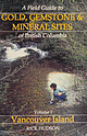 | | Book (volume) | | Mineral Sites of British Columbia Volume I: Vancouver Island LIDAARY Digitized by the Internet Archive In...Mineral Sites of British Columbia Volume I: Vancouver Island Rick Hudson OrCA BOOK PUBLISHERS Copyright...Columbia Includes index. Contents: Vol. I, Vancouver Island ISBN 1-55143-057-6 1. Mines and mineral resources... SI Orca Book Publishers PO Box 468 Custer, WA USA 98240-0468 By esiae) Ye il Front Cover Photo: Panning...producer Blue Grouse Mine shows copper sulphides and carbonates, Lake Cowichan. The mine dump is full of pyrite |
|


