| Locality type: | Mine |
| Classification |
|---|
|
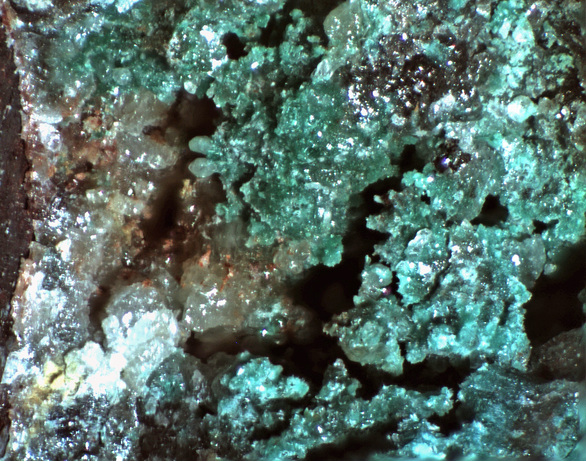
| Species: | Anglesite |
| Formula: | PbSO4 |
| Confirmation |
|---|
|
| Validity: | Believed Valid |
| Associated Minerals Based on Photo Data: |
|---|
|
| Minium | 2 photos of Anglesite associated with Minium at this locality. |
| Malachite | ⓘ2 photos of Anglesite associated with Malachite at this locality. |
| Data |
|---|
|
| Mineral Data: | Click here to view Anglesite data |
| Locality Data: | Click here to view Hilton Mines, Copper Camp, Hilton (Lead Mountain), Empire Mining District, Empire Mountains, Pima County, Arizona, USA |
| Data Identifiers |
|---|
|
| Mindat Occurrence Record ID: | 234633 |
| Long-form Identifier: | 1:3:234633:5 |
| GUID (UUID V4): | 8df10ede-10a1-4052-b1ba-07fd8dd445bf |
| Localities for Anglesite in this Region |
|---|
|
| Prince Mine group, Hilton Mines, Copper Camp, Hilton (Lead Mountain), Empire Mining District, Empire Mountains, Pima County, Arizona, USA |
| Chief Mine (Chief claim), Prince Mine group, Hilton Mines, Copper Camp, Hilton (Lead Mountain), Empire Mining District, Empire Mountains, Pima County, Arizona, USA |
| Gopher Mine (Go Pher Mine), Prince Mine group, Hilton Mines, Copper Camp, Hilton (Lead Mountain), Empire Mining District, Empire Mountains, Pima County, Arizona, USA |
| Nearest other occurrences of Anglesite |
|---|
|
|
| 1.8km (1.1 miles) | ⓘChief Mine (Chief claim), Prince Mine group, Hilton Mines, Copper Camp, Hilton (Lead Mountain), Empire Mining District, Empire Mountains, Pima County, Arizona, USA |
| 2.1km (1.3 miles) | ⓘGopher Mine (Go Pher Mine), Prince Mine group, Hilton Mines, Copper Camp, Hilton (Lead Mountain), Empire Mining District, Empire Mountains, Pima County, Arizona, USA |
| 2.3km (1.4 miles) | ⓘPrince Mine group, Hilton Mines, Copper Camp, Hilton (Lead Mountain), Empire Mining District, Empire Mountains, Pima County, Arizona, USA |
| 3.5km (2.1 miles) | ⓘTotal Wreck Mine, Cienega Creek, The Narrows, Empire Mining District, Empire Mountains, Pima County, Arizona, USA |
| 14.6km (9.0 miles) | ⓘHeavy Weight Mine, Heavy Weight Hill, Helvetia, Helvetia-Rosemont Mining District, Pima County, Arizona, USA |
| 15.6km (9.7 miles) | ⓘGolden Gate Mine group, Rosemont (Rosemont Camp), Helvetia-Rosemont Mining District, Pima County, Arizona, USA |
| 16.3km (10.1 miles) | ⓘArrastra Mine, Greaterville Mining District, Pima County, Arizona, USA |
| 18.8km (11.7 miles) | ⓘSt. Louis Mine (Morning Star Mine; Isabel), St. Louis Gulch, Hughes Gulch, Greaterville placer deposits, Greaterville, Greaterville Mining District, Pima County, Arizona, USA |
| 19.1km (11.9 miles) | ⓘSilver Leaf Mine, Greaterville Mining District, Pima County, Arizona, USA |
| 20.1km (12.5 miles) | ⓘYuba Mine (Inghram Mine), Hughes Gulch, Greaterville placer deposits, Greaterville, Greaterville Mining District, Pima County, Arizona, USA |
| References |
|---|
|
|


Chief Mine, Prince Mine group, Hilton Mines, Copper Camp, Hilton, Empire Mining District, Empire Mountains, Pima County, Arizona, USA