| Classification |
|---|
|
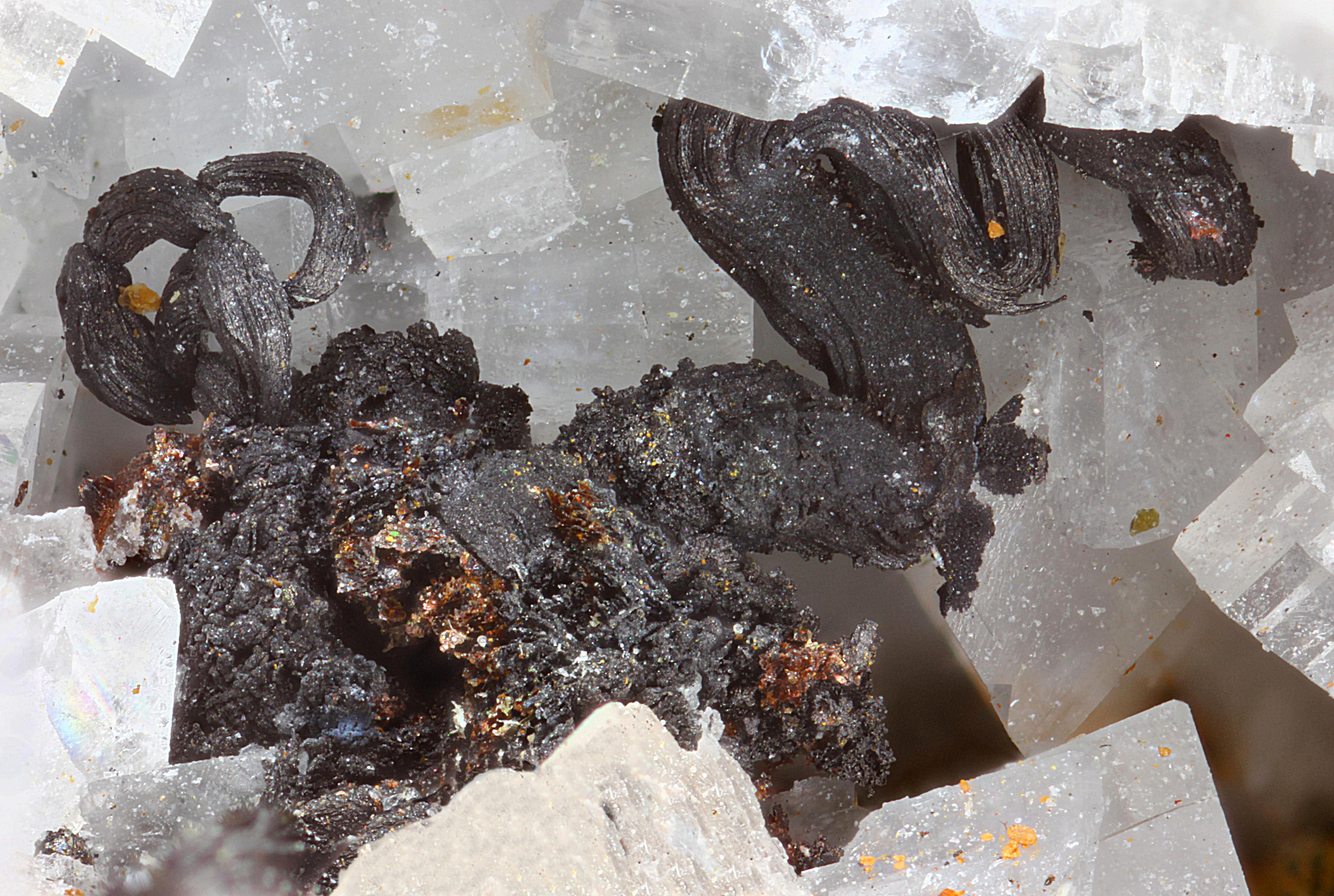
| Species: | Silver |
| Formula: | Ag |
| Confirmation |
|---|
|
| Validity: | Believed Valid |
| Data |
|---|
|
| Mineral Data: | Click here to view Silver data |
| Locality Data: | Click here to view Totenkopf (incl. Lower Riffl glacier), Uttendorf, Zell am See District, Salzburg, Austria |
| Photo Gallery | View Gallery (2 photos) |
| Data Identifiers |
|---|
|
| Mindat Occurrence Record ID: | 238395 |
| Long-form Identifier: | 1:3:238395:8 |
| GUID (UUID V4): | d3d32b0a-6151-423f-a451-ba100476556c |
| Nearest other occurrences of Silver |
|---|
|
|
| 11.4km (7.1 miles) | ⓘLeiter valley, Winkl, Heiligenblut am Großglockner, Spittal an der Drau District, Carinthia, Austria |
| 11.5km (7.2 miles) | ⓘKloben gold mines (south slope), Heiligenblut am Großglockner, Spittal an der Drau District, Carinthia, Austria |
| 11.7km (7.3 miles) | ⓘGold mines, Kloben (north slope), Fusch an der Grossglocknerstrasse, Zell am See District, Salzburg, Austria |
| 12.6km (7.8 miles) | ⓘBrennkogel north slope (Gold district), Fusch an der Grossglocknerstrasse, Zell am See District, Salzburg, Austria |
| 16.4km (10.2 miles) | ⓘWestern ore field, Mittersill Scheelite deposit, Mittersill, Zell am See District, Salzburg, Austria |
| 22.3km (13.8 miles) | ⓘGold mine (Goldzeche), Zirmsee area, Heiligenblut am Großglockner, Spittal an der Drau District, Carinthia, Austria |
| 25.1km (15.6 miles) | ⓘTrömmern, Große Zirknitz valley, Zirknitz, Großkirchheim, Spittal an der Drau District, Carinthia, Austria |
| 26.1km (16.2 miles) | ⓘAugustin adit, Rauriser Goldberg, Kolm-Saigurn, Alteck - Hoher Sonnblick area, Rauris, Zell am See District, Salzburg, Austria |
| 26.1km (16.2 miles) | ⓘNeubauhaus, Kolm-Saigurn, Alteck - Hoher Sonnblick area, Rauris, Zell am See District, Salzburg, Austria |
| 26.5km (16.5 miles) | ⓘSlag localities, Kolm-Saigurn, Alteck - Hoher Sonnblick area, Rauris, Zell am See District, Salzburg, Austria |
| References |
|---|
|
|


Totenkopf, Uttendorf, Zell am See District, Salzburg, Austria