| Classification |
|---|
|
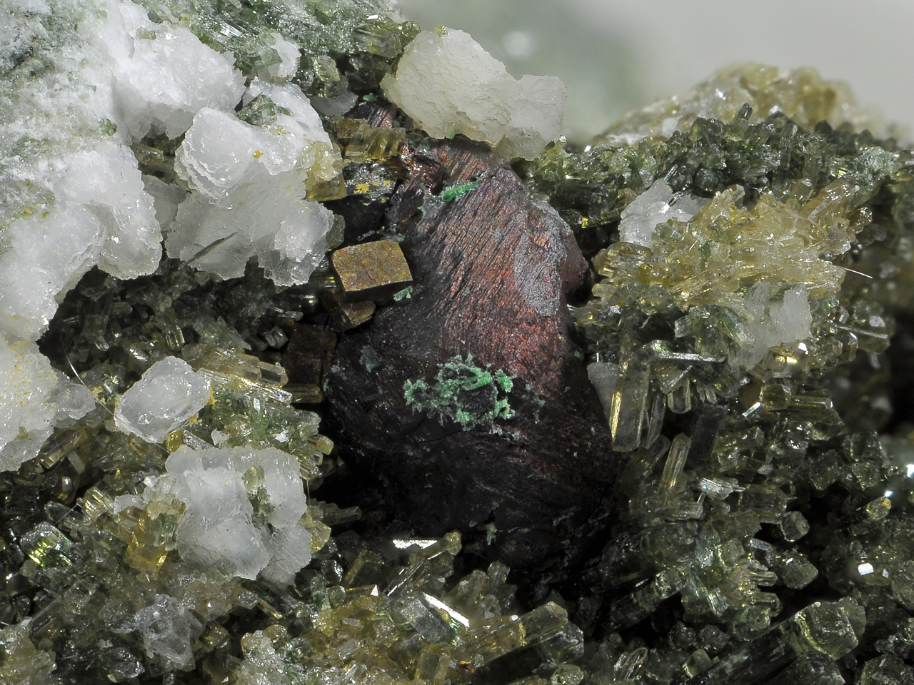
| Species: | Chalcopyrite |
| Formula: | CuFeS2 |
| Confirmation |
|---|
|
| Validity: | Believed Valid |
| Associated Minerals Based on Photo Data: |
|---|
|
| Albite | ⓘ1 photo of Chalcopyrite associated with Albite at this locality. |
| Pyrite | ⓘ1 photo of Chalcopyrite associated with Pyrite at this locality. |
| Epidote | ⓘ1 photo of Chalcopyrite associated with Epidote at this locality. |
| Chrysotile | ⓘ1 photo of Chalcopyrite associated with Chrysotile at this locality. |
| Data |
|---|
|
| Mineral Data: | Click here to view Chalcopyrite data |
| Locality Data: | Click here to view Totenkopf (incl. Lower Riffl glacier), Uttendorf, Zell am See District, Salzburg, Austria |
| Data Identifiers |
|---|
|
| Mindat Occurrence Record ID: | 238406 |
| Long-form Identifier: | 1:3:238406:1 |
| GUID (UUID V4): | 37fc0b0f-4d52-4bb4-9dbd-3a8a57d16edc |
| Nearest other occurrences of Chalcopyrite |
|---|
|
|
| 2.5km (1.5 miles) | ⓘKarling glacier, Kaprun, Zell am See District, Salzburg, Austria |
| 4.3km (2.6 miles) | ⓘSeewände quarry, Tauernmoos lake, Enzingerboden, Uttendorf, Zell am See District, Salzburg, Austria |
| 9.2km (5.7 miles) | ⓘSander lake veins, Pasterze (incl. Pasterzenboden), Heiligenblut am Großglockner, Spittal an der Drau District, Carinthia, Austria |
| 11.5km (7.2 miles) | ⓘKloben gold mines (south slope), Heiligenblut am Großglockner, Spittal an der Drau District, Carinthia, Austria |
| 11.5km (7.2 miles) | ⓘGraulahnerkopf (Graulahnerkogel), Mittersill, Zell am See District, Salzburg, Austria |
| 11.7km (7.3 miles) | ⓘGold mines, Kloben (north slope), Fusch an der Grossglocknerstrasse, Zell am See District, Salzburg, Austria |
| 12.6km (7.8 miles) | ⓘBrennkogel north slope (Gold district), Fusch an der Grossglocknerstrasse, Zell am See District, Salzburg, Austria |
| 14.4km (9.0 miles) | ⓘGold mines, Hirzbach Alp, Fusch an der Grossglocknerstrasse, Zell am See District, Salzburg, Austria |
| 15.0km (9.3 miles) | ⓘMesenaten, Wallackhaus, Heiligenblut am Großglockner, Spittal an der Drau District, Carinthia, Austria |
| 15.1km (9.4 miles) | ⓘGold mines, Schied Alp, Fusch an der Grossglocknerstrasse, Zell am See District, Salzburg, Austria |
| References |
|---|
|
|


Totenkopf, Uttendorf, Zell am See District, Salzburg, Austria