 | | Journal (article/letter/editorial) |
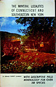
| Sciences University of Wisconsin-River Falls 410 South Third Street River Falls, Wisconsin 54022 his is Wisconsin’s... breweries, bratwurst, and Packers football, Wisconsin also has a diverse geology and a history rich...forgotten, abandoned, and overgrown. In this respect, Wisconsin represents a frontier state for the mineral collector...Vulcan Materials quarry in Racine (Scovil 1994), the pegmatites of Florence County (Koehier 1989) and...summarizes and highlights what has been found in Wisconsin in the past 150 years and points the way to new |
 | | Book |
| Minnesota, Fossil and Mineral Trails Lakes States Wisconsin, Indiana, Illinois, Michigan, by June Culp...knowledge and enjoyment of this great owners, mine and quarry operators and science by collecting. Thanks too...vast mineral deposits were located in northern Wisconsin. The Great Lakes States of the Midwest still have...St. Paul. Minnesota is a Lake Superior State. Wisconsin has shoreline on both Lake Superior and Lake Michigan...rocks scattered in their fields. Stop and look at road cuts, excavations, new construction, and sandy or |
 | | Report (edition) |
| 5 cm tall; gem weighs 2 carats. From the Havey Quarry, Poland, MaifJ. e. Photo copyright 1995 by Wendell...on quartz crystals, 24 x JO mm;Jrom the Bennett Quarry, Buckfield, Maine. Mined in 1996 by Holden !Jrothers...much information on collecting sites in Oxford County. Numerous other collectors of Maine minerals also...labels were added where necessary to show quarry sites, road names, and other useful landmarks. In addition...those which are still open. The words "mine" and "quarry" are often used interchangeably in discussing mineral |
 | | Book (volume) |
| Illinois, the glacial drift of the Late Pleistocene Wisconsin glaciation, the bluffs and detritus of the Ohio...600 to 800 feet thick in the north. ALEXANDER COUNTY FAYVILLE, area stream gravels⎯agate, jasper, rare...⎯agate, jasper; d RR siding of Clay⎯agate. CALHOUN COUNTY AREA, shores of the Mississippi R., in the Warsaw...crystals). CRAWFORD COUNTY PALESTINE, area deposits⎯Siderite. EDWARDS COUNTY AREA, T. 1 S, R. 10 E...E, regional deposits⎯Siderite. FULTON COUNTY FARMINGTON, W 6 mi. on Rte. 116 to the Rapatee No. 5 strip |
 | | Book (volume) |
| Dahlonega Co. and Rabum Co., and the McDuffie County Belt extending through portions of McDuffie, Warren...Sphalerite. BALDWIN COUNTY MILLEDGEVILLE, at state farmjasper. BANKS COUNTY COMMERCE, along Hwy. 59...along adjoining Co. linerock crystal. BARROW COUNTY WINDER, along rd. to Jefferson and 1½ mi. inside...Guide for Rock Hounds in the United States BARTOW COUNTY AREA, Saltpeter Cave, as floatjasper. CARTERSVILLE:...(banded, various colors), jasper. BIBB COUNTY MACON: at Holton Quarry, 7½ mi. NWagate; N of Calloway |
 | | Journal (article/letter/editorial) |
| therrBcromounrersg quartz, laumontite (and what the boys call metamorphosed apophyllite), add to the...said he was the first to find the zeolites in the quarry, that he was at the bottom of the pit when he discovered...Classic Fairgrounds. Its sponsors were the Forsyth County Gem and Mineral Society and the WinstonSalem Mineral...i p Hodges and Bert Vogler from the Woodleaf Quarry (road rock) at Woodleaf, North Carolina. The boys...lives in the Sage Gar den Community of Forsyth County, Route 3, Kernersville, North Carolina. He also |
 | | Report (issue) |
| .....................................4 The Main Road Log — St. Stephen to the Nova Scotia border......................11 The Ledge (Charlotte County Granite) quarry............................................................................14 Tower Hill Road occurrence..............................................................15 Bayside Black Granite quarry..............................................................................17 Digdeguash Lake quarry............................................... |
 | | Report (Issue volume) |
| map required to reach the collecting sites is a road map. For those who wish to use a topographical map...the original occurrence. Socialite from Princess Quarry at Bancroft, Ontario at one time had a considerable...usually good places to search for minerals, also road and railway cuts; rock exposures along cliffs and...Permission should be sought before entering a mine, quarry or other private property; in active mining areas...along the Little River road for a distance of 5 miles to Carrol's farm . The motor road ends here. Follow |
 | | Report (edition) |
| “old” Lime Bluff quarry, Muncy; right fibrous : tremolite, C. K. Williams quarry, Easton: bottom: calcite...oriented coatings of goethite, “old” Lime Bluff quarry, Muncy, (courtesy of Delbert L. Oswald) ADDITIONAL...edition of Mineral Collecting Cedar Hill in quarry where Dave had done IV much of his work PREFACE...permission from the owners of the land, from the quarry or mine operators before entering to collect. (Land...particular site, remember it is possible to visit the county courthouse in which the site is located, and trace |
 | | Report (issue) |
| Canada 1968 - iii - Plate I. Mont St-Hilaire quarry, (GSC 135741) - v - CONTENTS Page Abstract...Kingston - Island of Montreal Kingston township quarry . . . . . . . . . . . . . . . . . . . . . . . ...McFarland quarry .. . . . ..... . . . . . . . . . . . . . .'. . . . . . . . . . . . . . . . . . . Road-cuts...Highway 38... . ... . ... .. . . . . . . . . . . . Road-cuts, mile 5.8, Highway 3 8 . . . . . . . . . .... . . . . . . . . . . . . . . . . . . Limestone quarry, west of Highway 38 . . . . . . . . . . . . . |
 | | Book (edition) |
| from the Principal Localities in the Middlesex County Region in Connecticut Unclassified Material Page...Directions to the Mineral Localities in the Middlesex County Region in Connecticut .... Additional Locality...booklet devoted to the mineralogy of the Middlesex County region. Invaluable assistance in preparing the...m carbonate LAUEITE-Manganese iron phosphate LAUMONTITE-Hydrous calcium aluminum silicate LAZULITE-Basic...found in the aegirite-granite at the Flatrock (Quarry in Waterford. Its color is dull black to brownish |
 | | Report (issue) |
| COVER Left: Weloganite crystals from Francon Quarry, Montreal. Specimen measures 3 cm from tip to base...mangan-neptunite crystals from Mont St-Hilaire quarry. Specimen 22 is cm long. National Mineral Collection...change without notice Plate I Mont St-HilJaire quarry. (GSC 138741) v CONTENTS ix 1 1 3 5 5 6 6...Kingston township quarry McFarland quarry Road-cuts, km 8.2 to 8.4, Highway 38 Road-cuts, km 9.3, Highway...Limestone quarry, west of Highway 38 Freebern mica mine Mobey (Burnham) mine Enterprise mine Sand Road (Card) |
 | | Journal (article/letter/editorial) |
| OF MINERAL COLLECTING By GUNNAR BJAREBY 14 Palace Road, Boston 15, Mass. PART V (Continued from page 462...recovered in recent years. The Palm and Koleh Granite Quarry in Amherst, New Hamphire is located about one mile...garnets, micas, tourmaline and quartz. Granite quarry areas where many other minerals may be found are...there may be others. Yet in almost any granite quarry there might be rare micro crystals, the problem...sponsored field trips was to the old limestone quarry in Bolton. Massachusetts. It was then worked for |
 | | Catalog/List |
| Locality. including name of mine or quarry, nearest town and county, and six figure National Grid Reference...PYROMORPHITE 26 MIMETITE 27 LOWNGITE 28 TURQUOISE 29 LAUMONTITE 30 CHABAZITE 31 APOPHYLLITE 32 HARMOTOME 33 AOULARIA...Loanhead quarry TallskerBay Whyte'a Cleuch Loanhead quarry Port Glasgow Loanheadquarry Loanhelld quarry Loanhead...Loanhead quarry Benalltmlne BMS NATIONAL REFERENCE COUECTION Ecton.Staffs. Ecton.Staffs. Scordale,Cumbria...Trinafour.ScoU. Lochan-na-Lalrigh Loanhead quarry Loanhead quarry Hopeful vein Hopeful vein Ralk's vein Fethaland |
| | Report (issue) |
| without notice $9.00 PlateI Mont St-Hillaire quarry. (GSC 138741) CONTENTS ix | Abstract l Introduction...Kingston township quarry 6 McFarland quarry 7 8 3 Road-cuts, km 8.2 to 8.4, Highway Road-cuts, km 9.3, Highway...Highway 38 Limestone quarry, west of Highway Freebern mica mine 8 y Mobey (Burnham) mine 9 Enterprise... 38 38 Sand Road (Card) quarry 10 Dwyer 1] 1] Godfrey-Westport occurrences Road-cuts at km 4.5...5, Westport Road 12 Kingston (Bedford) mica mine 12 13 14 14 1D 1 16 16 17 Richardson feldspar mine |
 | | Report (Issue volume) |
| map required to reach the collecting sites is a road map. For those who wish to use a topographical map...e original occurrence. Socialite from Princess Quarry at Bancroft, Ontario at one time had a considerable...usually good places to search for minerals, also road and railway cuts; rock exposures along cliffs and...Permission should be sought before entering a mine, quarry or other private property; in active mining areas...feet from the lakeshore, and one just west of the road about 300 feet east of the first occurrence. Medicine |
 | | Book |
| HfiRIN COUNTY FREE LIBRfiRY 311110G386652Q I V Russell P MacFal A COLOR TREASUF FOR COLLECTORS...are 100 maps geared to leading the "hunter to his quarry" and more than eighty photographs of minerals in...to Hunting Locations ? i 9 GIVEN TO THE MARIN COUNTY LIBRARY BY MARI N L MTNF.RAT. SOCTETY DAVID...knapsack you can use a mountaineering bag or a mili- quarry or mine where a permit tary bag; make it it...rapidly, especially when it comes to quarries and road construction To avoid disappointment, go over your |
| | Book |
| 100 maps geared to leading the " hunter to his quarry" and more than eighty photographs of minerals in...easier for you If you plan to vIsIt an operating quarry or mine where a permll Is required make the necessary...rapidly especially when 11 comes to quarries and road construction To avoid disappoint• ment. go over...It is based on the accompanying topographic map. road maps, and collecting experience. For those who have...may be able to buy specimens. = - GAAVEL ROAD ==== DIRT ROAD ROCK SHOP C7 Part of the U.S. Geological |
 | | Report (issue) |
| limestone quarry Phillipsburg marble quarries Les Marbres Waterloo quarry Stukely Sud marble quarry Langlois...Canadian) mine Huntingdon mine Van Reet mine Orford Lake road-cut Castle Brook fossil occurrence Lake Memphremagog...serpentine occurrence Orford nickel mine Orford marble quarry Moe River placer deposit Capelton (Capel), Albert...Hartford, Lower Canada) mine Stanstead granite quarry St. Francis mine Acton mine Jeffrey mine Aldermac...Moulton Hill mine Scotstown granite quarry Mount Megantic quarry Ditton area placer deposits Amold River |
 | | Journal (issue) |
| society members have taken parties into the same quarry or mine to look at the same granite or rock face...Hall, near the junction of Kingsway & Manchester Road on Sunday 19th November 2000. Further Information...dark limestone. Location: Old dump near Backdale Quarry, Calver. Peak Dist. (probably originates from nearby...Survey Office is at: MURCHISON HOUSE, WEST MAINS ROAD, EDINBURGH,EH9 3LA. The Open Day begins at 10.30am...November were devoted to minerals of Coldstones Quarry. Dave Green showed some very good photographic |
 | | Report (issue) |
| deposits Occurrences east of Sudbury Falcon Mine Wanup quarry Elizabeth Mine Wahnapitei occurrences MacDonald...Page occurrence Warren quarry Occurrences along Highway 86 Wanapitei Lake quarry Vermilion River placer...Mine Nickel-copper mines west of Sudbury High Falls Road occurrences Espanola-Manitoulin Island occurrences...occurrence McMillan Mine Wallace Mine Sheguiandah quarry Shakespeare Mine Massey Mine Hermina Mine Elliot...occurrence Tribag Mine Mammoth-Vulcan occurrence Road-cuts, km 77 to km 98 Coppermine Point (Roussainville) |
 | | Journal (issue) |
| any material collected would be decided by the quarry owners and the sub-committee. We need to start... and recognised 5 zones - epidote, prehnite, laumontite, mesolite and carbonate. These zones are roughly...Society Newsletter Issue 40 - March 2002 A recent road cutting south of Tobermory had produced interesting...also occur on the south coast of Ulva and at a quarry near Tiroran. Various exposures along the southern...requirement for essential bulk materials such as road stone, and aggregates for concrete, against the |
 | | Journal (issue) |
| 247 WULFENITE—from level 4 of the 79 mine, Gila County, Arizona. The specimen was collected in 1971 by...identified to: Richard A. Bideaux, 1706 West Grant Road, Tucson, Arizona 85705. Enter miner al name and...Azurite, Leonite Halotrichite, Colemanite, Okenite, Laumontite, Natrolite, Scolecite. RARE or NEW SPEC IES:...Melano phlogite from Mount Hamilton, Santa Clara County, California. Am er Mineral., 57, 1494-1504. GRASSELLINI...south east of Lancaster in Bart Township, Lancaster County, Pennsylvania. The mine was opened in 1732 and |
 | | Report (issue) |
| Bay, Ontario Ottawa to Renfrew area – Highway 17 road log South March feldspar mine March mica mine Humphreys...feldspar mine Currie barite occurrence Pakenham quarry Cedar Hill soapstone occurrence Galetta celestine...Angelstone quarry Tatlock Omega quarry Black Donald mine Renfrew area Jamieson Lime quarry Renprior mine...Jamieson molybdenite mine Easton Minerals quarry Two Island marble quarry Ruby mine McCoy mine v 41 42 44...marble quarry Renfrew–Madawaska area Renfrew County Road 4 (Bruce Avenue) roadcut Highway 60 quarry Jamieson |


