 | | Journal (article/letter/editorial) |
| GRAND, ISLE: L Jirrwowwux/ lot* llMt UK* U'A VERMONT Mineral Locality Index VANDALL T. K I N G P.O....MASSACHUSETTS Figure J. Vermont political divisions map; adapted from U.S. Geological Survey map of New Hampshire...Hampshire and Vermont (1972). 324 ROCKS & MINERALS he state of Vermont is relatively small, but it does have...mining included the exploitation of bog iron ore for the manufacture of nails and simple iron objects....ry in the world is in Rochester (Windsor Co.), Vermont. Min eral products mined "as is" for their final |
 | | Report (volume) |
| DEPARTMENT OF THE INTERIOR UNITED STATES GEOLOGICAL SURVEY GEORGE OTIS--SMITH, DIRECTOR 455 COPPER...COPPER DEPOSITS OF THE APPALACHIAN STATES BT WALTER HARVEY WEED WASHINGTON GOVERNMENT PRINTING OFFICE 1911..._________________________ - _________________ Classification of deposits.!_____________________________ Types di... Occurrence and character of the ores______________ - 15 Origin of ores of the Blue Ridge type____.__________..._ 16 Warren mine ____ 16 Milan mine ____________.._____________________ ._ 18 Lyman mine _______ _ _________ |
 | | Report (issue) |
| 36 REPORT OF THE VERMONT STATE GEOLOGIST Brick Clays As pointed out by the writer,' there are in the...the State tremendous amounts of glacially-transported clays, classifiable as Estuarine Clays, Lake and...indicated by the number of brick dwellings in the country, oftentimes in out-of-the-way places, as well...ljrick Yards REPORT OF THE STATE GEOLOGIST ON THE MINERAL INDUSTRIES AND GEOLOGY OF Considerable brick...Bennington but, as far as the writer is informed, none of these plants is at present in operation. THE DRURY |
 | | Report (issue) |
| REPORT -->/ OF TFIE STATE GEOLOGIST ON THE S 7 Mineral Industries and Geology (9 12 of Certain Areas...Areas -o OF VERMONT. 'I 6 '4 4 7 THIRD OF THIS SERIES, 1901-1902. 4 0 GEORGE H. PERKINS, Ph. D...., State Geologist and Professor of Geology, University of Vermont 4 S 2 5 7 8 9 0 2 4 9 1 T. B. LYON...1NTRODFCTION SKETCH OF THE LIFE OF ZADOCK THOMPSON, G. H. Perkins ----------------LIST OF OFFICIAL REPORTS...REPORTS ON VERMONT GEOLOGY ----------------- -- -- ----LIST OF OTHER PUBLICATIONS ON VERMONT GEOLOGY ------- |
 | | Journal (volume) |
| MOUNTAIN / GEOLOGIST /I QUARTERLY NEWSLETTER OF THE VERMONT GEOLOGICAL SOCIETY / VOLUME 13 NUMBER 1 SPRING...Twenty—three student papers will cover the topics of tectonics, petrology, stratigraphy and sedimentation...Presentation of Student Papers 8:00A.M. Saturday, APRIL 26, 1986 Angell Lecture Center ZUniversity of Vermont...Colchester Avenue one block west of the Medical Center Hospital). Walk south around the Votey Engineering...Mineral of the Quarter . Meetings ........... 23 . . . 2 PRESIDENT'S LETTER On behalf of the Executive |
 | | Report (issue) |
| REPORT OF THE STATE GEOLOGIST ON T H E MINERAL INDUSTRIES AND GEOLOGY OF VERMONT loll - 1912 EIGHTH...EIGHTH OF THIS SERIES GEORGE H. PERKINS State Gcologist and Professor of Geology, Eniversity of Vermont...ACCOUNT OF THE GEOLOGY OF THE GREEN MOUNTAIN REGION, G. H. Perkins....................17 GEOLOGY OF THE STRAFFORD...STRAFFORD QUADRANGLE, C. H. Hitchcock. . 100 THE TERRANES OF IRASBURG, C. H. Rictiardson and E. F. Conway..........14 THE TERRANES OF CRAFTSBURY, C. H. Richardson...........162 THE TERRANES OF ALBANY, C. H. Richardson |
 | | Report (issue) |
| REPORT OF THE STATE GEOLOGIST ON THE GEOLOGY AND MINERAL INDUS1RIE OF VERMONT 1945-1946 I TWENTY-FIFTH...TWENTY-FIFTH OF THIS SERIES Centennial Issue I ELBRIDGE C. JACOBS F.G.S.A. State Geologist •1 REPORT OF...OF THE STATE GEOLOGIST ON THE GEOLOGY AND MINERAL INDUSTRIES OF VERMONT 1945-1946 I TWENTY-FIFTH...TWENTY-FIFTH OF THIS SERIES Centennial Issue I .1 ELBRIDGE C. JACOBS F.G.S.A. Stale Geologist d CONTENTS PAGE...MON, The Vermont Geological Survey: 1844-1946 .......................I STATE OF VERMONT State Geologists |
 | | Book (volume) |
| Location Guide for Rock Hounds in the United States SOUTH DAKOTA This northwestern Great Plains state varies...boundary with Wyoming. In the far western counties of Lawrence, Meade, Custer and Pennington the land rises...242’ this peak is the highest point in America east of the Rocky Mts. Cambrian rocks are exposed as thick...Cretaceous Dakota sandstone, which underlies most of the Great Plains, and bent the broken edges sharply...as the continental seas were advancing from the south, the Dakota sandstone represents topset beds, wave |
 | | Report (issue) |
| OF THE STATE GEOLOGIST ON THE MINERAL INDUSTRIES AND GEOLOGY OF / VERMO4 1923-1924 FOURTEENTH OF...PERKINS State Geologist and Professor of Geology University of Vermont BURLINGTON. VT.: FREE PRESS PRINTING...PRINTING 1924. Co. CONTENTS. STAFF OF THE VERMONT GEOLOGICAL SURVEY, 1923-1924. H. PERxrrcs, State Geologist...Geologist, Director. Professor of Geology, University of Vermont. ELBRIDCE C. JACOBS, Assistant Geologist...Mineralogy, University of Vermont. CITA1ILES H. RICHARDSON, Assistant Geologist. Professor of Mineralogy, Syracuse |
 | | Book (volume) |
| sea which received successively enormous quantities of Ordovician, Silurian, Devonian, Mississippian and...and Pennsylvanian sediments; the erosional products of some 200 million years. Few, if any Mesozoic rocks...rocks appear within the state, but every one of Ohio’s 88 counties is surfaced with Pleistocene debris....produces pieces of silicified wood. Ohio ranks first in the nation in the production of limestone and dolomite...dolomite, and second in the production of clays. Lesser production of iron, petroleum, natural gas and coal |
 | | Report (volume) |
| AVAILABILITY OF BOOKS AND MAPS OF THE U.S. GEOLOGICAL SURVEY Instructions on ordering publications of the U... along with prices of the last offerings, are given in the current-year issues of the monthly catalog...catalog "New Publications of the U.S. Geological Survey." Prices of available U.S. Geological Survey publications...Availability List" are no longer available. Prices of reports released to the open files are given in the...National Technical Information Service, U.S. Department of Commerce, Springfield, VA 22161; please include NTIS |
 | | Journal (article/letter/editorial) |
| bed in Lee County, Alabama, about 10 miles north of Auburn, Ala., on Highway 147 Take any of the old dirt...specimens of the above will be found." ARIZONA—A nice specimen of a black lustrous mass of gadolinite...Mohave Co., Ariz."—on label. ARKANSAS—Small, red xls of cinnabar have been found on quartzite at Amity, Clark...Range to get to Crescent City I noticed a great deal of serpentine and picked up some that was translucent...brownish-gray volcanic rock and was in coarse 'crystals' of about fist size or a bit larger such as one sees |
 | | Report (issue) |
| UNITED STATES DEPARTMENT OF THE INTERIOR GEOLOGICAL SURVEY Field trip guidebook to selected metallic...the Glens Falls 1° x 2° quadrangle, New York, Vermont, and New Hampshire by J.F. Slack-i/, G.R. Robinson...1° x 2° quadrangle (New York-Vermont-New Hampshire) is one of a number of l:250,000-scale quadrangles...quadrangles investigated under the auspices of CUSMAP (Conterminous United States Mineral Assessment Program). The...deposits and related geology of the Glens Falls 1° x 2" quadrangle. Because of time limitations, only representative |
 | | Journal (volume) |
| GREEN M®UNTAIN GE® L®GIST QUARTERLY NEWSLETTER OF THE VERMONT GEOLOGICAL SOCIETY VOLUME 11 NUMBER 1 SPRING...eleventh year at: VGS' ELEVENTH ANNUAL / PRESENTATION OF STUDENT PAPERS SATURDAY MAY 5,1984 9:20A.M. / ...HEMICYCLE LMIDDLEBURY COLLEGE DIRECTIONS: From the center of Middlebury village, drive west on VT 125. The Science...area east of the building by the loading dock. Warner Building is a short walk northwest of the Science...Below the Surface: Frozen Well ..........17 Mineral of the Quarter: Schorl .......... 22 Fossils: Sponges |
 | | Report (volume) |
| Exploration Technologies COVER.-Part of a color shaded relief aeromagnetic map of north-central Minnesota. Color...strength. The warm colors (red, orange, and yellow) represent areas of magnetic field highs; the cool...BULLETIN 2039 The Bulletin reports some accomplishments of the U.S. Geological Survey in research on mineral...PRINTING OFFICE WASHINGTON : 1993 U.S. DEPARTMENT OF THE INTERIOR BRUCE BABBITT, Secretary U.S. GEOLOGICAL...810 Denver Federal Center Denver, CO 80225 Any use of trade, product, or finn names in this publication |
 | | Book |
| E, S. MOORE COLEMAN LIBRARY OF GEOLOGICAL SCI- MCES UNIVERS ITY OF T ORONTO BOOKS TO BE RETURNED WlTHlN... KCONOMIC GEOLOGY BY CHARLES H. RICHARDSON PBOFESSOR OF MINERALOGY AND ECONOMIC GEOLOGY, SYRACUSE UNIVERSITY... Inc. PREFACE This work is bused upon a scries of lectures which the author has been compiling l'<»r...years. It treats only of the metallic ores in addition to ho chapters on the origin of ore t deposits. ...arranged, with the exception of the precious and rare metals, in the order of their group separation, and |
 | | Journal (article/letter/editorial) |
| ALTERATION MINE, F. AT THE VERMONT HOWARD PART STRUCTURE AT THE I ELIZABETH MINE ABSTRACT...orebodylying within mediumto high-grademetamorphicrocks of the Gile Mountain formation, believed to be Ordovician...major structural features of the district are the east-dipping eastern limb of the Green Mountain anticlinorium... Due to a flat northerlyplunge,the easterly part of this structure crops out as a seriesof recumbentdextral...folds in which the older rocks appear on the inside of the northerly-plungingV structures. Minor sinistral |
 | | Journal (volume) |
| QUARTERLY NEWSLETTER OF THE VERMONT GEOLOGICAL SOCIETY / VOLUME 8 NUMBER 1 SPRNG 1981 COME to the...Spring Meeting of THE VERMONT GEOLOGICAL SOCIETY feurina the eighth annuai PRESENTATION OF STUDENT PAPERS...bottom of the hill to the left at the beginning of the campus. Parmg can he found at the east side of the...Business and News Mineral of the Quarter The Applied Geologist - A Point of View Publications Review State...some of those who have not continued their memberships had moved from Vermont to other parts of the country |
 | | Report (issue) |
| U.S. DEPARTMENT OF THE INTERIOR U.S. GEOLOGICAL SURVEY TALC RESOURCES OF THE CONTERMINOUS UNITED STATES...STATES By Robert C. Greene J_/ Open-File Report OF 95-586 This report is preliminary and has not been...S. Geological Survey editorial standards. Any use of trade, product, or firm names is for descriptive...Government. 1995 Menlo Park, CA 94025 Talc Resources of the conterminous United States Contents Abstract...and optical properties of talc .........................10 Geology and Genesis of Talc Deposits ...... |
 | | Report (issue) |
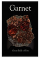
| Balls of Fire ISBN 978-0-9790998-4-7 Publisher Lithographie, LLC East Hampton, Connecticut, USA © 2008...Lithographie, LLC P.O. Box 263 • East Hampton, CT 06424 • USA Phone 1.860.267 .1512 • Fax 1.860 .267.7225 www.lithographie...lithographie.org Licensed edition in the English language of extraLapis No. 9: Granat Die Mineralien der Granat-Gruppe:...permission of Christian Weise Verlag, Munich, Germany German Edition Isaias Casanova, a fan of the X-Men...hematite is from the Wessels Mine near Hotazel in northern Cape Province, South Africa. Dan Carlson specimen; |
 | | Journal (article/letter/editorial) |
| 9 Springer-Verlag1989 Boron isotopic composition of tourmaline from massive sulfide deposits and tourmalinites...Department of Earth, Atmospheric and Planetary Sciences, E34-201, Massachusetts Institute of Technology...Cambridge, MA 02139, USA z US Geological Survey, National Center, MS 954, Reston, VA 22092, USA Abstract. Boron...tourmalinites from a variety of geologic and tectonic settings. The coverage of these localities is global...(Canada), Broken Hill (Australia), and Ducktown (USA). Overall, the tourmalines display a wide range in |
 | | Report (volume) |
| DEPARTMENT OF THE INTERIOR UNITED STATES GEOLOGICAL SURVEY GEORGE OTI8 SMITH, DIRECTOR BULLETIN 585...585 USEFUL MINERALS OF THE UNITED STATES COMPILED BY SAMUEL SANFORD AND RALPH W. STONE WASHINGTON...GOVERNMENT PRINTING OFFICE 1914 USEFUL MINERALS OF THE UNITED STATES. Compiled by SAMUEL SANFORD and...EDWARD W. PARKEH. The final chapters of two of the earlier volumes of the Geological Survey's annual report...Mineral Resources of the United States" (the volumes for 1882 and 1887) consist of lists of the useful minerals |
 | | Book (volume) |
| corner of Kimball Co. where it overlooks both Colorado and Wyoming. The subsurface rock strata of the entire...Mountains as they rose during the Larimide revolution of 100 million years ago that closed the Mesozoic era...west reaches rise to the high, arid sagebrush plains of eastern Wyoming, disclosing spectacular bedrock formations...contains most of the gem fields in the state, insomuch as both the Black Hills of South Dakota and the...scenic Badlands thrust long spurs into this part of the state. In this rough, uncurried region are found |
 | | Report (issue) |
| AVAILABILITY OF BOOKS AND MAPS OF THE U.S. GEOLOGICAL SURVEY Instructions on ordering publications of the U... along with prices of the last offerings, are given in the current-year issues of the monthly catalog...catalog "New Publications of the U.S. Geological Survey." Prices of available U.S. Geological Survey publications...Availability List" are no longer available. Prices of reports released to the open files are given in the...National Technical Information Service, U.S. Department of Commerce, Springfield, VA 22161; please include NTIS |
 | | Book (volume) |
| Prairie State, Illinois exhibits a length of 378 miles and a width of 210 miles, with its 56,000 sq. mi. sloping...more than 275 rivers, the state is bounded along ¾ of its circumference by navigable waters, primarily...along the northern borders, rising only to a altitude of 900 to 1,000 feet above sea level. Though well endowed...the Lead-Zinc mining dists. of northwestern Illinois, the glacial drift of the Late Pleistocene Wisconsin...Wisconsin glaciation, the bluffs and detritus of the Ohio and Mississippi rivers, and in the southern Fluorspar |


