| Classification |
|---|
|
| Species: | Quartz var: Amethyst |
| Formula: | SiO2 |
| Quality for species: | Excellent - world class for species or very significant. (!!) |
| Confirmation |
|---|
|
| Validity: | Believed Valid |
| Associated Minerals Based on Photo Data: |
|---|
|
| Quartz | ⓘ4 photos of Amethyst associated with Quartz at this locality. |
| Milky Quartz | 1 photo of Amethyst associated with Milky Quartz at this locality. |
| Data |
|---|
|
| Mineral Data: | Click here to view Amethyst data |
| Locality Data: | Click here to view Saltman Amethyst locality, Sweden, Oxford County, Maine, USA |
| Photo Gallery | View Gallery (21 photos) |
| Data Identifiers |
|---|
|
| Mindat Occurrence Record ID: | 33442 |
| Long-form Identifier: | 1:3:33442:0 |
| GUID (UUID V4): | 879164b2-1053-405b-a95a-70c7d8ad1631 |
| Nearest other occurrences of Amethyst |
|---|
|
|
| 8.1km (5.1 miles) | ⓘOliver Stone Farm Amethyst locality, Waterford, Oxford County, Maine, USA |
| 9.7km (6.0 miles) | ⓘKezar River Falls Gorge, Lovell, Oxford County, Maine, USA |
| 20.5km (12.8 miles) | ⓘTamminen Quarry, Greenwood, Oxford County, Maine, USA |
| 22.1km (13.7 miles) | ⓘIntergalactic Pit, Deer Hill, Stow, Oxford County, Maine, USA |
| 22.1km (13.7 miles) | ⓘEastman Quarry, Deer Hill, Stow, Oxford County, Maine, USA |
| 22.1km (13.7 miles) | ⓘDeer Hill, Stow, Oxford County, Maine, USA |
| 25.4km (15.8 miles) | ⓘBlack Cap Mountain, North Conway, Conway, Carroll County, New Hampshire, USA |
| 25.5km (15.8 miles) | ⓘHurricane Mountain localities, North Conway, Conway, Carroll County, New Hampshire, USA |
| 25.7km (16.0 miles) | ⓘSongo Pond Quarry (Kimball Ledge Quarry), Albany, Oxford County, Maine, USA |
| 27.6km (17.2 miles) | ⓘPeaked Mountain fluorite locality, North Conway, Conway, Carroll County, New Hampshire, USA |
| References |
|---|
|
|


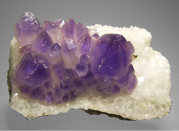

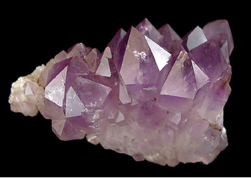


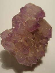


Saltman Amethyst locality, Sweden, Oxford County, Maine, USA