 | | Report (Issue volume) | | (at the m outh of Little \Vind River), in Hungry Creek and in a stream nearly opposite the mouth of the...creeks in the Dawson area, notably in Dominion Creek. Reference: Personal communication: H. S. Bostock...quartz veins cutting igneous schists on Thistle Creek which enters the Yukon R iver 8 miles above the...1898 began 11·ith the discovery of gold in Bonanza Creek in 1896 . Subsequent discoveries brought placer-mining...ries leadi ng to Hess and Lansing rivers. At Ledge Creek, cassiteritc and scheelite occur with the gold which | 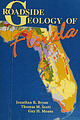 | | Book | | Econfina River, Bay County; top right, the Anastasia Formation, Martin County; bottom right, sand dunes...and Dugongs 209 Fossil Camels 210 With Love, from South America 219 Interstate 75 Ocala—Tampa—Bradenton...should be aware of some discrepancies concerning county and state roads. Commercial maps and those of the...disagree about whether a road is a state road or county road. Even within the Florida Department of Transportation...rivers: the Chattahoochee River, Fish Pond Creek, Spring Creek, and Flint River. These four rivers correspond |  | | Report (issue) | | vent area of the Pole Creek Top segment of the Jump Creek Rhyolite, Pole Creek canyon, Oregon. (Bottom...waterfall on the Snake River, north of Kimberly. The south cataract was appropriated for electrical power production...Province The Arch of Arch Canyon, where Cougar Creek was diverted from one side of an entrenched meander...other and through a large gas cavity in the Dorsey Creek rhyolite. Tectonic and Magmatic Evolution of the...and Geochemistry of the Miocene Tuff of McMullen Creek, Central Snake River Plain, Idaho By Karen E. Wright |  | | Report (issue) | | Silver King Mine , Toad Mountain, about 5 miles south of Nelson (G . M. Dawson, 1896 : Geol . Surv . Can...Mines, located on the Camsell River about 20 miles south of Great Bear Lake, argentite occurs in dolomite...have been reported in the townships of Coleman , South Lorrain, James , Tudhope, Speight, Whitson, Au ld...d Keeley mines, 20 miles southeasl of Cobalt in South Lorrain Township . The crystals were commonly frosted...Company in the Township of Langmuir a l ong the south boundary and immediately west of Night Hawk River |  | | Journal (issue) | | by M. Hansen The libethenite zone, Burra mine, South Australia ....................................105...R. Kampf Natural History Museum of Los Angeles County Arthur Roe Tucson, AZ Abraham Rosenzweig University...Renato Pagano Via S. Anna 1/B I-34074 Monfalcone South Africa: Horst Windisch 30 Van Wouw Street Groenkloof...and went around in a tunnel and we emerged headed south along the same cliff. This took us down to the city...stops and Finally passed through Paipote and headed south. It was a pleasure to pass through points that I |  | | Report (issue) | | ____________ Kentucky _____________ North Carolina-South Carolina-GeorgiaAlabama________________________...Continued Southeastern region -Continued North Carolina ___________. Tennessee ______________. Central..._____________ Jordan___________ _______ Korea, South ______________________ Malaysia _______________...world bauxite resources are in Africa, Australia, South America, and the Caribbean region; and significant...speculative bauxite resources are located in Africa, South America, and Australia. The other major global regions |  | | Report (volume) | | ____________ Kentucky _____________ North Carolina-South Carolina-GeorgiaAlabama________________________...Continued Southeastern region -Continued North Carolina ___________. Tennessee ______________. Central..._____________ Jordan___________ _______ Korea, South ______________________ Malaysia _______________...world bauxite resources are in Africa, Australia, South America, and the Caribbean region; and significant...speculative bauxite resources are located in Africa, South America, and Australia. The other major global regions |  | | Book (volume) | | (Netherlands) Ijsel Rivers River (Utrecht Province-South Holland, Netherlands) USE Hollandsche IJssel River...vomitoria (May Subd Geog) [QK495.A67 (Botany)] UF Carolina tea plant Cassena Cassina Emetic holly Hex caroliniana...Hha de USE Islands) lies Ileitis Ileus Chesterfield Islands Crozet USE Crozet Islands lies de Desolation...lies USE Intestine, Small — Diseases lies Chesterfield USE Wallis Islands (Wallis and Futuna Hex...Twin Island (Nunavut) He Jumelle Sud (Nunavut) USE South Twin Island (Nunavut) He Lamdque (N.B.) USE USE |  | | Journal (volume) | | Geology of Santa Rosa Mountain Area, Riverside County, California, by Lawrence B. Wright Geology and...Diego 15 County, California, by S. C. Creasey Tin Deposits of the Gorman District, Kern County, California...Mountain area, T. 7 S., R. 5 E., S.B., Riverside County, California A, View northwest from near west center... Geologic map, Julian-Cuyamaca area, San Diego County, California 16 Geologic and topographic map, Friday...Kern County, California 38 Geologic map and sections of Upper Butler tin prospect, Kern County, California |  | | Book (volume) | | te Uw Ptnua} JviM M fliMitr ; K*»Wi.i it » USA sr«t«> <#**1 Ssitfi t «. ts ...Sabaic language Sabean language BT Epigraphic South Arabian language Y emen Languages Sabaeans (May... Here are entered works on a Semitic people of South Arabia in pre-Islamic times, founders of the kingdom...Reserve (South Africa) USE Kruger National Park (South Africa) Sabi Private Game Scheme (South Africa)...Africa) USE Sabi-Sand Game Reserve (South Africa) (Zimbabwe and Mozambique) Save River (Zimbabwe and Mozambique) |  | | Book (volume) | | (Korea) Naejangsan (Korea) BT Mountains—Korea (South) Naejang San (Korea) USE Naejang Mountain (Korea)...Ethnology—Indonesia Naga (South Asian people) (May Subd Geog) [DS432.N3] UF Nagas [Former heading] Nagna (South Asian people)...people) Noga (South Asian people) BT Ethnology—Burma Ethnology—India Tibeto-Burman peoples NT Anal (Indie...(Indie people) Liangmai Naga (Indie people) Mao (South Asian people) Maram (Indie people) Mikir (Indie...USE Naga Pidgin Naga Kuki Chin (South Asian people) USE Kuki Chin (South Asian people) Naga languages (May |  | | Report (issue) | | 71 71 Northern Quebec ............ .. Abitibi county .......... .. ... . Savard-Poulin claims. Preissac-Lacorne.... .... .. .. ...... .... .. . . Terniscamingue county .. ..... .. ............ ...... .... ..... ....... ..... . ... ... .. .............. .. Pontiac county ..... .. ............. ...... .. .. .. ...... ... . ... . . .......... .. .. Southe rn Gatineau county ...... ..... .. ... .. .. ... ...... .. ... ...... .. . ..... ....... .. .. . Northern Gatineau county .... .. .. .... .... .. .. ... .. .... .. .. . |  | | Report (issue) | | Western Traverse Mountains earthquake, Salt Lake County, Utah, Utah Geological Survey Open-file Report...and Nava, SJ. (1992). The St. George (Washington County), Utah, earthquake of September 2, 1992, University...Tennessee Valley Authority and the University of North Carolina at Chapel Hill is designed to provide modern instrumental...occurred at 12:32 EDT northwest of Charleston, South Carolina. The NEIC released the location and size parameters...10 60 145 145 215 215 215 215 215 Giles County, VA 10 15 15 30 30 215 215 215 215 215 |  | | Report (issue) | | ••• 78 ••• • •• 78' 79 • •• ••• Union of South Africa:Traasvaal ••• ••• • •• Cape Province ......Orange River Colony ... ••• Natal ._ •• • •• ••• South-West Africa Territo1·y .. Ca.nada • •• •• • •••...43 50 50 Australia ••• New South Wales , Victoria •• • Queensland ••• South A t1stralia Wes tern Australia...Caledonia •• • I • • I • •• ••• • •• ••• 0 I . South America :Argentina ••• • ♦ ••• 0 Asia . •...tracts of Africa, northern and eastern Asia, and south a.n d central America., ha;ve scaa.. cely been explored |
|


