 | | Report (volume) |
| Coking-Coal Deposits of the Western United States ; By PAUL AVERITT CONTRIBUTIONS TO ECONOMIC GEOLOGY...short summary of the geology ' and occurrence of coal in 21 \ localities in 8 Western States UNITED STATES...coke--___----_-_---_-------------------_-------_---_Coking-coal deposits___^__-__-___---__---__-----____-__--__...____ Sunnyside-Castlegate field, Carbon County, Utah _____________ Mount Pleasant field, Sanpete County...Colo_______-__________________._____ Somerset field, Coal Creek district_______________________ Crested Butte |
 | | Report (issue) |
| GEOLOGICAL SURVEY CIRCULAR 90 March 1951 COKING-COAL DEPOSITS OF THE WESTERN UNITED STATES By Louise...distribution ·of coal. . . . . . • . . • . ••. 1 Properties of coking coal. . . . . . . . . 4 Coking-coal deposits...10 Utah . . . . . . . . . . . . . . . . . . . 11 Sunnyside-Castlegate field, Carbon County, Utah . .... Sanpete 12 County, Utah . . . . . . . . . . . 12 Kanab field, Iron County, Utah • Colorado . . . . .... • . 16 Southern part of the 01:1~ 1oma field, Coal, Pittsburg, Atoka, Latimer, and Le Flore Counties |
 | | Report (volume) |
| Coal Resources of the United States January 1, 1967 By PAUL AVERitT GEOLOGICAL SURVEY BULLETIN 1275...information concerning the quantity and distribution of coal in the United States. Supersedes Bulletin 1136 ...__________ ___ _________________ _______________ _ Total coal resources ____ _ __ __ _ __ __ _ _ _ __ __ _ __...characteristics of the coaL __________ Rank of coaL ____________ _______ Grade of coal _ _ _ __ _ _ __ _ _...__ _ _ _ _ _ __ _ _ _ _ ___ _ Specific gravity of coaL ______________________________ __ Thickness of beds__ |
 | | Report (volume) |
| o CO Coal Reserves of the United States A Progress Report January 1, 1960 *? a t w o Pi OQ w (25...& w o 03 GEOLOGICAL SURVEY BULLETIN 1136 Coal Reserves of the United States A Progress Report...information concerning the quantity and distribution of coal UNITED STATES GOVERNMENT PRINTING OFFICE, WASHINGTON...-_-_---___--_Methods of preparing and reporting coal-reserve estimates..____________ Reserves versus...ssification according to characteristics of the coal. ______________ Rank of coal__---__-_---__----_-_-__ |
 | | Report (issue) |
| ANALYSES OF COAL SAMPLES FROM VARIOUS FIELDS IN THE UNITED STATES. By MARitrs R. CAMPBELL. INTRODUCTION...The accompanying table gives the analysis of all coal samples collected by the United States Geological...two organizations. In the. course of a year many coal fields are examined in detail or reconnaissance...purpose of determining the amount and quality of the coal contained in them and of making public the facts...nonmineral according to its coal content. If the land is classed as coal land a valuation must be assigned |
 | | Report (volume) |
| . Coal Resources of the - United States, " January 1,1 * GEOLOGICAL SURVEY BULLETIN 1412 > Coal...information concerning the quantity and distribution of coal in the United States. Supersedes Bulletin 1275 ... Includes index. Supt.ofDocs.no.: 119.3:1412 1. Coal-United States. I. Title. II. Series: United States................................ 4 Distribution of coal in the United States................................................................. 4 Number of coal beds........................................... |
 | | Journal (article/letter/editorial) |
| of the current research and activities related to coal, coalbed methane, gas hydrates, gas shales, geospatial...resources, oil sands, and uranium resources. KEY WORDS: Coal, coalbed methane, gas hydrates, geospatial information...of the current research and activities related to coal, coalbed methane, gas hydrates, geospatial information...cause greater dependence on energy minerals such as coal, uranium, and unconventional sources of oil and...Association of Petroleum Geologists, Tulsa, OK 74119, USA. 2 U.S. Geological Survey, 956 National Center, Reston |
 | | Report (volume) |
| WELLINGTON, AND SUNNYSIDE O QUADRANGLES, CARBON COUNTY, UTAH BY FRANK R. CLARK UNITED STATES GOVERNMENT PRINTING...__________________ Aberdeen sandstone member___________ Coal-bearing beds_________________ Price River forma...Altitudes of coal beds ____________ 26 Stratigraphy of the coal beds and associated rocks 29 Coal below the...Sunnyside bed _ _ _ __ 34 Coal beds above the Lower Sunnyside bed 34 Description of coal by townships 35 General...in regard to coal contracts to supply fuel to the United States Government Original coal content of Sunnyside |
 | | Journal (article/letter/editorial) |
| PETROGRAPHIC COMPONENTS OF A HIGH VOLATILE BITUMINOUS COAL SABRI ERGUN, JAMES T. McCARTNEY, AND MORRIS...NTRODUCTIO N ALTSOUGHthe petrographiccomponentsof coal have been observedand describedboth megascopically...propertiesof the petrographiccomponentsof an American coal. The propertiesinvestigatedare chemicalcomposition...EXPERIMENTAL PROCEDURE A l«-inch thick layer of dull coal was cut out of a columnof Hemshaw bed high-volatileA...1068 PROPERTIES OF PETROGRAPHIC COMPONENTS OF COAL 1069 to facilitatereductionof the oversize. 94 |
 | | Report (issue) |
| OF THE INTERIOR GEOLOGICAL SURV2T Coal resources of the Alton, Utah, EMRIA site By W. E. Bowers, A. A..........».....*..-*.......,.................viii Coal............................................ , .........2 Rank of coal...................................................3 Type of coal..................of coal.................................................10 Estimation and Classification of Coal Resources...Resources.....................11 Tabulation of estimated coal resources...........................11 Recoverability |
 | | Report (issue) |
| GEOLOGICAL SURVEY CIRCULAR 94 Deeember 1950 COAL RESOURCES OF THE UNITED STATES A progress report,............................... " . Preparation of coal-reserve estimates ............................................................ . Rank of coal ................................................. .' ..................................... . Percentage of coal recovered in mining .........·....................................................... . Weight of coal ............................... ~ ............. |
 | | Report (issue) |
| MAP SHOWING COAL DEPOSITS, OIL AND GAS WELLS AND SEEPS, AND TAR SANDSTONE OCCURRENCES IN THE BASIN AND...REsToN V A. Aji ocr 211983 214- ,1R MAP SHOWING COAL DEPCSITS, OIL AND GAS WELLS AND SEEPS, AND TAR SANDSTONE...Page 1 Introduction Summary of selected data for coal fields and occurrences Arizona Chiricahua Mountains...Whetstone Mountains 8 General references selected for coal in Arizona 9 California Colorado Camp Group (Gerbracht...French Deposit, Randsburg Coal) 10 General references selected for coal in California 11 Idaho Goose |
 | | Report (volume) |
| Miles City coal field, Montana, by A. J. Collier and C. D. Smith ........ The Bull Mountain coal field, Montana...62 Coal near the Crazy Mountains, Mont., by B. W. Stone. ...... ...........^.. The Red Lodge coal field...Lewistown coal field, Montana, by W. R. Calvert...................... 108 The Sheridan coal field, Wyoming....... The Glenrock coal field, Wyoming, by E. W. Shaw ........................ Coal fields of the northeast................... .......e.... ................. Coal fields of the southwest side of the Bighorn Basin |
 | | Report (issue) |
| GEOLOGICAL SURVEY CIRCULAR 258 COAL RESOURCES OF COLORADO A Progress Report, January 1, 1953 UNITED...Wrather, Director GEOLOGICAL SURVEY CIRCULAR 258 COAL RESOURCES OF COLORADO A Progress Report, January...the Geological Survey, Washington 25, D. C.· COAL RESOURCES OF COLORADO A Progress Report, January.... . . . . . . . . . . . . . . . . . . . Rank of coal-. . . . . . . . . . . . . . . . . . . . . . . ....Comparison of past and present estimates . . . . . . . Coal fields of Colorado. . . . . . . . . . . . . . . |
 | | Journal (article/letter/editorial) |
| acid oxidation of a series of Permian Australian bituminous coals in order to probe the effects of maturation...oxidation products. INTRODUCTION EXAMINATION OF coal organic structure at the molecular level, is generally...oxidation. These methods rely on the cleavage of coal into mixtures of molecules amenable to chromatographic...spectrometric analysis. The value of oxidation studies in coal structural determinations is dependent on two factors:...acid (per TFA) as a coal oxidation reagent. This reagent was initially applied to coal structural studies |
 | | Report (issue) |
| Accompany: Open-File Report 79-1403 1979 COAL RESOURCE OCCURRENCE MAPS AND COAL DEVELOPMENT POTENTIAL OF THE WHITE... 3 4 8 Coal geology.................................................. 8 Fairfield coal group................... Lion Canyon coal group................................... Coal beds of the Fort Union formation........ 9 9 9 Coal resources................................................ 10 Coal development potential...1-4. Coal resource occurrence maps 1. Coal data map 2. Boundary and coal data map 3. Coal data |
 | | Report (issue) |
| accompany: Open-File Report 79-1418 COAL RESOURCE OCCURRENCE AND COAL DEVELOPMENT POTENTIAL MAPS OF THE...AND UINTAH COUNTY, UTAH By AAA Engineering and Drafting, Inc. Salt Lake City, Utah Prepared for the U...- -- 6 Coal Geology 6 Main coal zone, coal bed 1- --- Chemical analyses of the coal Mining operations----...operations---- -- 4 -- Coal resources-- 7 -- -- ---- -- Coal development potential-- -- 8 8 9 12...and in situ coal gasification methods---- 16 References 18 ILLUSTRATIONS Plates 1-7 Coal resource |
 | | Report (issue) |
| Study Areas, Carbon, Emery, and Grand Counties, Utah U.S. GEOLOGICAL SURVEY BULLETIN 1753-B iHipP ;...Study Areas, Carbon, Emery, and Grand Counties, Utah By WILLIAM B. CASHION, JAMES E. KILBURN, HARLAN...WILDERNESS STUDY AREAS: CENTRAL GREEN RIVER REGION, UTAH DEPARTMENT OF THE INTERIOR MANUEL LUJAN, JR.,...study areas, Carbon, Emery, and Grand counties, Utah / by William B. Cashion ... [et al.]. p. cm. (Mineral...wilderness study areas Central Green River Region, Utah ; ch. B) (U.S. Geological Survey bulletin ; 1753-B) |
 | | Journal (article/letter/editorial) |
| the USA. All rights reserved 0016-7037/99 $20.00 ⫹ .00 Pergamon PII S0016-7037(99)00252-5 Coal weathering...Geophysics, Yale University, New Haven, CT 06520, USA (Received October 15, 1998; accepted in revised form...pyrite-free bituminous coal at 24° and 50°C by using a dual-cell flow-through method. Coal was used as...but still rapid on a geologic time scale. Aqueous coal oxidation results in the formation of dissolved...studies of coal oxidation, where relatively sulfur-free coal is used, with the idea that coal represents |
 | | Catalog/List |
| (basic potassium aluminum sulfate) ,Wassive, pure; Utah ............................. . 13 lv!assive, white;...Carolina . . . . . . . . . 17 ANTHRACITE-See Mineral Coal ANTI MONY (an timony) .Nodules, high grade; California...Mexico, 1 x 2 ", 1 . 5 0. . . . . . 170 BITUMINOUS COAL-Sec Mineral Coal BLENDE-Sec Sphaforitc BLOEDITE (hydrous.... . . . . . . . . .... . .... 6 CANNEL COAL-Sec Mineral Coal CARNOTITE (hydrous potassium uranyl vanadate)..... ......37 CLINOZOISITE-See Fouqueite COAL-See Mineral Coal COLEl\iANITE (hydrous calcium hexa-borate) |
 | | Journal (article/letter/editorial) |
| EconomicGeology Vol. 54, 1959, pp. 629-665 COAL STRATIGRAPHY AND RESOURCES STUDIES, CHARLES 1949-1957.................................................. Coal resources ........................................dealing with stratigraphy and resourcesstudies on coal-bearingrocksin the United Statesand Canadahave beenpublished...than 40 Coal InvestigationsMaps, which cover 7•-minute quadrangles,15-minutequadrangles, coal fields,... or coal districts. Circulars have been published which include the calculation of coal reserves {or |
 | | Report (issue) |
| Geological Survey Coal Quality Characteristics of the Blind Canyon Coal Bed, Utah, Source of the Argonne...The Blind Canyon coal bed, a high volatile bituminous coal in the Wasatch Plateau coal field in Emery County...County, Utah was sampled for the Argonne Premium Coal Sample Bank The Blind Canyon coal bed is in the...Formation of the Mesaverde Group. This coal is economically important in Utah because of its thickness (average...average ash yield and sulfur content of Blind Canyon coal samples in this study are 4.5 percent and 0.6 percent |
 | | Report (issue) |
| Accompany: Open-File Report 79-1399 1979 COAL RESOURCE OCCURRENCE AND COAL DEVELOPMENT POTENTIAL MAPS OF THE... 3 4 8 Coal geology.................................................. 8 Lion Canyon coal group......... Lion Canyon [1] coal bed............................... Lion Canyon [3] coal bed................... 9 9 9 9 Coal resources................................................ 10 ~"*& Coal development...ILLUSTRATIONS Plates 1-8. Coal resource occurrence and coal development potential maps 1. Coal data map 2. Boundary |
 | | Report (issue) |
| Database of the United States Coal Pellet Collection of the U.S. Geological Survey Organic Petrology...Hackley, P.C., 2012, Database of the United States Coal Pellet Collection of the U.S. Geological Survey........12 The Argonne National Laboratory Premium Coal Samples..............................................................................14 Appendix: Coal Pellet Preparation ...............................Map showing the location and extent of the major coal fields highlighted in this report.. ........... |
 | | Report (issue) |
| accompany Open-File Report 79-489 1979 COAL RESOURCE OCCURRENCE AND COAL DEVELOPMENT POTENTIAL MAPS OF THE...THE PINE CANYON QUADRANGLE CARBON COUNTY, UTAH (Report includes 16 plates) By AAA Engineering and Drafting... Structure Coal Geology --- -- 6 I Chemical Analyses of the Coal 7 Kenilworth Coal Bed 9 Gilson...Gilson Coal Bed 9 Fish Creek Coal Bed 10 Rock Canyon Coal Bed 10 Lower Sunnyside Coal Bed -~ Upper...Upper Sunnyside Coal Bed 10 -- 11 Mining Operations--- n Coal Resources Coal Development Potential |

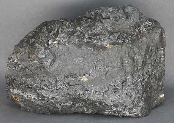


SUFCO Mine, Sevier County, Utah, USA