 | | Report (issue) | | Development Division of Mining & Water Management FRONT COVER Top: Ryan Lode Mine gold recovery plant and...investigates a silver prospect in the Chulitna mining district during a DGGS mapping project in July 1997...to follow up recently-flown geophysical surveys. Denali is in the background. Photo by K.H. Clautice. ...(left) and Jim Vohden (right) of the Alaska Division of Mining & Water Management, and Bronwen Wang of...on face in the Greens Creek Mine on Admiralty Island west of Juneau, Alaska. Photo by Jan Nauman. GEOLOGY |  | Nokleberg, W.J., Bundtzen, T.K., Berg, H.C., Brew, D.A., Grybeck, Donald, Robinson, M.S., Smith, T.E., Yeend, W.E. (1988) Metallogeny and major mineral deposits of Alaska. Open-File Report Vol. 1988 (88-73) US Geological Survey doi:10.3133/ofr8873 | Report (issue) | | SURVEY Metallogeny and Major Mineral Deposits of Alaska by 1 Thomas K. BundtzenS 7 Henry C. Berg 0"3 ,...endorsement by the U.S.G.S. ' U.S. Geological Survey ^ Alaska Division of Geological and Geophysical Surveys...unpublished data on metalliferous mineral deposits of Alaska, and on recent and older published articles and... universities, the U.S. Geological Survey, the Alaska Division of Geological and Geophysical Surveys... Andersen, Resource Associates of Alaska, Inc., Fairbanks, Alaska Roger P. Ashley, U.S. Geological Survey |  | | Report (issue) | | developed, the deposit will be mined by underground mining methods. The deposit is part of lands owned by...placer gold mine operations on the Eureka and Mary's bench depositsin the Koyukuk-Nolan district of northern...northern Alaska. The center nugget weighs 41.35 ounces (1,286 grams) and is unofficially the tenth largest...placer gold mine, 50 miles (80 kilometers) east of Cantwell, has been Alaska's largest gold mine for ten...in the world. In 1994 the mine, which has been operated by Cambior Alaska Inc., produced 47,622 ounces |  | | Report (issue) | | Division of Mining & Water Management FRONT COVER Top left: From late 199] to 1993 Cambior Alaska Inc. constructed...Phase one channeled the stream around the open-pit mine operations. During the stream diversion the company...quality, stream flow, and fish populations. When the mine closed, Valdez Creek was diverted back to its original...work on Pit A-8 of Valdez Creek gold mine operated by Cambior Alaska Inc. as it appeared in early August...August 1994. From 1984 to 1995 Cambior Alaska and previous operators produced 459,162 ounces (14,279 kilograms) |  | | Report (volume) | | Metalliferous Lode Deposits of Alaska By HENRY C. BERG and EDWARD H. COBB . G E O L O G I C A L S...A n inventory of the mines and )- grosfiects of Alaska and their ' f geologic settings UNITED STATES...acknowledgments--- - - - - - ----- - - - -- - -- 4 Alaska Peninsula region- - - - - - - - -- - - - - - -...- - - _ - - - _ - - - - - - - - - - 16 Redoubt district--- - - - - - - - - - - - - - - - - - - - - - -.... . . . . . . . . . . . . . . . . . . . . . 27 Denali-MacLaren River area. . . . . . . . . . . . . . |  | | Report (issue) | | only a few localities. Those of the Mount Eielson district are described by Moffit in an accompanying paper...is approached at its eastern edge by way of the Alaska Railroad, built a,nd operated by the Federal Government...park here covers a complete section' across the Alaska Range and offers a great variety of scenery, from...glacier-filled valleys of 219 220 MINERAL BESOtmOES OF ALASKA, 1930 the main divide to the open valleys and...penetrated to this rather inaccessible portion of Alaska up to the end of the Russian occupa- PIGURE 6 |  | | Report (volume) | | Metalliferous Lode Deposits and Placer Districts of Alaska By WARREN j. NOKLEBERG, THOMAS K. BUNDTZEN, HENRY...metalliferous lode deposits and placer districts of Alaska. U.S. Geological Survey Bulletin 1786 Bibliography...No.: 119.3:1786 1. Placer deposits-Alaska. 2. Ore deposits-Alaska. I. Nokleberg, Warren j. II. Series...COVER Mill buildings at Kennecott, Alaska. The Kennecott district Cu-Ag mines in the Wrangell Mountains...deposit description for Kennecott district (number 30 for southern Alaska). Copyrighted drawing used by permission |  | | Report (issue) | | PRELIMINARY SUMMARY OF RECONNAISSANCE FOR URANIUM IN ALASKA, 1951 By M.G. White, W. S. West, G. E. Tolbert...PRELIMINARY SUMMARY OF RECONNAISSANCE FOR URANIUM IN ALASKA, 1951 By M.G. White, W. S. West, G. E. Tolbert...Conclusions.................. . . . . . . . .. Part 2. --Alaska Railroad-Iliamna ;region, by Gene E. Tolbert and... . . . . . . . . . . . Page Fart 3, --Gulf of Alaska region, by Authur E Nelson and Gene E. Tolbert.... . . . . . . . . . . . Part 4. --Southeastern Alaska, by Joseph R. Houston Abstract. . . . . . . . | 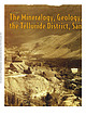 | | Journal (article/letter/editorial) | | campaign (Nevins Figure 2. Map of the Telluride district showing the principal veins, adits, and shafts...1932): defense of a cause as holy as the cause of liberty-the cause of If you repay me not on such a day...researches Colorado ‘s geology, mineralogy, and mining history, is part owner of FRS Geotech, Inc., an...historic preservation efforts in the Leadville mining district. Downloaded by [UZH Hauptbibliothek / Zentralbibliothek...convention. Colorado’s silver interestsdomposed of mine, milling, and smelter entrepreneurs; managers, professionals |  | | Report (issue) | | ON AN APPRAISAL OF THE URANIUM POSSIBILITIES OF ALASKA* By Helmuth Wedow9 Max G 0 White, and Robert M0...authors 7 opinions of the uranium possibilities of Alaska through March 1951 S the date of the completion...Seward Peninsula-Kobuk region ............ York district .................. Lost River area ................ Uranium possibilities of the York district . Nome district .................. . Uranium- possibilities...possibilities ........... Council district ................ Uranium possibilities- ........... Pairhaven and |  | | Report (issue) | | made in the study of a particular topic in one district would aid in the study of the same topic in the...regional report, it must be remembered that for each district only such information could be used as was readily...work in the encouragement which they offer to deep mining, irrespective of more purely scientific results...Fred Carroll, of the Atlas mine, Ouray; Mr. F. G. Farish, of the Humboldt mine, ^iear Telluride; Mr. L....S. Holland, then in charge of the Smuggler-Union mine, at Telluride, and many others for valuable aid |  | | Report (issue) | | isotope data base for sulfide occurrences from Alaska, December, 1989 by J.D. Gaccetta1 and S.E. Church2...of Alaska used in this report.............. 2 Figure 2. Mining regions and districts of Alaska......isotope data from sulfide occurrences from northern Alaska..................................... 8 Table...data from sulfide occurrences from west-central Alaska................................. 14 Table 3. ...data from sulfide occurrences from east-central Alaska................................. 20 Table 4. |  | | Report (volume) | | ................... (A) The Candelaria silver district, Nev., by Adolph Knopf (published Jan. 20, 1922)............................. (J) The Los Burros district, Monterey County, Calif., by J. M. Hill (published...Russell mine, near Maltby; B, Hydraulic jet in Heaton & Russell mine; C, Hayes-Hoblitzell mine, near Marble;...Marble; D, Mammillary ore in Savage mine, near Murphy....................... VI. Views in brown-hematite...western North Carolina: A, Ore bed in mine of Southern Iron Mining Co., near Andrews; B, West end of bed |  | Nokleberg, W.J., Bundtzen, T.K., Grybeck, D.J., Koch, R.D., Eremin, R.A., Rozenblum, I.S., Sidorov, A.A., Byalobzhesky, S.G., Sosunov, G.M., Shpikerman, V.I., Gorodinksy, M.E. (1993) Metallogenesis of mainland Alaska and the Russian Northeast. Open-File Report Vol. 1993 (93-339) US Geological Survey doi:10.3133/ofr93339 | Report (issue) | | GEOLOGICAL SURVEY PREPARED IN COLLABORATION WITH ALASKA DIVISION OF GEOLOGICAL AND GEOPHYSICAL SURVEYS...NORTHEASTERN RUSSIA METALLOGENESIS OF MAINLAND ALASKA AND THE RUSSIAN NORTHEAST By Warren J. Noklebergl...and Richard D. Koch 1 1-U.S. Geological Survey ^-Alaska Division of Geological and Geophysical Surveys...OPEN-FILE REPORT 93-339 PREPARED IN COLLABORATION WITH ALASKA DIVISION OF GEOLOGICAL AND GEOPHYSICAL SURVEYS...LODE DEPOSITS AND PLACER DISTRICTS FOR MAINLAND ALASKA AND THE RUSSIAN NORTHEAST By Warren J. Nokleberg1 |  | | Journal (article/letter/editorial) | | paperis concerned with an area in part of that district includingmany of the principal producers. The...marked vertical changes in the depths attained by mining, due to hypogenezoning. (f) Zoning has also causedareal...closely succeededby formation of tetrahedrite, chalcopyrite, galena, and gold. Mineralization closed with...period of mineralization. The ore depositsof the district are classifiedas leptothermal,a division proposedby...summerof I934 preparing detailed geologic maps for a mining companynear Ouray and devotedthe subsequent winter |  | | Journal (article/letter/editorial) | | 11 October 2014 A Historical Overview of t h e District and the Smuggler Union and Associated Mines and...history have called Leadville the quintessential mining camp of the frontier. If that is true-and it probably...Telluride was the scene of many encounters that the mining frontier had with its own destiny. From its struggle...here, too, the goals of frontier precious-metal mining shifted in midtwentieth century as the quest for...125 years of mining, are still capable of inspiring wonder at the inventiveness of the mining men and road |  | | Report (volume) | | of Documents. ANCHORAGE, Alaska--4230 University Dr., Rm. 101 ANCHORAGE, Alaska--605 West 4th Ave., Rm...Map Sales Box25286 Denver, CO 80225 Residents of Alaska may order maps from U.S. Geological Survey, Map...ROLLA, Missouri--1400 Independence Rd. FAIRBANKS, Alaska--New Federal Building, Twelfth Ave. 101 CORRECTIONS...Metric tons of coal (xl 09 ) Geologic Studies in Alaska by the U.S. Geological Survey, 1990 DWIGHT C. BRADLEY...the Shublik Mountains, northeastern Brooks Range, Alaska 3 Robert B. Blodgett, James G. Clough, Anita G |  | | Journal (issue) | | and finding new material, such as: Current day mining operations – Blast it! Litigation-minded people...material recently discovered at the Blue Lizard Mine in southeastern Utah has produced a whole set of...Silver Coin Mine. IMA No. 2015-077 Fluorwavellite Al3(PO4)2(OH)2F·5H2O Silver Coin mine, Valmy, Iron...Iron Point district, Humboldt Co., Nevada, USA (40°55’44”N, 117° 19’26”W), and Wood mine, 5 miles NE of Del...Del Rio, Cocke Co., Tennessee, USA (35°57’52”N, 82°57’36”W). Anthony R. Kampf*, Paul M. Adams, Henry |  | | Report (volume) | | of Metallic and Nonmetallic Mineral Deposits of Alaska Compiled From Published Reports of Federal and...of metallic and nonmetallic mineral deposits of Alaska, compiled from published reports of Federal and...resources Indexes. 2. Mines' and mineral resources Alaska. I. Kachadoorian, Reuben, 1921-, rjoint author...investigations__________________---_-_----____-__ Territory of Alaska Department of Mines pamphlets____________--_ 360...ILLUSTRATIONS PLATE 1. Map showing quadrangles of Alaska Reconnaissance Topographic Series (1:250,000)__ |  | | Report (issue) | | SURVEY Pb-isotope data base for sulfides from Alaska, March, 1987 by S. E. Church*, M. H. Delevaux...Bibliography -for Alaska. ........................... 3O ILLUSTRATIONS Figure 1. Regions of Alaska used in this...report.............. 2 Figure 2. Mining regions and districts of Alaska............. 3 TABLES Table 1...from northern Alaska.. 8 Table 2. Pb-isotope data from sulfides from west-central Alaska...............Pb isotope data from sulfides from east-central Alaska.............................................. |  | | Report (volume) | | Mendenhall, Director Bulletin 907 GEOLOGY OF THE ALASKA RAILROAD REGION BY STEPHEN R. CAPPS UNITED STATES...Copper-Susitna lowland._------------..___-..._.--_.-.-.-._ Alaska Range.______.___------__----_-_-__--_-_-__________..._-_-_-.-_-_.--.------------__-------._--_..-._ The Alaska Railroad.__.____.___-_-______.______-__.___.._...history of the Talkeetna region._____________________ Alaska Range._______________ _________________________________...123 128 130 Summary of geologic history of the Alaska Range______--_--_- 130 Yukon-Tanana region._ |  | | Report (issue) | | zinc, tungsten, and copper. In 1896 world-renowned mining engineer Thomas ''T.A." Rickard called the San...San Juans one of Colorado's four great mining regions along with Leadville, Cripple Creek, and Central City...during the eighteenth century, were the first to mine in the San Juans. One of the earliest recorded expeditions...discovered, mines were opened, and by 1874, small mining camps had begun to appear. The towns of Silverton...Arrastra Gulch near Silverton, was the first lode mine in the San Juans. Its gold assays ran from $ 1,000 |  | | Book (volume) | | .............................................1 Alaska ..............................................................................................4 Alaska County and Stream Map ..................................................14 Arizona – Apache Co. Mining Districts .............................................................23 Arizona – Cochise Co. Mining Districts ...........................................24 Arizona – Northern half of Coconino Co. Mining Districts ..............................25 Arizona |  | | Report (issue) | | description of the geology, mining history, and production of the major gold-mining districts in 21 States...relations ---------------------------History of gold mining and trends in production_ J\labama -----------...- Tallapoosa County --------------------------Alaska -----------------------------------------Cook Inlet-Susitna...J\la:ska region ------------------Southwestern Alaska region ------------------1'ukon region -------...(to nearest 1,000 ounces) of 25 principal gold-mining districts of the United States-through 1959--- |  | | Report (volume) | | lattices of sulfide minerals, such as pyrite, chalcopyrite, sphalerite, galena, marcasite, and arsenopyrite...deposits in the Silver City district, Idaho; Comstock Lode and Jarbidge district, Nev.; and Guanajuato, Mexico...with gold and silver are found in the Republic district, Wash., and in Radjang Lebong, Sumatra. The seleniferous...Nev.; San Francisco district, Utah; and the Liberty Bell mine, Telluride district, Colo., all contain...at Buckskin Peak, Nev.; the Abbott mine, Calif.; the Lucky Boy mine, Piute County, Utah; and at Guadalcazar |
|


