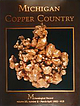
 | | Journal (issue) | | large mass of native copper in the Quincy mine ca. 1918. (Michigan Technological University Archives, Houghton)...Donald Pearce (1941-1989) The “Copper King” The MICHIGAN COPPER COUNTRY L. W i l s o n New Mexico Bureau...t a n l e y J. D y l II Seaman Mineral Museum Michigan Technological University % 1992 T h e M in e...crystal group, 13.6 cm, from an unknown mine in the Michigan Copper Country. Richard A. Kosnar collection;...wrote the classic work on the copper deposits of Michigan in 1929. Photo by Wendell E. Wilson. TENT . |  | | Book | | Mineralogy of Michigan by E. W. Heinrich updated and revised • by George W. Robinson M By E W~ Hellnr]ch...Museum Michigan Technological University Houghton, Michigan 49931 2004 © MINERALOGY OF MICHIGAN 3 FOREWORD...FOREWORD Michigan has a long and varied geologic history that includes repeated episodes of volcanism...before the first Europeans set foot here. When Michigan became a state in 1837, one of the first actions...and we continue to learn more about them today. Michigan minerals helped to build the state and nation |  | | Report (issue) | | (CaBSiO4OH) vesicle filling from a basaltic Houghton County lava flow. Small specks of native copper occur...the surface and between the nodular masses. The Michigan Bicentennial symbol (back cover) incorporates...Survey Division BULLETIN 6 THE MINERALOGY OF MICHIGAN by E. Wm. Heinrich Professor of Mineralogy and...University of Michigan Ann Arhor, Michigan Lansing, Michigan 1976 STATE OF MICHIGAN WILLIAM G. Mrr...State of Michigan CL '48 s.321.6. Printed by Speaker-Hines and Thomas, Inc., Lansing, Michigan. Available |  | | Journal (article/letter/editorial) | | February 2015 Figure 2. A generalized map of the Michigan copper district showing the location of new finds...arborescent copper crystal groups cached at the Central mine town site, (2) copper crystals recovered from Lake...fissure vein, (3) hundreds of copper from the Indiana mine, and (4) more than two hundredV aecilS mens of ...analcime/calcitecrystal groups from the Rhode Island mine. This article describes these and other finds made...starting with Keweenaw Point and continuing in a southwestern direction to the White Pine mine at the southern | 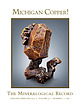 | | Journal (issue) | | MICHIGAN COPPER! The Mineralogical Record JANUARY-FEBRUARY 2023 ? VOLUME 54 ? NUMBER 1 ? $40 ... KRISTALLE Est.1971 Laguna Beach, California, USA • Tel: +1 949 494 5155 • Email: info@kristalle.com.......................3 by W. E. Wilson The Keweenaw County Fissure Mines.......................................13 by C. J. Stefano The Cliff Mine, Keweenaw County, Michigan................................... Stefano & P. Persson The Central Mine, Keweenaw County, Michigan................................... |  | | Journal (article/letter/editorial) | | COPPER-BEARING FISSURE VEINS Keweenaw County, Michigan Downloaded by [University of Delaware] at 05:05...crystallized copper specimen came from the Central mine and was in the collection of Donald C. Gabriel....exploration 2. Cliff mine 3. Phoenix group of mines 4. Central mine 5. Northwestern mine 6. Central exploration...Resolute mine 9. Hard Rock fissure 10. Iron City (Empire) mine 11. Cape mine 12. Copper Falls mine 13. Clark...Clark mine 14. Point prospect 15. Mendota mine 16. Gull Rock fissure and Laker pocket Figure 3. A 1900 |  | | Journal (article/letter/editorial) | | 81427 THE CLIFF MINE, discovered in 1844, is located on the Keweenaw Peninsula of Upper Michigan in the...turned the Cliff into a successful mining operation and made it the first mine on the "Keweenaw" to pay...dividends to stockholders. Throughout its history, the mine also produced spectacular specimens of crystallized...over. N ative copper was first mined on the Keweenaw Peninsula several thousand years ago by Native...controlled three mineral tracts on the northern part of Keweenaw Peninsula. After examining the copper prospect |  | | Journal (article/letter/editorial) | | recovered from a large vug in the fissure vein of the Cliff mine; the largest crystal is 2 cm across. The specimen...Probably the best arborescent silver from the Cliff mine, this specimen is 9.5 × 10.5 cm and was originally...Jaszczak photo. Figure 18. This calcite from the Cliff mine is 3.6 cm long and perched on a matrix of spongy...lava on earth (Bornhorst and Rose 1994). At the Cliff mine it thickens to more than 1,300 feet and remains...some of the veins (Butler and Burbank 1929). Cliff Mine After the failed 1844 mining venture at the Hays | 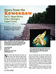 | | Journal (article/letter/editorial) | | News from the Keweenaw Downloaded by [Florida State University] at 18:43 12 November 2014 Part 3—Recent...years have passed since the last “News from the Keweenaw”; this article updates new finds to the spring...Tom Rosemeyer is a native of Upper Michigan and a graduate of Michigan Technological University in Houghton...year. During the last four years, the crushing of mine dumps (poor-rock piles) for road repairs and construction...construction in the Keweenaw. However, extensive logging operations, primarily in Keweenaw County, have increased |  | | Journal (volume) | | vein-stones. The ignorance and prejudice of the native mine-owner prohibits use of the wheel-barrow, the windlass...wrought to advantage, now remains unbroken in the mine, and undressed at the surface. All necessaries of...Province,situate between Congonhas do Campo on the south, Candonga on the north, tributaries of the River...Quente, Piracatú Pissaraō, Fazendaō, Duraō, and south of the Periçicaba (g, h, i,j, k, l, m. ) , the Corrego...and copper, in deep than in shallow parts of the mine, and contains platina near the surface only. Short |  | | Journal (article/letter/editorial) | | suggested that, mixed with the better-class coal of New South Wales, it is likely to be valuable for the production...to the Society. The copper-mining district of Michigan is situated in the upper peninsula, or north-western...proper. The sandstones on the eastern side have a south-easterly dip, while the traps, which axe well stratified...conglomerates on the north shore forming a steeply-scarped cliff, surmounted by gently sloping inclines on the upper...places--as, for instance, at the Nanmkey mine, on the south side of Portage lake, where a shaft was abandoned |  | | Journal (issue) | | ...............................................South East.... . 9 .......................................................................... Copper County Mineral Retreat Christine Chritchley 41 .........each day Possible sites include: Great Orme Copper Mine (entrance fee) Alderley Edge Mines (insurance fee)...CHARLTON, Ms S CAMPBELL, Ms T CAMPBELL Ms L BRIDGETT South West: Miss M PALMER, Mr AP PALMER, Mr L PALMER...Newsletter Issue 49 - September 2006 Branch reports South East Branch Attendance at our monthly lecture meetings |  | | Journal (issue) | | Mendips, selenite from the Mountfield mine, Sussex; a calcite from South Wales which unusually fluoresces...level 5 in ·the Tsumeb mine, Namibia and three beautiful fluorites from Illinois USA; Hunan, China and the...the Okorusu mine in Namibia. The conditions were just right for an auction and bids came from all around...Journal 211 Jan/Feb 2008 Sgar Complex, calcite, prehnite, albite, epidote, apophyllite and chabazite have...polarity magnetic field (i.e. the north pole was the south pole!), probably about 55 million years ago. Peter |  | | Report (edition) | | Cornwall. Front Cover: Old engine house, Botallack Mine (photograph David Alderton). Geologists Association...Map of the St. Agnes district 26 14. North-south cliff section through the Cligga stock 26 15. Map...the structurally very complex section along the south coast between Porthleven and the Lizard. In accounts...1860's, and continued until August 1997 at the South Crofty mine, near Camborne in the west of Cornwall. The...given in the British Regional Geology handbook for South-west England (Edmonds, 1985) and in Geology of Cormvall |  | | Report (issue) | | Minnesota area of Rove slate is a narrow strip south of the international boundary from Pigeon Point...Point to a few miles west of Gunflint Lake in Cook County. (See Figure 1.) Since the base of the formation...trends northeast into Ontario and the beds dip south, it is believed that eastern outcrops in :Minnesota...the building of transcontinental railways both south and north of Lake Superior the Portage has rapidly...• G. M. Schwartz, "A Sulphide Diabase from Cook County, Minnesota," Economic Geology, 20:261-~65 (l9~5) |  | | Report (volume) | | geology and mining industry of Leadville, Lake County, Colorado, by S. F. Emmons, pp. 201-290, pis. xliv-xlv...C. Chamberlin, pp. 147-248, pi. viii. Obsidian Cliff, Yellowstone National Park, by Joseph P. Iddings...pis. Vi-xix. The Penokee iron-bearing series of Michigan and Wisconsin, by Koland Duer Irving and Charles...report on the Marquette iron-bearing district of Michigan, by Charles Richard Van Hise and William Shirley...Lindgren, pp. 1-262, pis. i-xxiv. Geology of Silver Cliff and the Rosita Hills, Colorado, by Whitman Cross |  | | Report (Issue volume) | | Arms, and Trefdraeth , all of which localities are south of Lat. 53 ° 20', are eight little outliers of ancient...required magnitude traverses them towards the south -south -west, nor is there any evidence whatever along...counting from the south -western edge of the outlier . But these give FIG . 191. FACE OF CLIFF , Two and three-quarter...beneath a minor thrust about half way down the cliff. Along this minor thrust-plane, moreover, is The...system . The localities are 1. A strip in the sea -cliff, 200 yards in cove, north -west of Bwrdd Arthur |  | | Report (Issue volume) | | required magnitude traverses them towards the south-south-west, nor is there any evidence whatever along...Arms, and Trefdraeth, all of which localities are south of Lat. 53° 20', are eight little outliers of ancient...required 1nugn.it ude t1·aver~e,; thein towards the south-south-w~st, nor is there any evidence whatever along...sections along Baron Hill drive, counting from the south-western edge of the outlier. But these give no idea...degree to Fro. 191. which the fine banded mudFACE OF CLIFF. stones have been fractured. Two and three-quitrter |  | | Report (issue) | | Physical evidence for Late Cretaceous unconformity, south-central Wyoming, by M. W. Reynolds___________________...part of the Roberts thrust, Toiyabe Range, Lander County, Nev., by J. H. Stewart and A. R. Palmer _____...Ordovician tectonism in the Ruby Mountains, Elko County,· Nev., by Ronald Willden and R. W. Kistler__ _...of the Little Elk Granite, northern Black Hills, South Dakota, by R. E. Zartman and T. W. Stern ______...in the southern Santa Rita Mountains, Santa Cruz County, Ariz., by Harald Drewes---------------------- |  | | Report (volume) | | Clearance Center, 27 Congress Street, Salem, MA 01970, USA: the item-fee code for this publication is 0435-4052/02/$15...Glasgow, UK. Distributors USA AAPG Bookstore PO Box 979 Tulsa OK 74101-0979 USA (Orders: Tel. +1 918 584-2555...Diabaig Alligin to Liathach Upper Loch Torridon (south side) Applecross Raasay and Fladday Scalpay, Longay...Orkney basin (Cheadle et al. 1987). It extends south for 330 km to the latitude of lona (Binns et al...observed to be flat whereas in Assynt and farther south the palaeorelief was mountainous, reaching 600 m |  | | Book (volume) | | Mandela Metropolitan University, Port Elizabeth, South Africa François M. Roure, Rueil-Malmaison, France...of Biological Sciences, University of Adelaide, South Australia, Australia Antonio García-Casco Departamento...Department of Geology, Bryn Mawr College, Bryn Mawr, PA, USA S. Zamora Instituto Geológico y Minero de España...in the north and with the African plate in the south (Alpine orogeny) from the latest Cretaceous to the... 229 231 231 238 .... .... .... 247 250 254 South Portuguese Terrane: A Continental Affinity Exotic |
|


South Cliff Mine, Allouez Township, Keweenaw County, Michigan, USA