| Classification |
|---|
|
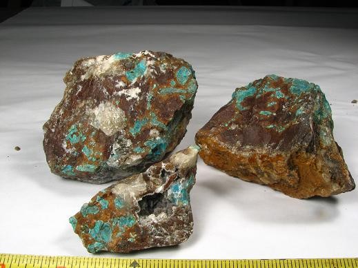
| Species: | Chrysocolla |
| Formula: | Cu2-xAlx(H2-xSi2O5)(OH)4 · nH2O, x < 1 |
| Confirmation |
|---|
|
| Validity: | Believed Valid |
| Associated Minerals Based on Photo Data: |
|---|
|
| Quartz | ⓘ3 photos of Chrysocolla associated with Quartz at this locality. |
| Siderite | ⓘ1 photo of Chrysocolla associated with Siderite at this locality. |
| Data |
|---|
|
| Mineral Data: | Click here to view Chrysocolla data |
| Locality Data: | Click here to view Date Creek quartz crystal locality, Date Creek Mountains, Yavapai County, Arizona, USA |
| Photo Gallery | View Gallery (2 photos) |
| Data Identifiers |
|---|
|
| Mindat Occurrence Record ID: | 435377 |
| Long-form Identifier: | 1:3:435377:5 |
| GUID (UUID V4): | e156cda2-6af3-44df-9bf0-5db088842ba7 |
| Nearest other occurrences of Chrysocolla |
|---|
|
|
| 28.7km (17.8 miles) | ⓘBullard Mine (Little Giant Mine), Bullard Peak (Smith Peak), Yavapai County, Arizona, USA |
| 34.3km (21.3 miles) | ⓘOro Grande Mine (Frenchman Patented; Platna Grande group; May Patented), Sam Powell Peak, Black Rock Mining District, Yavapai County, Arizona, USA |
| 37.4km (23.2 miles) | ⓘZonia Mine (Zonia group; Fairplay Mine; Defiance Mine; Cuprite Mine; Zonia McMahon Mine), Peeples Valley, Walnut Grove Mining District (Wagoner Mining District), Antelope Mountains (Antelope Range), Yavapai County, Arizona, USA |
| 41.4km (25.7 miles) | ⓘStukey Mine (Stucky Mine; Lawrence group of claims), Bagdad, Eureka Mining District, Yavapai County, Arizona, USA |
| 42.0km (26.1 miles) | ⓘMountain Spring Mine, Bagdad, Eureka Mining District, Yavapai County, Arizona, USA |
| 43.0km (26.7 miles) | ⓘUnida Mine (Unida group; Blue Nelley Mine; Bloo Nelley Mine; Bloo Lead group; Bloo Nelly group; Arizona Copper and Gold property; Home; Patented claims MS 2489), Yavapai County, Arizona, USA |
| 44.3km (27.5 miles) | ⓘCopper King Mine (Lawler Mines), Bagdad, Eureka Mining District, Yavapai County, Arizona, USA |
| 44.6km (27.7 miles) | ⓘMammoth Mine (Hubbard Mine), Eureka Mining District, Yavapai County, Arizona, USA |
| 44.9km (27.9 miles) | ⓘBagdad Mine, Bagdad, Eureka Mining District, Yavapai County, Arizona, USA |
| 46.2km (28.7 miles) | ⓘCopper Creek Sillimanite deposit, Copper Creek, Bagdad, Eureka Mining District, Yavapai County, Arizona, USA |
| References |
|---|
|
|


Date Creek quartz crystal locality, Date Creek Mountains, Yavapai County, Arizona, USA