| Locality type: | Mine |
| Classification |
|---|
|
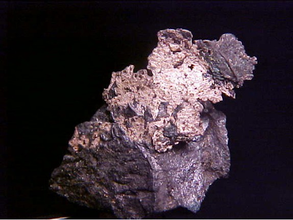
| Species: | Silver |
| Formula: | Ag |
| Comments: | Occurs in upper portions of the orebody. |
| Confirmation |
|---|
|
| Validity: | Believed Valid |
| Associated Minerals Based on Photo Data: |
|---|
|
| Stromeyerite | ⓘ10 photos of Silver associated with Stromeyerite at this locality. |
| Data |
|---|
|
| Mineral Data: | Click here to view Silver data |
| Locality Data: | Click here to view Magma Mine (Magma Superior Mine; Magma Copper Mine), Superior, Pinal County, Arizona, USA |
| Photo Gallery | View Gallery (4 photos) |
| Data Identifiers |
|---|
|
| Mindat Occurrence Record ID: | 43802 |
| Long-form Identifier: | 1:3:43802:7 |
| GUID (UUID V4): | bf29c3fe-d741-4ce4-bb1d-b137ebcd148a |
| Nearest other occurrences of Silver |
|---|
|
|
| 0.3km (0.2 miles) | ⓘLake Superior and Arizona Mine (L.S. & A. Mine; Gold Eagle Mine; Golden Eagle Mine; Superior and Arizona Mine; Vivian shaft; Monarch vein; Queen Creek-Magma Mine; Superior Manganese Mine), Superior, Pinal County, Arizona, USA |
| 3.2km (2.0 miles) | ⓘSilver King Mine, Comstock Wash, Kings Crown Peak area, Pinal County, Arizona, USA |
| 4.1km (2.5 miles) | ⓘBelmont Mine (Belmont Copper property; Goodwin Mine; Monte Carlo claim; Smith lease; Doggs Mine; Lone Star Mine), Belmont Canyon, Apache Leap, Superior, Pinal County, Arizona, USA |
| 11.5km (7.1 miles) | ⓘReymert Mine, Reymert Canyon, Mineral Mountain Mining District, Pinal County, Arizona, USA |
| 16.3km (10.1 miles) | ⓘRay, Pinal County, Arizona, USA |
| 16.6km (10.3 miles) | ⓘHunch Mine (Civalier property), Scott Mountain, Pinal County, Arizona, USA |
| 17.8km (11.1 miles) | ⓘCastle Dome Mine (Castle Dome deposit; Pinto Valley deposit), Castle Dome area (Castle Dome Mine area; Pinto Valley Mine area), Inspiration, Miami-Inspiration Mining District, Globe-Miami Mining District, Gila County, Arizona, USA |
| 18.5km (11.5 miles) | ⓘContinental Mine (Continental tunnel), Jewel Hill, Castle Dome area (Castle Dome Mine area; Pinto Valley Mine area), Inspiration, Miami-Inspiration Mining District, Globe-Miami Mining District, Gila County, Arizona, USA |
| 18.9km (11.7 miles) | ⓘLead Queen Mine (Cochreham Lead Mine), Scott Mountain, Pinal County, Arizona, USA |
| 19.5km (12.1 miles) | ⓘSilver King Mine (Vaughan property), Mineral Mountain area, Mineral Mountain Mining District, Pinal County, Arizona, USA |
| References |
|---|
|
|


Magma Mine, Superior, Pinal County, Arizona, USA