 | | Report (issue) | | deposit. Table 4, part B, gives an alphabetic list of mine and properties followed by the deposit name. CHARACTERISTICS...of deposits used in Table 1 may represent a major mine, district name, or local town name or other prominent... Pyrrhotite appears to be been reported in just a single mine in the East Belt of the Sierra Nevada foothills...(Malcolm, 1912), galena was widely considered by mine operators to be correlated with better gold grades...was described in a carbonate quartz veinlet in one mine in the Mother Lode system (Knopf, 1929). Method |  | | Report (volume) | | Minerals of Colorado: A 100- Year Record By EDWIN B. ECKEL GEOLOGICAL SURVEY BULLETIN 1 1 14 A...knowledge____________________________________ Future of Colorado mineralogy______________________________________...mineral localities and metallic mineral deposits of Colorado ________________________________ In pocket III...mineral localities and metallic mineral deposits of Colorado, has not been included in this reprint. Many of...especially Fischer and others, 1946). MINERALS OF COLORADO: A 100-YEAR RECORD By EDWIN B. EcKEL ABSTRACT |  | | Report (issue) | | AND ORE DEPOSITS OF THE BONANZA MINING DISTRICT, COLORADO BY W. S. BURBANK WITH A SECTION ON HISTORY AND...W. HENDERSON Prepared in cooperation with the COLORADO METAL MINING FUND UNITED STATES GOVERNMENT PRINTING..._ ... Structural features and distribution __ Greenback Gulch volcanic neck._____ Petrographic features...Gulch____.._____-----Sosthenes Gulch and Antoro mine __..-.-_ Vicinity of Round Mountain ____________...and prospects.__________-_____-_--_-__-___-Rawley mine-----___-_-.-_-------------------Production____________ | 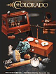 | | Journal (issue) | | R. Kampf Natural History Museum of Los Angeles County George Robinson National Museums of Canada Arthur...SPECIMENS from the collection of the Geology Museum, Colorado School of Mines. See page 242 for a full description... All rights reserved. notes fromthej EDITOR COLORADO-III Here we are with our third special issue devoted...devoted to the mines and minerals of Colorado. As most long-time subscribers know, the first in the series...about $200 on the out-of-print market. The second Colorado issue was vol. 10, number 6 (1979), and we still |  | | Journal (issue) | | Articles Native gold from the Jamestown mine, Tuolumne County, California...............................Adularia from the Howard-Montgomery quarry, Howard County, Maryland .......................................collectors interested in visiting the Blanchard mine or other mines in the Hansonburg mining district...signed in at Bingham for entry to the Blanchard mine area for surface collecting. Underground collecting...strictly prohibited due to the hazardous nature of the mine workings, and visitors are required to acknowledge |  | | Report (issue) | | ORE DEPOSITS OF TILE LEADVILLE MINING DISTRICT, COLORADO BY S. F. EMMONS, J. D. IRVING, AND G. F. LOUGIILIN...High terrace gravel_ 15 Low terrace gravel_ _ 17 "Lake beds"_ 17 Character and distribu17 tion _ Deformation...fault _ 88 56 011ie Reed pipe_ Iron-Mikado group_ 88 57 Josie pipe _ 89 Iron fault _ 58 Eureka pipe_ Mikado..._94 61 Mike anticline _ Origin of the Iron-Mikado fault 61 Colorado Prince anticline _ group _ 95 61 Mosquito...syncline_ Faults southeast_ of _ Leadville 62 the_ Fryer Hill folds _ 62 district _ 95 Warping and drag along |  | | Report (issue) | | commercial borates. Lawsonite, first found in Marin county in 1895, has proved to be of great petrographic...nickel telluride, melonite, found in Calaveras County in 1867. New minerals and new mineral this is ...products. The gem-bearing pegmatites of San Diego County have aroused special masses, interest. Many ...short articles on California diamonds. A Amador County: few small stones have been picked up near the...recently, one of 21 carats near Plymouth. ; Butte County: In 1853 it was observed that diamonds occurred |  | | Report (issue) | | been found in the mining the nugget Jim, Placer County, California, in 1871 by a small girl in who town...The bibliography has been updated and expanded. County lists published by Collins (1) pp. 40-64, in Murdoch...rhyolite locality in Alameda County and the lawsonite type locality Marin County, which have been completely...mineral localities the Mother Lode, Crestmore, Searles Lake, Pala, Mesa Grande, and others which contributed...Flat, Butte County); and to borax ("Lake County, in large crystals in the clay of the Borax lake; Boracic |  | | Report (issue) | | --------------Cleburne County ----------~----------------- Tallapoosa County --------------------------Alaska...------------------Cochise County -----------------------------Gila County --------------------------------Greenlee...ee County ----------------------------R[aricopa County ----------------------------R[ohave County --...-----------------------------Pima County -------------------------------Pinal County -------------------------------Santa...-------Santa Cruz County --------------------------'ravapai County -----------------------------'ruma |  | | Report (issue) | | localities ^the Mother Lode, Crestmore, Searles Lake, Pala and Mesa Grande, and others have contributed...from the land surface and spread out on the sea (or lake) bottom. The fine-grained sediments (shale), are...tribes in the northeast corner of San Bernardino County in pre-historic times. The old workings here were...stone hammers, and called his claim the Stone Hammer mine. This find aroused so much interest that the San...circumstance the location was named the Stone Hammer mine. "The State Slining Bureau reported at about the | 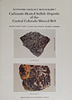 | | Report (issue) | | Carbonate-Hosted Sulfide Deposits of the Central Colorado Mineral Belt DAVID W . BEATY, GARY P . LANDIS...are paralle l to host-rock bedding. Black Cloud mine, Leadville district. Sherman-type ore (bottom) in...cemented or veined with ferroan dolomite. rv1oose mine, North Alma district. Photographs b)' \Villiarn...Carbonate-hosted sulfide deposits of the central Colorado mine ral belt: Introduction, general discussion,...Regional geologic and tectonic setting of the central Colorado mineral belt . . . . Alan R. Wallace Paleozoic |  | | Report (volume) | | ............................................. Colorado.................................................deposits of some others, such as clay, coal, and iron ore, are mentioned only in general terms. One material...especially from those of Arkansas, California, Colorado, New Mexico, Oregon, South Dakota, Tennessee,...minerals and rocks, their occurrence and uses: Colorado State Geol. Survey Bull. 6, 1913. 8 USEFUL...Albany. North Carolina_.Dr. Joseph Hyde Pratt, Chapel Hill. North Dakota_.Dr. A. G. Leonard, Grand Forks. Mr |  | | Book (volume) | | ...........................................59 Colorado ...............................................................548 Table of Maps Page Alabama County Map ...................................................................................4 Alaska County and Stream Map ......................................................................22 Arizona County Map ..................................................................45 Arizona – Yuma Co. Hull Mine Site Map ...................................... |  | | Book | | MINES AND MINERALS OF THE GREAT AMERICAN RIFT (COLORADO-NEW MEXICO) Sine —_—< ¢ te om At _SHT 40...MINES AND MINERALS OF THE GREAT AMERICAN RIFT (COLORADO-NEW MEXICO) Richard Walker Holmes and Marrianna...Mines and minerals of the Great American Rift (Colorado-New Mexico). Bibliography: p. Includes index...index. 1. Mines and mineral resources—Colorado. 2. Mines and mineral resources—New Mexico. I. Kennedy, Marrianna...enter must be obtained to prevent trespass. Old mine workings are dangerous and entering underground |  | | Book (volume) | | ...........................................47 Colorado ................................................rights, so remember you were told. If in doubt, a county map will tell you who the legal owner is. Good...gemmy qualities for cutting and polishing. AUTAUGA COUNTY PRATTVILLE, N. 6 mi., and just E of the Birmingham...well known to prehistoric Indians.) BARBOUR COUNTY BAKER HILL, SE 1 mi. : 1 in a deep ravine, as a bed deposit⎯yellow...deep red to variegated⎯ocher. BIBB COUNTY GENERAL AREA: c county gravel pits along the Cahaba R.⎯gemmy |  | | Book (volume) | | ...........................................47 Colorado ................................................rights, so remember you were told. If in doubt, a county map will tell you who the legal owner is. Good...gemmy qualities for cutting and polishing. AUTAUGA COUNTY PRATTVILLE, N. 6 mi., and just E of the Birmingham...well known to prehistoric Indians.) BARBOUR COUNTY BAKER HILL, SE 1 mi. : 1 in a deep ravine, as a bed deposit⎯yellow...deep red to variegated⎯ocher. BIBB COUNTY GENERAL AREA: c county gravel pits along the Cahaba R.⎯gemmy |  | | Report (volume) | | deposits of some others, such as clay, coal, and iron ore, are mentioned only in general terms. One material...A. F. Rogers, Stanford University, Palo Alto. Colorado.........Prof. R. D. George, Boulder. Connecticut...North Carolina.. .Dr. Joseph Hyde Pratt, Chapel Hill. North Dakota... .Dr. A. G. Leonard, Grand Forks...See Bauxite and Hallpysite. Asbestos. Tallapoosa County, with corundum deposits near Dudleyville; not found...commercial quantity or quality. Asphalt. Colbert County, small quantity has been shipped from near Leighton; |  | | Book | | crystal drawings for publication. H. Earl Pemberton Lake Elsinore, California Contents Preface / v 1...in the state is geomorphic provinces From the lake-bed deposits of the Basin Ranges and Mojave come...species are reported by 1-2 shows the county boundaries and county names. When possible, locations of mines...within a township is illustrated by Figure 1-1. county of occurrence. Map *M. Fleischer’s 1980 Glossary...DESERT IX TRANSVERSE RANGES X PENINSULAR RANGES XI COLORADO DESERT GOLD-BEARING AREA I U Map 1-1. Map |  | | Book | | commercial ores and secondary minerals by state, county, township, and geologic range. For easy identification...61 232 PART The Making 43 II 5 7 3 III Mine PART 267 IV Glossary 279 Bibliography 291...cities, and many of today’s prosperous western county seats began as mining-boom camps. trating sand...Whether you such as those listed alphabetically by county, township, and range in Part II of this book. Where...minerals which make lovely cabinet specimens. old mine western states, to kick up and oxidation, |  | | Report (issue) | | the. Leadville, Colorado, mining district. Prepared in cooperation with the Colorado State Geological...Geological Survey Board and the Colorado Metal Mining Fund UNITED STATES GOVERNMENT PRINTING OFFICE, WASHINGTON...High-level terraces,_____________________________ "Lake beds".__________________________________ Stratigraphy...Union syncline___ __________________________ Empire Hill syncline_ _-____-_-__--------_-__ Sheridan transverse...___________________ Pendery group of faults. _________________ Iron fault and its brancheS--_____________ in 23 23 | | | Book | | crystal drawings for publication. H. Earl Pemberton Lake Elsinore, California Contents Preface/ v 1. Introduction...eleven geomorphic provinces (See Map 1-1). From the lake-bed deposits of the Basin Ranges and Mojave Desert...are reported by county of occurrence. Map 1-2 shows the county boundaries and county names. When possible...II TRANSVERSE RANGES X PENINSULAR RANGES XI ~ COLORADO DESERT GOLD-BEARING AREA Map 1-1. Map of California...,o Map 1-2. Outline map of California showing county boundaries. __ _) 4 MINERALS OF CALIFORNIA |  | | Book (edition) | | Morocco; (center, left) wulfenite, San Francisco mine, Sonora, Mexico; (center) ameihyst, Veracruz, Mexico;...rnodochrosite, N’Chwaning mine, South Africa; (lower left, center) wulfenite, Red Cloud mine, Arizona; (lower...Encyclopedia of minerals Sagiiache County Pu blic Library Saguache , Colorado DEMCO For Reference Not to...Wendell E. Wilson Library Saguache County Public Saguache, Colorado VAN NOSTRAND REINHOLD New York ...Cal and Kerith Graeber Cureton Mineral Company Colorado School of Mines Charles and Marcelle Weber Dan | | | Book (edition) | | Morocco; (center, left) wulfen ite San Francisco mine, Sonora, Mexico; (center) amethyst, Veracruz, Mexico;...Mountains, Utah; (lower le ft) rhodochrosite, N'Chwaning mine, Sou th A frica; {lower left, center) wulfenite...Encyclopedia of minerals ~~cbe County Public Library Saguache, Colorado OEMCO For Refere nee Not to...Sagtiache Co1tntr Publlc I...ibran' Saguache, Colorado ~ VANNOSTRAND REINHOLD ~ - - - - N e w York...Cal and Kerith Graeber Cureton Mineral Company Colorado School of Mines cw Charles and Marcelle Weber |  | | Journal (article/letter/editorial) | | techniques. Several concentrate samples from different mine plants of Katanga Copperbelt (Kalukuluku, Mutanda...ages of two hematite samples from the Glengonnar mine imply a late Triassic age for the early oxide phase...world gold reserves. Large objects are known in the USA, Australia, Russia, China, Kazakhstan and other regions...million carats of rough diamonds have been won and the mine has grown famous for its spectacular violet, red...the gem-quality material produced by the Argyle mine there is little information available on the more |  | | Report (volume) | | Rm G-84 DENVER, Colorado--Federal Bldg., Rm. 169, 1961 Stout St. LAKEWOOD, Colorado-- Federal Center...Center, Rm. 1C402, 12201 Sunrise Valley Dr. SALT LAKE CITY, Utah--Federal Bldg., Rm. 8105,125 South State...skarn deposits 93 Tonnages of Fe skarn deposits 97 Iron grades of Fe skarn deposits 97 Generalized map showing...Tonnages of volcanic-hosted magnetite deposits 173 Iron grades of volcanic-hosted magnetite deposits 174...Tonnages of Algoma Fe and Superior Fe deposits 229 Iron grades of Algoma Fe and Superior Fe deposits 230 |
|


